Wolftone - Curran
Total Miles
5.6
Technical Rating
Best Time
Fall, Spring, Summer
Trail Type
Single Track
Accessible By
Trail Overview
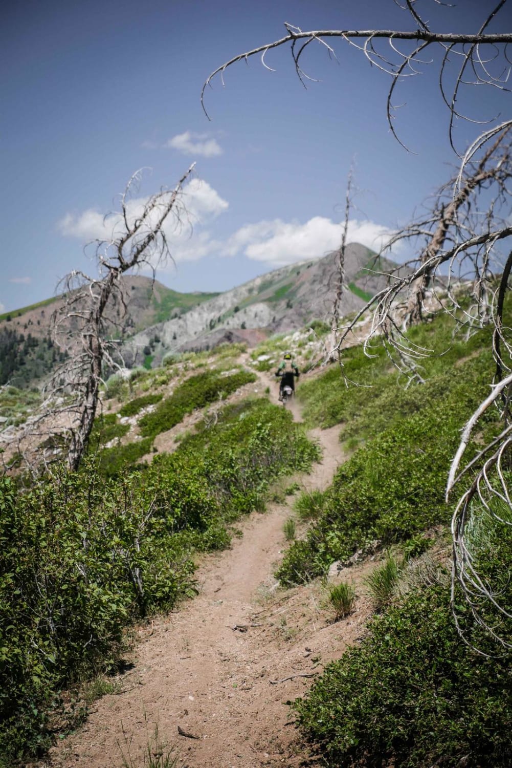
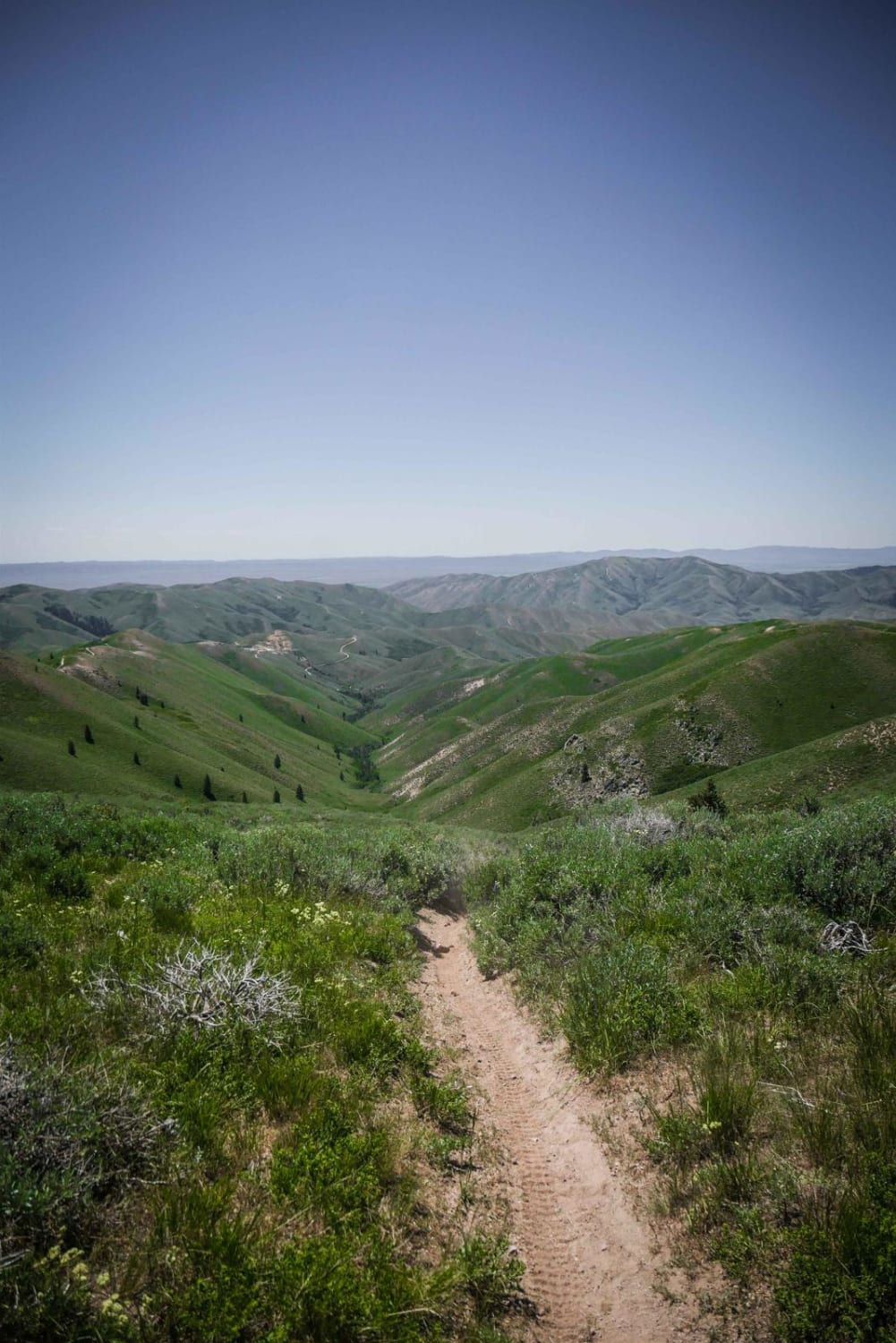
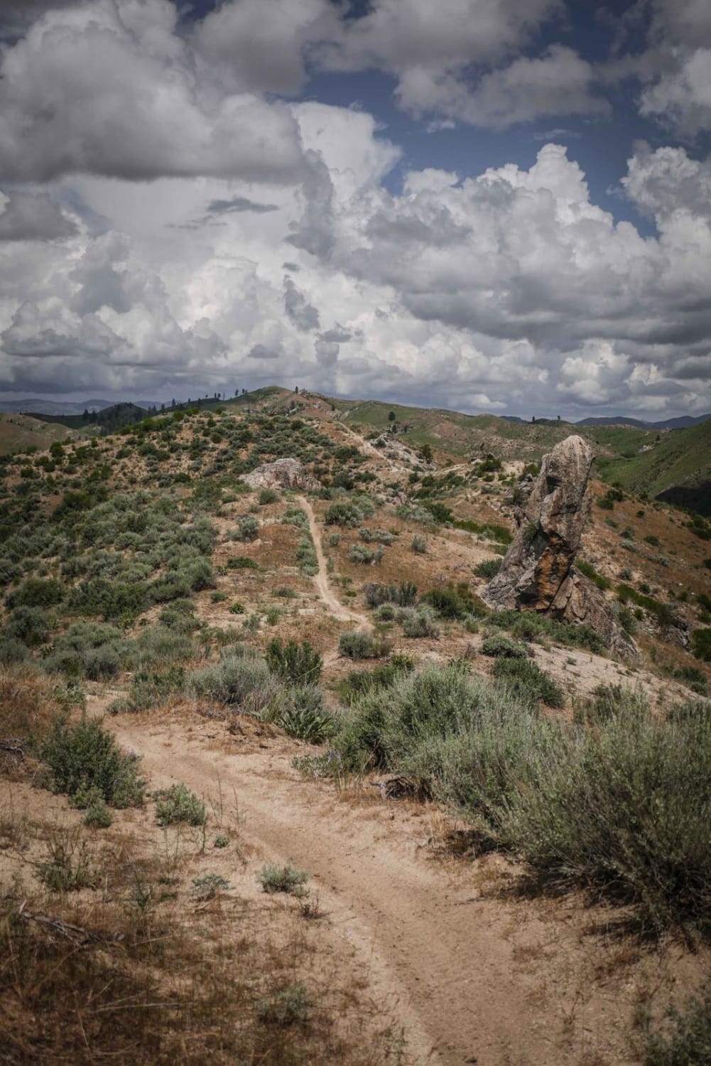
This is a really great single track on the south end of the Greenhorn Trail system near Ketchum, Idaho. The south end of the trail starts from a saddle with a loose downhill onto a narrow and epic side hill where you'll feel like you are on the edge of the world. It's a different terrain on this mountain than the rest of the trail system as this zone is drier and in sagebrush. The side-hilling section has some moderate exposure as it rides through wildflowers with endless views of these steep green mountains. It has some curves as it crosses over onto the back side of the mountain and is less dry but in a burn area. It has some switchbacks that are pretty easy and continue as an elevated trail above a creek. There are lots of low dead branches to duck for in the burn area. Most of the downfall in the burn area is cut, but some of the cuts are at handlebar or peg height, so you have to watch out for them, especially on the narrow exposed sections of the trail. There are also a couple wash washouts to look out for as you are elevated above the creek. The trail is mostly smooth and not too rocky, but is quite narrow, and ends on a rocky dry creek bed with a creek crossing at the intersection with Deer Creek.
Photos of Wolftone - Curran
Difficulty
Intermediate single track with narrow sections, exposure, and deadfall.
Status Reports
Wolftone - Curran can be accessed by the following ride types:
- Dirt Bike
Wolftone - Curran Map
Popular Trails
Arco Pass Road to Wood Canyon

South Curlew Connector

Bing Cherry Trail
The onX Offroad Difference
onX Offroad combines trail photos, descriptions, difficulty ratings, width restrictions, seasonality, and more in a user-friendly interface. Available on all devices, with offline access and full compatibility with CarPlay and Android Auto. Discover what you’re missing today!