Middle Fork Shoshone Creek Spur
Total Miles
0.7
Technical Rating
Best Time
Fall, Summer, Spring
Trail Type
Single Track
Accessible By
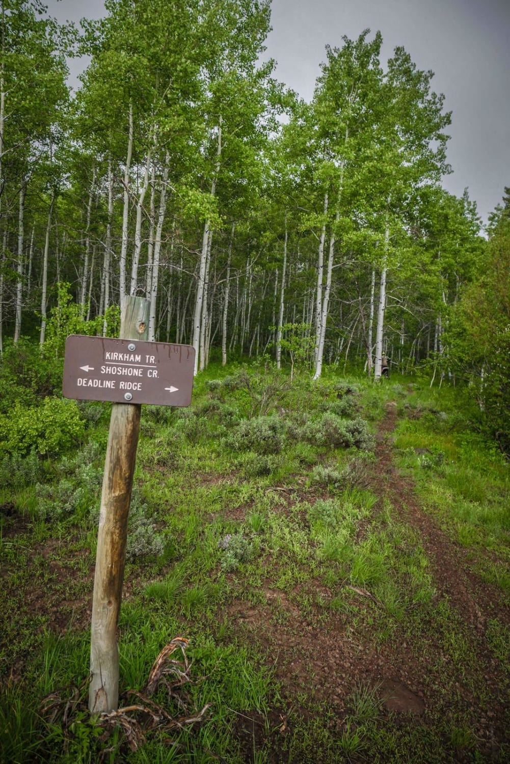
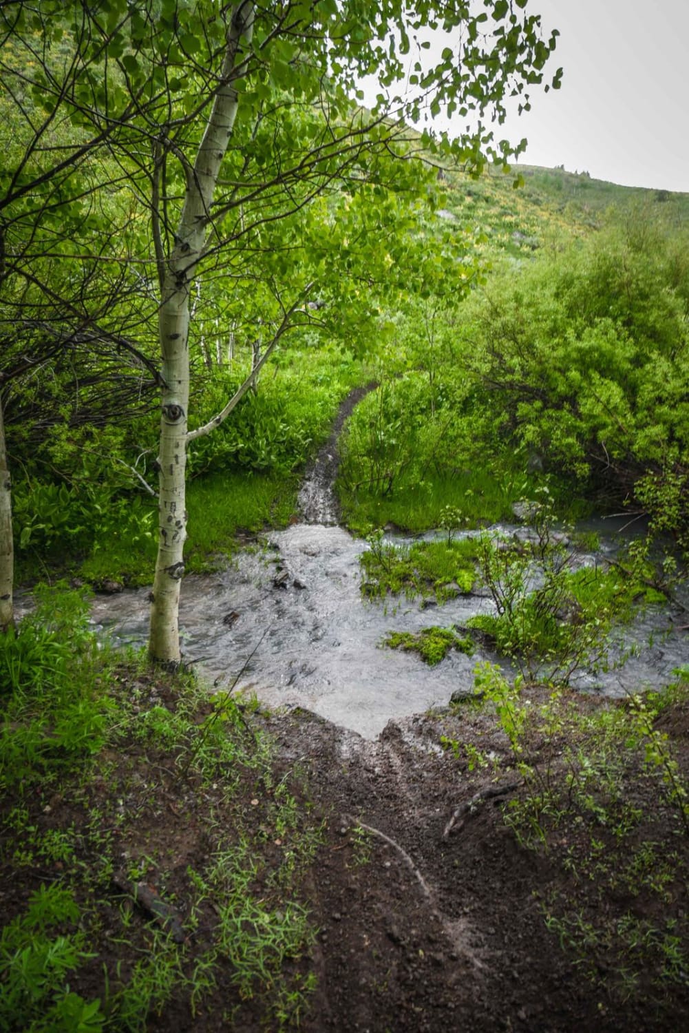
Trail Overview
The is a short spur trail from the Middle Fork Shoshone Creek Trail that connects to an ATV trail. There is a trail sign at the intersection with Middle Fork Shoshone Creek indicating the start of the spur. The trail follows a creek all the way up and crosses the creek at an easy crossing. Most of the trail is good dirt with few rocks, but there is one spot that is rockier with small jagged rocks in the trail. It goes past two ponds. You can use this trail to access more trails in the system.
Photos of Middle Fork Shoshone Creek Spur
Difficulty
This is an easy forested single track with some rocks but no major challenges.
Status Reports
Middle Fork Shoshone Creek Spur can be accessed by the following ride types:
- Dirt Bike
Middle Fork Shoshone Creek Spur Map
Popular Trails
City of Rocks/Twin Sisters

Canfield Mountain- Trail 9
Jackass Loop Trail (FS 264)

NF 221 - C/FDR Grangeville - Salmon Road
The onX Offroad Difference
onX Offroad combines trail photos, descriptions, difficulty ratings, width restrictions, seasonality, and more in a user-friendly interface. Available on all devices, with offline access and full compatibility with CarPlay and Android Auto. Discover what you’re missing today!