Johnson Creek #5124
Total Miles
0.6
Technical Rating
Best Time
Fall, Summer
Trail Type
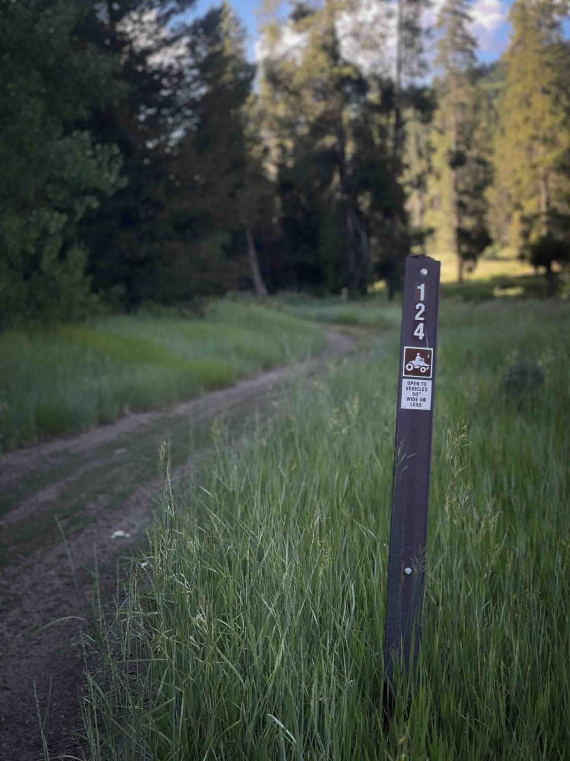
50" Trail
Accessible By
Trail Overview
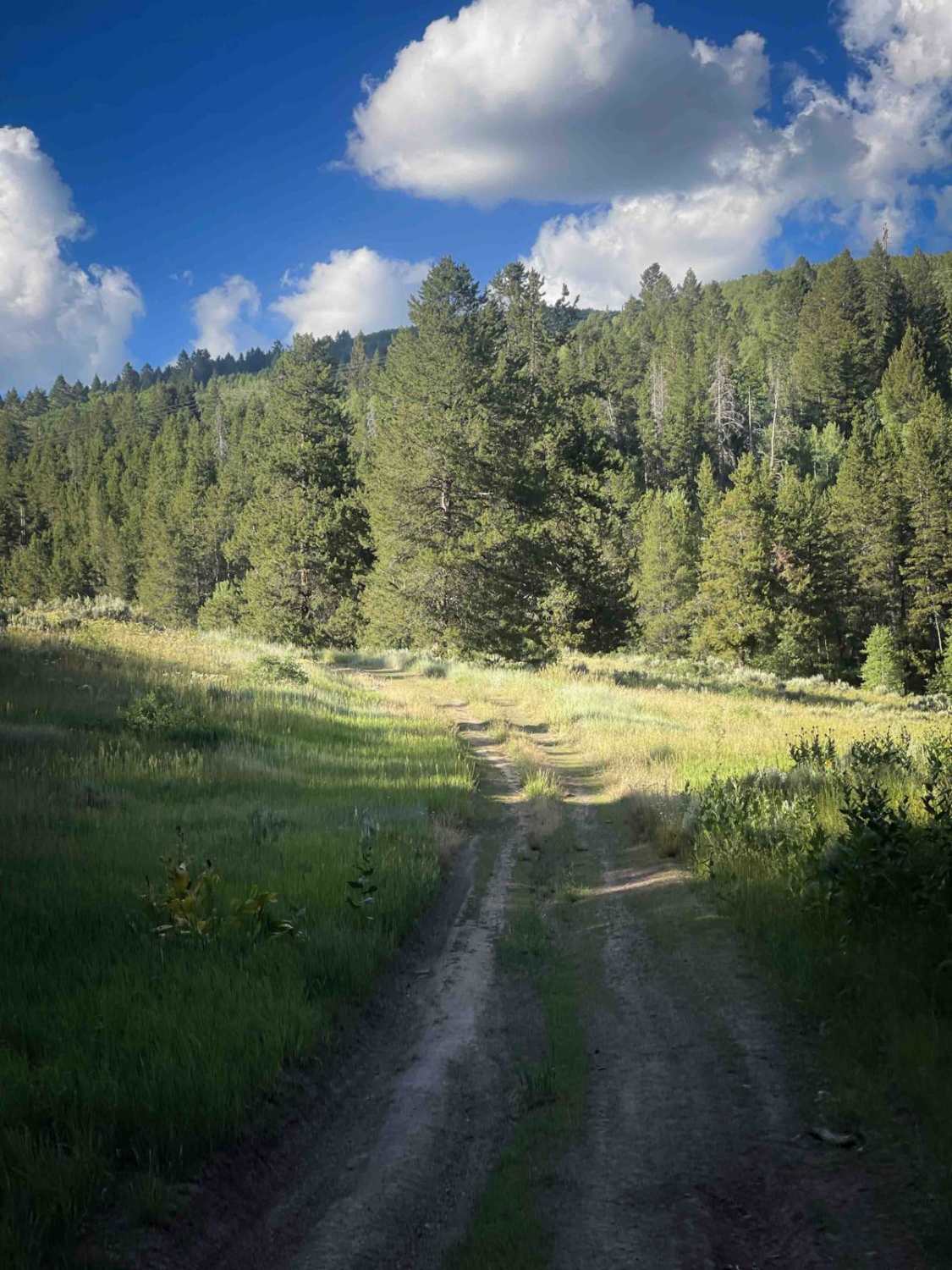
Johnson Creek #5124 is a short, easy ATV trail off of Forest Service Road 50110 that must be ridden as an out-and-back route. The trail travels through scenic forest with pine trees, wildflowers, and meadows, but it does not connect to any other trails or destinations. It ends beneath a set of powerlines at a clear sign indicating that motorized travel is not permitted beyond that point. Although the trail is the width of a road, it is restricted to vehicles 50 inches or less. The surface is smooth and free of obstacles, with only a few large bumps, dips, and shallow ruts along the edges, but plenty of room for 50" vehicles to maneuver. The route is well marked and straightforward, beginning across from a small creek and meadow that could be used as a staging spot or camp spot.
Photos of Johnson Creek #5124
Difficulty
This is an easy trail due to its smooth surface, minimal technical features, and short length. Some minor ruts and dips are present but do not significantly affect the overall ease. It's great for newer or younger riders practicing their skills.
Status Reports
Johnson Creek #5124 can be accessed by the following ride types:
- ATV (50")
- Dirt Bike
Johnson Creek #5124 Map
Popular Trails

Butcher Knife

Petterson Canyon #5232
Contest Mountain- 2642
The onX Offroad Difference
onX Offroad combines trail photos, descriptions, difficulty ratings, width restrictions, seasonality, and more in a user-friendly interface. Available on all devices, with offline access and full compatibility with CarPlay and Android Auto. Discover what you’re missing today!