Placer and Picayne Gulch
Total Miles
6.4
Technical Rating
Best Time
Spring, Summer, Fall
Trail Type
Full-Width Road
Accessible By
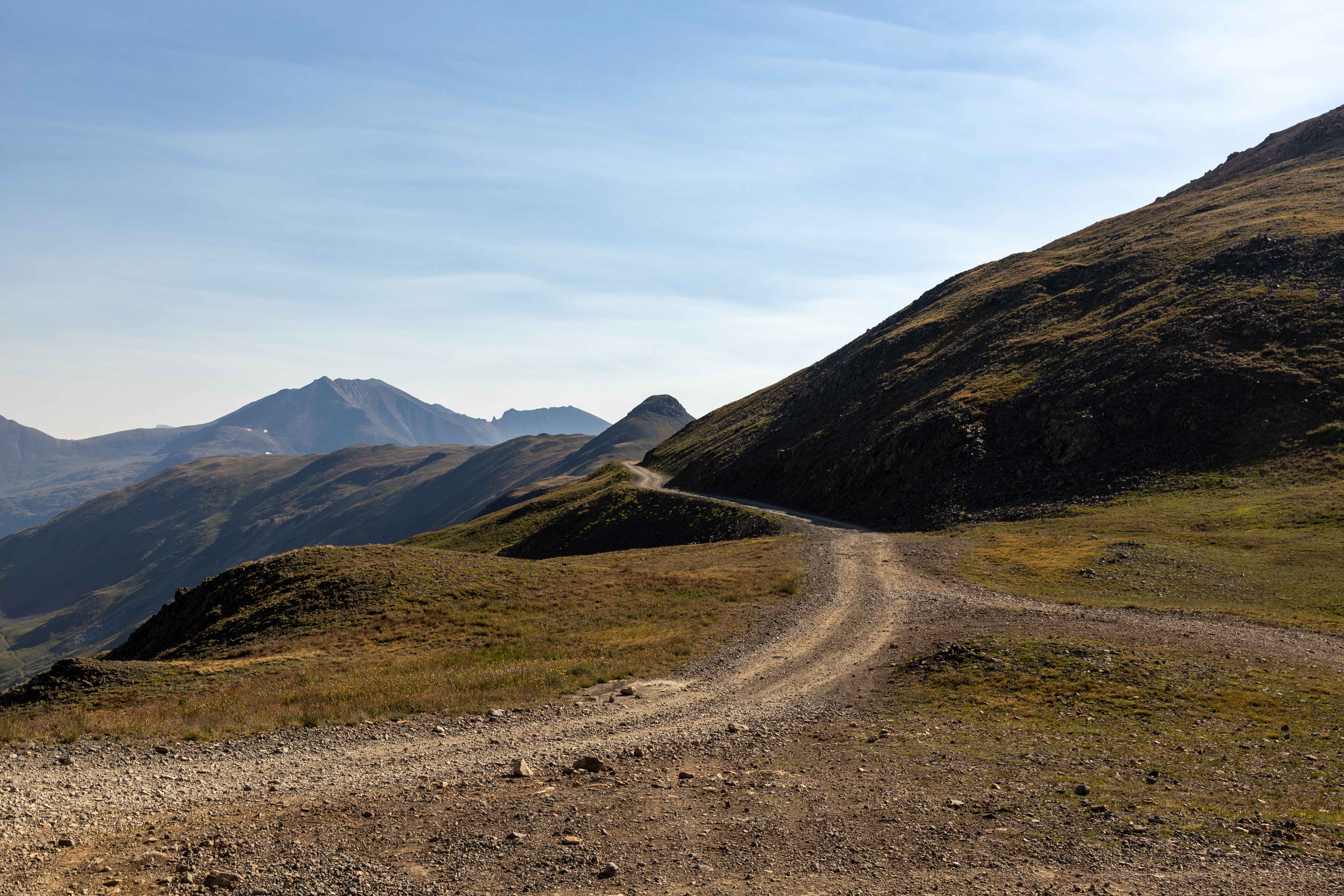
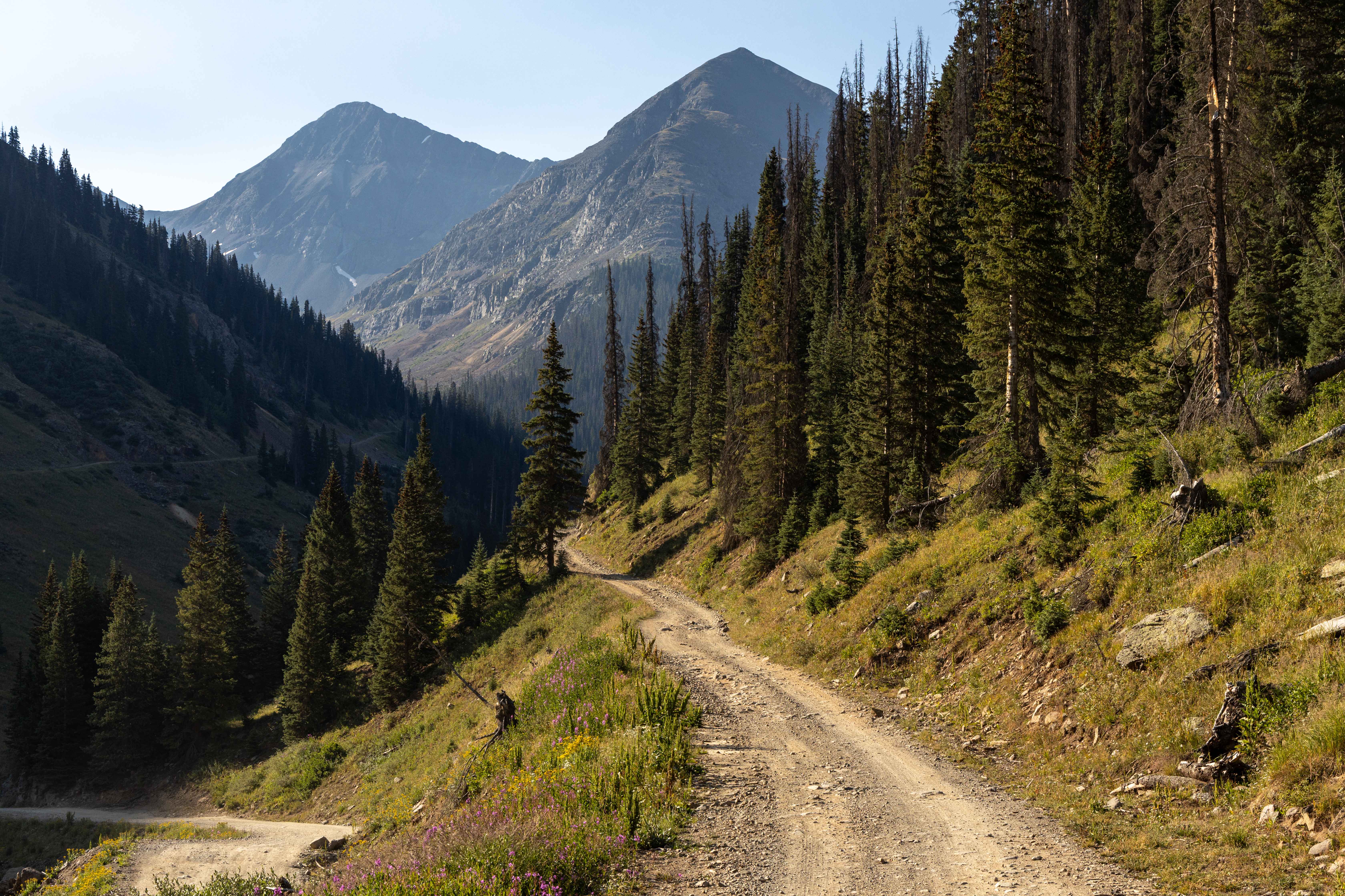
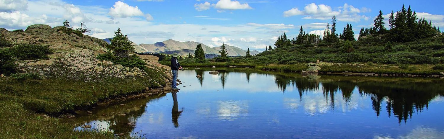
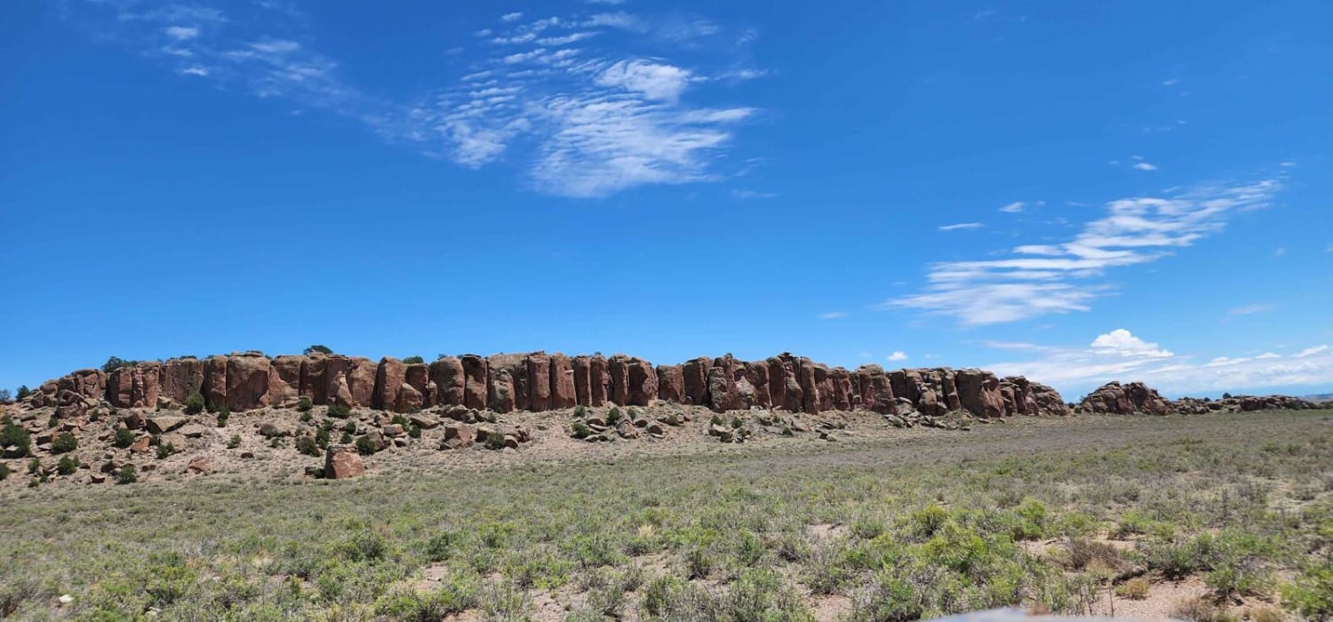
Trail Overview
This historic and scenic off-road route travels between two high alpine gulches just outside Silverton, climbing through wildflower-speckled meadows, past century-old mining ruins, and into panoramic high-country views. The trail begins with a steep, rocky ascent over the first two miles--expect careful driving as you climb into alpine meadows. It then mellows, offering a smooth, vehicle-friendly shelf road with no major obstacles. There's no cell service here, so be sure to bring offline maps or GPS. The high passes sit above 12,600 ft, opening into high alpine meadows that burst with wildflowers--Indian paintbrush, alpine avens, and columbine--especially vivid during late July and early August. As you move through subalpine zones, look for harsh alpine grasses, stunted bristlecone pines, and possible sightings of marmots, pika, mule deer, or even bighorn sheep navigating the rocky slopes. At the crest between gulches, you'll find a natural pull-out viewpoint, offering sweeping panoramas over Animas Valley and the surrounding San Juan peaks. The trail then descends into Picayune Gulch over a loose, steep descent, recommended in 4-low gearing to maintain control on loose rock and erosion-prone terrain. With its preserved mining heritage and breathtaking alpine landscape, Placer & Picayune Gulches offers a balanced and rewarding experience--equal parts scenic cruise and light adventure through Colorado's high-country past.
Photos of Placer and Picayne Gulch
Difficulty
This is a well-traveled road that has long steep grades and erosion. Parts of this trail may become more challenging during or after inclement weather. Caution is urged. There is no cell service available, so offline maps are heavily recommended.
History
Established during Colorado's early 1900s gold-silver boom, the Treasure Mountain Gold Mining Company site features a bunkhouse, blacksmith shop, and remnants of its stamp mill--closed off to preserve what's left. The Sound Democrat Mill, built in 1905-1906 (expanded 1909), is one of Colorado's most complete amalgamation stamp mills still standing, with original processing equipment like stamp batteries and Wilfley tables preserved in place. Nearby lie the ruins of other mining operations, including the Gold Prince Mine, Mastodon Mill, and Hanson/Sunnyside Extension Mill, all within view of the trail's high point.
Status Reports
Placer and Picayne Gulch can be accessed by the following ride types:
- High-Clearance 4x4
- SUV
- SxS (60")
- ATV (50")
- Dirt Bike
Placer and Picayne Gulch Map
Popular Trails
Forest Road 630/Williams Creek
Old Dry Drainage
The onX Offroad Difference
onX Offroad combines trail photos, descriptions, difficulty ratings, width restrictions, seasonality, and more in a user-friendly interface. Available on all devices, with offline access and full compatibility with CarPlay and Android Auto. Discover what you’re missing today!