Lower Spring Creek Trail
Total Miles
7.2
Technical Rating
Best Time
Summer, Fall, Spring
Trail Type
Single Track
Accessible By
Trail Overview
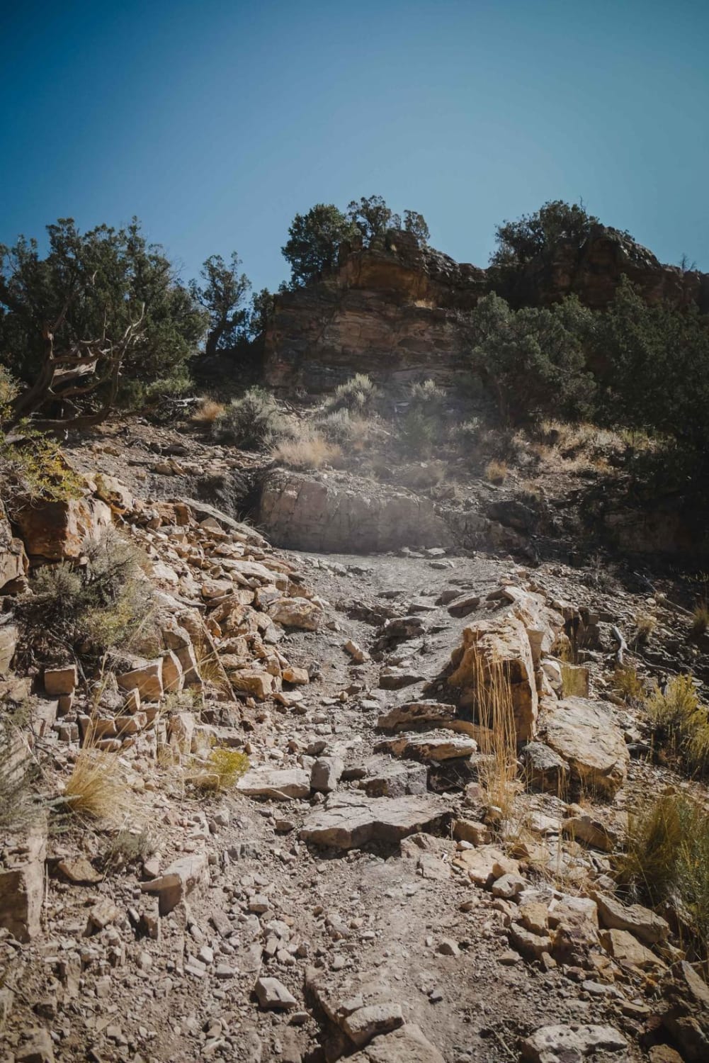
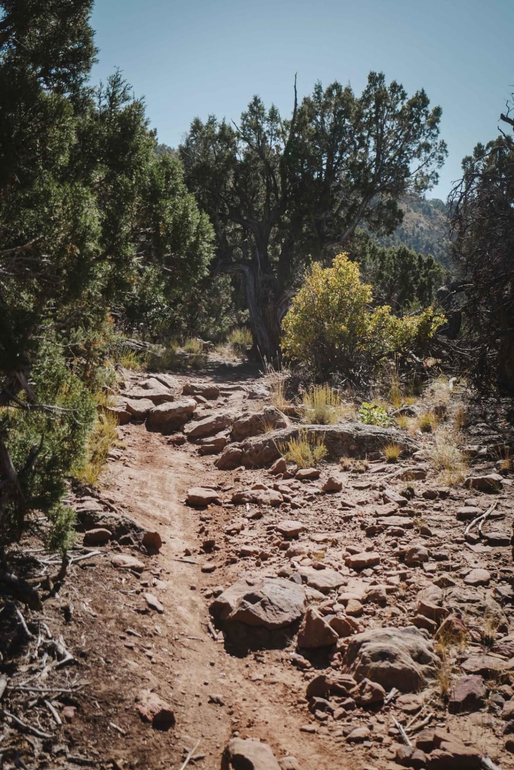
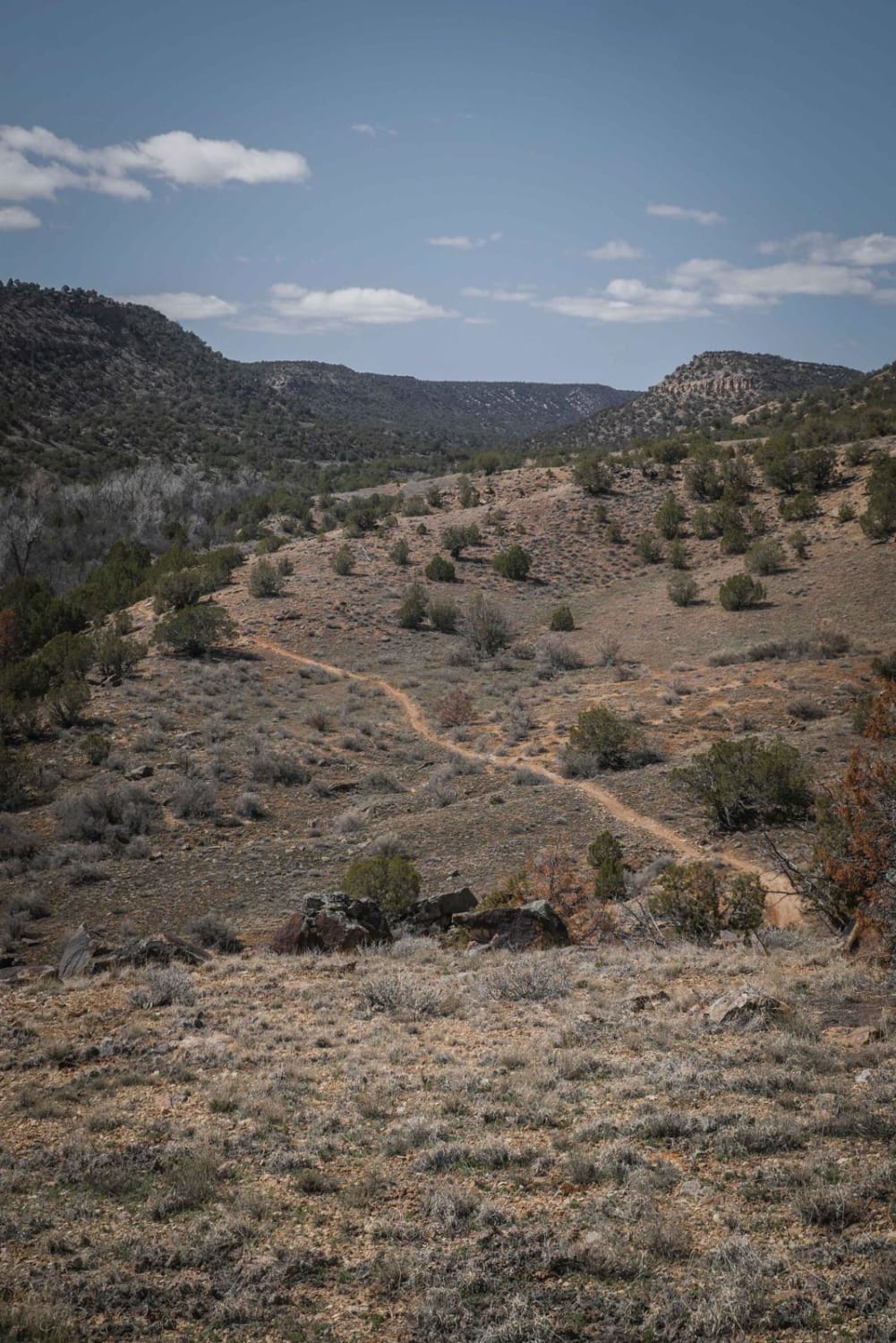
Lower Spring Creek is a 7-mile-long trail west of Montrose, Colorado, that starts on the south end of the Uncompahgre National Forest and heads north through BLM land. It heads straight down towards Montrose from the forest, dropping 1,500 feet in elevation as it descends from the pine trees into more of a high desert terrain with lots of bushes. It's very windy, with lots of tight sections that are fun if you plan ahead for the tightness. It's flowy for the most part but has some sporadic boulder gardens. It drops down with a steady grade all the way to the very end, but then has an uphill multi-switchback section that is quite steep for the inexperienced rider and could be a challenge. These switchbacks are narrow and tight, with loose rock and some small rock ledges. One switchback also has a section of rock slab covered in loose dirt that is more challenging. Coming down the switchbacks would be easier (north to south), but don't plan to drop down them unless you can get back up if you are riding this as an out-and-back. This trail doesn't connect to any other single track or have any bail outs, so it's most likely ridden as an out-and-back or on a through-route. You'd have to be street-legal to loop back to the trailhead via Dave Wood Road.
Photos of Lower Spring Creek Trail
Difficulty
Intermediate/Advanced single track trail with some challenging switchbacks that are loose and rocky.
Status Reports
Lower Spring Creek Trail can be accessed by the following ride types:
- Dirt Bike
Lower Spring Creek Trail Map
Popular Trails
West Green Mountain Trail (#719)

Mount Antero Access

Spring Creek ATV Trail (East)
The onX Offroad Difference
onX Offroad combines trail photos, descriptions, difficulty ratings, width restrictions, seasonality, and more in a user-friendly interface. Available on all devices, with offline access and full compatibility with CarPlay and Android Auto. Discover what you’re missing today!