770 Watson Park
Total Miles
5.7
Technical Rating
Best Time
Spring, Summer, Fall
Trail Type
Single Track
Accessible By
Trail Overview
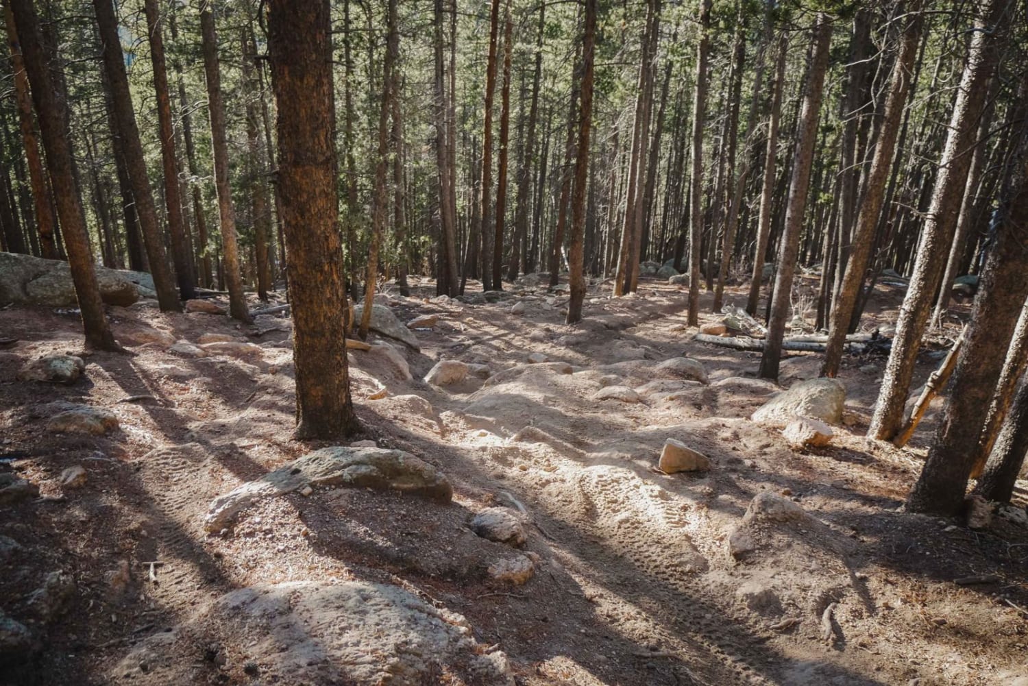
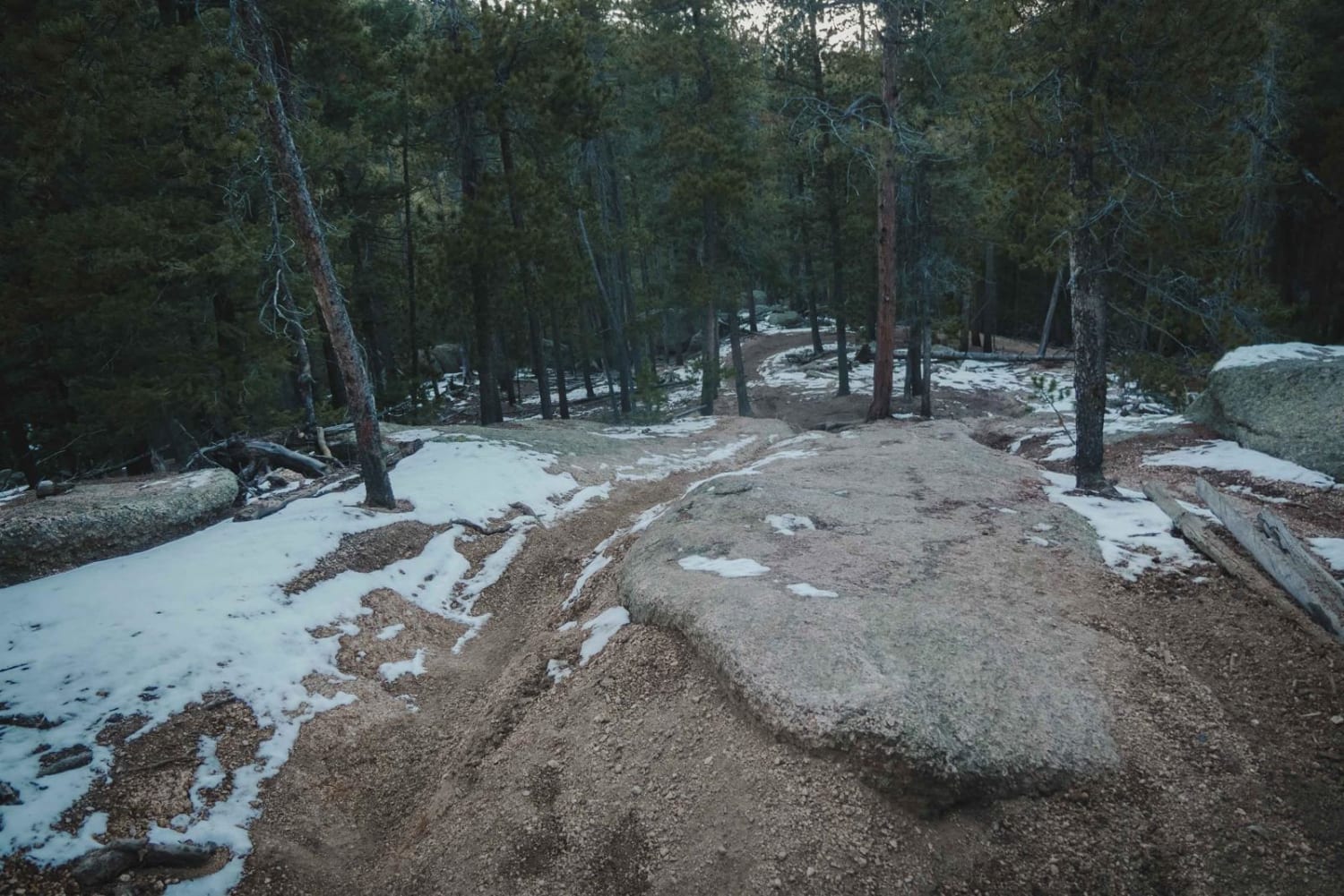
The Watson Park single track is an advanced trail due to very narrow sections through tight trees and technical rocky sections. It runs north to south between Rampart Range Road and Watson Park Road. There are also more sections of single track on either side of this trail, Bergen Rock Trail to the north, and Long Hollow Bypass Trail to the south. It also crosses Tornado Alley, another advanced single track with lots of rock problems. Watson Park trail follows a hillside on a narrow shelfy trail that often has spots of exposure, sections of whoops, and very tight pine trees that might grab your handlebars if not careful. You can actually see lots of gashes in the trees where riders have bashed into them. It goes over huge granite boulders like a ramp, through rock pinches between the boulders, and over moderate rock ledges and drop-offs. This trail has a lot of climbs and descents going in either direction and is super windy. It also has a braided section with a rock garden of embedded boulders that could be tricky to go up, although it has multiple lines to choose from. The surface of the trail is often on crushed gravel, which can be slippery and loose and makes the climbs harder.
Photos of 770 Watson Park
Difficulty
This is an advanced single track with several rocky spots and narrow spots of exposure. It is one of the harder trails in the recreation area.
Status Reports
770 Watson Park can be accessed by the following ride types:
- Dirt Bike
770 Watson Park Map
Popular Trails

Art Cooks View


The onX Offroad Difference
onX Offroad combines trail photos, descriptions, difficulty ratings, width restrictions, seasonality, and more in a user-friendly interface. Available on all devices, with offline access and full compatibility with CarPlay and Android Auto. Discover what you’re missing today!