Queen Ester Road
Total Miles
7.9
Technical Rating
Best Time
Fall, Winter, Spring
Trail Type
Full-Width Road
Accessible By
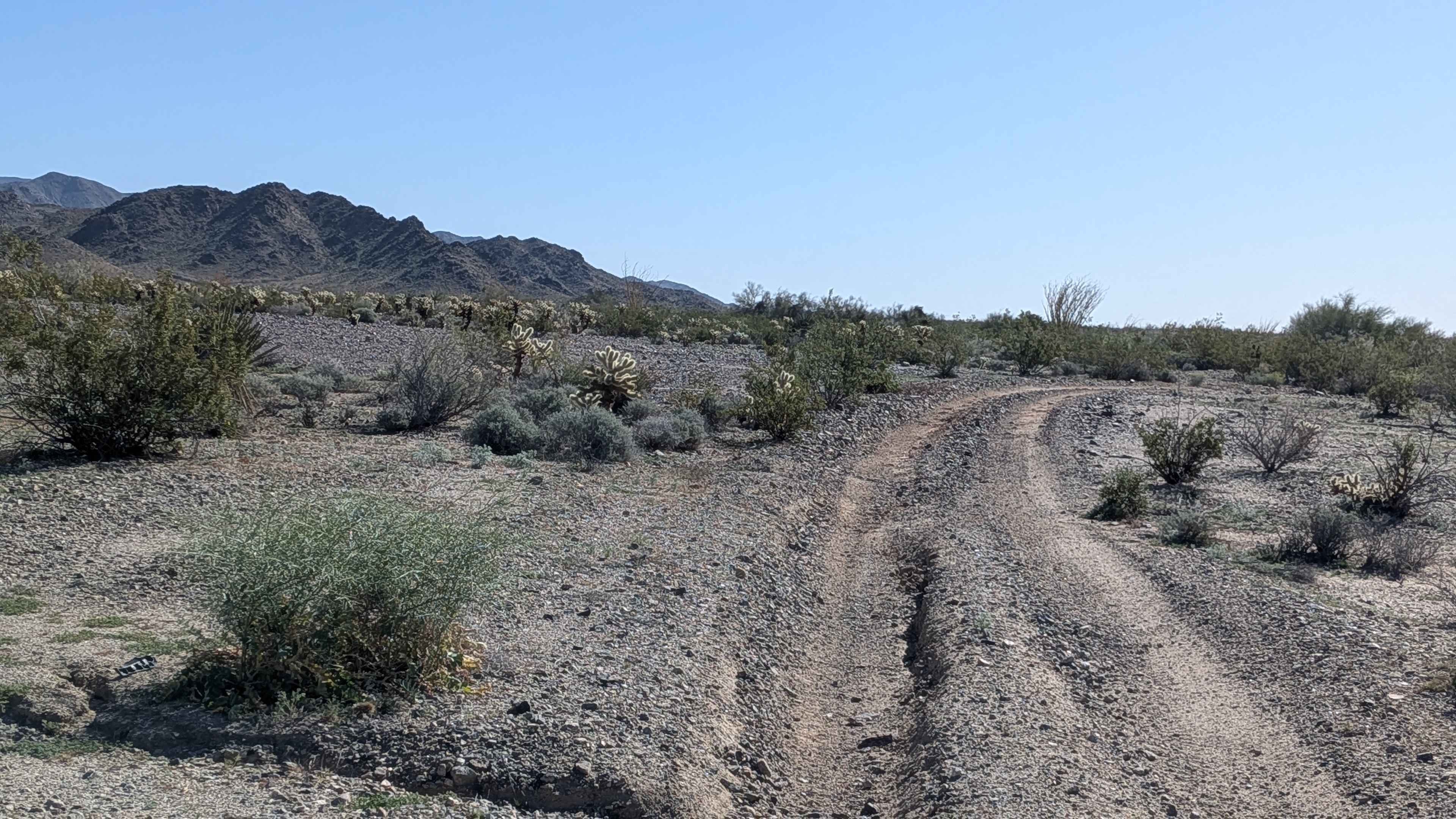
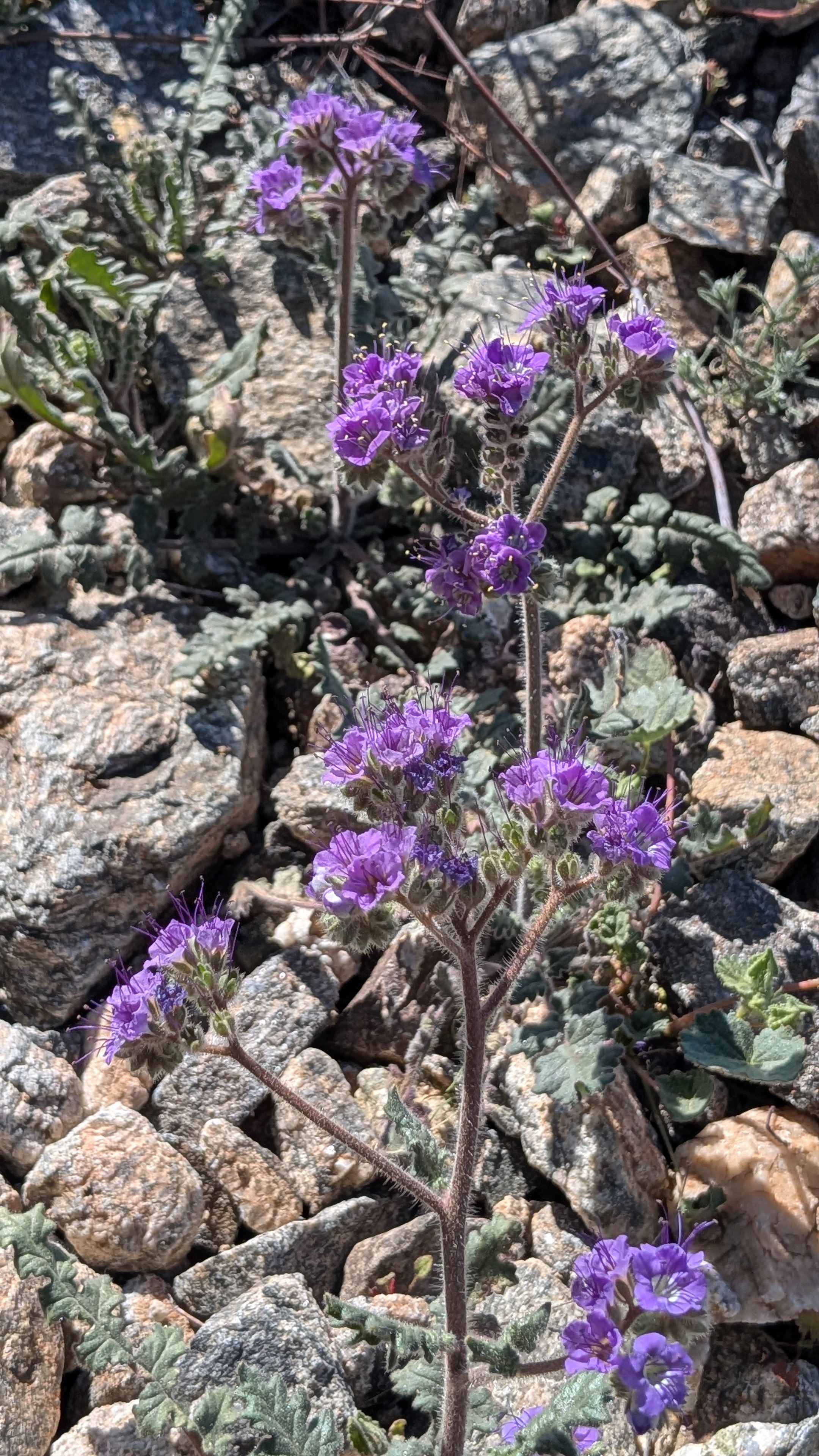
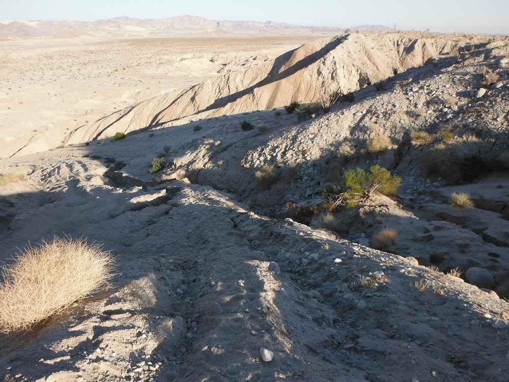
Trail Overview
This out-and-back trail climbs almost 800 feet in just under 8 miles, running east to west from Gas Line Road 281. The trail is one vehicle wide with a hard-pack sand surface and small rocks. This is one of the most scenic trails in the area, lined with lots of vegetation, including desert ironwood, cheese bushes, colorful desert flowers of many colors, ocotillo bushes, and forests of Teddy Bear Cholla. You'll enjoy nice views of the surrounding Orocopia Mountains throughout. There are a couple of entrances and exits out of washes where high clearance is highly recommended, and long wheelbases may have challenges. The last half mile runs along a cliff edge next to a canyon, adding drama to the finale. Wide vehicles may get pinstripes. The trail ends at the border of a wilderness area. Please exercise extra caution when traveling near the wilderness boundary.
Photos of Queen Ester Road
Difficulty
The wash entrances and exits are the main technical challenge on this trail, requiring high clearance and presenting potential difficulty for longer wheelbase vehicles. The cliff-edge section in the last half mile demands attention and respect. The narrow width and potential for pinstriping on wide vehicles add to the consideration.
Status Reports
Queen Ester Road can be accessed by the following ride types:
- High-Clearance 4x4
- SUV
- SxS (60")
- ATV (50")
- Dirt Bike
Queen Ester Road Map
Popular Trails
Two Road Road - FS 31358D

Sweetwater Ridge - FS 3S012
Candy Rock Road P.2
Diablo Dropoff
The onX Offroad Difference
onX Offroad combines trail photos, descriptions, difficulty ratings, width restrictions, seasonality, and more in a user-friendly interface. Available on all devices, with offline access and full compatibility with CarPlay and Android Auto. Discover what you’re missing today!