Sweetwater Ridge - FS 3S012
Total Miles
3.6
Technical Rating
Best Time
Fall, Summer, Spring
Trail Type
Full-Width Road
Accessible By
Trail Overview
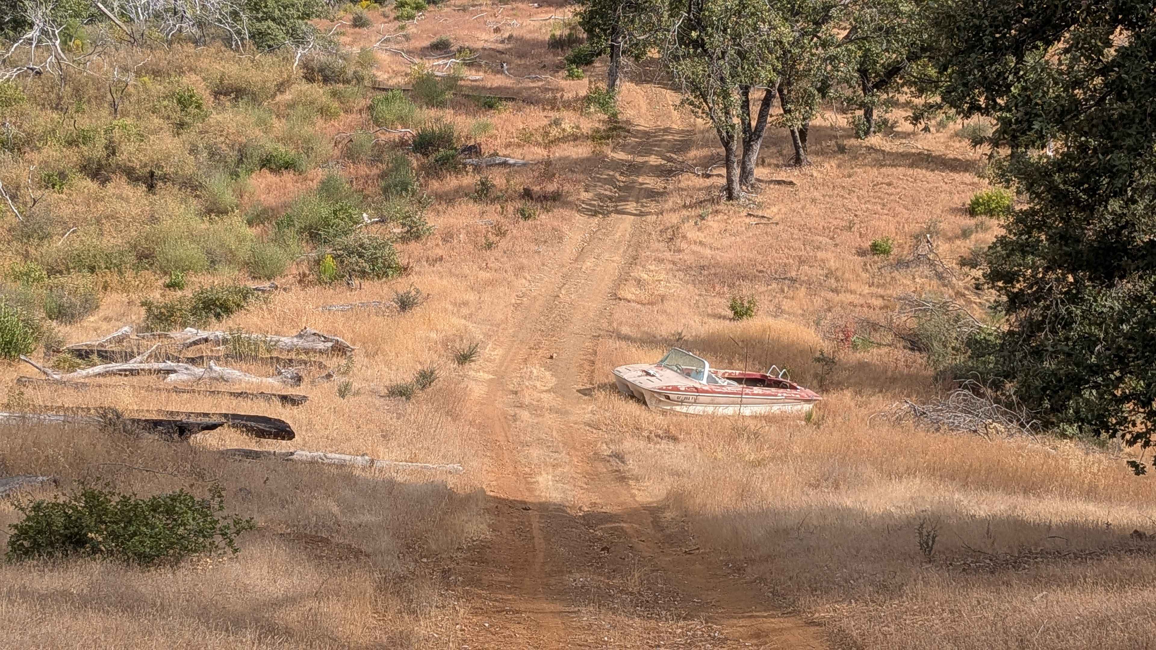
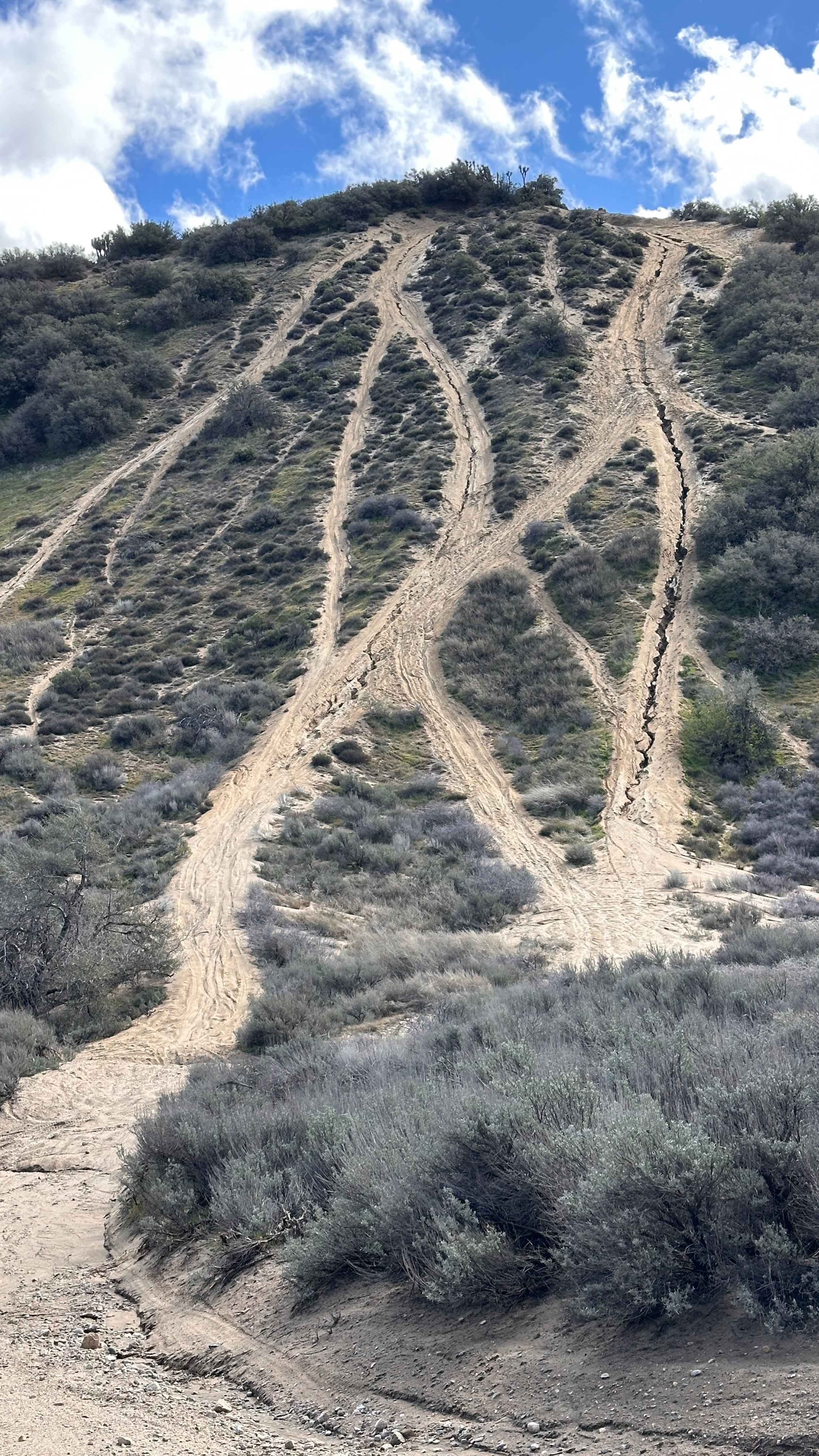
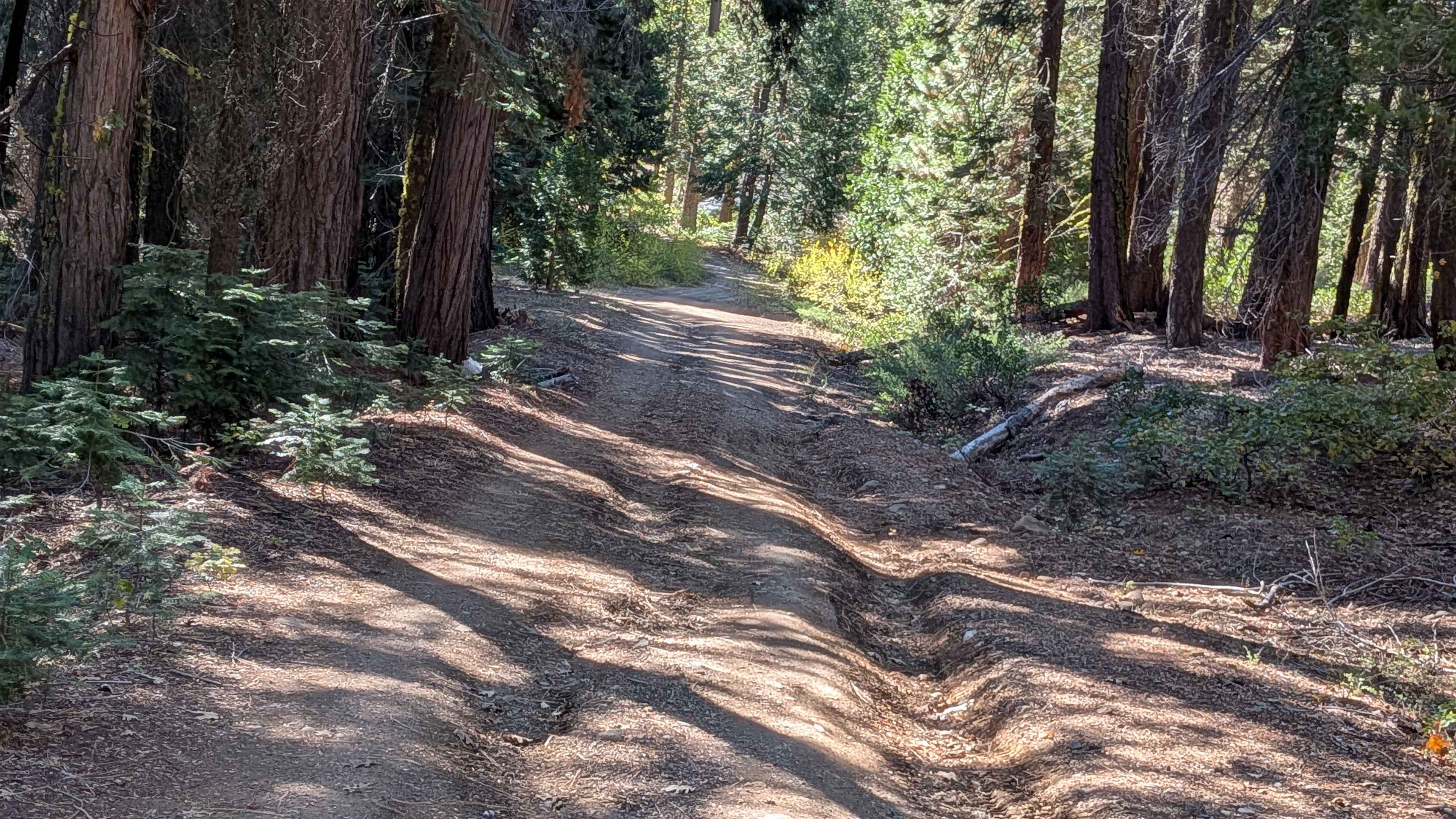
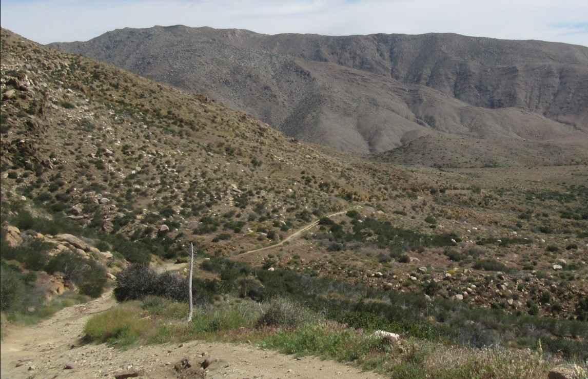
Sweetwater Ridge climbs almost 500 feet and drops almost 800 feet over just 3.6 miles, though this 7-mile out-and-back trail starts at Feliciana Mountain Road. The trail begins as a gravel surface and transitions to sand as it progresses, maintaining a single vehicle width throughout while providing adequate maneuvering space. Less than a quarter mile down the trail, the remnants of an old rolled-over pickup truck serve as an early landmark and foreshadowing of what lies ahead. The route winds up and down hills along the ridge, offering excellent views of the valleys below, canyons, and surrounding mountains as it follows the natural terrain contours. A steep hill climb with significant ruts presents the primary technical challenge, requiring attention to line selection and throttle control. Unfortunately, this trail has become a literal junkyard with over 50 abandoned vehicles and even a boat scattered along the route, creating an environmental eyesore that detracts from the natural beauty of the area. Wildlife encounters are common, particularly with mule deer, requiring drivers to remain alert and maintain appropriate speeds. The trail terminates at the end of the ridge, where it provides spectacular 270-degree views of the surrounding valleys and mountains, offering a rewarding destination despite the littered conditions along the way.
Photos of Sweetwater Ridge - FS 3S012

Difficulty
This trail receives a difficulty rating of 2, indicating moderate conditions suitable for most high-clearance vehicles and drivers with basic off-road experience. The primary challenges include the steep hill climb with ruts and navigating around the numerous abandoned vehicles, though the technical demands remain manageable for intermediate drivers.
History
Sweetwater Ridge near Mariposa is named for a significant historical gold mine in the Sweetwater Mining District, which operated from the late 1800s into the 20th century and produced hundreds of thousands of dollars in gold. The ridge is on National Forest land and was named Sweetwater after the mine. Its history is tied to the broader California Gold Rush and the subsequent mining efforts in Mariposa County.
Status Reports
Sweetwater Ridge - FS 3S012 can be accessed by the following ride types:
- High-Clearance 4x4
- SUV
- SxS (60")
- ATV (50")
- Dirt Bike
Sweetwater Ridge - FS 3S012 Map
Popular Trails
Chickens
Walker Way - BLM 656
EC 19 Table Mountain Road
The onX Offroad Difference
onX Offroad combines trail photos, descriptions, difficulty ratings, width restrictions, seasonality, and more in a user-friendly interface. Available on all devices, with offline access and full compatibility with CarPlay and Android Auto. Discover what you’re missing today!