Lower Tamarack - FS 9s026
Total Miles
2.1
Technical Rating
Best Time
Summer, Fall
Trail Type
Full-Width Road
Accessible By
Trail Overview
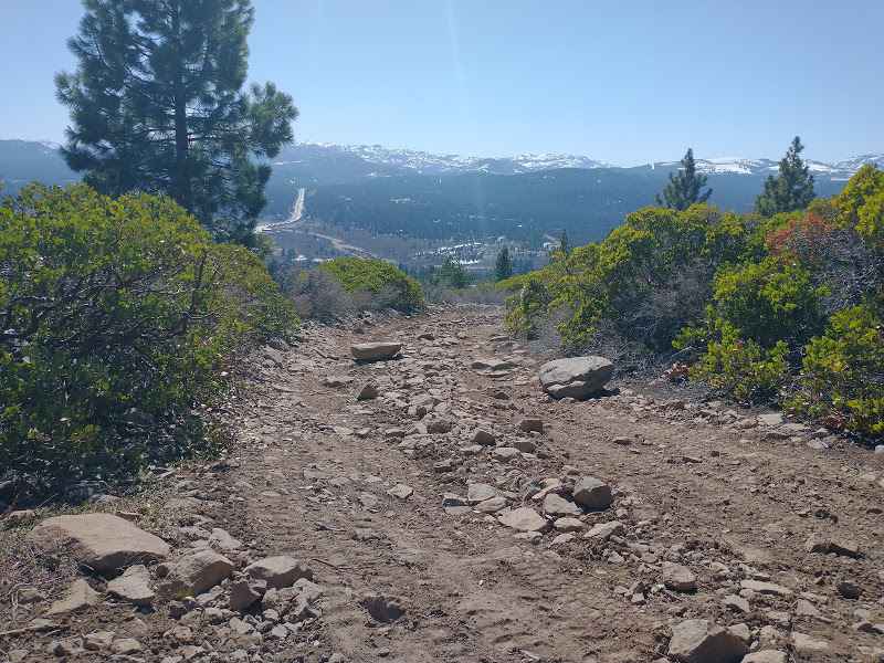
This is an easy, wide 2.1-mile dirt forest service road designed for fast transit through the high country. The road runs through a massive, high-severity burn scar from the 2020 Creek Wildfire (visible in photos), leaving the area wide open and exposed. The roadbed is predominantly smooth, loose duff and packed dirt, but carries significant debris from ongoing salvage logging operations (debris piles and signage visible). This is a key route for fire recovery efforts, but it remains accessible to the public, offering clear views and fast travel when active work is not underway. The slow drive time reflects the caution needed in this industrial and hazardous environment.
Photos of Lower Tamarack - FS 9s026


Difficulty
Rated 1 (Smooth Operator): This road is suitable for all passenger vehicles when dry, requiring no technical 4WD skill. The rating is maintained due to the wide, smooth track and efficient transit. High clearance is recommended for comfort when driving over the loose duff and debris, but the trail presents no articulation or obstacle challenges.
Status Reports
Lower Tamarack - FS 9s026 can be accessed by the following ride types:
- High-Clearance 4x4
- SUV
Lower Tamarack - FS 9s026 Map
Popular Trails
Lake Crowley North Landing 1
Owen's River Road

The onX Offroad Difference
onX Offroad combines trail photos, descriptions, difficulty ratings, width restrictions, seasonality, and more in a user-friendly interface. Available on all devices, with offline access and full compatibility with CarPlay and Android Auto. Discover what you’re missing today!