Forest Service Road 5S108
Total Miles
2.3
Technical Rating
Best Time
Summer, Spring, Fall
Trail Type
Full-Width Road
Accessible By
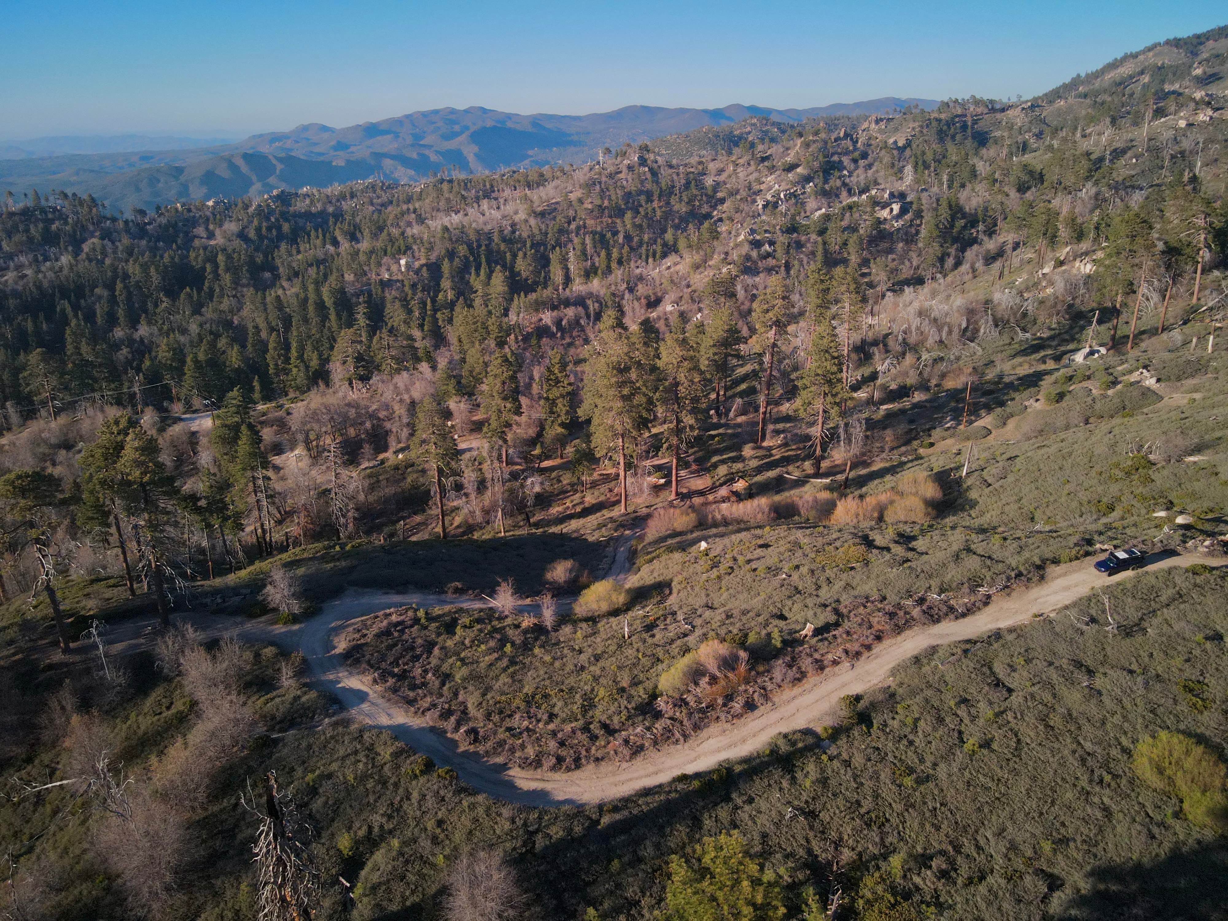
Trail Overview
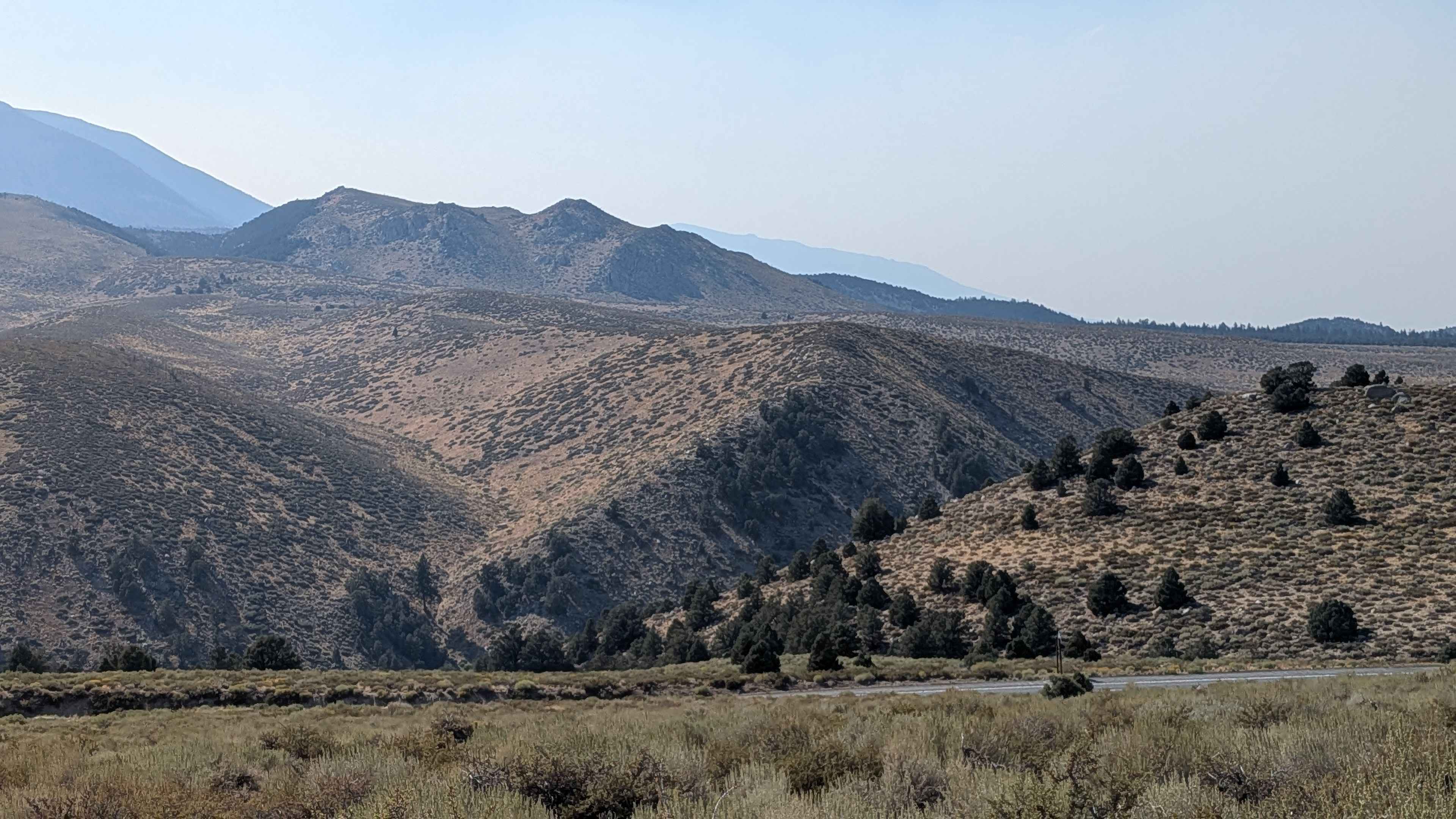
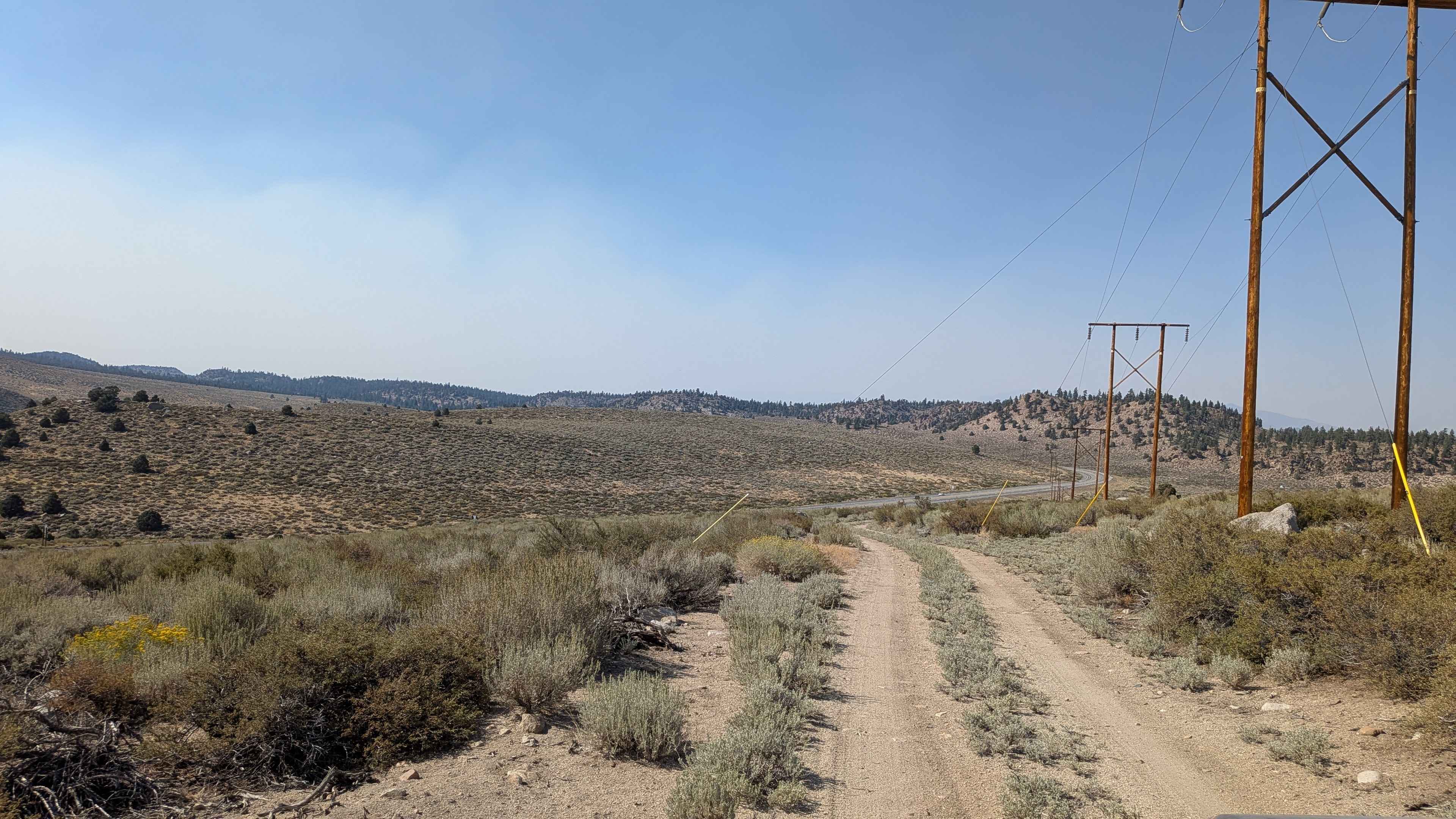
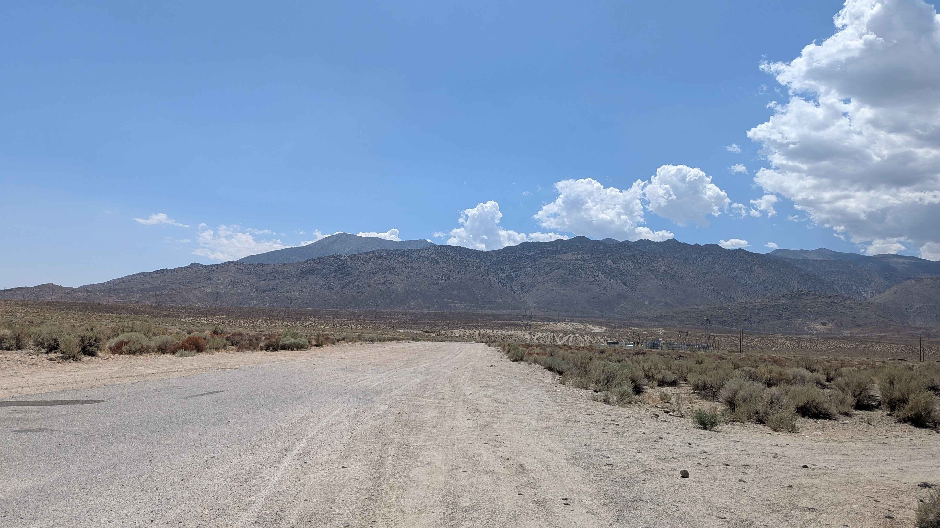
This trail climbs more than 550 feet and drops 160 feet in just over 2.25 miles, running parallel to Highway 395. From the south, it immediately climbs a small hill and continues as a sandy, dusty track with scattered rocks, about 1.5 vehicles wide. The route winds up and down rolling hills, lined with rock formations and tall juniper trees, offering an adventurous alternative to pavement. As you climb, you're rewarded with sweeping views of the Eastern Sierra, including Mount Tom, Pine Creek Canyon, Bishop, and Swall Meadows. To the east, Casa Diablo Mountain rises in contrast, while the foothills of the Sierra and Lower Rock Creek appear just beyond the highway. There are several good opportunities for dispersed camping along the way, especially in the open meadows. Around mile 1.5, the trail steepens into a sandy hill climb, but cresting it opens up more stunning mountain views in all directions.
Photos of Forest Service Road 5S108
Difficulty
The sandy climbs and narrow access require some care, but the trail is approachable for most high-clearance vehicles. For the south entrance, the shoulder of the highway near this trail entrance is very narrow, so use caution when pulling off to start the trail. It is an abrupt turn and immediately climbs up a sandy hill with rocks.
Status Reports
Forest Service Road 5S108 can be accessed by the following ride types:
- High-Clearance 4x4
- SUV
- SxS (60")
- ATV (50")
- Dirt Bike
Forest Service Road 5S108 Map
Popular Trails
Arc OHV Trail
Coyote Valley Road
Little Green Valley
Saratoga Springs
The onX Offroad Difference
onX Offroad combines trail photos, descriptions, difficulty ratings, width restrictions, seasonality, and more in a user-friendly interface. Available on all devices, with offline access and full compatibility with CarPlay and Android Auto. Discover what you’re missing today!