BLM SC129
Total Miles
3.1
Technical Rating
Best Time
Winter, Fall, Summer, Spring
Trail Type
Full-Width Road
Accessible By
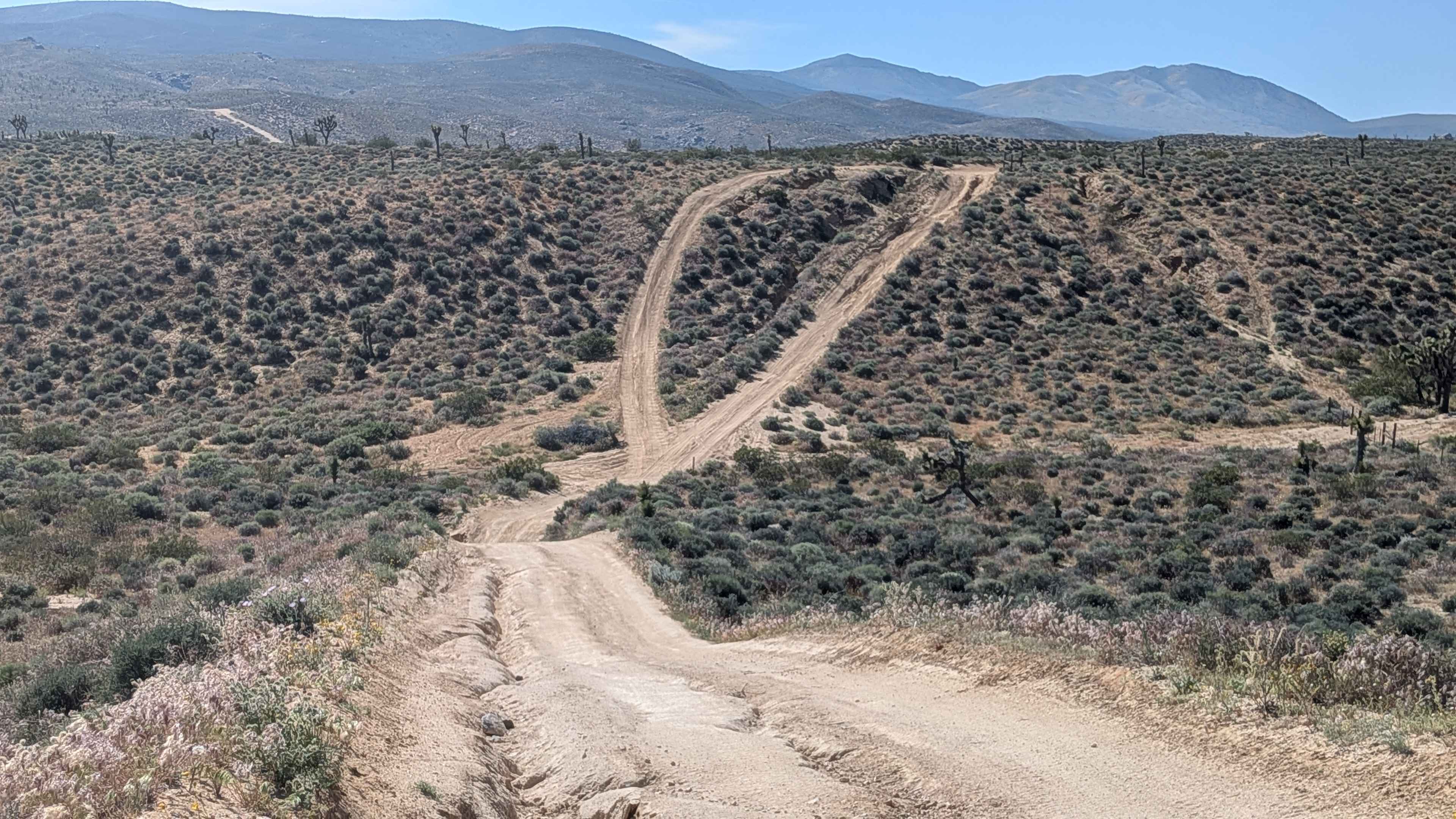
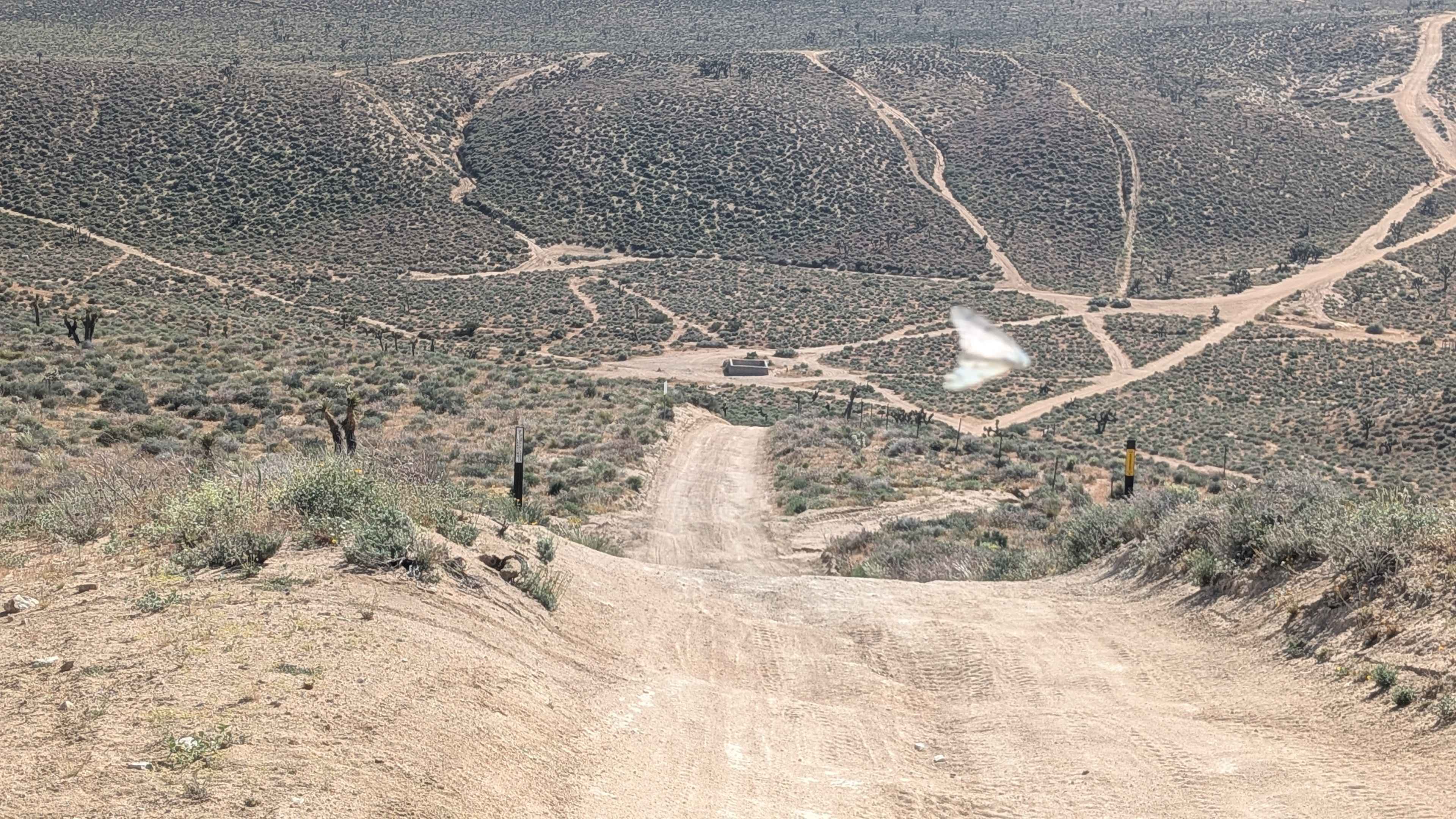
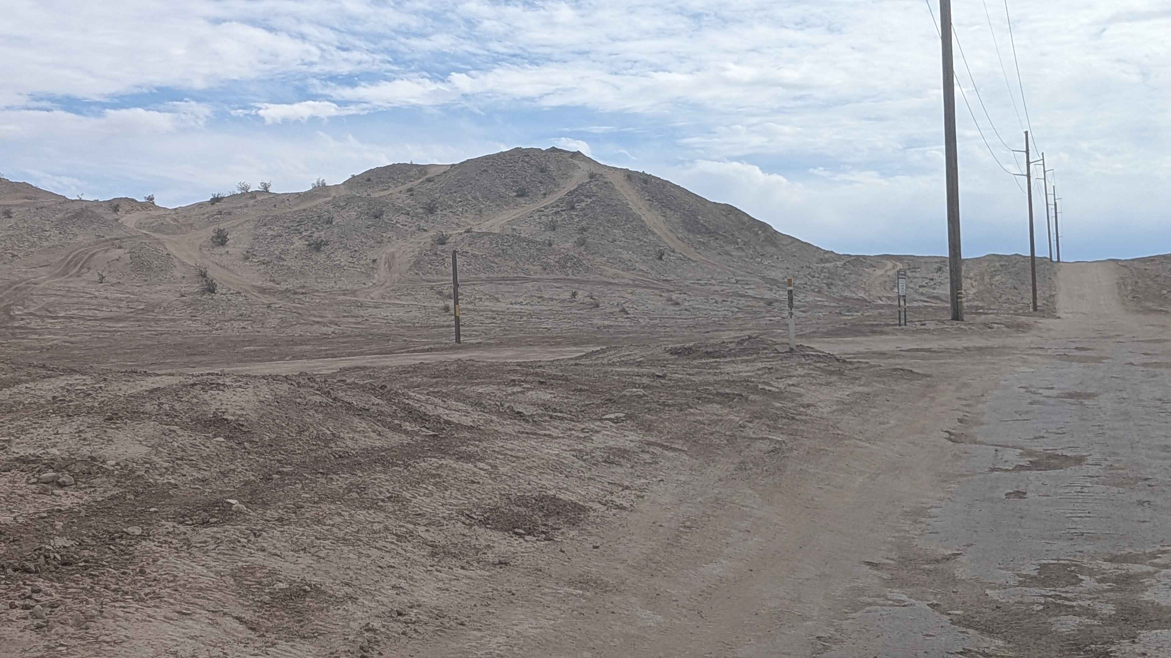
Trail Overview
This hard-pack sandy trail winds through Dove Springs OHV open riding area, perched high above, where you can look down into the main riding area below. Running along the north and east border of Dove Springs OHV, this elevated route passes near where wall trails climb and descend from below. Off-camber sections, ruts, whoops, and uneven surfaces all under 12 inches deep appear throughout. Great views showcase the Dove Springs OHV area, Eastern Sierra Mountains, and El Paso Mountains across Highway 14. The north section features a very steep hill, adding a demanding climb or descent.
Photos of BLM SC129
Difficulty
Off-camber sections, ruts, whoops, and uneven surfaces all under 12 inches create accumulated challenges without individual extreme depth. The very steep hill on the north section is the crux, demanding low range and controlled descent or committed climb. Being perched high above the area creates exposure psychology. Hard pack sandy surface provides decent traction. The sub-12-inch obstacles are manageable with clearance. Four wheel drive handles the steep north section hill. The elevated border position provides excellent views of the OHV area activity below.
Status Reports
BLM SC129 can be accessed by the following ride types:
- High-Clearance 4x4
- SUV
- SxS (60")
- ATV (50")
- Dirt Bike
BLM SC129 Map
Popular Trails
By Day Creek - FS 32076

Boneridge - FS 8s035
Mojave Road, West
Pole Line Road North
The onX Offroad Difference
onX Offroad combines trail photos, descriptions, difficulty ratings, width restrictions, seasonality, and more in a user-friendly interface. Available on all devices, with offline access and full compatibility with CarPlay and Android Auto. Discover what you’re missing today!