15EV71
Total Miles
0.6
Technical Rating
Best Time
Fall, Spring
Trail Type
50" Trail
Accessible By
Trail Overview
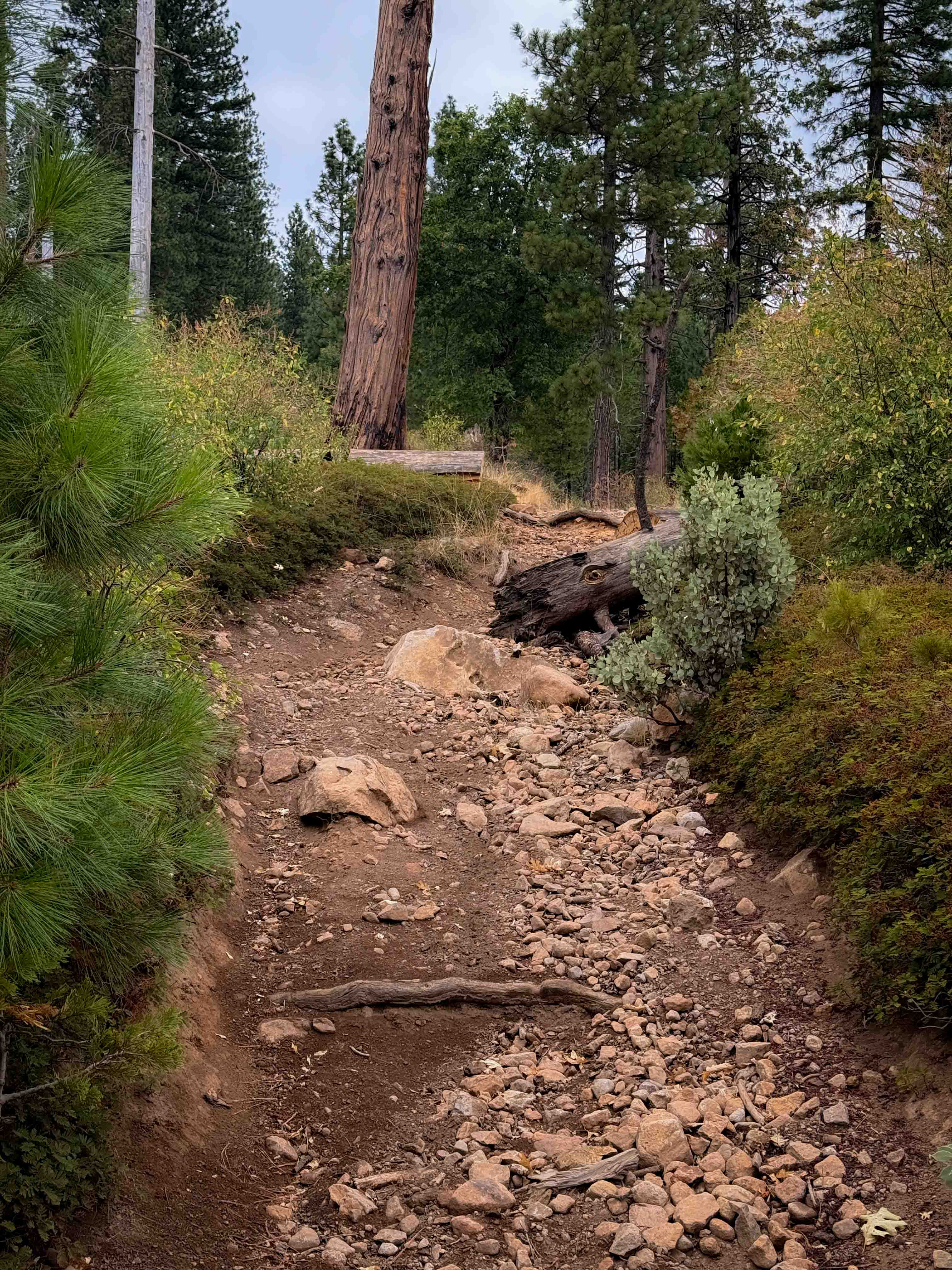
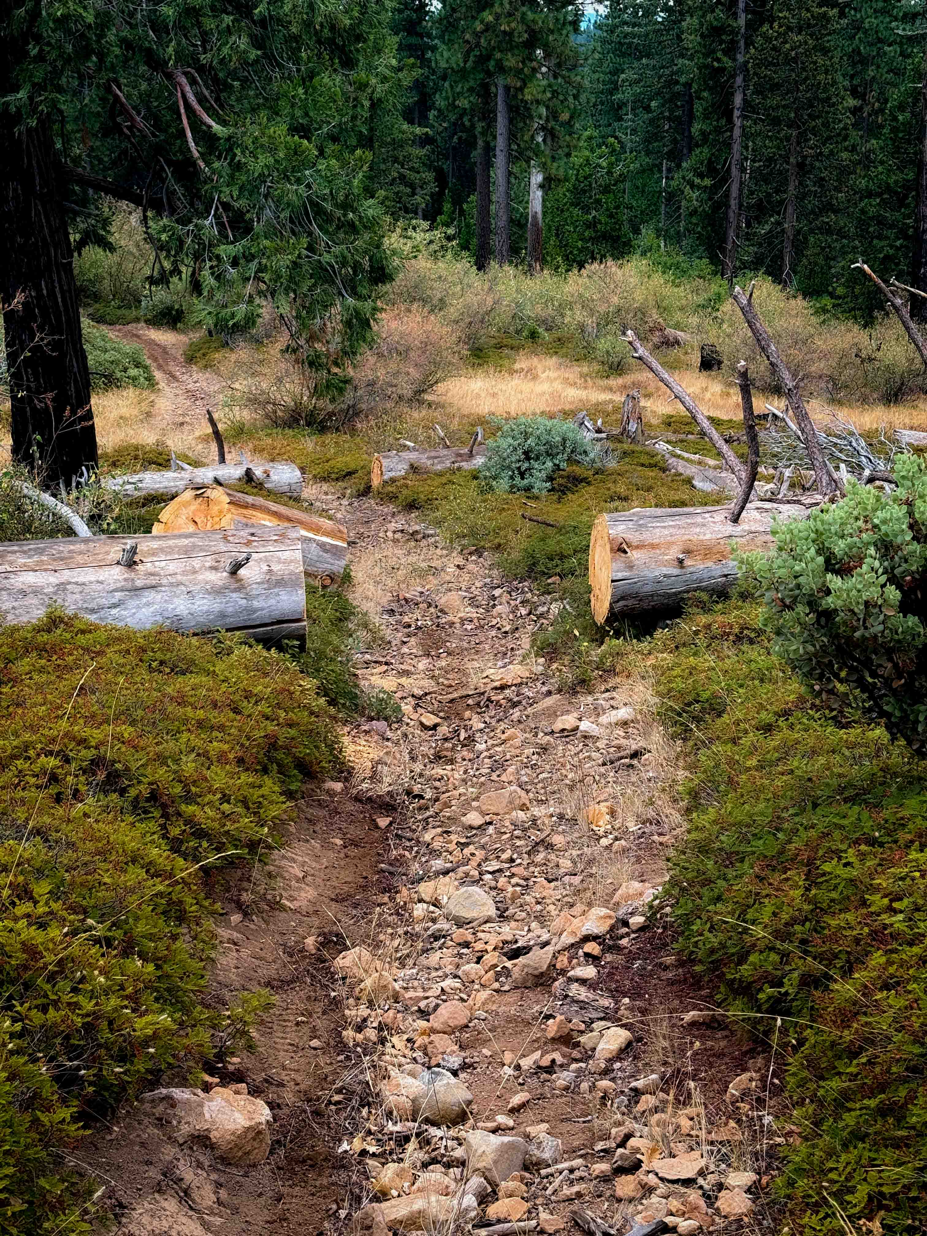
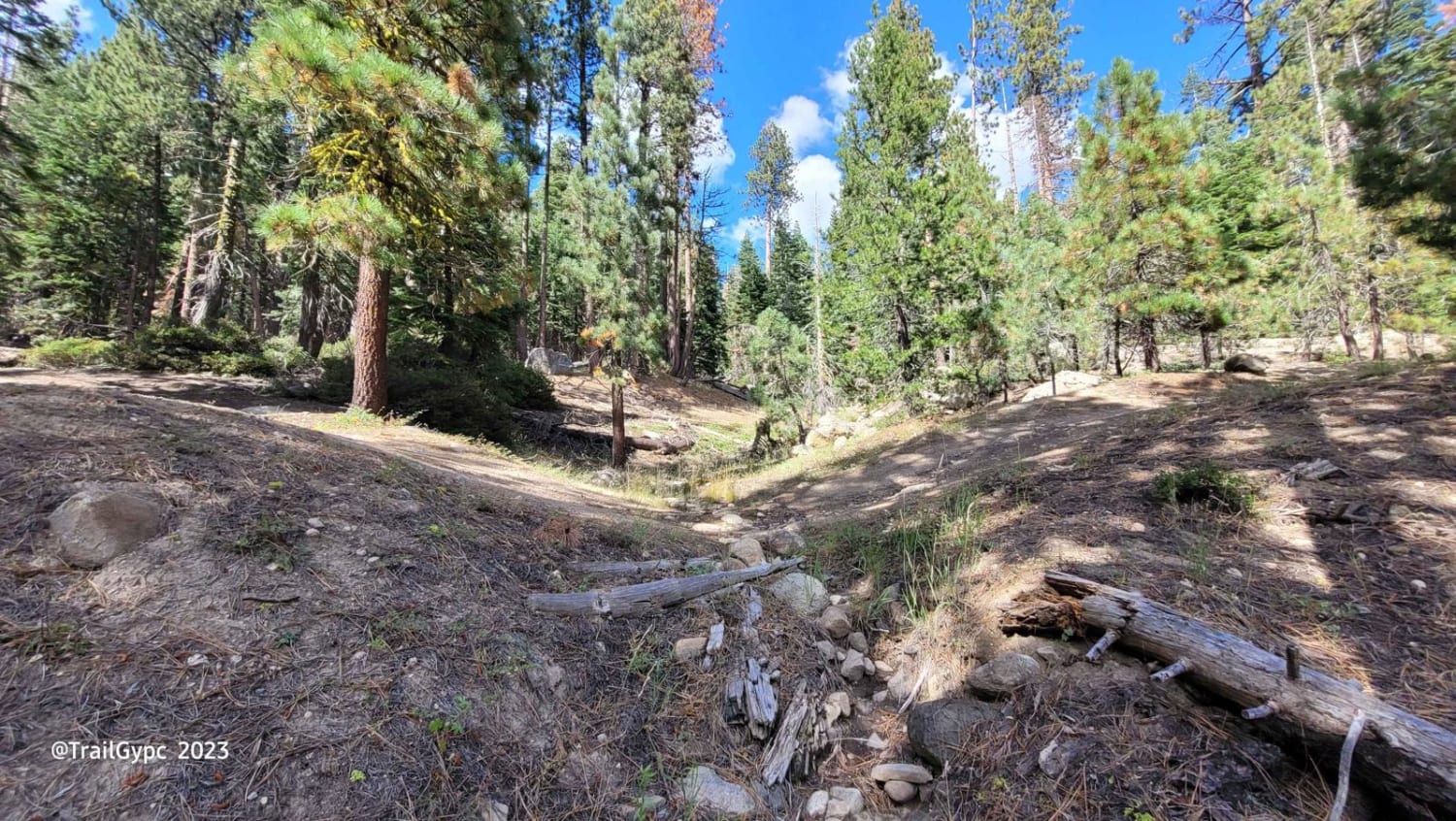
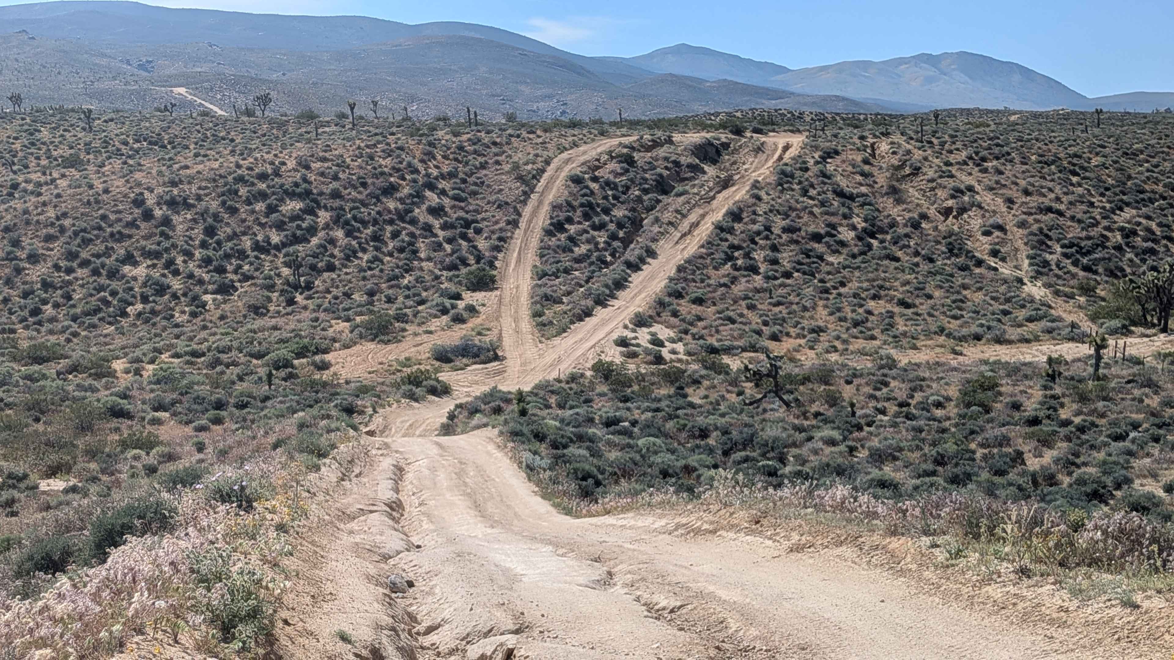
15EV71 is a .6 mile long ATV trail, gaining almost 500 feet elevation from south to north. It starts out as a wide dirt path between young pine trees, curving up the hillside. It goes through a lot of previously cut logs, and goes through segments that are more rutted and narrow and covered in a layer of small loose rocks that makes this trail more suited to intermediate riders. There is one steep hill climb in particular covered in bigger loose rocks, with a couple big embedded boulders and big root bands. You'll want to keep your momentum up for this climb. The trail gets narrow in spots between the shrubs, looking more like a single track in segments. It meets up with ATV trail 15EV73 on the north end.
Photos of 15EV71
Difficulty
This is a moderate ATV trail due to a steep climb with big boulders, loose rock and roots. Other sections will be narrow for ATV riders.
Status Reports
15EV71 can be accessed by the following ride types:
- ATV (50")
- Dirt Bike
15EV71 Map
Popular Trails

Hawkins Peak Road
Utica-Union Byway
The onX Offroad Difference
onX Offroad combines trail photos, descriptions, difficulty ratings, width restrictions, seasonality, and more in a user-friendly interface. Available on all devices, with offline access and full compatibility with CarPlay and Android Auto. Discover what you’re missing today!