Ss1050
Total Miles
23.9
Technical Rating
Best Time
Spring, Summer, Winter, Fall
Trail Type
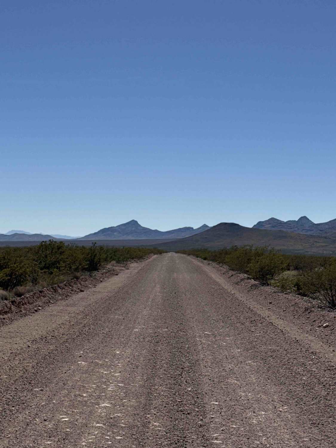
Full-Width Road
Accessible By
Trail Overview
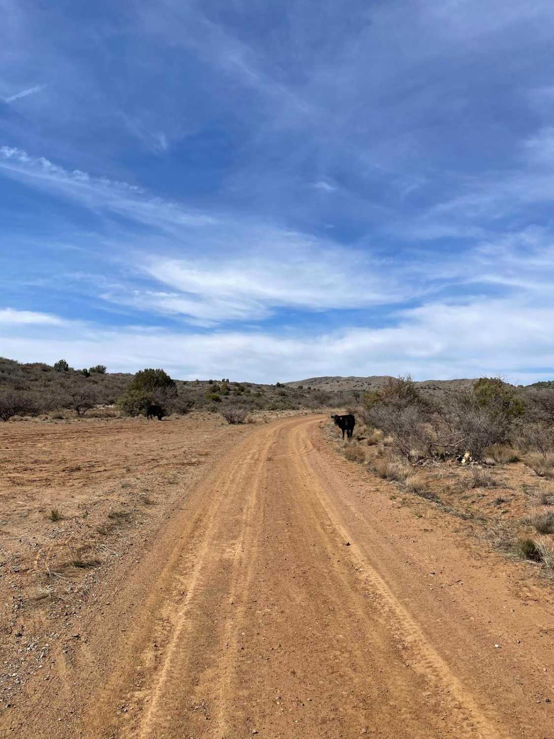
Trail guide summery Trail Ss1050 Enters off Highway 70. There's a large parking and air down area right off the highway, just past the open gate cattle guard. Next, you will come to a cattle guard with a sign that says Hackberry Ranch and State Trust Land Permit Required. Hackberry Road goes to the right at the Y and stays left to continue Ss1050. This is a connector Gravel trail, easy-graded rocky berm sides lined with desert creosote. Trees eventually get larger after you pass the power lines. Watch for livestock on the trail. Next, you will come to a ranch. You will enter slowly and turn right to go between the 2 buildings and approach the closed gate. Keep this gate closed. This is Hackberry Ranch. SLOW. This is a working ranch; do not stop other than to open and close the gate. On the other side of the trail, it weaves through more desert filled with livestock. Watch your speed. Lots of cow traffic and lots of ruts you will not see until you are on them, and potential damage. Next, you will come to a Y, and you will need to go right. Sand dunes will be on the east side, and you will pass through an open section of private property. Do not stop in the private property area. There are no gates on the road. The trail is packed sand and smooth. You will soon pass by the Whitlock detention dam, built in 1968. There is a side trail to explore. This section becomes smooth hard-packed sand. Shortly after the Dam you will cross back into BLM land and come to Sands Draw and cross another cattle guard. At this point, you are east of Hot Wells Dunes with lots of trail options at the end of Ss1050. Ss1050 dead ends at County Line Road going west or Ss1123 to the east to go into the mountains. Ss1050 quickly ends at a wagon wheel of trails.
Photos of Ss1050

Difficulty
This trail follows an easy, graded gravel surface that transitions to packed sand and serves primarily as a connector route. Potential hazards include livestock, hidden ruts, and ranch gates. Any vehicle can travel this route under normal conditions.
History
Whitlock Detention Dam was constructed in 1968 as part of a series of watershed structures designed to control erosion and manage runoff in the San Simon River watershed. It was one of several side channel detention dams completed between 1967 and 1972 to help stabilize the landscape and slow sediment movement following significant erosion issues in the region. The dam was not constructed for water storage for agriculture or municipal supply, but primarily to slow floodwaters, trap sediment, and reduce downstream channel degradation. These types of structures help protect the overall watershed by reducing how quickly water and soil move through the landscape after storms. Whitlock Dam is one of many grade control and detention structures installed across the San Simon River watershed beginning in the mid-20th century. The goal was to halt severe channel incision, decrease soil loss, and rehabilitate a watershed that had been heavily impacted by overgrazing and natural erosion processes.
Status Reports
Ss1050 can be accessed by the following ride types:
- High-Clearance 4x4
- SUV
- SxS (60")
- ATV (50")
- Dirt Bike
Ss1050 Map
Popular Trails
Highway to Hell

Power Bc1096
Gas Line Road
The onX Offroad Difference
onX Offroad combines trail photos, descriptions, difficulty ratings, width restrictions, seasonality, and more in a user-friendly interface. Available on all devices, with offline access and full compatibility with CarPlay and Android Auto. Discover what you’re missing today!