Sonoran Flats
Total Miles
0.9
Technical Rating
Best Time
Winter, Spring, Fall
Trail Type
50" Trail
Accessible By
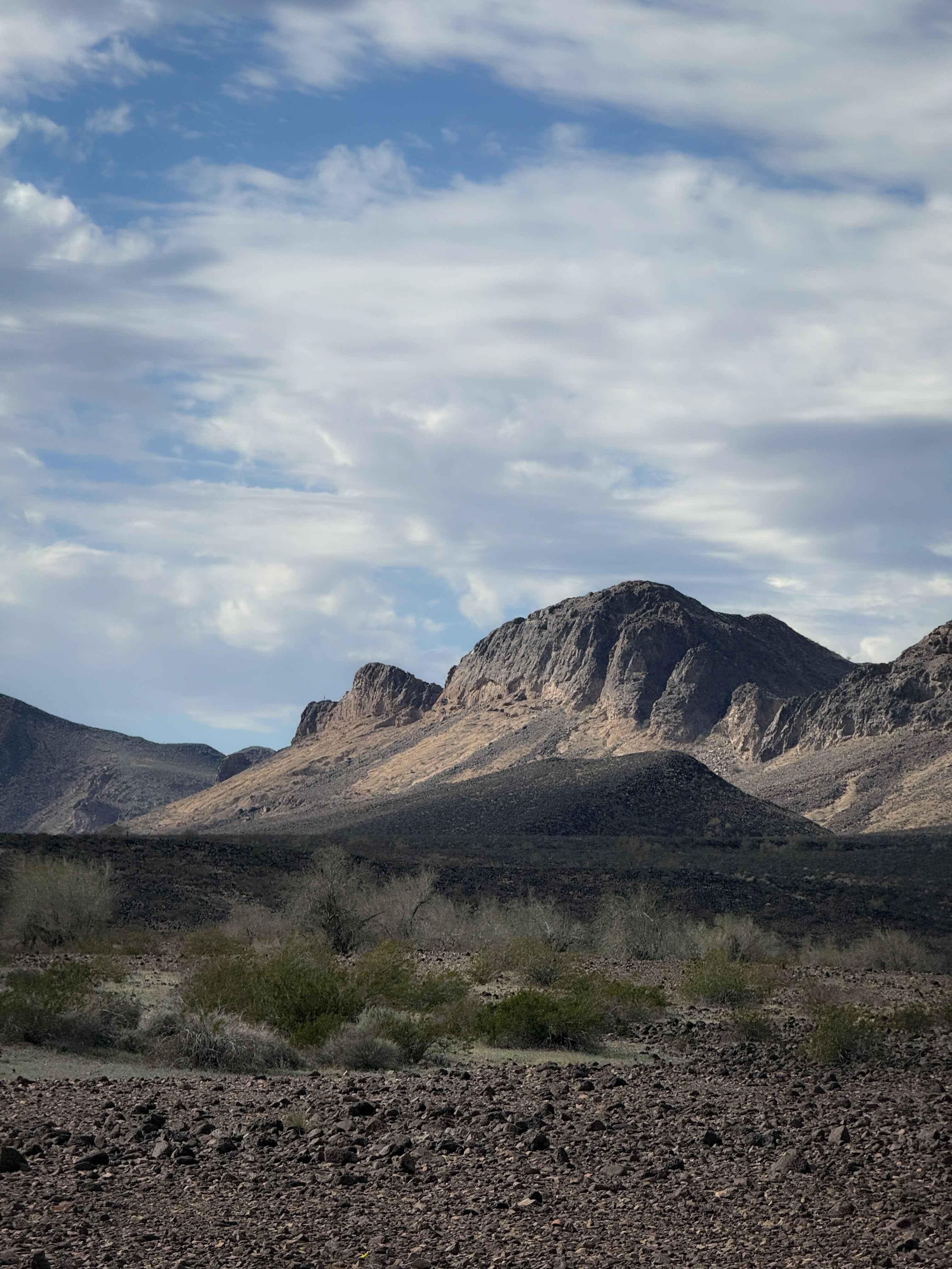
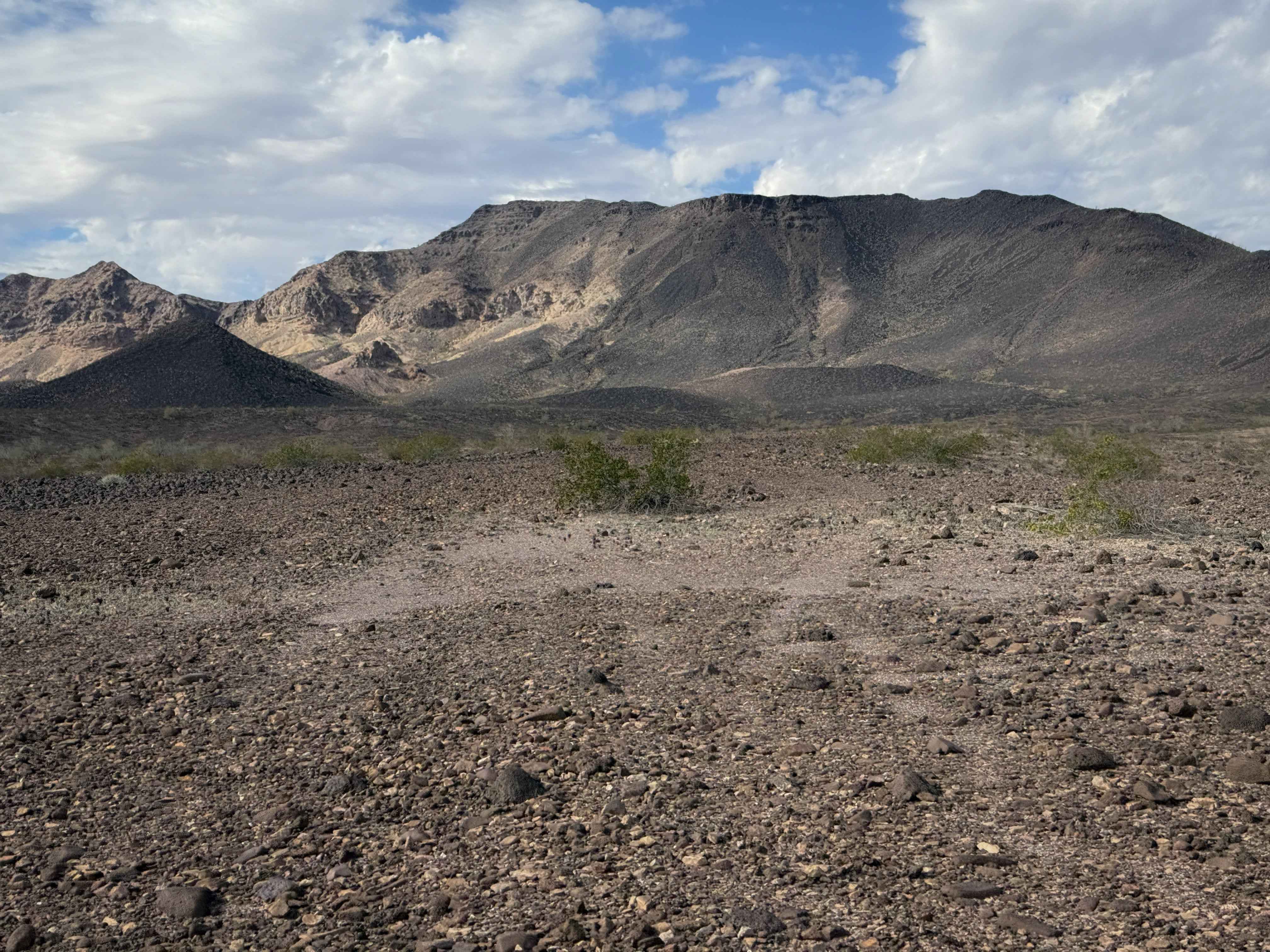
Trail Overview
This is a short route through the BLM land north of Palomas, Arizona. It is unmarked, but has lots of tracks to follow. It is mostly just a road-width route across flat and barren desert terrain. It rides at the base of a rugged mountain range, but stays in the flat valley the whole time, riding through creosote bushes and mesquite trees. The ground is mostly smooth, with a few shallow ruts and loose rocks. A couple of times, it's easy to lose track of the route because the tracks get swept away, especially because there are some unmarked splits in the track, so a GPS map is very helpful to have. The west end of the trail spurs off the main track and goes a bit further out towards the mountains. Enjoy the view here before getting back on the main track.
Photos of Sonoran Flats
Difficulty
This is a very easy trail as it is mostly a flat dirt road-width trail. There are no major obstacles, just easy curves and shallow ruts.
Status Reports
Sonoran Flats can be accessed by the following ride types:
- ATV (50")
- Dirt Bike
Sonoran Flats Map
Popular Trails

Kentucky Gulch - FR 163
Road to the Mountain's Foot

Canyon Camp Loop Ajo
The onX Offroad Difference
onX Offroad combines trail photos, descriptions, difficulty ratings, width restrictions, seasonality, and more in a user-friendly interface. Available on all devices, with offline access and full compatibility with CarPlay and Android Auto. Discover what you’re missing today!