Sheridan Mountain #11
Total Miles
3.8
Technical Rating
Best Time
Winter, Spring, Fall
Trail Type
50" Trail
Accessible By
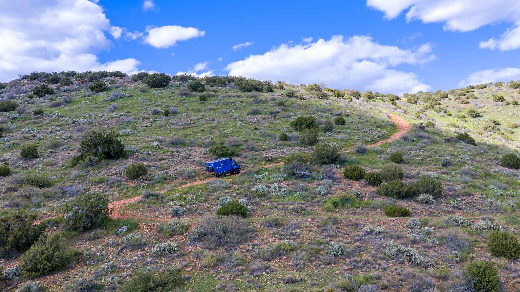
Trail Overview
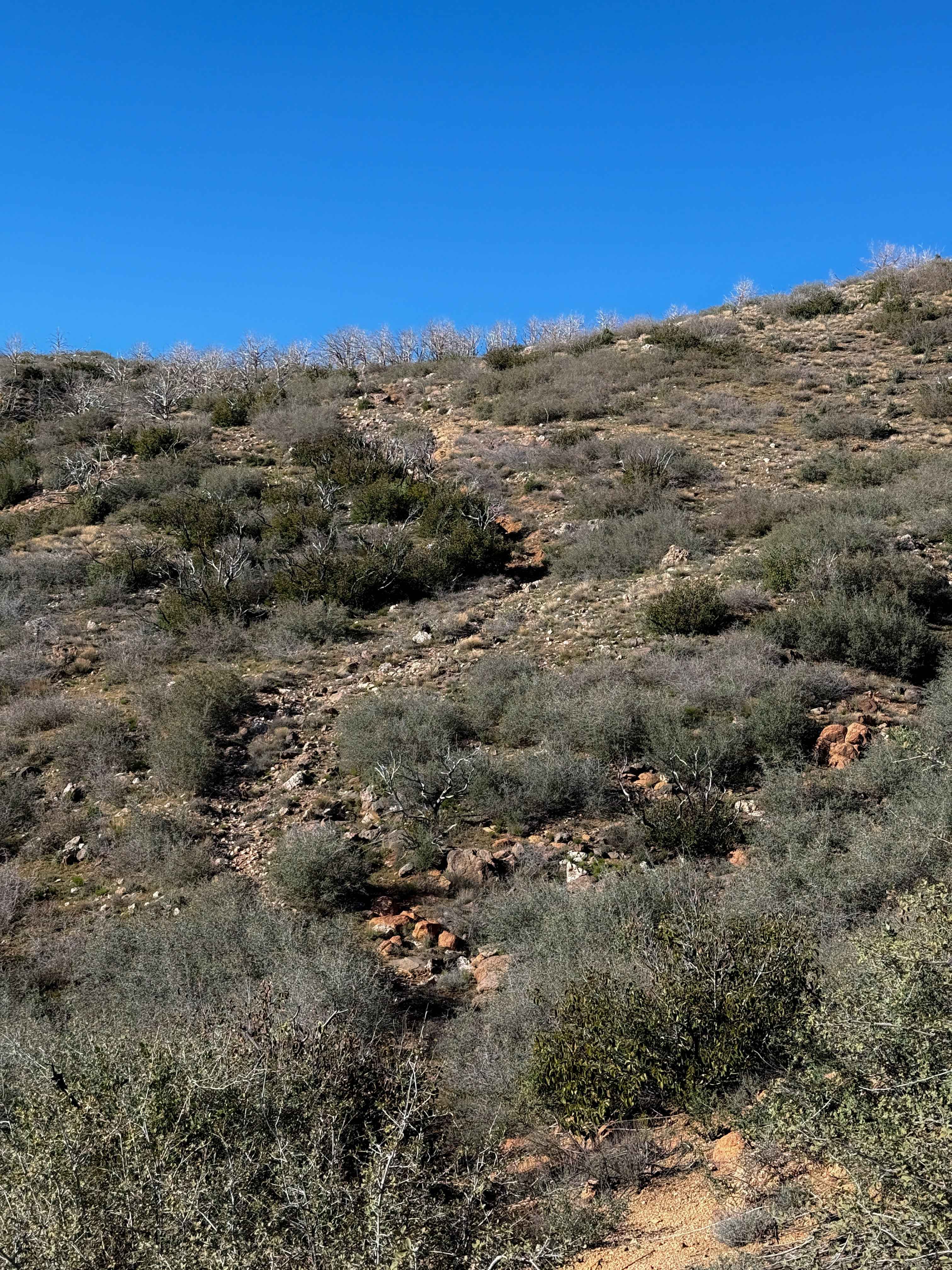
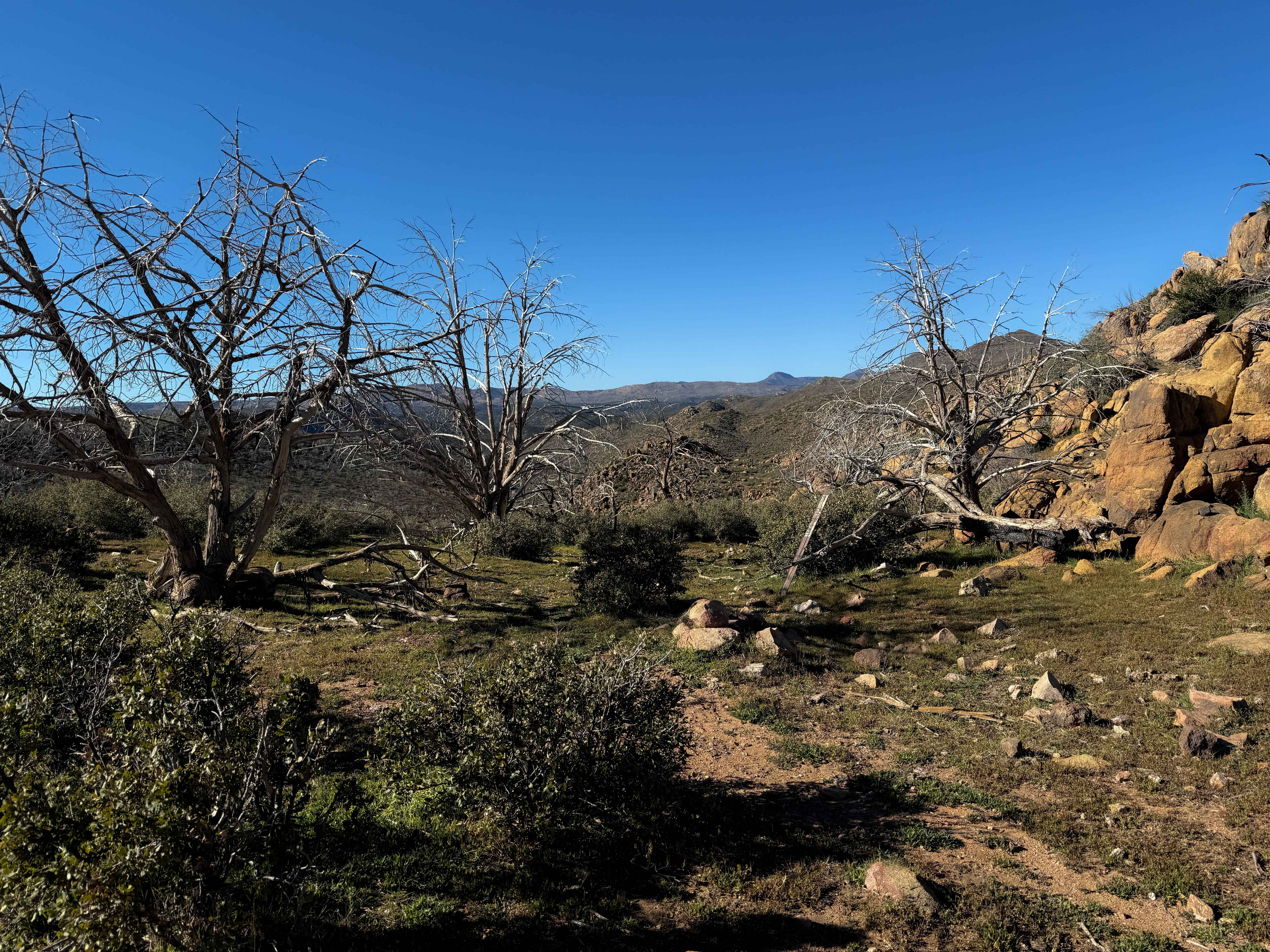
This is a technical and primitive trail that, although designated for ATVs, is only suitable for more experienced dirt bikers, as it has become narrow and washed out over time, making it unpassable for ATVs. It is highly technical, with very steep and loose climbs, narrow side hilling, and faint sections tightly weaving in the scrub oak. The south end begins on a saddle at the intersection with Trail #13, and it drops down a steep descent full of loose rocks, and is deeply rutted right away. There is a several-foot-deep rut down the center of the trail that would already make it very difficult for ATVs to get through. The trail is highly eroded as it meanders through the scrub oak, next to giant granite boulders. It climbs steeply around the side of Sheridan Mountain, requiring several long, sustained hill climbs up a rutted and narrow trail full of loose rocks. There are several tall ledges, small downed juniper trees creating log hazards, and primitive sections where route finding through the scrub oak is required. Overall, it is an adventurous trail that will be fun for more experienced dirt bikers.
Photos of Sheridan Mountain #11
Difficulty
This is a more challenging trail appropriate for experienced dirt bikers, because it has steep, loose climbs and descents, moderate rock ledges, primitive sections of route finding, and narrow side-hilling. Although designated for ATVs, it doesn't look trafficked by ATVs for a long time, and the narrow sections would make it impassable for an ATV; thus, ATV traffic is not recommended.
Status Reports
Sheridan Mountain #11 can be accessed by the following ride types:
- ATV (50")
- Dirt Bike
Sheridan Mountain #11 Map
Popular Trails

Cowboy Miller Road
Braddock Creek - FS 9
The onX Offroad Difference
onX Offroad combines trail photos, descriptions, difficulty ratings, width restrictions, seasonality, and more in a user-friendly interface. Available on all devices, with offline access and full compatibility with CarPlay and Android Auto. Discover what you’re missing today!