Laguna Ridge (AZPT)
Total Miles
14.2
Technical Rating
Best Time
Spring, Fall, Winter
Trail Type
Full-Width Road
Accessible By
Trail Overview
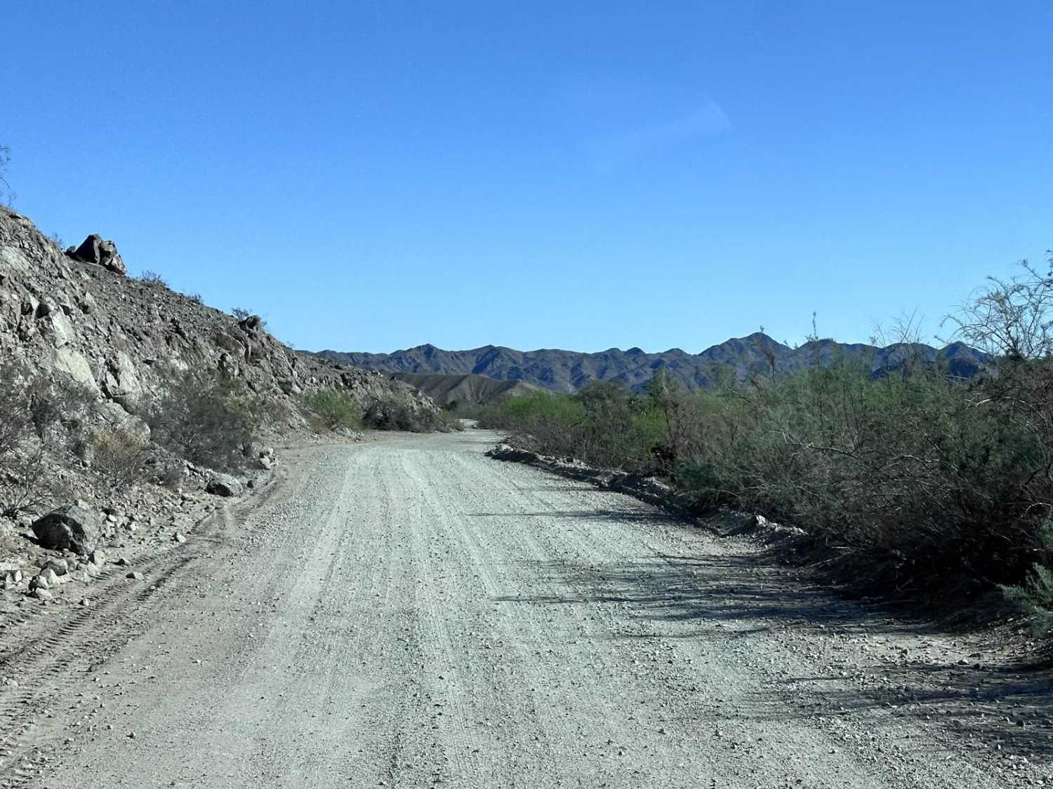
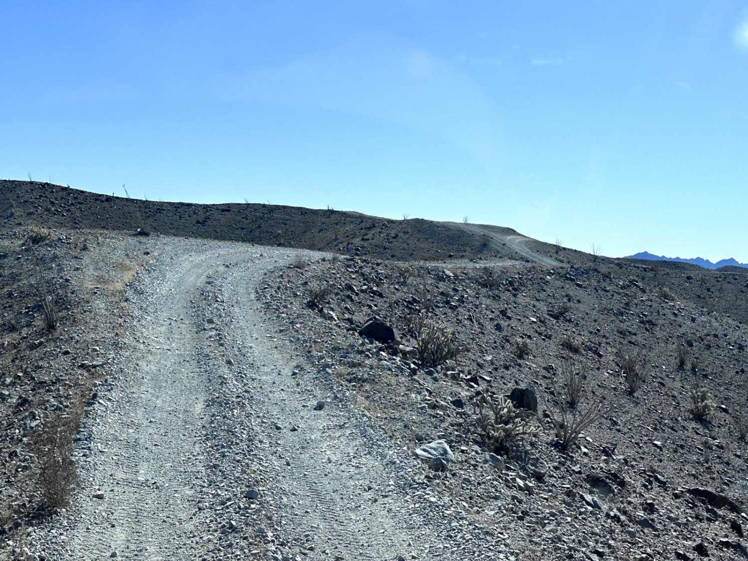
Laguna Ridge Trail is a 14.2-mile section of the Arizona Peace Trail that traverses the Laguna Hills area. This is a ridge line trail with steep climbs and descents on a narrow, rocky trail. There are very few areas for opposite-direction vehicles to pass, so always keep an eye on the trail ahead for any traffic. There are several blind turns when cresting hills, take caution and travel slowly when cresting to ensure you remain on the trail. The ridge line gives you great views of Yuma and the surrounding farming areas.
Photos of Laguna Ridge (AZPT)
Difficulty
This section of the Arizona Peace Trail has long steep climbs on a narrow ridge trail with loose rocks. Rocks along this trail are up to 18 inches in height. There are many blind turns on the crest of a hill with a steep descent after cresting. Slow and cautious travel is recommended for this trail.
History
The Arizona Peace Trail has its beginning is 2013 when the Bureau of Land Management (BLM) and the Arizona Game and Fish Department (AZGFD) wanted to create a connector trail between Bullhead City, AZ and Yuma, AZ (a total of 210 miles). Also during this time frame the Arizona Sun Riders (ATV club in Quartzite, AZ) was working with La Paz County to create a loop trail around Quartzite. Additionally, the Bouse Ghost Riders (ATV club in Bouse, AZ) was also working with La Paz County to develop OHV trails around Bouse, AZ. When the Bouse Ghost Riders learned of the efforts of BLM and AZGFD, along with other projects by different Offroad groups, they took the opportunity to combine efforts for a single trail system. 14 different Off-road clubs joined efforts with Federal, State, County and local agencies to create the Arizona Peace Trail. A system of over 675+ miles of trails which is one of the largest loop trail system in the United States. https://arizonapeacetrail.org/
Laguna Ridge (AZPT) can be accessed by the following ride types:
- High-Clearance 4x4
- SUV
- SxS (60")
- ATV (50")
- Dirt Bike
Laguna Ridge (AZPT) Map
Popular Trails

Quarry Bypass - FR745
Lost Spring Mesa BLM 2100

Turkey Creek Springs FR 4408
The onX Offroad Difference
onX Offroad combines trail photos, descriptions, difficulty ratings, width restrictions, seasonality, and more in a user-friendly interface. Available on all devices, with offline access and full compatibility with CarPlay and Android Auto. Discover what you’re missing today!