Lost Spring Mesa BLM 2100
Total Miles
16.0
Technical Rating
Best Time
Spring, Summer, Fall, Winter
Trail Type
Full-Width Road
Accessible By
Trail Overview
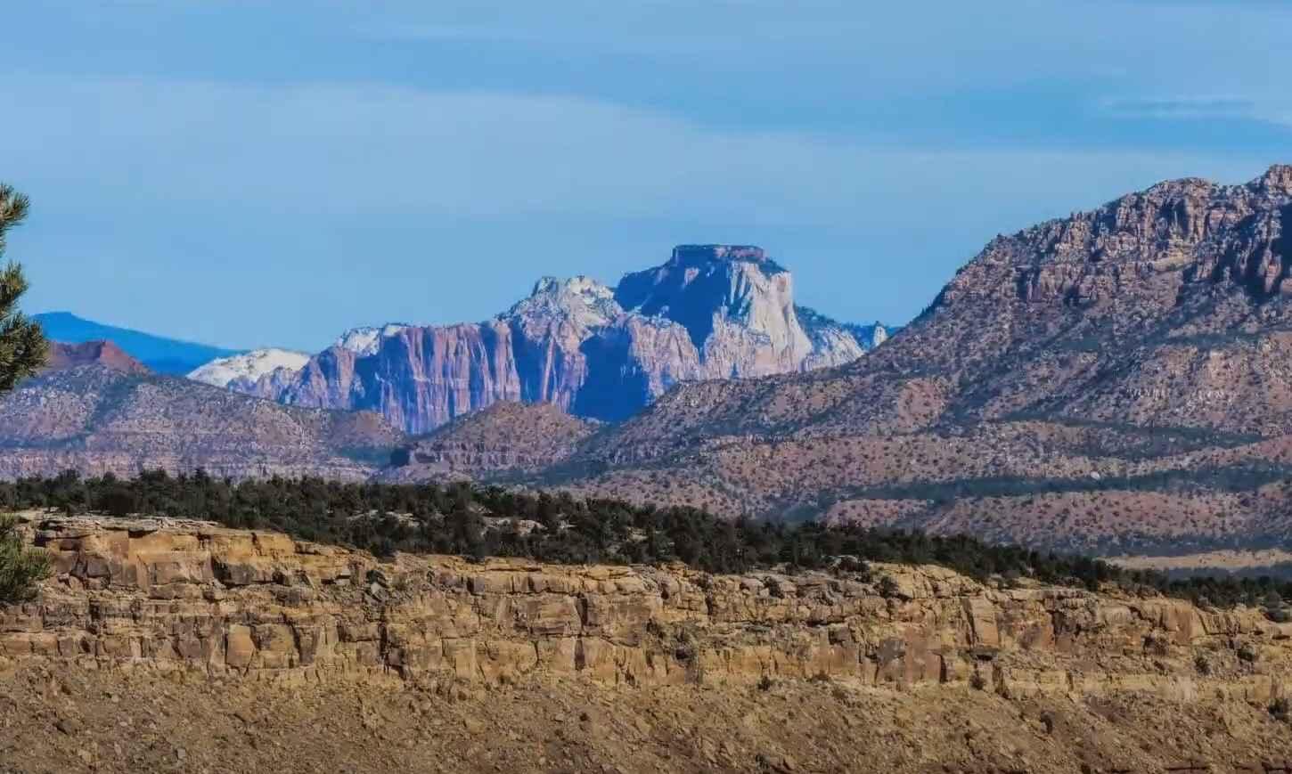
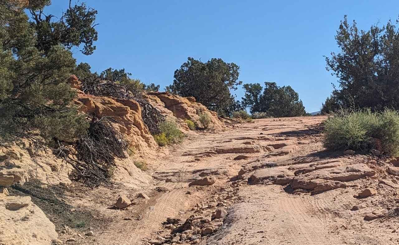
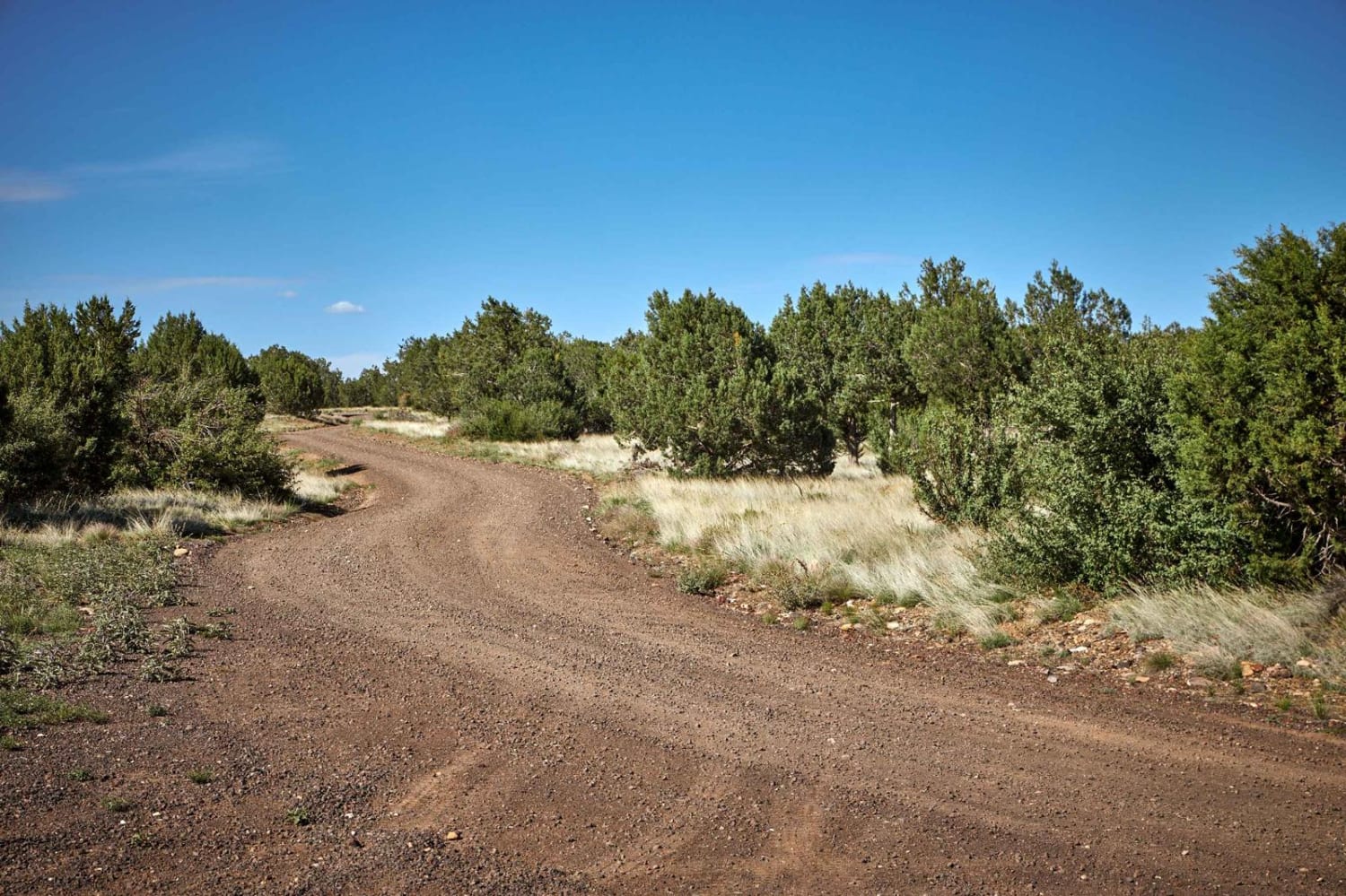
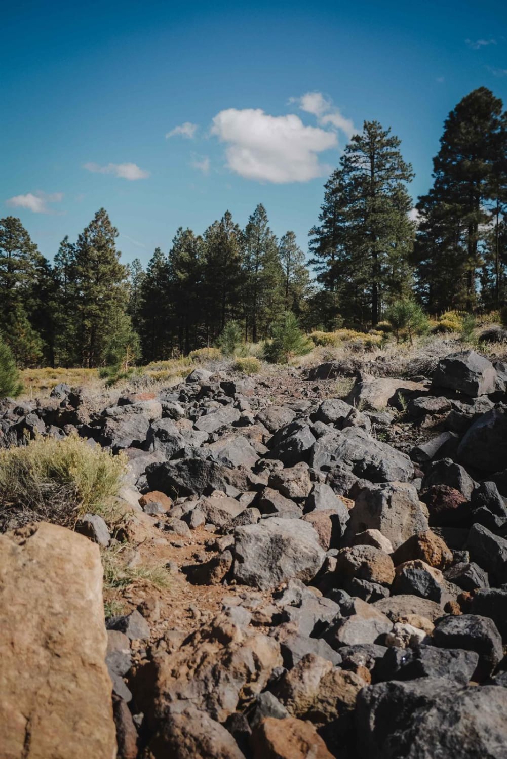
Lost Spring Mesa BLM 2100 is a 16.3-mile (one-way) out-and-back trail across the mesa to Lost Spring Mountain at 5,700 feet. This is a 3 of 10 rated dirt and rock trail that consists of flat plains dirt track and a single wide rocky shelf road climb to the top of the mesa, with a sand and dirt flat single track across the mesa. The ascent up the side is fairly easy with several rocky sections. Near the top of the climb are a couple of dry wash crossings that can be a little more difficult if there has been severe weather during the season. At 11.4 miles, make sure to bear southwest; continuing straight will lead to private property and a locked gate. As you proceed west on the trail there are several side trails to the south that provide panoramic views of the Kanab Plateau. The one on this track will take you to a scenic view and also to one of the largest balancing rocks in the area. The first major scenic overlook is when the trail reaches the west end of the mesa and turns north. Continuing north, a favorite stop of locals is at an ancient Indian water glyph, a large carving on the flat surface of the rock at the rim's edge (36.95619, -113.16819). Continue on to the end of the trail at the Lost Spring Mountain for views of Little Creek Mesa and Zion mountains to the north. Cellphone coverage should be available from most major carriers with limited dead spots. The nearest services are in Colorado City.
Photos of Lost Spring Mesa BLM 2100
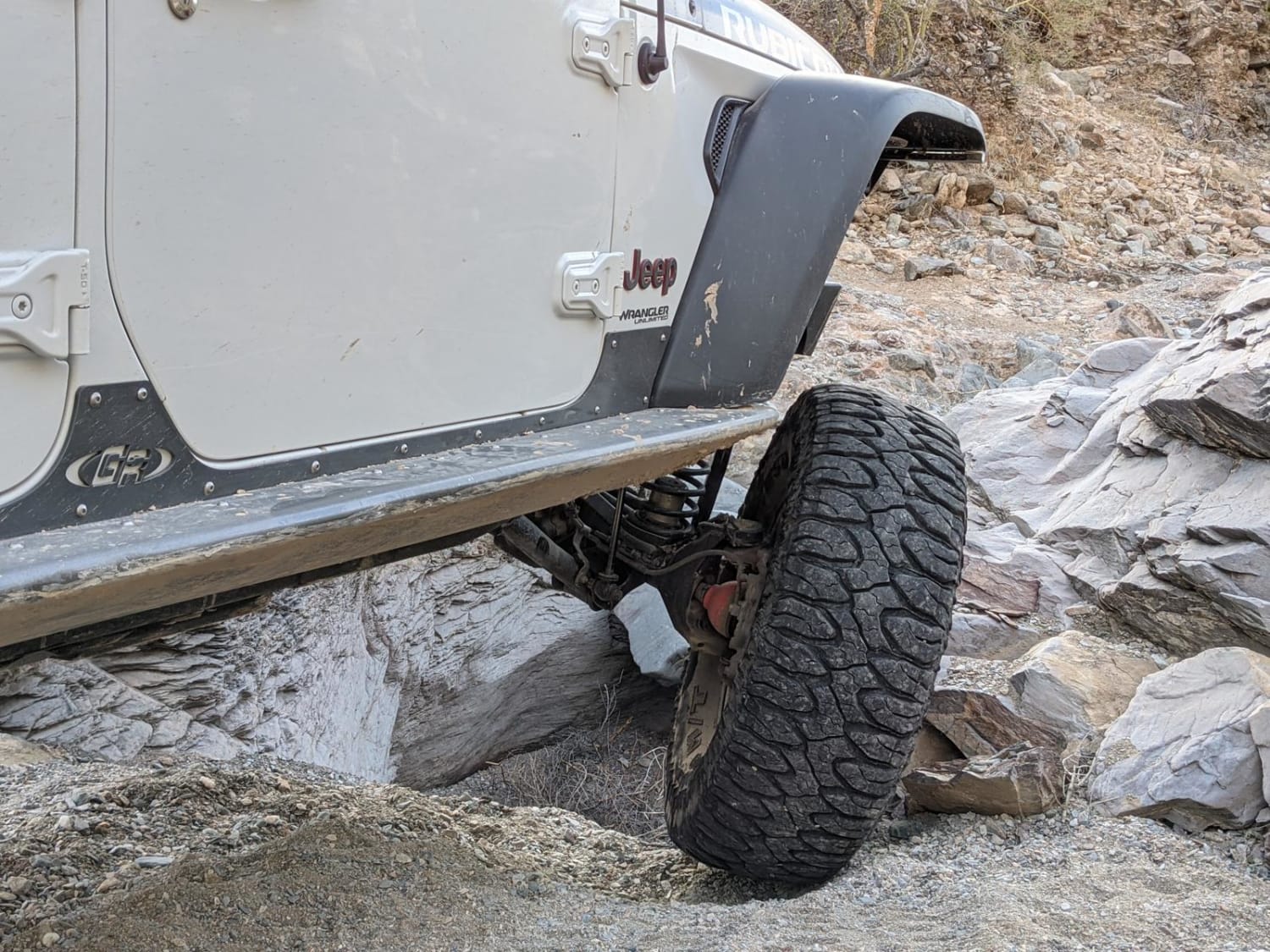
Difficulty
The trail consists of loose rocks, dirt, and sand with some slick rock surfaces, mud holes possible, and no steps higher than 12 inches. 4WD is required and aggressive tires are a plus. This trail is not recommended after heavy rains.
Lost Spring Mesa BLM 2100 can be accessed by the following ride types:
- High-Clearance 4x4
- SUV
- SxS (60")
- ATV (50")
- Dirt Bike
Lost Spring Mesa BLM 2100 Map
Popular Trails
Mary's Dinner
Pumpkin Smasher
The onX Offroad Difference
onX Offroad combines trail photos, descriptions, difficulty ratings, width restrictions, seasonality, and more in a user-friendly interface. Available on all devices, with offline access and full compatibility with CarPlay and Android Auto. Discover what you’re missing today!