3 trails found in Arizona
Which "honeymoon trail" are you looking for?
We found 3 off-road trails in Arizona matching your search. Pick the one you're looking for below.
Honeymoon Trail - Hurricane Cliffs
This is the section of the Honeymoon Trail that the Mormon settlers built in order to ascend and descend the Hurricane Cliffs. This is a 3 of 10 rated trail that is mostly hard-pack dirt with a few slick rock or rock gardens to cross. The trail is mostly a single-lane steep climb from the base at th...
Learn more about Honeymoon Trail - Hurricane Cliffs

Antelope-Honeymoon Trail Central
Antelope-Honeymoon Trail Central covers the segment of the Antelope Trail connecting the Antelope-Honeymoon Trail (North) and (East). This is a fairly well-maintained two-lane road. The three sections combined extend from the Navajo Trail on the south end and Highway 59 on the north end. The terrain...
Learn more about Antelope-Honeymoon Trail Central
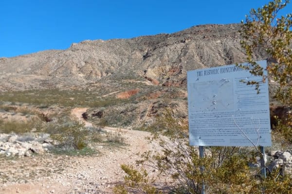
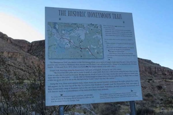
Honeymoon Trail
A steep incline drive on dirt and gravel. Single lane with 12 inch steps possible. During wet conditions could be washed out. Higher you climb the amazing views of surrounding mountains and valleys. Once at the top off climb the trail turns in to a gravel, dirt graded and is a nice scenic drive. Oth...
Learn more about Honeymoon Trail