Gas Line Road
Total Miles
11.0
Technical Rating
Best Time
Spring, Summer, Fall, Winter
Trail Type
Full-Width Road
Accessible By
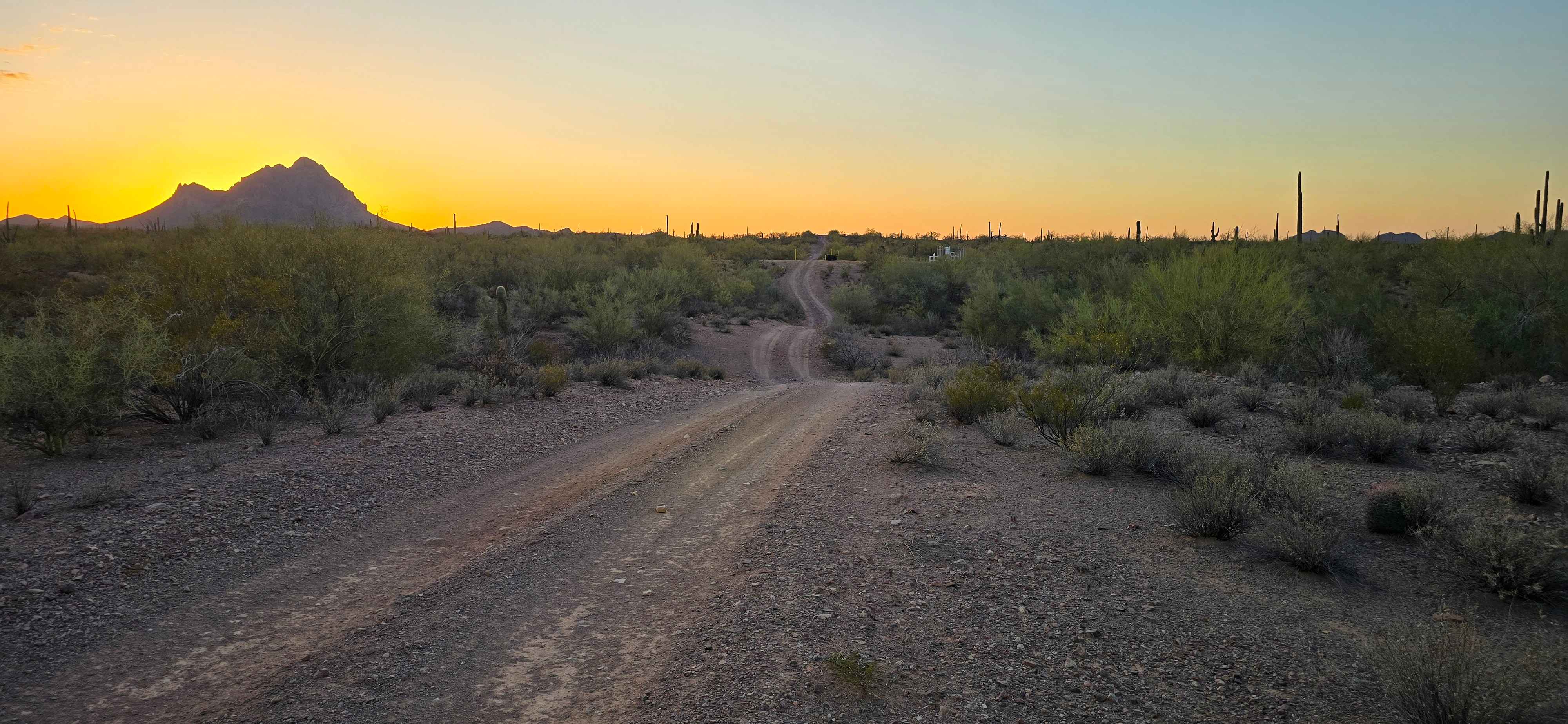
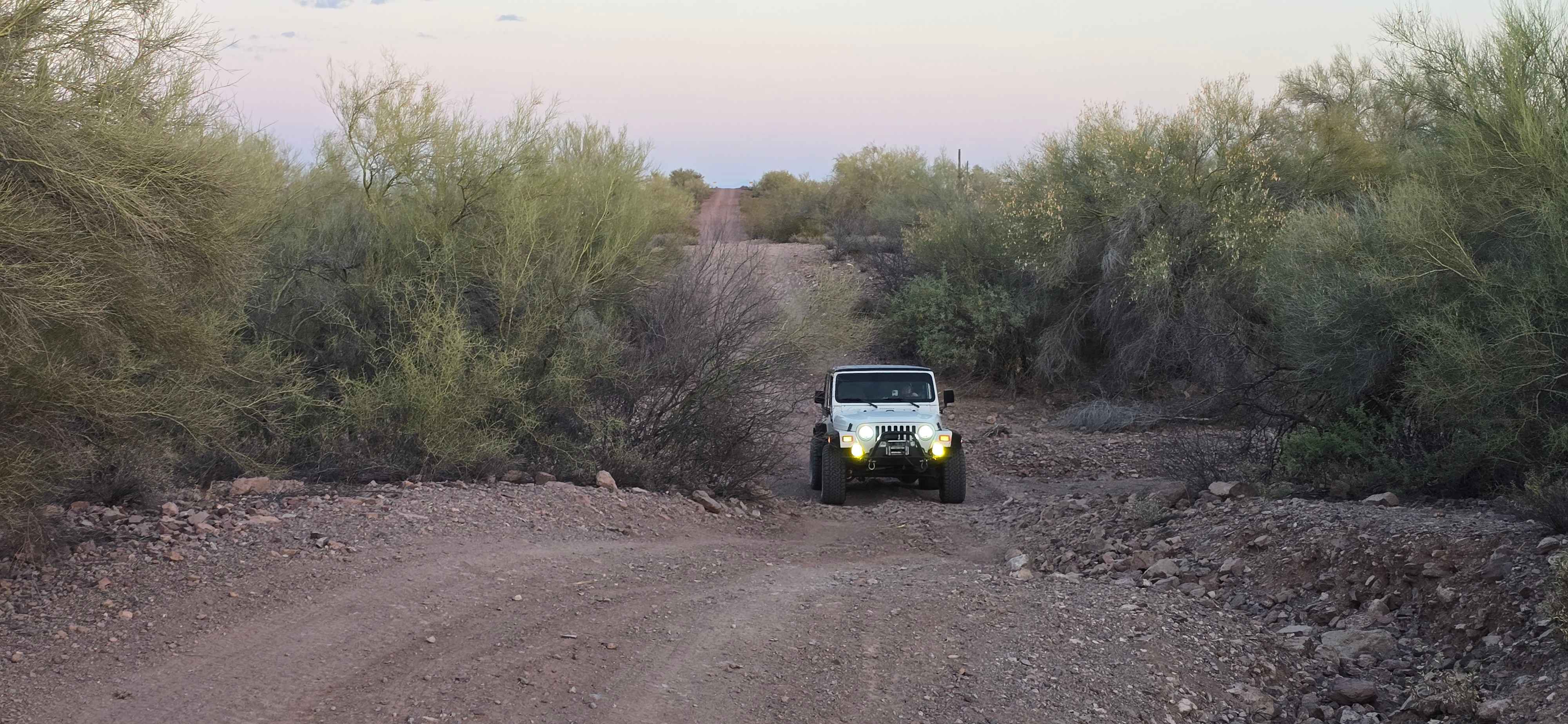
Trail Overview
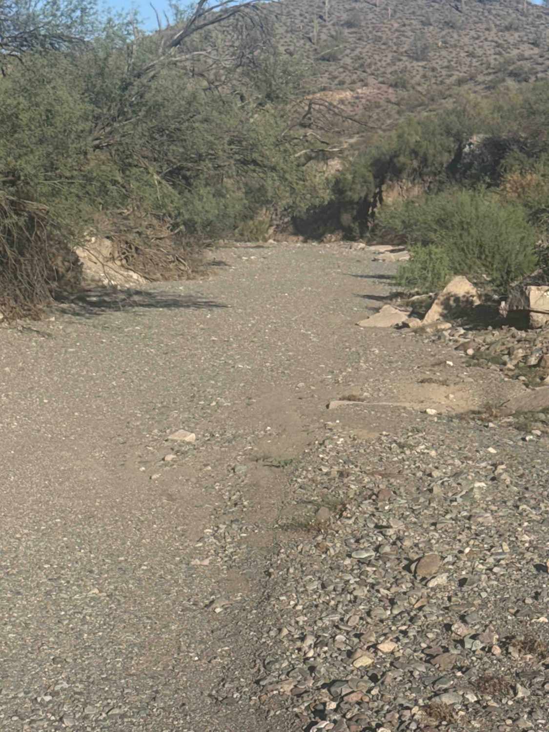
Gas Line Road offers a classic desert wheeling experience, winding through a stunning tapestry of protected landscapes, including the Ironwood Forest National Monument, BLM sections, and Arizona State Trust Land. This single-lane trek provides an intimate look at the rugged backcountry of the Southwest, far from the hum of the highway. The trail surface is primarily comprised of compacted dirt and small loose rocks, but the terrain is far from flat. Drivers will find themselves dipping into gentle valleys and cresting rolling desert ridges, creating a rhythmic driving experience that keeps you engaged with the landscape without requiring extreme climbs or descents. As you navigate the route, you will traverse numerous small washes that are occasionally overgrown with desert flora. In these tighter sections, be prepared for some "desert pinstriping" on your vehicle's paint from encroaching branches. You should also stay alert for washed-out areas where seasonal rains have carved ruts into the path. The visual crown jewel of the trip is Ragged Top Mountain to the west; these jagged, volcanic remnants of an ancient eruption dominate the skyline and provide a dramatic backdrop to a forest of majestic saguaros, cholla cactus, and desert mesquite trees. While the trail is a beautiful way to experience the Sonoran Desert, preparation is key. Because the route crosses Arizona State Trust Land, you must have a valid recreational permit in your possession, as these sections are not open to the public in the same way as BLM land. High-clearance vehicles are recommended to navigate the washouts safely. There are no facilities or reliable cell service along the way, so ensure you have offline maps and plenty of water before heading into this remote and striking piece of Arizona backcountry.
Photos of Gas Line Road
Difficulty
While the majority of the trail is a straightforward drive, the technical difficulty is centered on the frequent wash crossings. Any stock high-clearance vehicle will handle the route with ease, provided the driver is mindful of the transitions into and out of the washes. These specific points are prone to seasonal erosion, often resulting in deep ruts or washed-out areas that may require a slower approach.
Status Reports
Gas Line Road can be accessed by the following ride types:
- High-Clearance 4x4
- SUV
- SxS (60")
- ATV (50")
- Dirt Bike
Gas Line Road Map
Popular Trails

Eberts Secret

Twin Peaks View
The onX Offroad Difference
onX Offroad combines trail photos, descriptions, difficulty ratings, width restrictions, seasonality, and more in a user-friendly interface. Available on all devices, with offline access and full compatibility with CarPlay and Android Auto. Discover what you’re missing today!