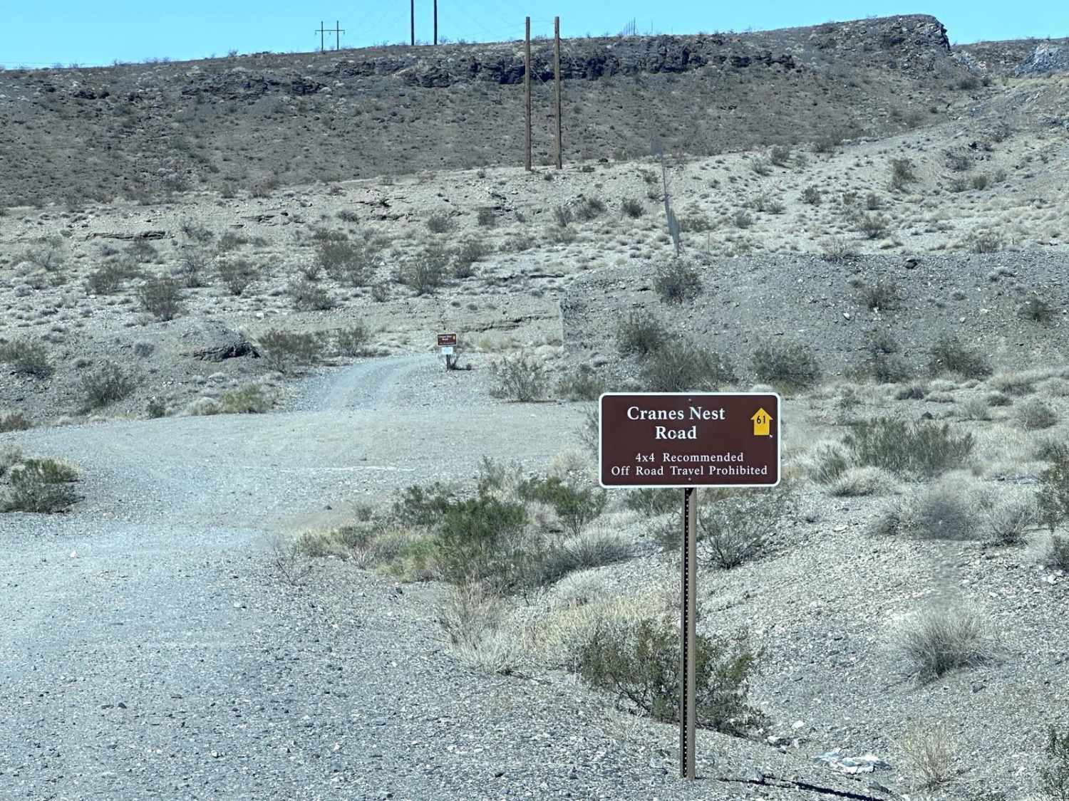
Crane's Nest Road
Total Miles
4.1
Technical Rating
Best Time
Spring, Fall, Winter
Trail Type
Full-Width Road
Accessible By
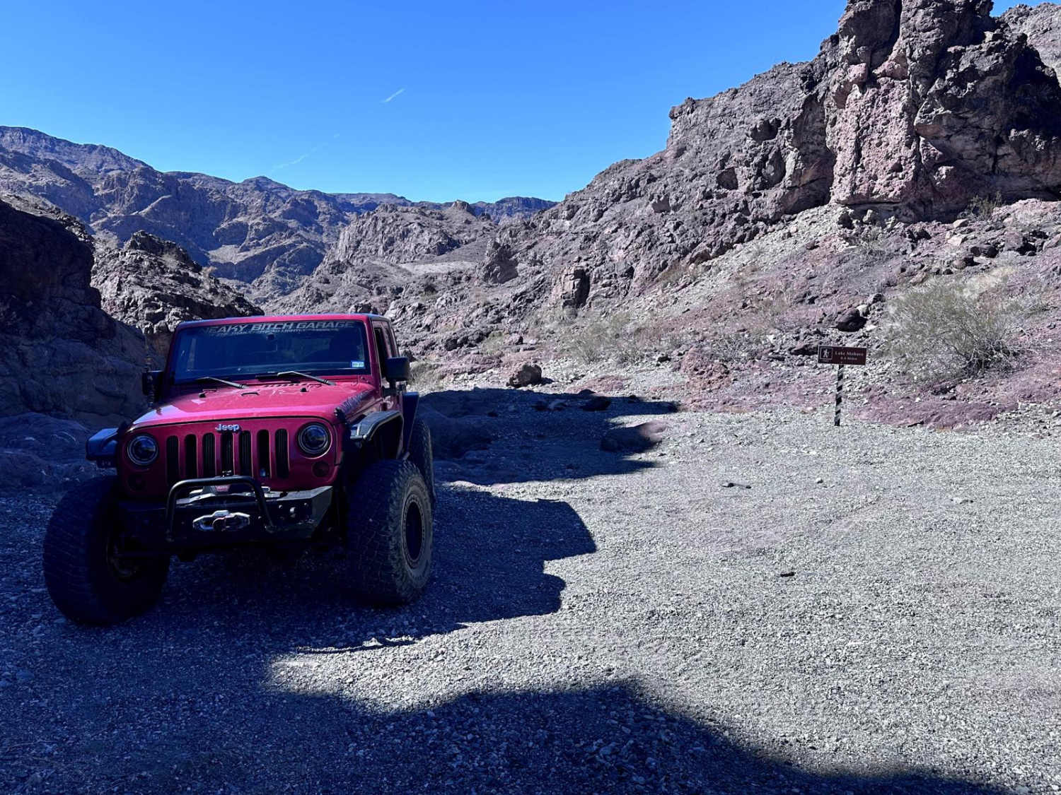
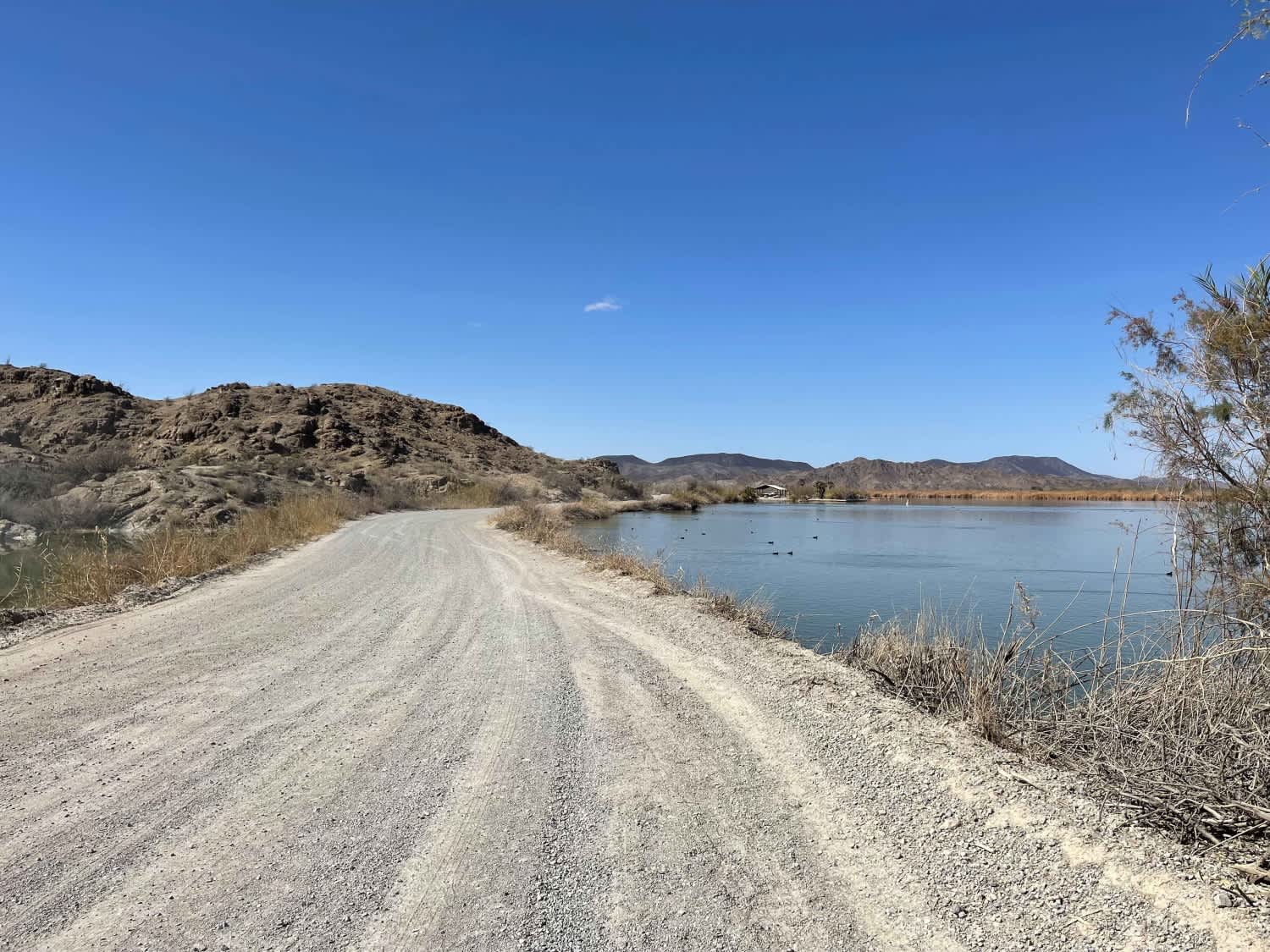
Trail Overview
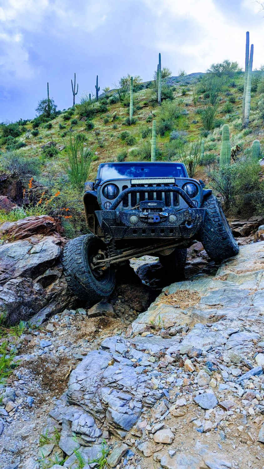
Crane's Nest Road is an 8.4 mile out and back trail that ends at a primitive camping area and trailhead for a short hiking trail that takes you to the Colorado River. The trail up to the primitive camping area is easy and passable by most 4WD and some AWD vehicles. The last short portion (approximately 1/4 mile) to the hiking trailhead is more difficult with rocks up to 12" in height.
Photos of Crane's Nest Road
Difficulty
The majority of the trail (up to primitive camping area) is rated 2. The final short section to the hiking trailhead gives this trail its rating with rocks up to 12" in height to negotiate.
Status Reports
Crane's Nest Road can be accessed by the following ride types:
- High-Clearance 4x4
- SUV
- SxS (60")
- ATV (50")
- Dirt Bike
Crane's Nest Road Map
Popular Trails

FS 9201J Climb
AZ Peace Trail Mittry Lake Leg
Jack Handle
The onX Offroad Difference
onX Offroad combines trail photos, descriptions, difficulty ratings, width restrictions, seasonality, and more in a user-friendly interface. Available on all devices, with offline access and full compatibility with CarPlay and Android Auto. Discover what you’re missing today!