BH1075
Total Miles
6.3
Technical Rating
Best Time
Spring, Winter, Fall
Trail Type
Single Track
Accessible By
Trail Overview
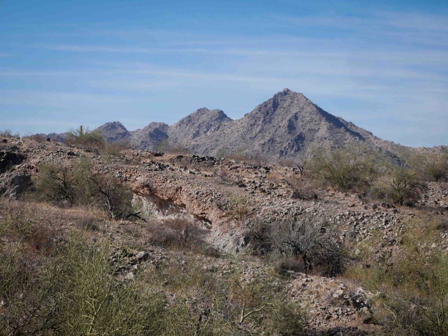
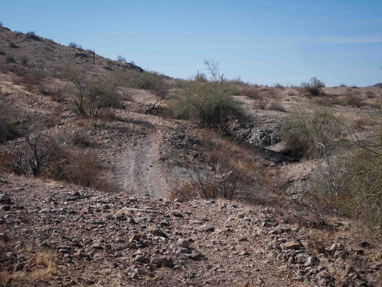
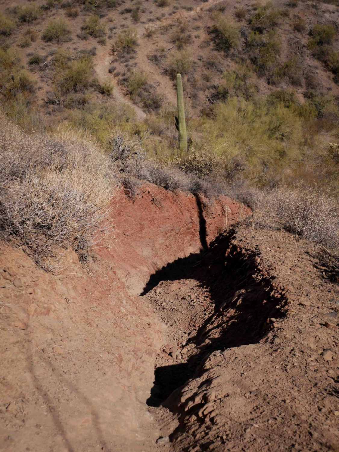
This is a 6-mile-long dirt bike trail through the BLM south of Buckeye, Arizona. The trail is a mix of wide two-track, road, and singletrack, and it's very faint and hard to follow at times. It starts out as a wide trail on either end of the loop. There are loose softball-sized rocks in the trail, big ravine crossings where the trail drops steeply in and out of the ravine, with loose rocks at the bottom of the wash. When it chokes down to a singletrack and winds through the hills, it becomes a bit more technical, but also hard to navigate as there aren't many tracks to follow. There are spots that are slightly off-camber, with big rocks in the trail, requiring tight maneuvers through the ravines. It also has small hill climbs, with a steep climb on the north end that is covered in loose rocks. The southwestern portion of the trail at the bottom of the loop will require some route finding to get through and connect the loop, as it's very faint here and the trail has been washed away. It needs to be reclaimed and beat in more.
Photos of BH1075
Difficulty
This trail has rocky sections and loose hill climbs that make it intermediate difficulty. Part of the difficulty on this one is having to navigate and find the trail because there aren't many tracks to follow and it can be hard to see if you are on the right path.
Status Reports
BH1075 can be accessed by the following ride types:
- Dirt Bike
BH1075 Map
Popular Trails

Pasture Waterline

Grass Mine Trail
The onX Offroad Difference
onX Offroad combines trail photos, descriptions, difficulty ratings, width restrictions, seasonality, and more in a user-friendly interface. Available on all devices, with offline access and full compatibility with CarPlay and Android Auto. Discover what you’re missing today!