Apache Trail to Apache Lake Marina
Total Miles
8.4
Technical Rating
Best Time
Fall, Spring, Winter
Trail Type
Full-Width Road
Accessible By
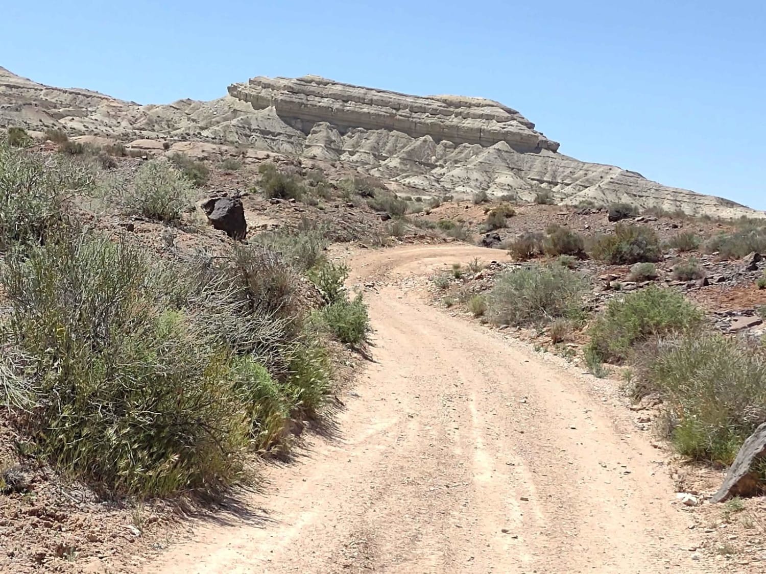
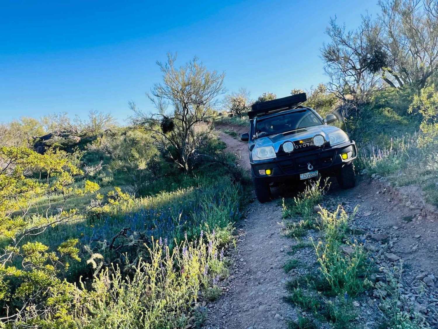
Trail Overview
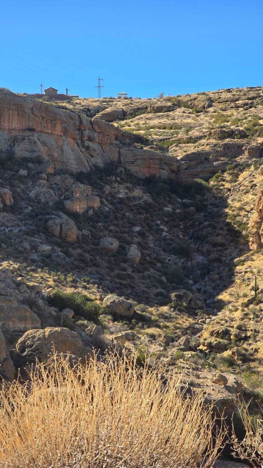
The Apache trail that was closed for many years due to rockslides that blocked off the path is now open. The Apache trail is a historic trail that is over 100 years old. With it now being open, it allows travelers who would like to go to Apache Lake to bypass the longer route around through the globe and past Roosevelt Lake.
Photos of Apache Trail to Apache Lake Marina

Difficulty
The trail was able to be passed by most all wheel drive or higher clearance cars or trucks like the Subaru Outback or Ford Maverick. There are many switchbacks and areas where you must pull to the side to let others pass by. Some 10-20% grades to climb or descend, but as long as your tires are good, you should be fine. No airing down of tires is necessary.
History
The Apache Trail began its humble beginning as the wagon-haul road for the transportation of men, equipment, and supplies from the townsite of Mesa to the proposed construction site of the Tonto Dam. Construction of this 62-mile haul road began in August of 1903. The announcement of the building of the Apache Trail and the Tonto Dam brought in approximately 1500 Apache and 400 Pima Indian laborers seeking employment. The Apache's brought their family members with them. As they completed each section of the new roadway, they would construct their homes (wickiups) mile by mile. The building of the Apache Trail was finally completed in September 1905 and construction of the Tonto Dam ensued. Louis C. Hill was hired as the supervising engineer for the construction of the Tonto Dam. Initially, the main purpose of the Dam was to control and regulate the water flow to the Valley. As time progressed, Hill suggested the addition of hydroelectric generators to produce power and electricity. Although this inclusion increased construction costs by several million dollars, he stood behind his belief that the sale of power to Arizona would be the ideal source of income to repay the cost of building the Dam. Hill was correct. Not only was the payoff completed in record time, a transmission power line to Phoenix via Mesa began delivering power to about 6 customers in 1909. After completion of the Tonto Dam in February 1911, the Dam was renamed and dedicated to President Roosevelt. It then became known as Roosevelt Dam. Approximately 1600 people and a contingent of 30 Apache Indian laborers watched as Roosevelt pressed a button, releasing the reservoir waters for the very first time. Some of the first water spilled was saved in a glass bottle. In June 1915, an Arizona delegation including Governor George Hunt and 13 year old Esther Ross from Prescott, carried the glass bottle to the Brooklyn Naval Yard in New York. The bottle was wrapped in a copper wire mesh provided by 2 of the local mining companies in Arizona and was then used to christen the USS Arizona, United States' most powerful battleship. This bottle of water collected from Roosevelt Dam represented liquid gold for the State of Arizona. Water was and will always be, sustenance for a land of promise and opportunity - Arizona.As we look back on Arizona's history, this meager footpath used by the ancient Salado Indian tribe laid the groundwork in the development of Arizona while the Dam set the cornerstone for supplying the life-sustaining water and power to the city rising up from the desert floor. This is OUR LIFELINE in the Desert! Roosevelt Dam still supplies much-needed water and power to millions of full-time residents who now reside in the metropolis of Phoenix and its suburbs. Tourists from all over the world continue to flock to the area to gaze upon Roosevelt Dam and to experience the breathtaking beauty that abounds en-route along the Apache Trail. Both Roosevelt Dam and the Apache Trail played a monumental role in transforming a dry and hostile desert into the lush and prosperous land it is today. While Roosevelt Dam maintains its distinctive roles of supplying water and power to Central Arizona, the Apache Trail is deteriorating daily after being closed following the flood damage caused in 2019 by Tropical Storm Lorena. If not repaired and reopened, the Apache Trail will vanish as did our ancient Indian tribes, and we will forever lose that valuable part of our Arizona history. IT IS NOW OPEN.
Status Reports
Apache Trail to Apache Lake Marina can be accessed by the following ride types:
- High-Clearance 4x4
- SUV
- SxS (60")
- ATV (50")
- Dirt Bike
Apache Trail to Apache Lake Marina Map
Popular Trails
East Mesa Wash Spur

Canyon Ruins Tour
O'Haco Reroute

Big Reef Mill Singletrack
The onX Offroad Difference
onX Offroad combines trail photos, descriptions, difficulty ratings, width restrictions, seasonality, and more in a user-friendly interface. Available on all devices, with offline access and full compatibility with CarPlay and Android Auto. Discover what you’re missing today!