486
Total Miles
2.1
Technical Rating
Best Time
Winter, Spring, Fall
Trail Type
Single Track
Accessible By
Trail Overview
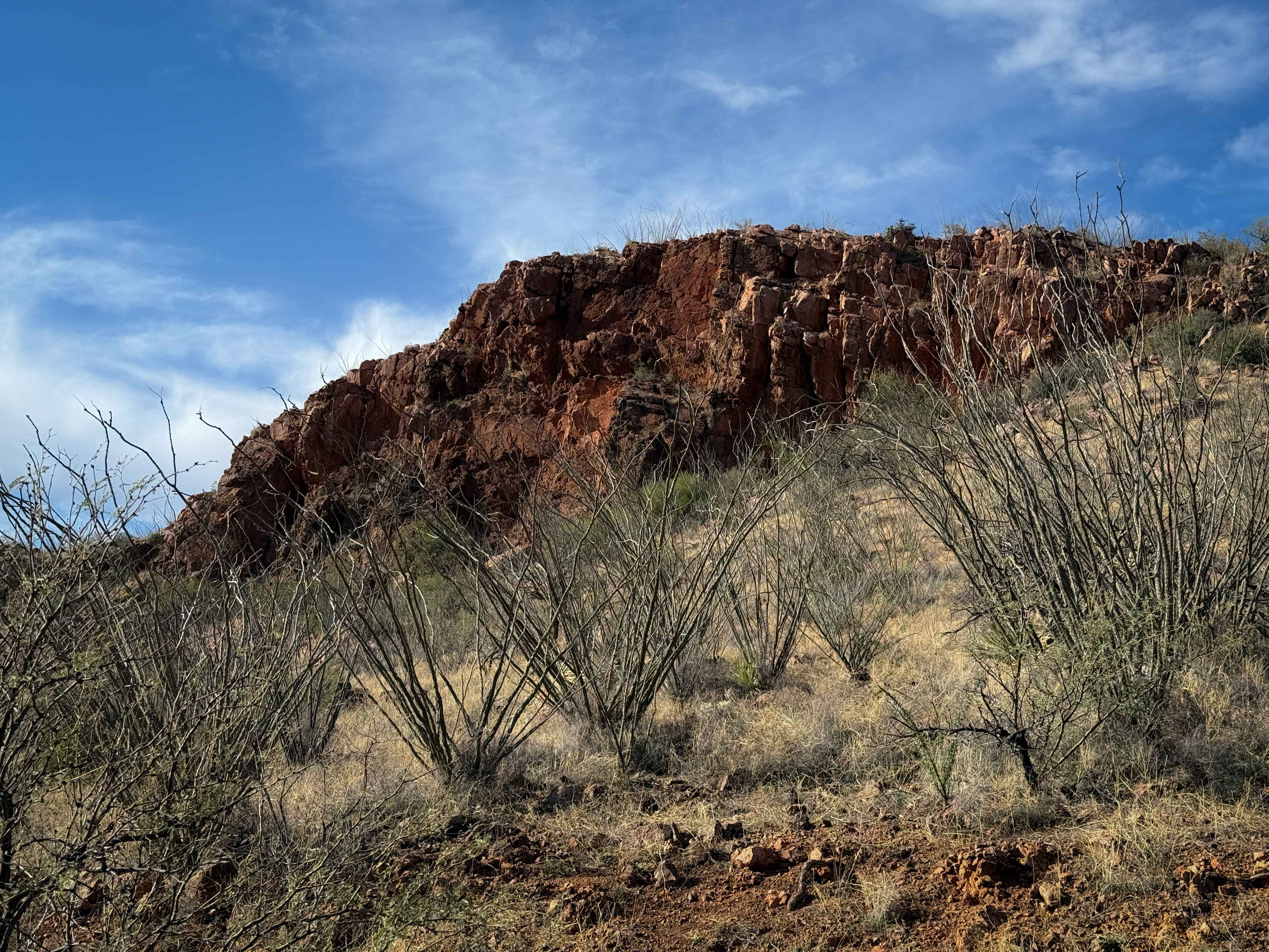
This entire trail is road-width, although designated for dirt bikes only. It starts off Sardina Canyon Road (684) in a wash full of small rocks, and rides north towards some rocky outcroppings, riding past the entrance for 485. The trail surface is constantly full of small loose rocks and shallow ruts, but remains wide the whole time, with intermittent slab rock as well. Parts of it are an old shelf road repurposed into a dirt bike trail. It winds around the rolling hills, lined with mesquite trees, crossing small ravines and washes. The trail dead ends after two miles with a view of some of the nearby red rocky cliffs in the distance, a bit past the red spring. You can ride this as an out-and-back, or connect via 484A to single-track trail 484.
Photos of 486

Difficulty
This trail remains road width the whole time, but is constantly covered in small loose rocks. It is mostly gradual, with only a few steep spots. There are no major obstacles throughout the route, making it ideal for less experienced riders.
Status Reports
486 can be accessed by the following ride types:
- Dirt Bike
486 Map
Popular Trails

Big Bertha Road
Burro Creek West

M0775 The Wash
The onX Offroad Difference
onX Offroad combines trail photos, descriptions, difficulty ratings, width restrictions, seasonality, and more in a user-friendly interface. Available on all devices, with offline access and full compatibility with CarPlay and Android Auto. Discover what you’re missing today!