West Fork Ohmer Creek 6246
Total Miles
2.7
Technical Rating
Best Time
Summer, Fall
Trail Type
Full-Width Road
Accessible By
Trail Overview
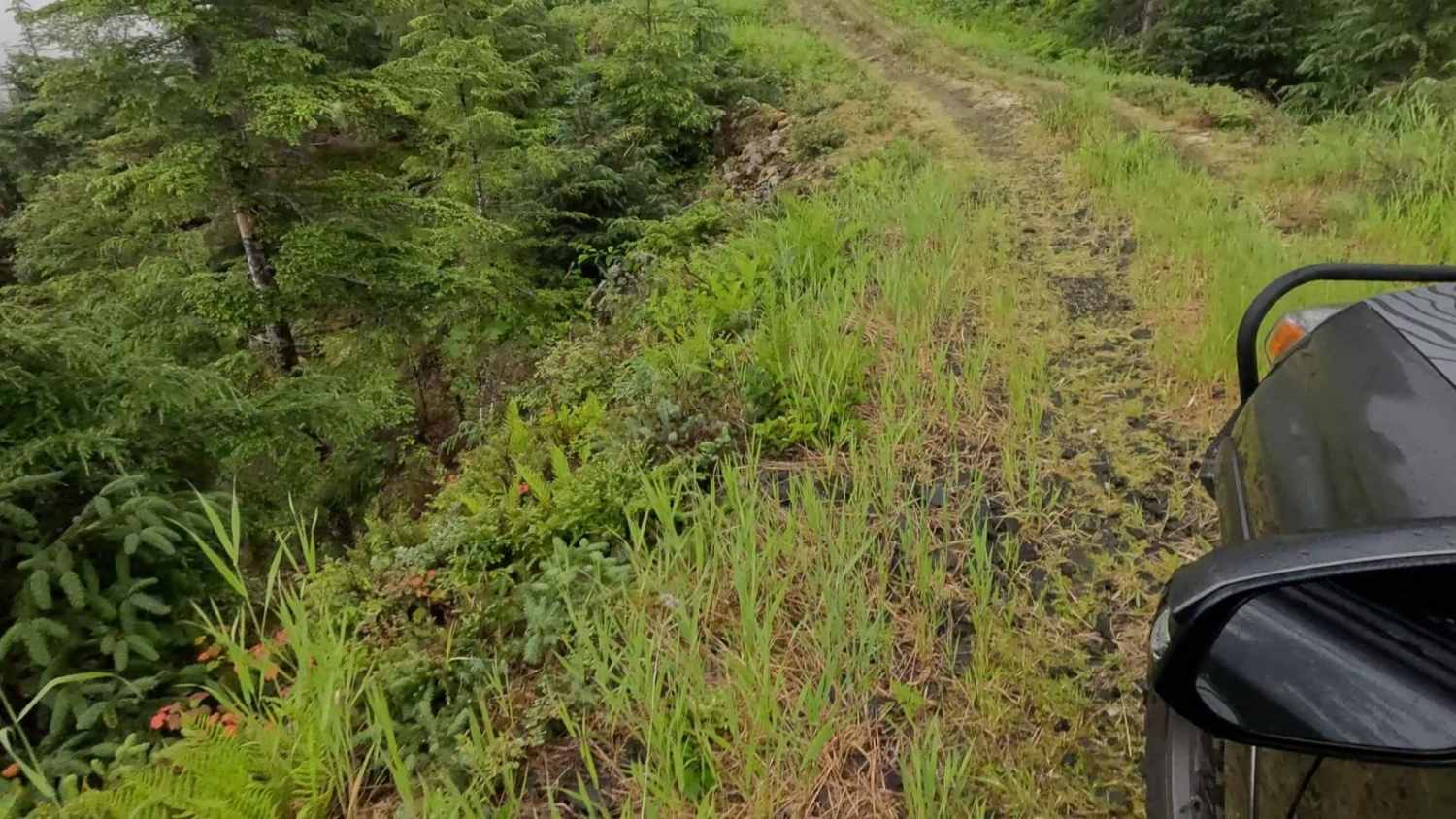
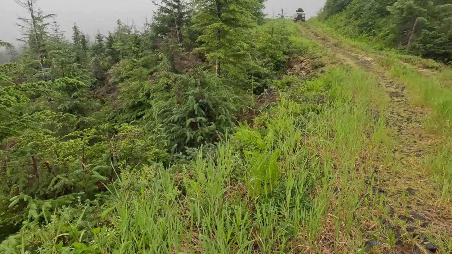
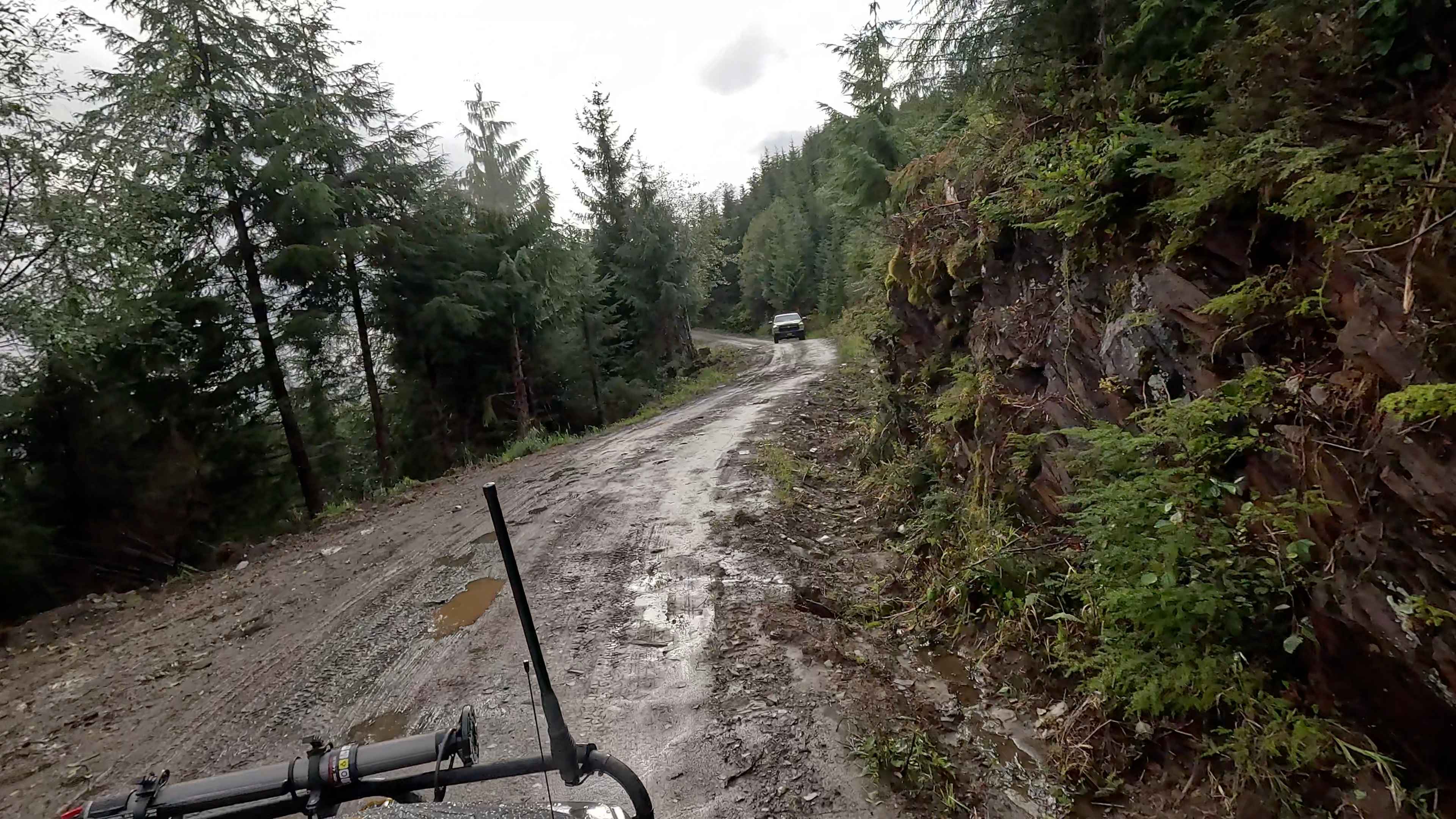
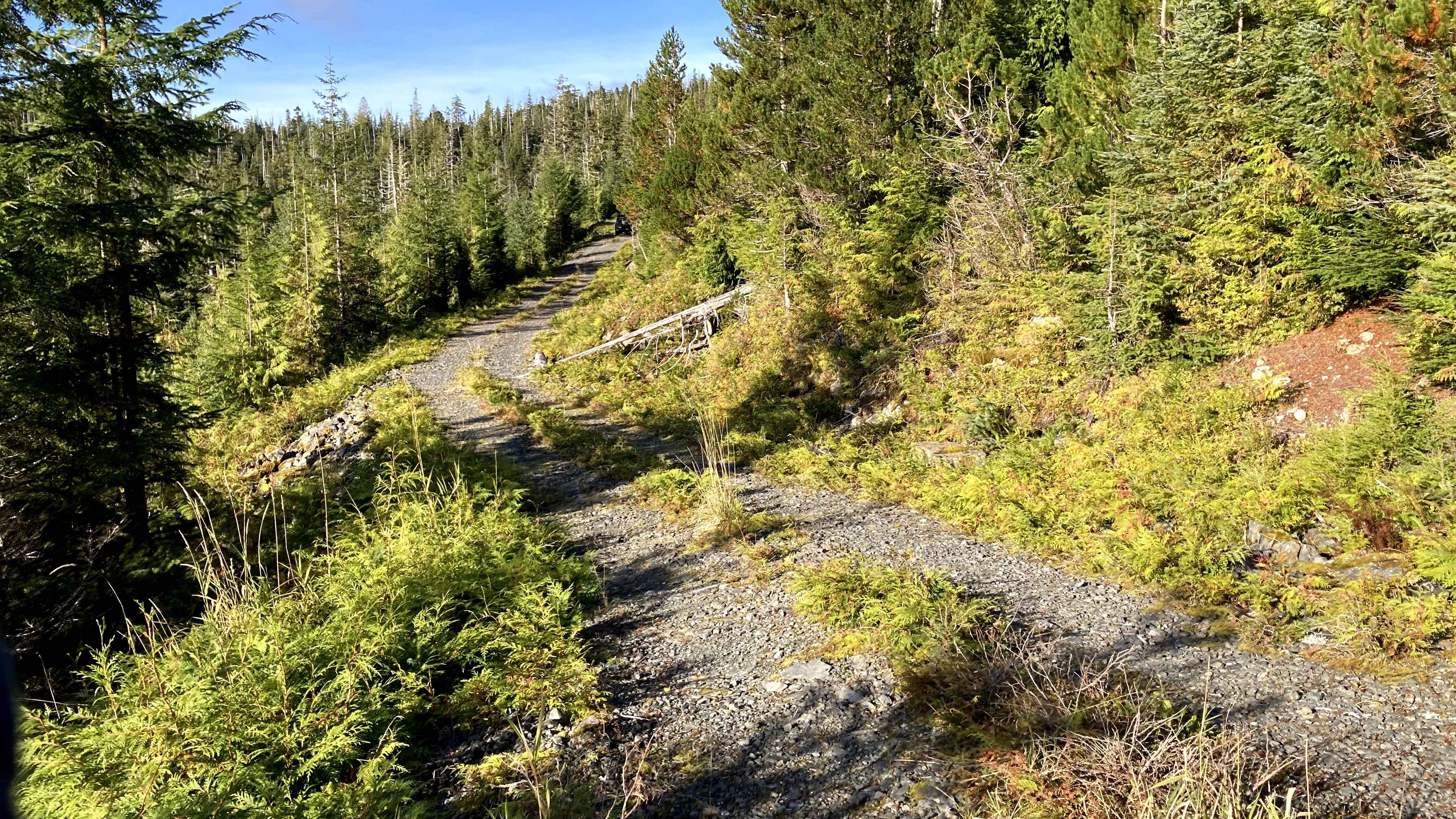
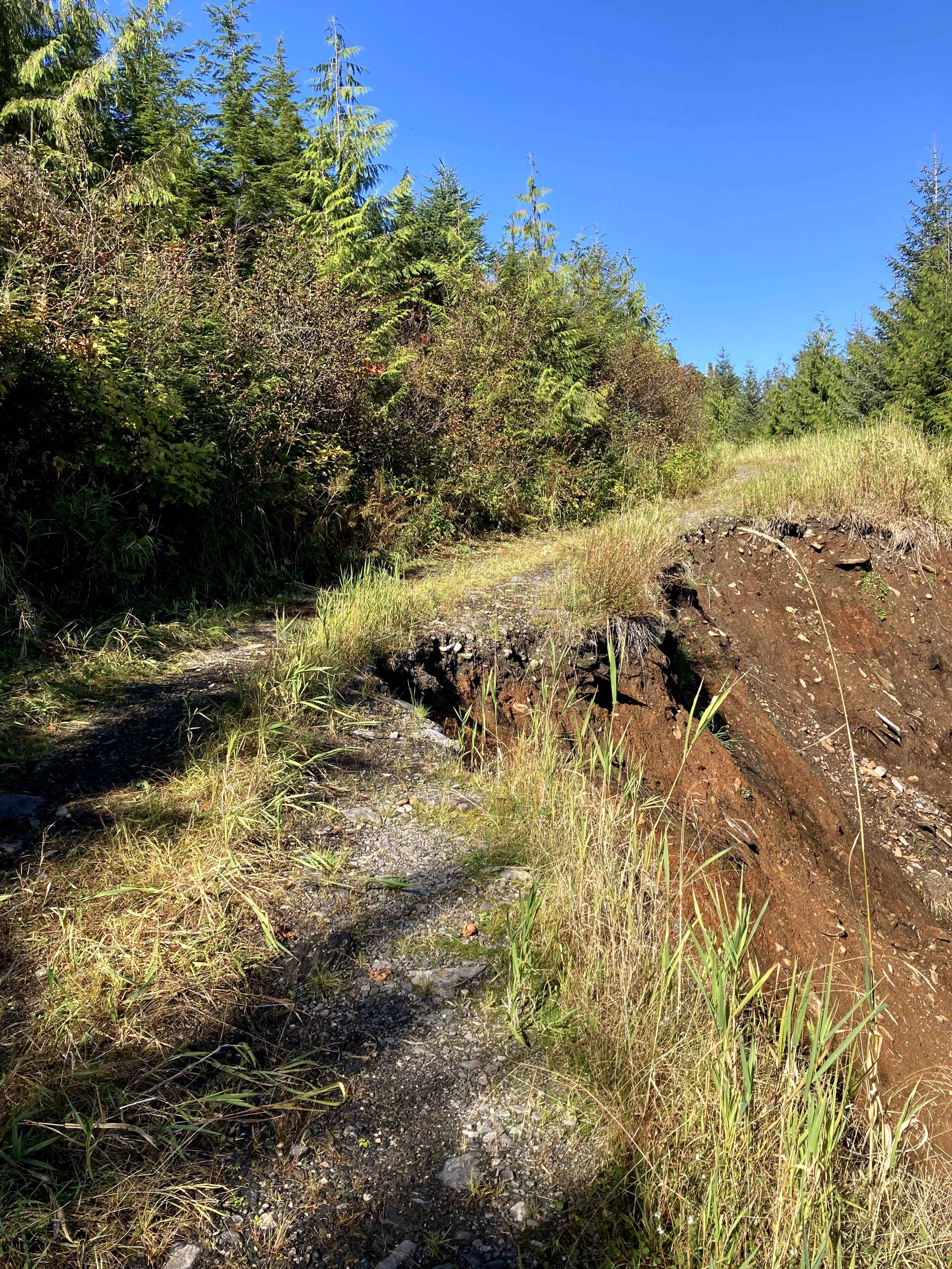
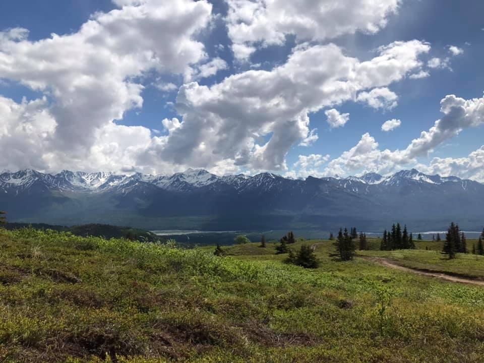
West Fork Ohmer Creek is mostly a dirt road with gravel or large rip rap. It is the first offshoot road after you turn onto Woodpecker road from Highway 7. The road ends early due to vegetation overgrowth and ends at the top of a hill. Small turn around area at the end or spot to park and camp. Lots of wildlife on this road and an offshoot road to Snake Ridge. Rating is a 3 as it is a one lane road that deteriorates as you get to the end and narrows with drop offs towards the end. Deep potholes in some areas, and both Muskeg/wetlands, and treed areas. Time to complete this road will vary depending on weather and road conditions. There is a lot of wildlife in this area. Be safety minded as there are Brown Bear, Black Bear, Deer, and Porcupines along this road. Driving on the road, you can see obvious signs of Brown Bear and can see them on the road as well as Deer, and Porcupines. Weather plays a part in the level of difficulty as this is in a rainforest and a lot of these roads are going through areas of muskeg/wetlands. There are sections of loose rock and parts of the road have drop offs where there is a gain in elevation towards the end. There are great views of muskeg/wetlands and the valley at the top of the trail on a clear day. Tall grass, ferns, a variety of trees, lichens, moss and flowers can be seen along the road. Also, the only road to get to Snake Ridge, which is a very scenic drive with wildlife.Views: Scenic landscapes of the muskeg and views at the end of the road when there isn't fog. There are 2 dry camping spots along this road. One larger campsite area to the right at the beginning of the road, and one at the end of the road that has a small overlook area. There isn't much room for a turnaround. Not advisable to bring trailers on this road. Warnings: Keep on the road (Muskeg and wetlands), watch for signs of road deterioration or washouts due to heavy rainfall. Be mindful of wildlife, especially Bears. No cell service noted. Check weather conditions and be prepared for rain, fog with low visibility, and lower temperatures. It is a rainforest.
Photos of West Fork Ohmer Creek 6246
Difficulty
Rating is a 3 as it is a one lane road that deteriorates as you get to the end and narrows with drop offs towards the end. Deep potholes in some areas and both Muskeg/wetlands, and treed areas.
Status Reports
West Fork Ohmer Creek 6246 can be accessed by the following ride types:
- High-Clearance 4x4
- SUV
- SxS (60")
- ATV (50")
- Dirt Bike
West Fork Ohmer Creek 6246 Map
Popular Trails
Shelter Cove 8340000
The onX Offroad Difference
onX Offroad combines trail photos, descriptions, difficulty ratings, width restrictions, seasonality, and more in a user-friendly interface. Available on all devices, with offline access and full compatibility with CarPlay and Android Auto. Discover what you’re missing today!