
Off-Road Trails Near Polkton, North Carolina
Off-Road Trails Near Polkton, North Carolina
Discover the best offroad trails near you. Browse trail maps, check difficulty ratings, and find your next adventure — whether you're looking for a quick ride or an all-day expedition.
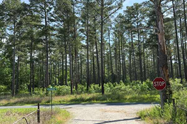
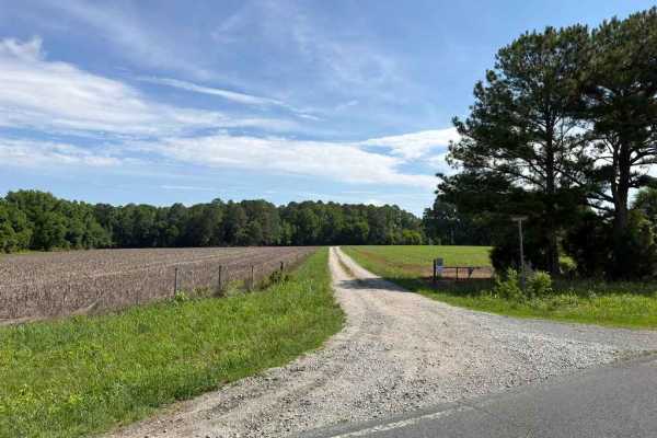
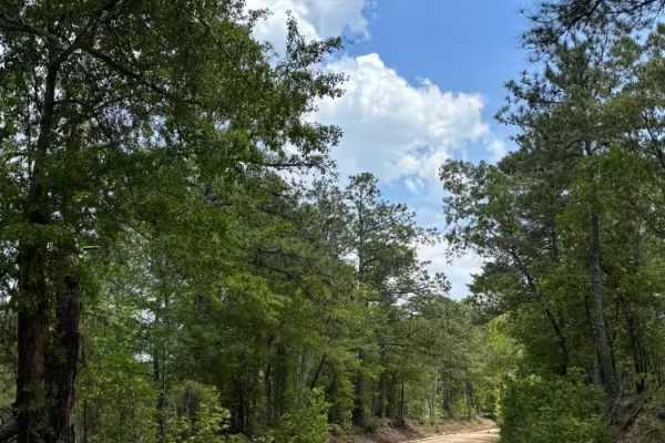
Ross Road
Ross Road is a wide, Forest Service-style road that provides direct access to the Pee Dee National Wildlife Refuge. As one of the longest trails winding through the area, it primarily runs through dense woodlands with the occasional clearing of open farm fields. The trail is predominantly a gravel d...
Learn more about Ross Road
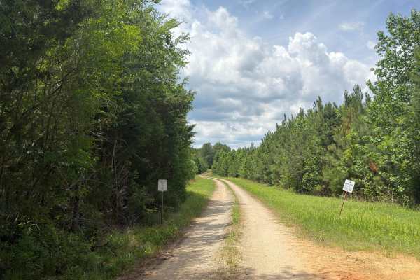
Griffin Road
Griffin Road is one of the longest and most unique trails throughout the Pee Dee National Wildlife Refuge. Winding through dense woods, open farm fields, and scenic marshlands, it provides access to several notable landmarks. Shortly into the trail, visitors will spot an abandoned grain silo. Furthe...
Learn more about Griffin Road
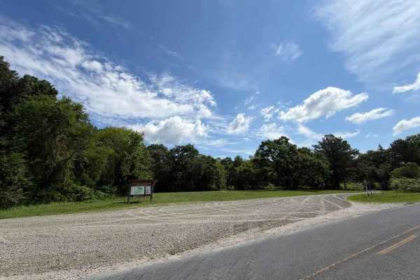
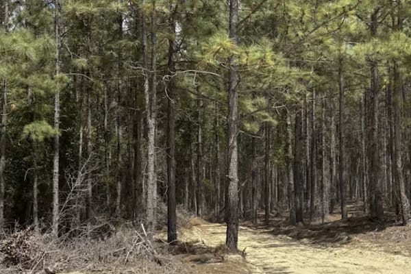
Gaddy Road
Gaddy Road is a double-track gravel trail running through the middle portion of the Pee Dee National Wildlife Refuge. This gravel service road winds through a variety of habitats, primarily bordering open farm fields. The trail is generally easy, featuring only a few potholes and slight crowning tha...
Learn more about Gaddy Road
Beaver Pond Road
Beaver Pond Road is a Forest Service-style road running through the western portion of the Pee Dee National Wildlife Refuge. This trail provides access to a large area of the refuge as well as multiple connecting trails. It is predominantly a gravel double-track trail that winds through wooded envir...
Learn more about Beaver Pond Road
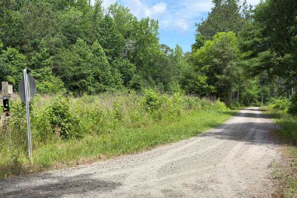
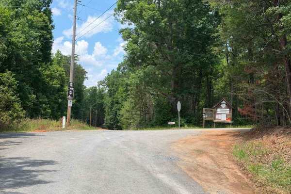
Anson Access Road
Anson Access Road is a Forest Service-style, double-track trail providing access to the eastern portions of the Pee Dee National Wildlife Refuge. This out-and-back route winds through a scenic mix of dense woodlands and open farmland, offering a peaceful drive. It serves as an excellent corridor for...
Learn more about Anson Access Road
Stutts Redfield Road
Stutts Redfield Road is a shorter trail running through the northern portion of the Pee Dee National Wildlife Refuge. As the first split off Dusty Road, this trail leads a short way through a beautifully wooded area. Despite its shorter length, the trail is relatively wide and highly accessible due ...
Learn more about Stutts Redfield Road
Dusty Road
Dusty Road is a Forest Service-style road providing access to the northern portion of the Pee Dee National Wildlife Refuge. The trail is predominantly a narrow, dirt and gravel double-track that is generally easy to traverse, featuring only a few small ruts or bumps. This trail is a perfect option f...
Learn more about Dusty Road
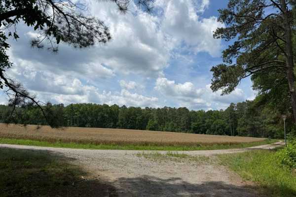
Andrews Pond Road
Andrews Pond Road is a major trail through the northern portion of the Pee Dee National Wildlife Refuge. The route runs through a variety of diverse environments, ranging from open fields to tight, wooded areas. Along the route, visitors can expect to see an abundance of wildlife, including deer, tu...
Learn more about Andrews Pond Road
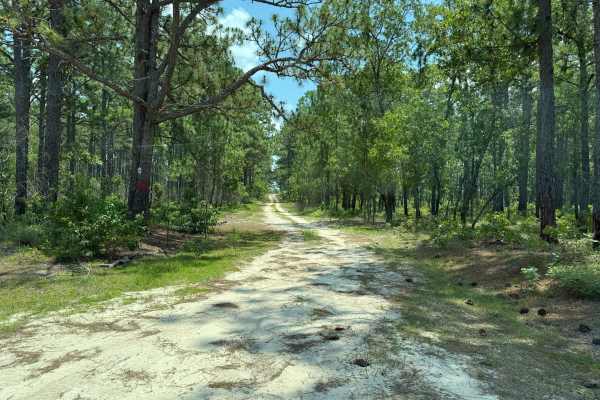
Shag Road
Shag Road is a scenic sandy road located not far from the Carolina Sandhills National Wildlife Refuge. The road passes through pine woods, mixed forest, and a few more open areas with big sky views. Trail conditions were mostly clean and passable, with a wide sandy surface, some loose sand, tire tra...
Learn more about Shag Road
Mary D Road
Mary D Road can be accessed from State Highway 109; after getting off the highway, take a left turn onto the sandy road. The route has a typical sandhills feel, with pale sandy road surfaces, pine forest, and mixed woods. Trail conditions were generally clean and passable, but the surface varies fro...
Learn more about Mary D Road
Dennis Road
The mapped portion denotes a split in Dennis Road providing access to the Uwharrie Game Lands and the Uwharrie River public fishing area. These unique areas are lesser-known than other designated game lands and fishing spots within Uwharrie National Forest, featuring dedicated parking areas, short w...
Learn more about Dennis Road
Dusty Level Rd
Dusty Level Rd is a county road comparable to many Forest Service roads in the area, providing access to less-established portions of Uwharrie National Forest while routing through some stretches of private property. The trail is generally easy, featuring a few potholes, mild ruts, and a couple of s...
Learn more about Dusty Level Rd
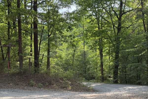
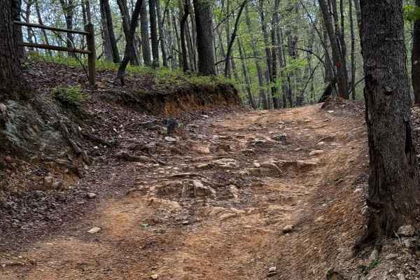
Green Gap - FS 6584
Green Gap (FS 6584) is a standard Forest Service road providing access to the southern end of Uwharrie National Forest and the south side of Dickey Bell (FS 91). Notably, this entrance of Dickey Bell is the closest access point to the popular hill climb portion. In addition to providing access to Fo...
Learn more about Green Gap - FS 6584
Falls Dam Trail 96
Falls Dam trail is another easier trail in Uwharrie National Forest. It has views of the forest humps and a few optional challenges. For the most part, the trail is a shelf road in the hills and can be done in most off-roading vehicles. Some optional challenges can be taken to add a little variety t...
Learn more about Falls Dam Trail 96
Lake View Trail 69
Lake View Trail is an easier trail offering great views of Uwharrie National Forest and Badin Lake. A view of Badin Lake can be seen about halfway through the trail. Most of the trail is an easy shelf road that winds along the hills and mountains of the forest. There are a few optional challenges th...
Learn more about Lake View Trail 69
Wolfden 89
Wolfden can be a challenging trail if all optional challenges are taken. There is a variety of small water crossings, hill climbs that may be off-camber, switchbacks, a handful of large rocks, a few small rock gardens, and medium-to-large drops and ledges. The first section after the trailhead is ge...
Learn more about Wolfden 89
Dutch John Trail 90
Dutch John is one of the harder trails within the Uwarrie National Forest, part of the "Dirty Ds" in Uwharrie. It offers a variety of obstacles ranging from rolling humps to small stream crossings and a couple of technical hill climbs and descents. The trail can be done on dirt bikes, ATVs, and othe...
Learn more about Dutch John Trail 90

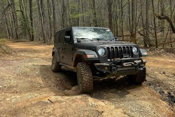
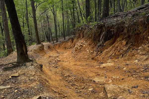
Dickey Bell Trail 91
Dickey Bell is the second most challenging trail in Uwharrie National Forest and the only Jeep Badge of Honor Trail in North Carolina. The majority of the trail is an easy trail with small humps that could result in lower ground clearance vehicles bottoming out or scraping dirt. The major obstacle i...
Learn more about Dickey Bell Trail 91
Slab Pile Trail 79
Slab Pile is a fun trail with off-camber portions, small hill climbs, ruts, and several optional challenges. Most of the trail is accessible to most vehicles with moderate ground clearance. Little to none of the main trail requires 4WD, but some of the optional lines and obstacles will likely requir...
Learn more about Slab Pile Trail 79
Nursery Lane
Nursery Lane is a longer Forest Service road within Sandhills Game Lands that offers a generally easy drive with only minimal challenges, most of which depend on weather conditions. A short section of the trail has been rutted out by recent rainfall, though the ruts are typically no deeper than 6 in...
Learn more about Nursery Lane
ATV trails near Polkton, North Carolina
Explore ATV-friendly trails near you. These trails are accessible for vehicles up to 50 inches wide, perfect for ATVs and smaller off-road machines.
Falls Dam Trail 96
Falls Dam trail is another easier trail in Uwharrie National Forest. It has views of the forest humps and a few optional challenges. For the most part, the trail is a shelf road in the hills and can be done in most off-roading vehicles. Some optional challenges can be taken to add a little variety t...
Learn more about Falls Dam Trail 96
Lake View Trail 69
Lake View Trail is an easier trail offering great views of Uwharrie National Forest and Badin Lake. A view of Badin Lake can be seen about halfway through the trail. Most of the trail is an easy shelf road that winds along the hills and mountains of the forest. There are a few optional challenges th...
Learn more about Lake View Trail 69
Wolfden 89
Wolfden can be a challenging trail if all optional challenges are taken. There is a variety of small water crossings, hill climbs that may be off-camber, switchbacks, a handful of large rocks, a few small rock gardens, and medium-to-large drops and ledges. The first section after the trailhead is ge...
Learn more about Wolfden 89
Dutch John Trail 90
Dutch John is one of the harder trails within the Uwarrie National Forest, part of the "Dirty Ds" in Uwharrie. It offers a variety of obstacles ranging from rolling humps to small stream crossings and a couple of technical hill climbs and descents. The trail can be done on dirt bikes, ATVs, and othe...
Learn more about Dutch John Trail 90
UTV/side-by-side trails near Polkton, North Carolina
Find UTV and side-by-side trails near you. These trails accommodate vehicles up to 60 inches wide, ideal for UTVs, side-by-sides, and wider off-road rigs.
Falls Dam Trail 96
Falls Dam trail is another easier trail in Uwharrie National Forest. It has views of the forest humps and a few optional challenges. For the most part, the trail is a shelf road in the hills and can be done in most off-roading vehicles. Some optional challenges can be taken to add a little variety t...
Learn more about Falls Dam Trail 96
Lake View Trail 69
Lake View Trail is an easier trail offering great views of Uwharrie National Forest and Badin Lake. A view of Badin Lake can be seen about halfway through the trail. Most of the trail is an easy shelf road that winds along the hills and mountains of the forest. There are a few optional challenges th...
Learn more about Lake View Trail 69
Wolfden 89
Wolfden can be a challenging trail if all optional challenges are taken. There is a variety of small water crossings, hill climbs that may be off-camber, switchbacks, a handful of large rocks, a few small rock gardens, and medium-to-large drops and ledges. The first section after the trailhead is ge...
Learn more about Wolfden 89
Dutch John Trail 90
Dutch John is one of the harder trails within the Uwarrie National Forest, part of the "Dirty Ds" in Uwharrie. It offers a variety of obstacles ranging from rolling humps to small stream crossings and a couple of technical hill climbs and descents. The trail can be done on dirt bikes, ATVs, and othe...
Learn more about Dutch John Trail 90
The onX Offroad Difference
onX Offroad combines trail photos, descriptions, difficulty ratings, width restrictions, seasonality, and more in a user-friendly interface. Available on all devices, with offline access and full compatibility with CarPlay and Android Auto. Discover what you're missing today!
Open Trail Map