San Lorenzo Canyon
Total Miles
5.7
Technical Rating
Best Time
Spring, Summer, Fall, Winter
Trail Type
Full-Width Road
Accessible By
Trail Overview
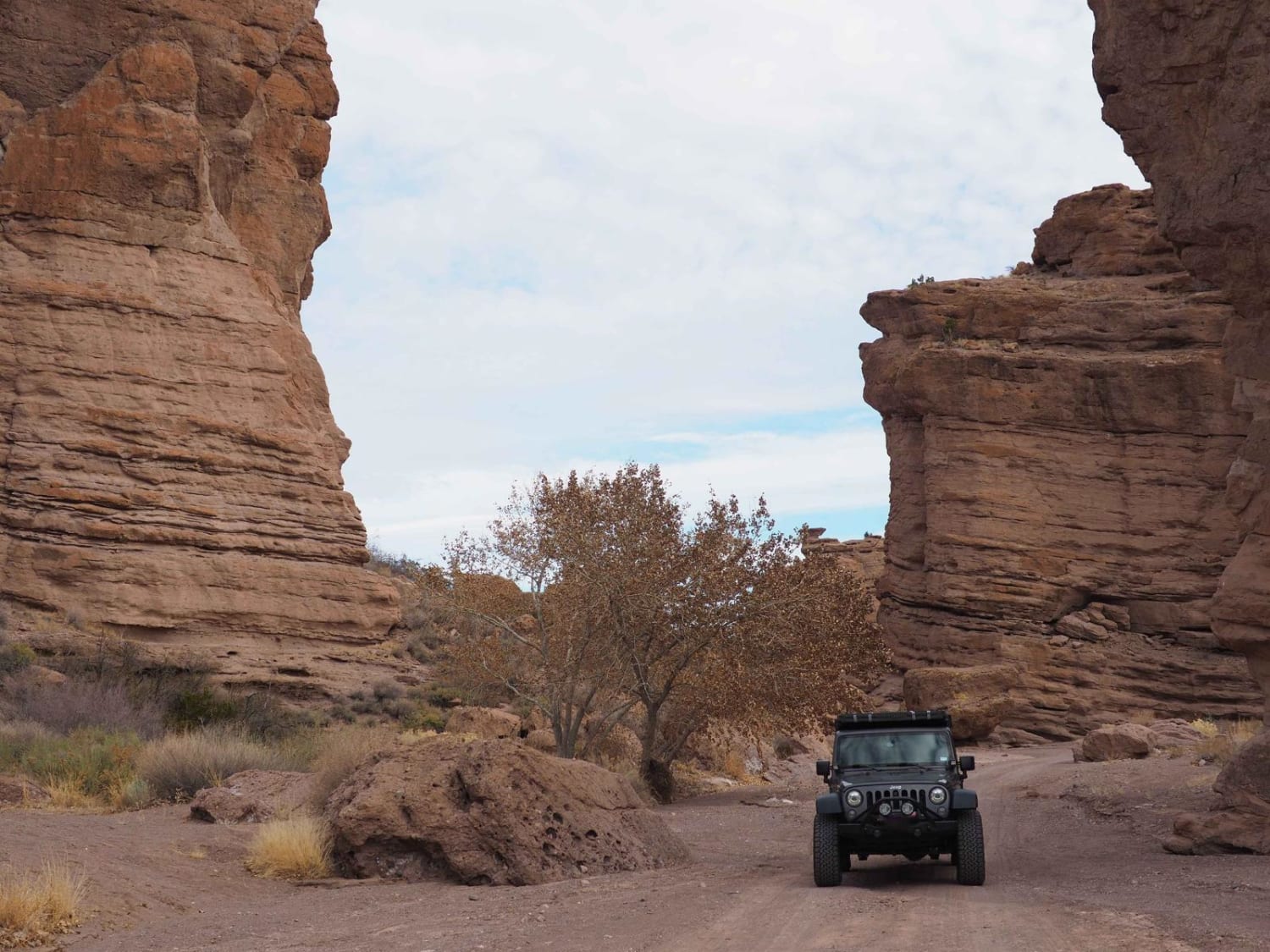
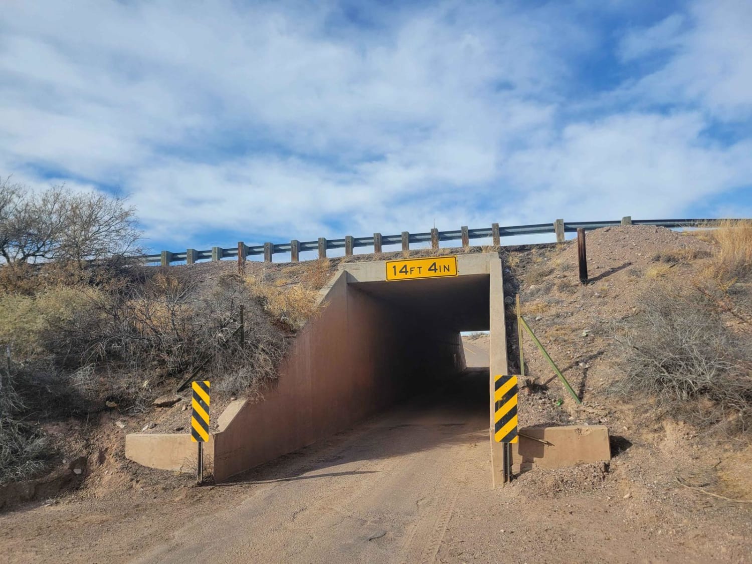
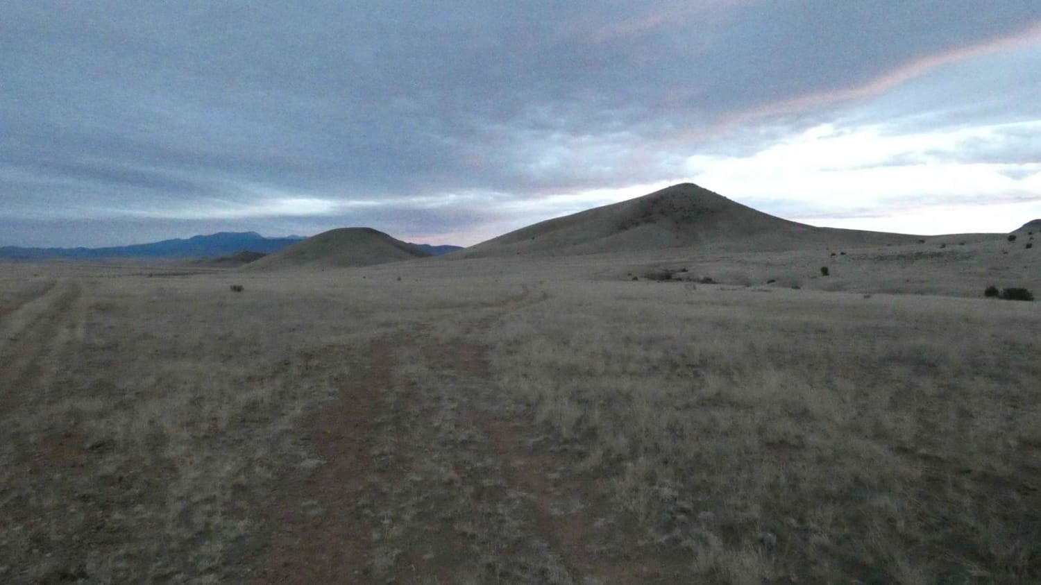
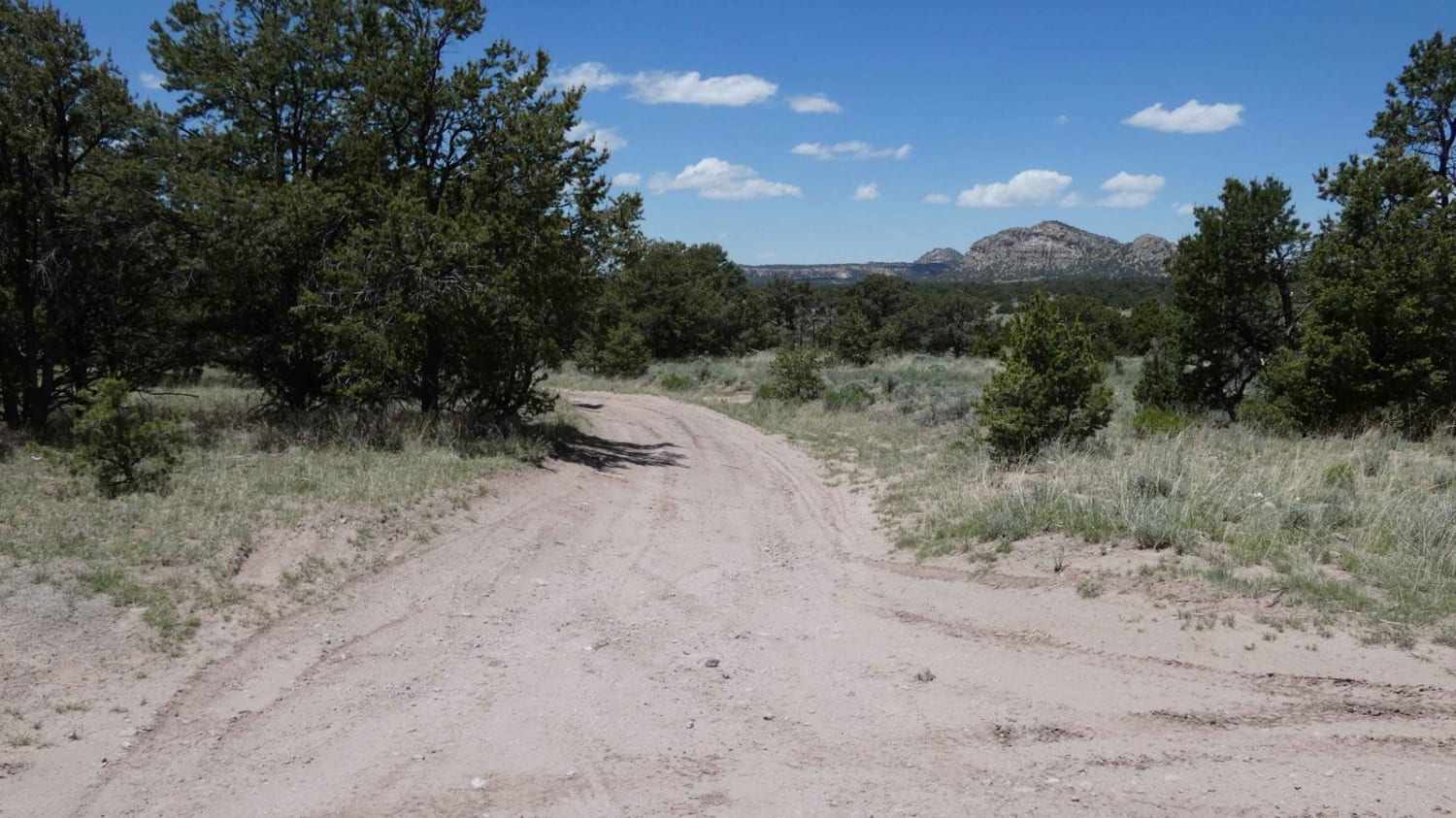
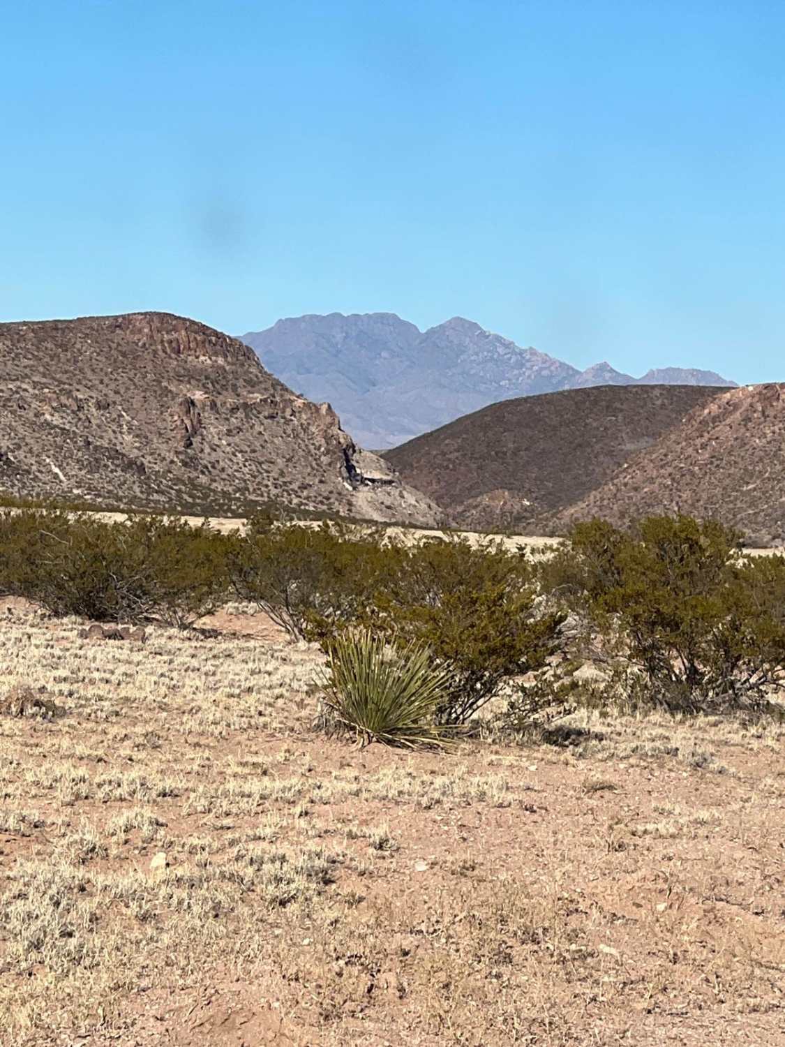
San Lorenzo Canyon is a series of rock formations and canyons on the southern border of Servilleta Wildlife Refuge. This area features numerous hiking and camping opportunities in a unique landscape not far from Albuquerque. It's a favorite day trip for locals, and you will often find others here hiking, camping, and doing cookouts in the canyon. This is a great first trip for aspiring overlanders or people looking to get out of town for an afternoon. The route starts at a 1-way bridge crossing under I-25. Signs will provide directions onto BLM land calling out San Lorenzo canyon. The first part of the drive is through an open desert, with sweeping views of the surrounding landscape. A network of trails in and out of a dry river bed provides opportunities for a variety of riding. After a few miles, the trail will go into the canyon. There are numerous places along the trail to park and explore the rock formations on either side of the road. These sandstone formations are unique in that there are few restrictions in exploration on foot, though vehicles should stick to the trail. After 6 miles, the road dead ends in a rocky cul-de-sac. Additional hiking is available beyond the end of the trail, but vehicle traverse is not permitted.
Photos of San Lorenzo Canyon
Difficulty
This trail is accessible in any crossover. However, there are some washboards that can be pretty rough if your suspension is more on-road oriented.
Status Reports
San Lorenzo Canyon can be accessed by the following ride types:
- High-Clearance 4x4
- SUV
- SxS (60")
- ATV (50")
- Dirt Bike
San Lorenzo Canyon Map
Popular Trails
Spook to Monument Hill Loop
Lone Mountain FS312
Puertecito of Bowling Green
The onX Offroad Difference
onX Offroad combines trail photos, descriptions, difficulty ratings, width restrictions, seasonality, and more in a user-friendly interface. Available on all devices, with offline access and full compatibility with CarPlay and Android Auto. Discover what you’re missing today!