Route 50
Total Kilometers
6.4
Technical Rating
Best Time
Spring, Summer, Fall
Trail Type
High-Clearance 4x4 Trail
Accessible By
Trail Overview
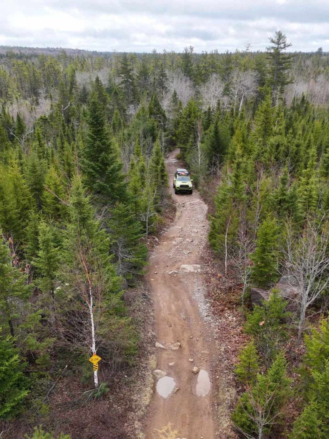
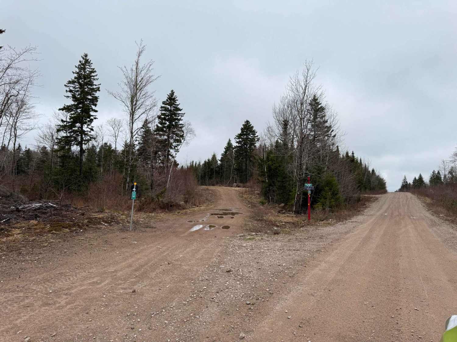
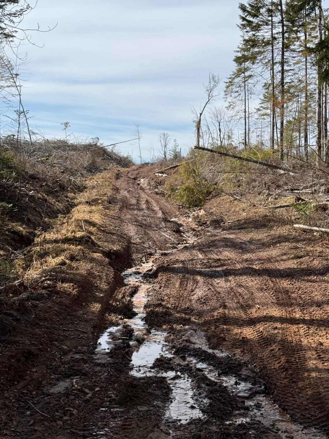
Route 50 is a former logging road within the well-used ATVANS crown land trail system. The trail features hard-packed dirt with numerous large puddles and flooded sections. There are a few short, rocky hill climbs where using 4L can help avoid damaging the trail. Always be cautious of washouts after rain. If you're coming from the south end on Route 99, keep right at the Y as you approach the trail's north end. The trail is 6.4 km long, with the north end located 400 meters from the Y.
Photos of Route 50
Difficulty
Large water holes, rough sections and tight turns.
History
The Cloud Lake Wilderness Area is a protected region in Nova Scotia, located south of Greenwood, near the Kings-Annapolis County line. It spans over 15,800 hectares (39,046 acres) and is part of the South Mountain Rolling Plain natural landscape.This area was expanded in 2015 to include a diverse range of natural features such as granite bedrock, upland regions, forested landforms, glacial deposits, large lakes, and steep-sided streams. The landscape is characterized by a mosaic of mixed wood and deciduous forests, with species like red spruce, red and white pine, yellow birch, and various maples.The Cloud Lake Wilderness Area is also home to several rare species, including the eastern white cedar, which is listed as a vulnerable species in the province. The area is valued for outdoor recreation, including canoeing, hiking, sport fishing, and some hunting.Route 50, which partially follows a former logging road, leads into the Cloud Lake Wilderness Area. This trail provides access to the wilderness and showcases the historical significance of the logging industry in the region 2. The former logging road adds a unique historical dimension to the trail, connecting visitors to the area's past while they enjoy its natural beauty.
Status Reports
Route 50 can be accessed by the following ride types:
- High-Clearance 4x4
- SxS (60")
- ATV (50")
- Dirt Bike
Route 50 Map
Popular Trails
Old Liverpool Road
Mill Road

East River Road
The onX Offroad Difference
onX Offroad combines trail photos, descriptions, difficulty ratings, width restrictions, seasonality, and more in a user-friendly interface. Available on all devices, with offline access and full compatibility with CarPlay and Android Auto. Discover what you’re missing today!