Cape Clear
Total Kilometers
10.9
Technical Rating
Best Time
Spring, Summer, Fall
Trail Type
Full-Width Road
Accessible By
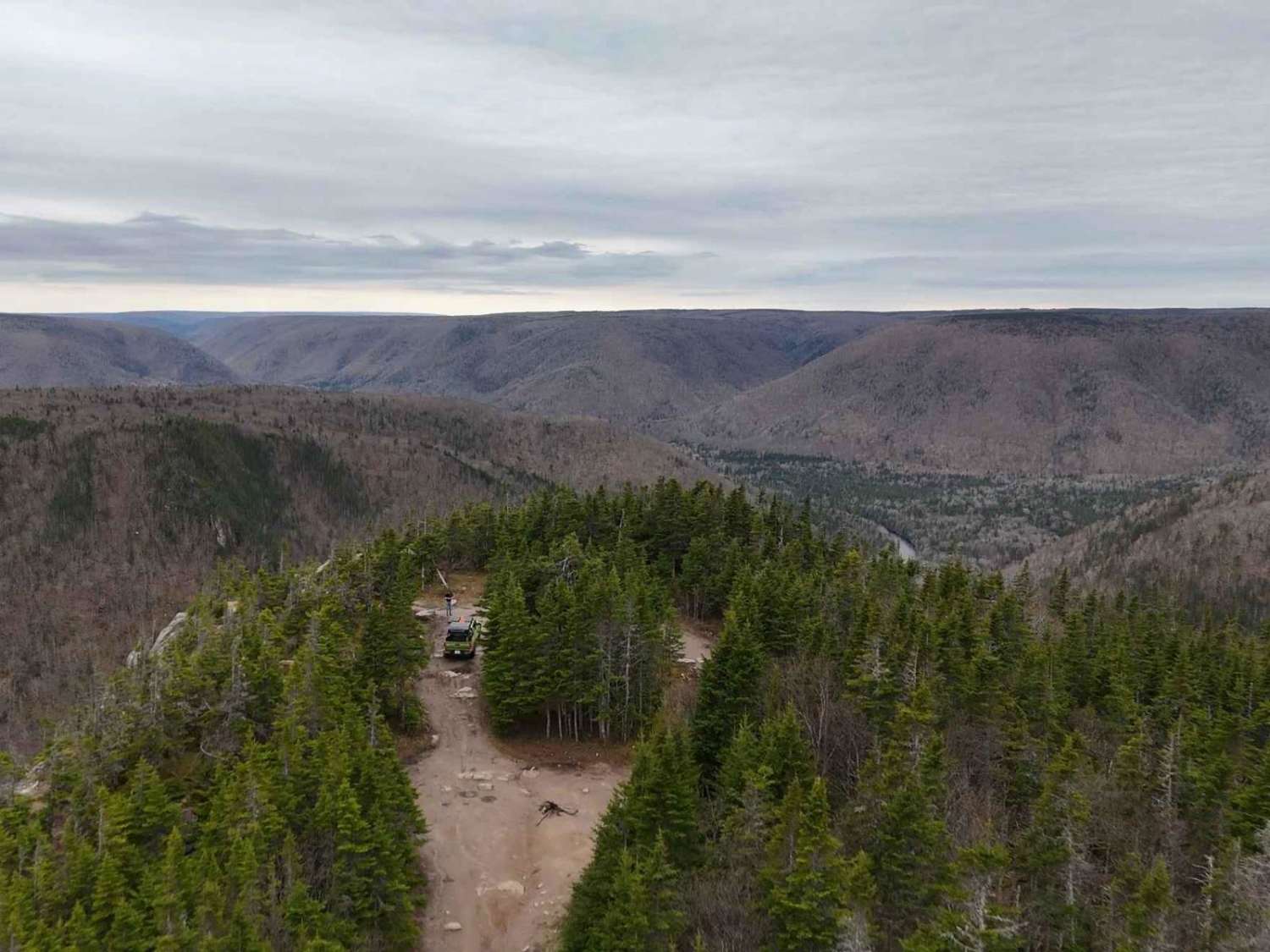
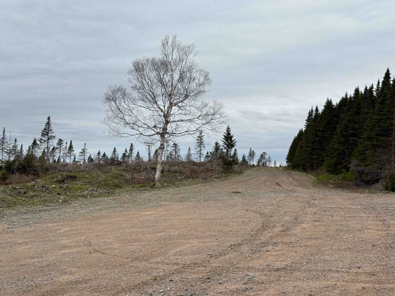
Trail Overview
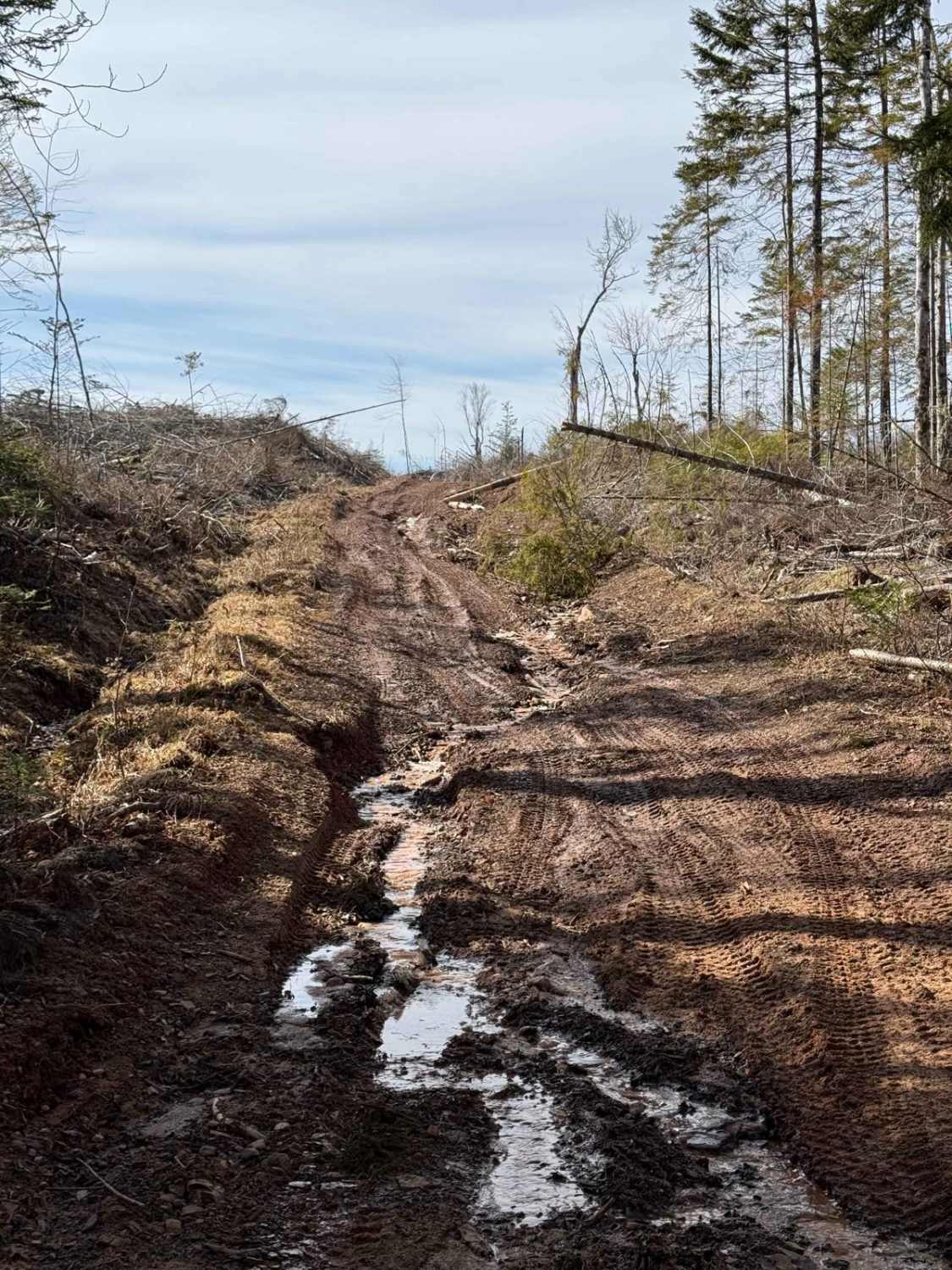
The trail begins as a wide, hard-packed dirt logging road with some rocky sections and a few potholes. After approximately 8.5 km, the road begins to deteriorate, with a couple of washouts that are passable with caution. The final 400 metres are more challenging, with large waterholes and a cul-de-sac at the end full of exposed rocks. While most SUVs can navigate the trail, less confident drivers might consider parking at the final turn and walking the last stretch. The effort is worth it for the destination.
Photos of Cape Clear
Difficulty
The trail's challenges include washouts that require careful navigation, large waterholes in the final 400 metres, and substantial exposed rocks in the last 80 metres. These obstacles make the trail moderately difficult, particularly for less experienced drivers or vehicles with lower ground clearance.
Status Reports
Cape Clear can be accessed by the following ride types:
- High-Clearance 4x4
- SUV
- SxS (60")
- ATV (50")
- Dirt Bike
Cape Clear Map
Popular Trails

Hiking Trail Road
Old Liverpool Road
Cottage 2 Lane
Mill Road
The onX Offroad Difference
onX Offroad combines trail photos, descriptions, difficulty ratings, width restrictions, seasonality, and more in a user-friendly interface. Available on all devices, with offline access and full compatibility with CarPlay and Android Auto. Discover what you’re missing today!