Smith Creek
Total Kilometers
8.4
Technical Rating
Best Time
Summer
Trail Type
Full-Width Road
Accessible By
Trail Overview
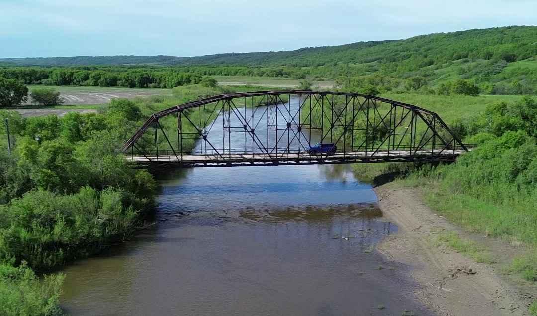
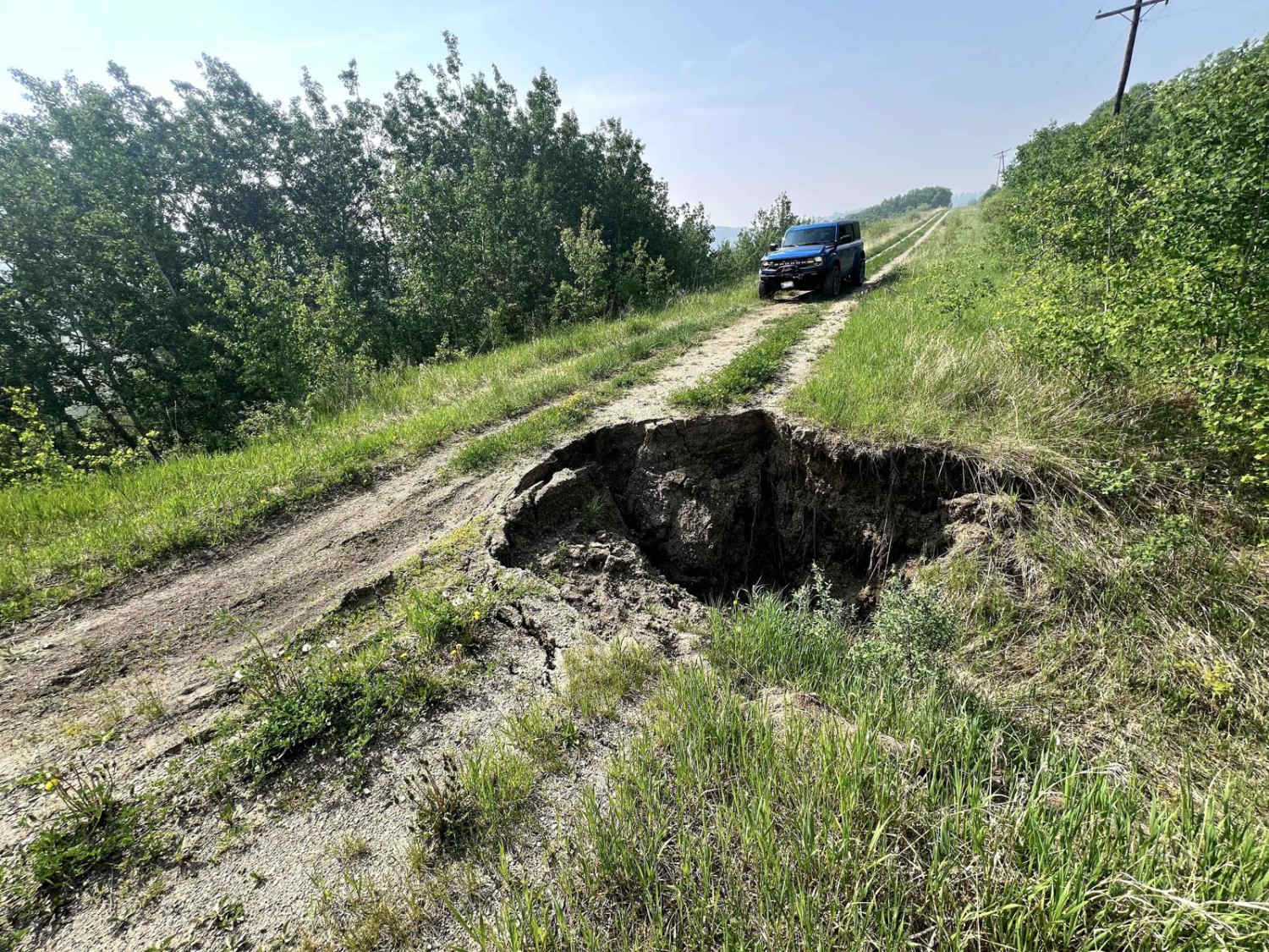
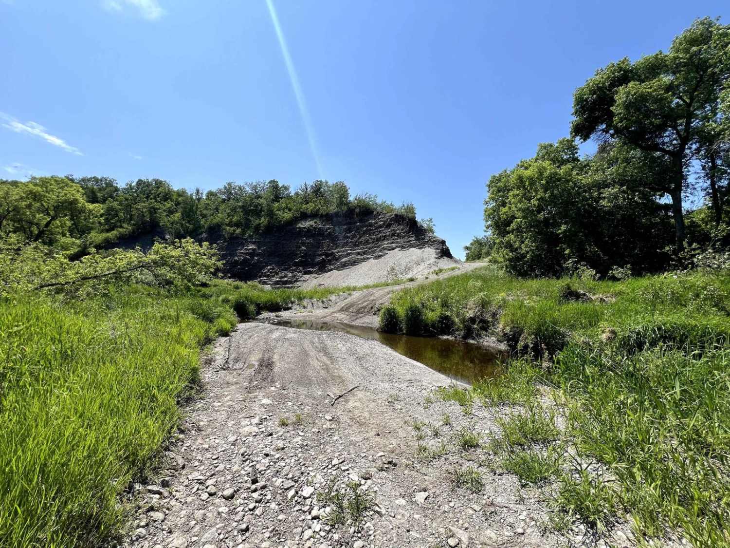
This short 5-mile trail runs alongside Smith Creek as it connects with the Assiniboine River, just outside Russell, Manitoba (near the Saskatchewan border). The route follows an old power/telephone line corridor, cutting through open prairie and wooded sections. The trail roughly parallels a small ravine before reaching a shallow water crossing -- typically passable for vehicles during dry seasons, but depth can fluctuate seasonally. A highlight of the trail is a historic steel bridge crossing over the Assiniboine River. Along the route, you'll encounter several culverts and some muddy sections after rain. Midway through, one culvert has experienced significant erosion but was still cautiously passable as of June 2025. Drivers should approach this section slowly and use their discretion based on vehicle capability and trail conditions. Winter conditions are unknown, please leave a Trail Report if attempted. Best accessed from late spring through early fall. The trail may become impassable during wet conditions or spring runoff due to mud and high water levels at the crossings. Please respect the nearby farmland.
Photos of Smith Creek
Difficulty
Muddy ruts. Water crossing typically less than 12" (but could be more depending on season/rain). Typically one vehicle wide with places to pass.
Status Reports
Smith Creek can be accessed by the following ride types:
- High-Clearance 4x4
- SUV
- SxS (60")
- ATV (50")
- Dirt Bike
Smith Creek Map
Popular Trails

North Star Trail
Roseisle Creek


The onX Offroad Difference
onX Offroad combines trail photos, descriptions, difficulty ratings, width restrictions, seasonality, and more in a user-friendly interface. Available on all devices, with offline access and full compatibility with CarPlay and Android Auto. Discover what you’re missing today!