
Off-Road Trails in Manitoba
Discover off-road trails in Manitoba
Off-Road Trails in Manitoba
Discover the best off-road trails in Manitoba. Browse trail maps, check difficulty ratings, and find your next adventure — whether you're looking for a quick ride or an all-day expedition.
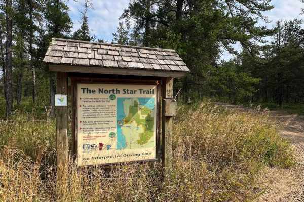
North Star Trail
The trail is an old logging road once the only roadway to the beaches. Today, you can explore the trail in summer by truck, horseback, mountain bike, or ATV. Logging and gravel trucks still use part of the trail near the northern end. The south trailhead is at Hwy 304 at Stead Road. The north trailh...
Learn more about North Star Trail
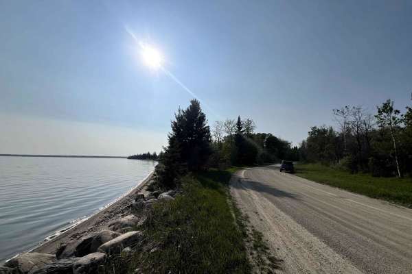
Lake Audy Road
Lake Audy Road is an easy gravel trail in Riding Mountain National Park that takes you through rolling forest and prairie landscapes to one of the park's highlights -- the Lake Audy Bison Enclosure. Here, you can drive through a massive fenced pasture and get up-close views of a free-roaming bison h...
Learn more about Lake Audy Road
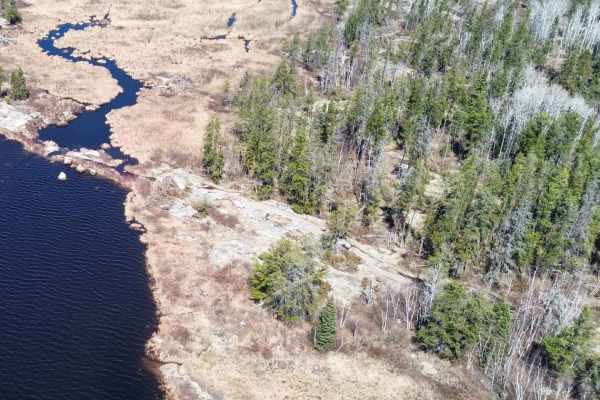
Pit Lake
This is Manitoba's most popular and challenging rock crawling trail, located near Rennie in the rugged Whiteshell Provincial Forest. Known for the exposed granite bedrock, tight technical lines, mud, and water, this has become a proving ground for local off-roading enthusiasts. High-clearance, well-...
Learn more about Pit Lake
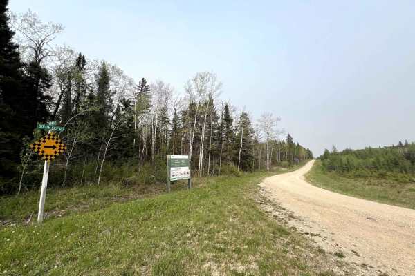
Rolling River Road
Rolling River Road is a scenic, remote trail cutting through the south end of Riding Mountain National Park. Originally built as a firebreak, this one-vehicle-wide gravel road winds through dense boreal forest, open meadows, and marsh. The trail has gentle elevation changes and several long, open st...
Learn more about Rolling River Road
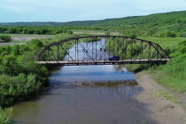
Smith Creek
This short 5-mile trail runs alongside Smith Creek as it connects with the Assiniboine River, just outside Russell, Manitoba (near the Saskatchewan border). The route follows an old power/telephone line corridor, cutting through open prairie and wooded sections. The trail roughly parallels a small r...
Learn more about Smith Creek
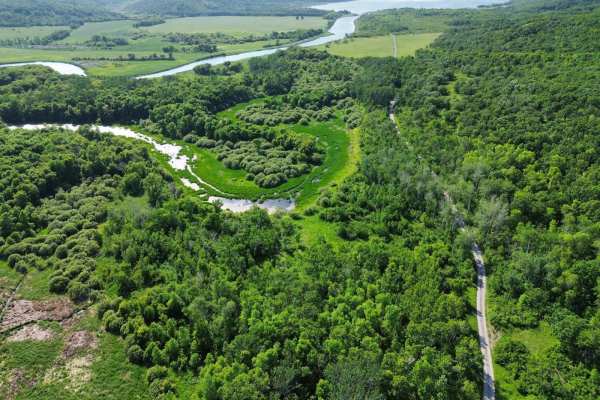
Grasse Lake
A short dirt/mud trail from the gravel road leads to Grasse Lake, a quiet, shallow wetland nestled within the valley, attracting a rich variety of waterfowl, shorebirds, and other wildlife. The trail was mapped during an unusually dry time. The trail is not passable when wet, as it gets too muddy. Q...
Learn more about Grasse Lake
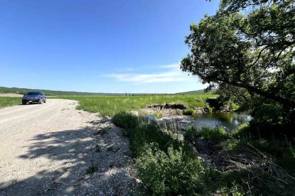
Pembina Valley WMA
This low-maintenance gravel dry-weather road route through Manitoba's Pembina Valley Wildlife Management Area offers a peaceful, scenic drive through one of southern Manitoba's picturesque natural landscapes. The road meanders through a mix of open prairie, dense aspen bluffs, and winding valley ter...
Learn more about Pembina Valley WMA
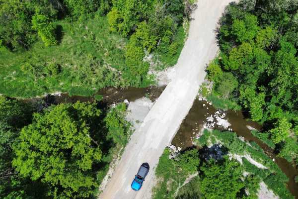
Snow Valley Road
Snow Valley Road is a scenic, historic rural route running through the wooded valley west of Roseisle, Manitoba. This gravel backroad partially follows the path of an early 1900s rail line built by the Canadian Northern Railway to service a cement plant deep in the valley. Today, it offers a quiet a...
Learn more about Snow Valley Road
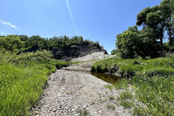
Roseisle Creek
The trail follows the remnants of a century-old, decommissioned rail line through Manitoba's secluded Babcock Valley. Initially built in 1905 by the Canadian Northern Railway to service a now-abandoned cement factory, the trail winds alongside Roseisle Creek, offering scenic views and creek crossing...
Learn more about Roseisle Creek
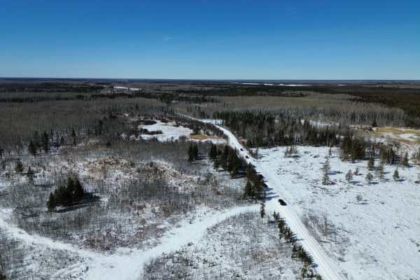
Sandilands Forestry Road 31
Forestry Road 31 / Fire Guard Road 31 is an easy forest access road in Manitoba’s Sandilands Provincial Forest near Woodridge. The route runs north from the Woodridge area toward Highway 1 through sandy pine forest and managed forestry land. This is primarily a forestry/fire-guard road, not a techni...
Learn more about Sandilands Forestry Road 31
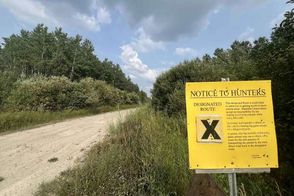
Beaver Creek Road
Beaver Creek Road is a remote former forestry road extending into the boreal wilderness northeast of Manigotagan and Hollow Water. Originally developed for timber harvesting and resource access, the route now varies greatly in condition, with sections that may be overgrown or washed out. The road pa...
Learn more about Beaver Creek Road
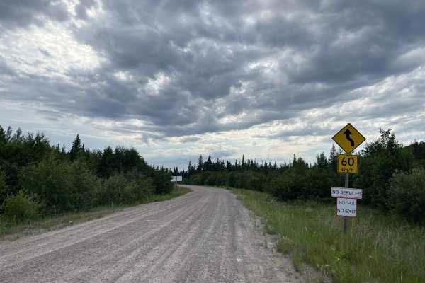
Loon Straits
The Loon Straits Access Road is an all-season gravel route branching west from Rice River Road and continuing to the remote lakeside community of Loon Straits on the eastern shore of Lake Winnipeg. The drive passes through boreal forest, wetlands and exposed Canadian Shield terrain before reaching t...
Learn more about Loon Straits
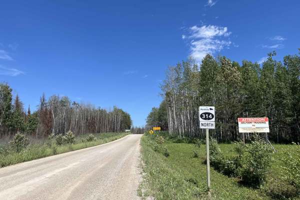
Nopiming - MB 314
PR 314 is a remote, maintained gravel road running north through the heart of Nopiming Provincial Park. The route winds through rugged Canadian Shield terrain, passing exposed granite, boreal forest, wetlands, rivers, and numerous lakes. Along the way, it provides access to Black Lake, Tooth Lake, B...
Learn more about Nopiming - MB 314
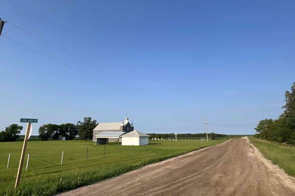
Lowland Road
Lowland Road is a quiet rural gravel route west of Lac du Bonnet that winds through a mix of farmland, wetlands, old homesteads, and wooded sections of aspen and mixed forest. The road is generally easy in dry conditions, but drivers may encounter washboard, potholes, loose gravel, muddy shoulders, ...
Learn more about Lowland Road
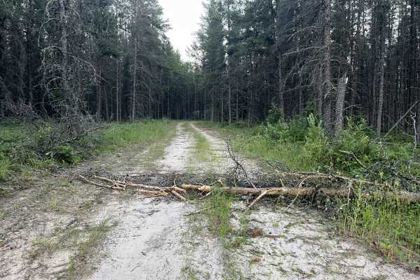
Brightstone Forest
Brightstone offers a network of quiet gravel roads, sandy resource routes, old forestry tracks, and winter trail corridors through the rolling Brightstone Sand Hills Provincial Forest northwest of Lac du Bonnet.
The terrain is generally easier than the rocky trails found farther east in Manitoba’s ...
Learn more about Brightstone Forest
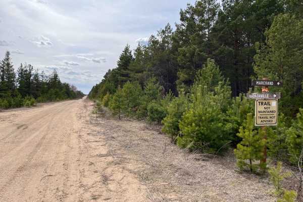
Sandilands Forestry Road 18
Forestry Road 18 / Fire Guard Road 18 is an easy forest access road in Manitoba’s Sandilands Provincial Forest near Woodridge. The route runs through sandy pine forest and managed forestry land.
This is primarily a forestry/fire-guard road. In dry conditions, it is generally an easy drive for a sto...
Learn more about Sandilands Forestry Road 18
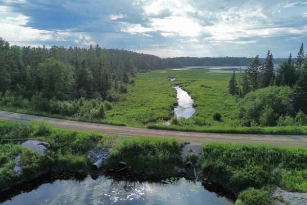
Nopiming - MB 315
Nopiming - MB 315
Provincial Road PR-315 is a scenic backcountry highway running east from PR 313 near Lac du Bonnet through the southern portion of Nopiming Provincial Park to the Ontario boundary. The route begins as pavement through cottage country before changing to maintained gravel east of th...
Learn more about Nopiming - MB 315
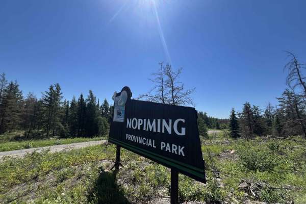
MB-304
MB-304 from Manigotagan to Long Lake is a remote, scenic gravel route through Manitoba’s eastern Canadian Shield. The road passes through dense boreal forest, exposed rock, wetlands, and lake country as it travels toward the northern edge of Nopiming Provincial Park and the Bissett area.
This is a ...
Learn more about MB-304
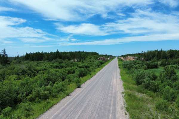
Berens River Road
This remote all-season gravel road connects Bloodvein with the isolated community of Berens River on the eastern side of Lake Winnipeg. The route travels through undeveloped boreal forest, wetlands and exposed Canadian Shield terrain. It was constructed as a permanent transportation route and includ...
Learn more about Berens River Road
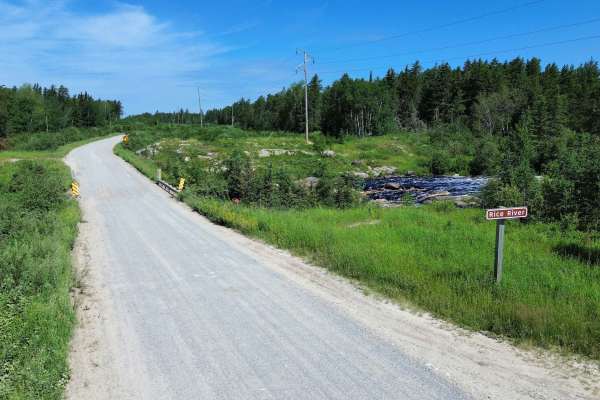
Rice River Road
Rice River Road is a remote all-season gravel route running north from PR- 304 near Manigotagan toward Bloodvein First Nation. The road travels through boreal forest, wetlands, and exposed Canadian Shield terrain, forming the southern portion of the all-season road system connecting Manitoba’s east-...
Learn more about Rice River Road
ATV trails in Manitoba
Explore ATV-friendly trails in Manitoba. These trails are accessible for vehicles up to 50 inches wide, perfect for ATVs and smaller off-road machines.
North Star Trail
The trail is an old logging road once the only roadway to the beaches. Today, you can explore the trail in summer by truck, horseback, mountain bike, or ATV. Logging and gravel trucks still use part of the trail near the northern end. The south trailhead is at Hwy 304 at Stead Road. The north trailh...
Learn more about North Star Trail
Pit Lake
This is Manitoba's most popular and challenging rock crawling trail, located near Rennie in the rugged Whiteshell Provincial Forest. Known for the exposed granite bedrock, tight technical lines, mud, and water, this has become a proving ground for local off-roading enthusiasts. High-clearance, well-...
Learn more about Pit Lake
Smith Creek
This short 5-mile trail runs alongside Smith Creek as it connects with the Assiniboine River, just outside Russell, Manitoba (near the Saskatchewan border). The route follows an old power/telephone line corridor, cutting through open prairie and wooded sections. The trail roughly parallels a small r...
Learn more about Smith Creek
Grasse Lake
A short dirt/mud trail from the gravel road leads to Grasse Lake, a quiet, shallow wetland nestled within the valley, attracting a rich variety of waterfowl, shorebirds, and other wildlife. The trail was mapped during an unusually dry time. The trail is not passable when wet, as it gets too muddy. Q...
Learn more about Grasse Lake
UTV/side-by-side trails in Manitoba
Find UTV and side-by-side trails in Manitoba. These trails accommodate vehicles up to 60 inches wide, ideal for UTVs, side-by-sides, and wider off-road rigs.
North Star Trail
The trail is an old logging road once the only roadway to the beaches. Today, you can explore the trail in summer by truck, horseback, mountain bike, or ATV. Logging and gravel trucks still use part of the trail near the northern end. The south trailhead is at Hwy 304 at Stead Road. The north trailh...
Learn more about North Star Trail
Pit Lake
This is Manitoba's most popular and challenging rock crawling trail, located near Rennie in the rugged Whiteshell Provincial Forest. Known for the exposed granite bedrock, tight technical lines, mud, and water, this has become a proving ground for local off-roading enthusiasts. High-clearance, well-...
Learn more about Pit Lake
Smith Creek
This short 5-mile trail runs alongside Smith Creek as it connects with the Assiniboine River, just outside Russell, Manitoba (near the Saskatchewan border). The route follows an old power/telephone line corridor, cutting through open prairie and wooded sections. The trail roughly parallels a small r...
Learn more about Smith Creek
Grasse Lake
A short dirt/mud trail from the gravel road leads to Grasse Lake, a quiet, shallow wetland nestled within the valley, attracting a rich variety of waterfowl, shorebirds, and other wildlife. The trail was mapped during an unusually dry time. The trail is not passable when wet, as it gets too muddy. Q...
Learn more about Grasse Lake
The onX Offroad Difference
onX Offroad combines trail photos, descriptions, difficulty ratings, width restrictions, seasonality, and more in a user-friendly interface. Available on all devices, with offline access and full compatibility with CarPlay and Android Auto. Discover what you're missing today!
Open Trail Map