Roseisle Creek
Total Kilometers
8.3
Technical Rating
Best Time
Summer
Trail Type
Full-Width Road
Accessible By
Trail Overview
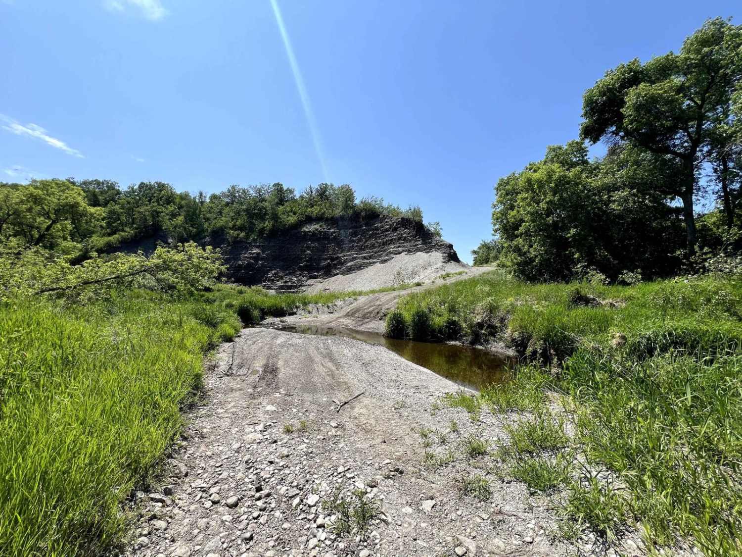
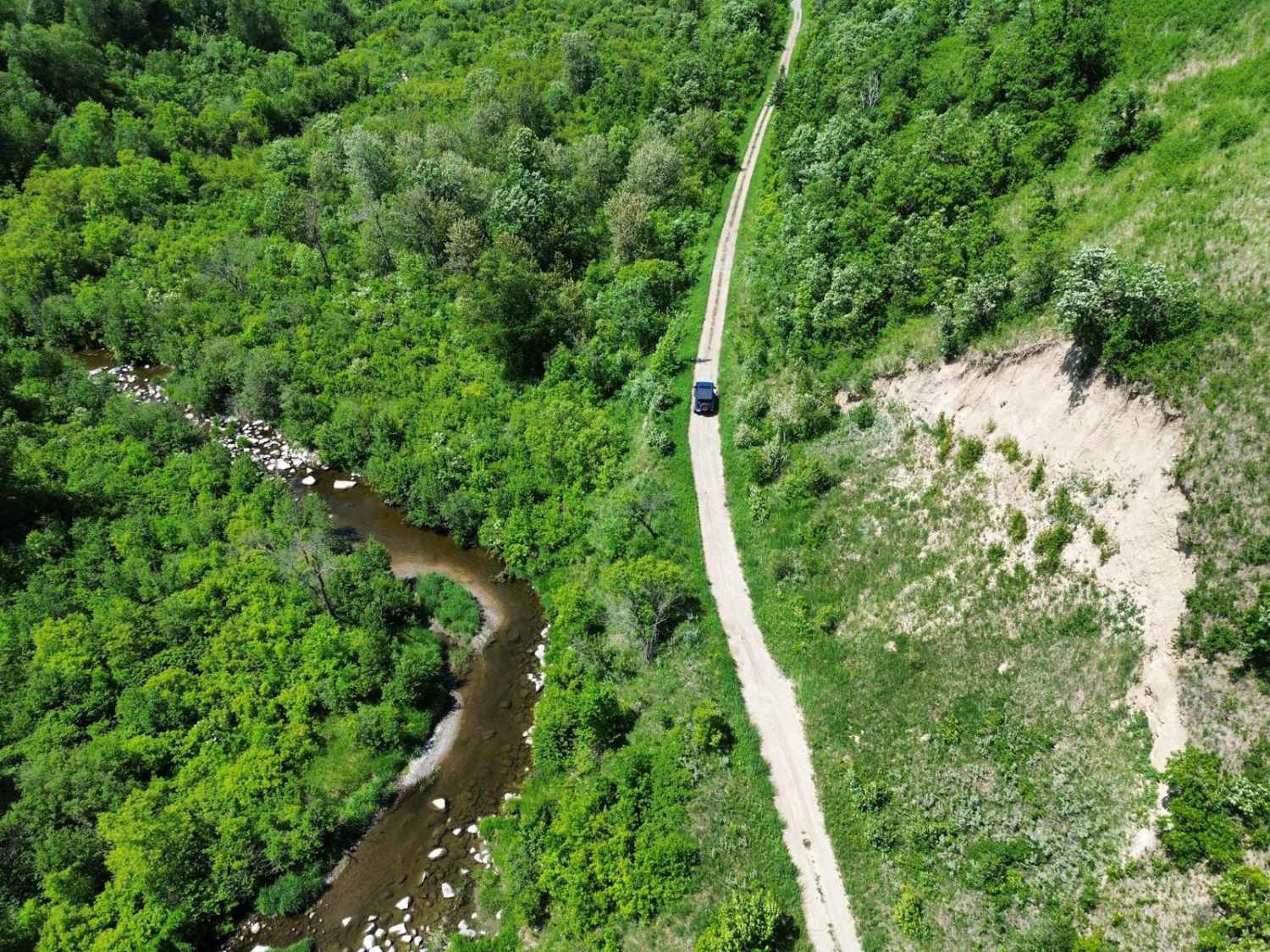
The trail follows the remnants of a century-old, decommissioned rail line through Manitoba's secluded Babcock Valley. Initially built in 1905 by the Canadian Northern Railway to service a now-abandoned cement factory, the trail winds alongside Roseisle Creek, offering scenic views and creek crossings. Along the route, explorers can spot remnants of the old railbed, quarry cuts, and traces of the valley's industrial past. The trail is passable in dry conditions, with sections transitioning into bush quad trails and water crossings. The trail was mapped during a dry time, and the water depth at the crossing fluctuates seasonally and is dependent on rain. This is part of the groomed SnoMan trail system in the winter. Vehicles/ATVs should avoid this trail during the winter as it can damage the snowmobile trails and pose a hazard to snowmobilers.
Photos of Roseisle Creek
Difficulty
single vehicle wide, potential water crossings up to 18" depending on season/rain.
Status Reports
Roseisle Creek can be accessed by the following ride types:
- High-Clearance 4x4
- SUV
- SxS (60")
- ATV (50")
- Dirt Bike
Roseisle Creek Map
Popular Trails

Rolling River Road


Roseisle Creek
The onX Offroad Difference
onX Offroad combines trail photos, descriptions, difficulty ratings, width restrictions, seasonality, and more in a user-friendly interface. Available on all devices, with offline access and full compatibility with CarPlay and Android Auto. Discover what you’re missing today!