Sharptail North
Total Kilometers
3.9
Technical Rating
Best Time
Spring, Summer, Fall
Trail Type
Full-Width Road
Accessible By
Trail Overview
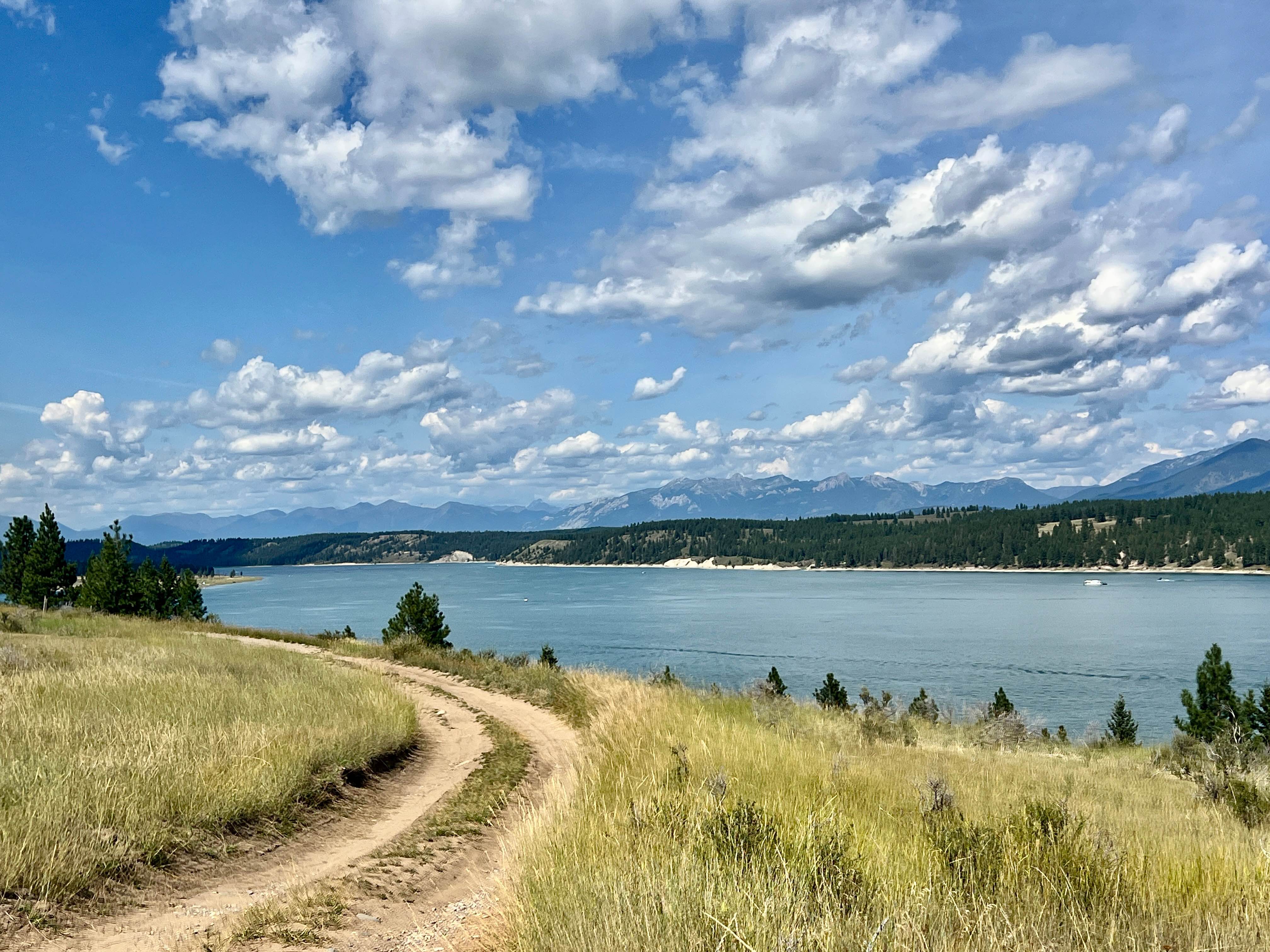
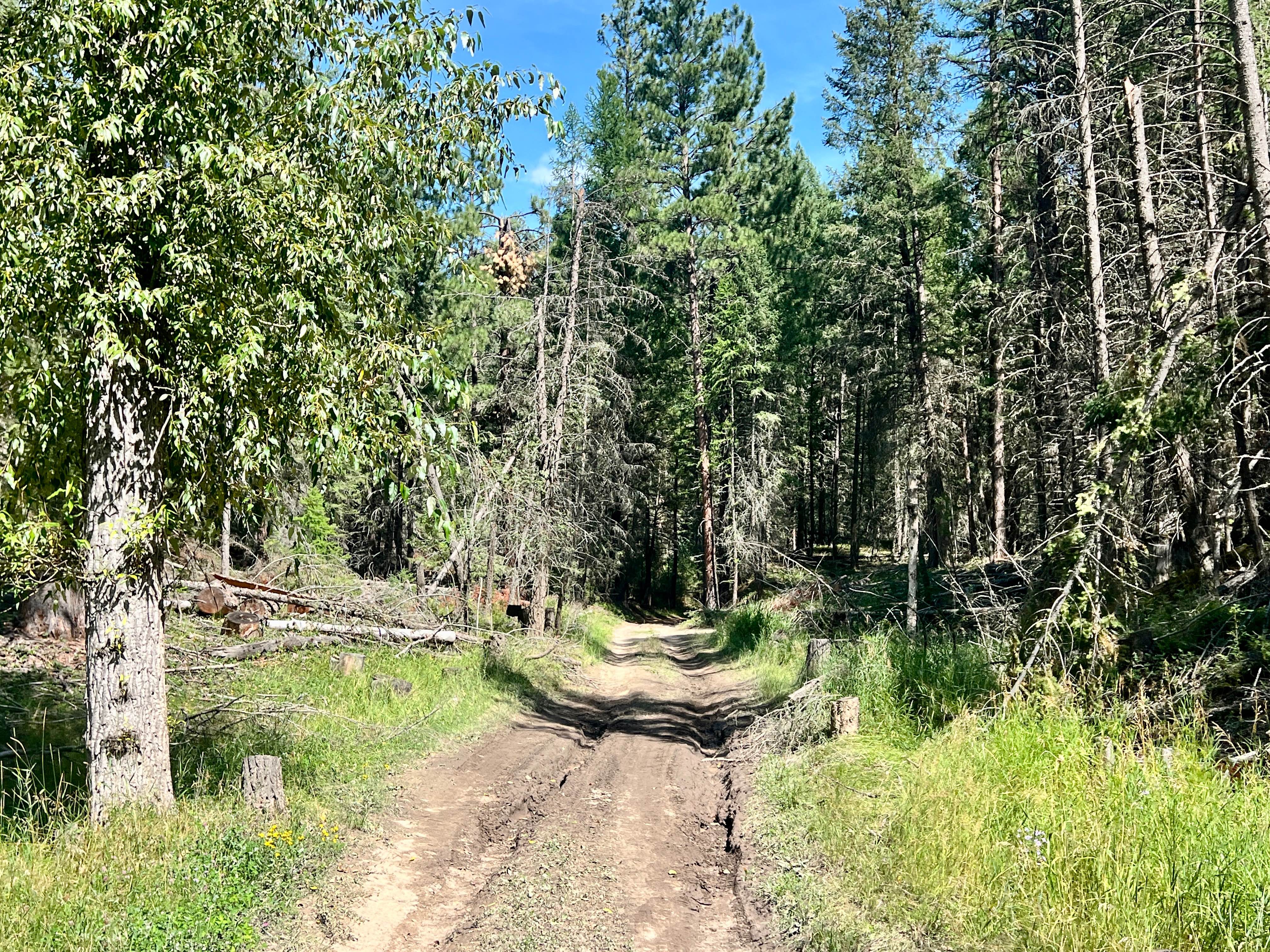
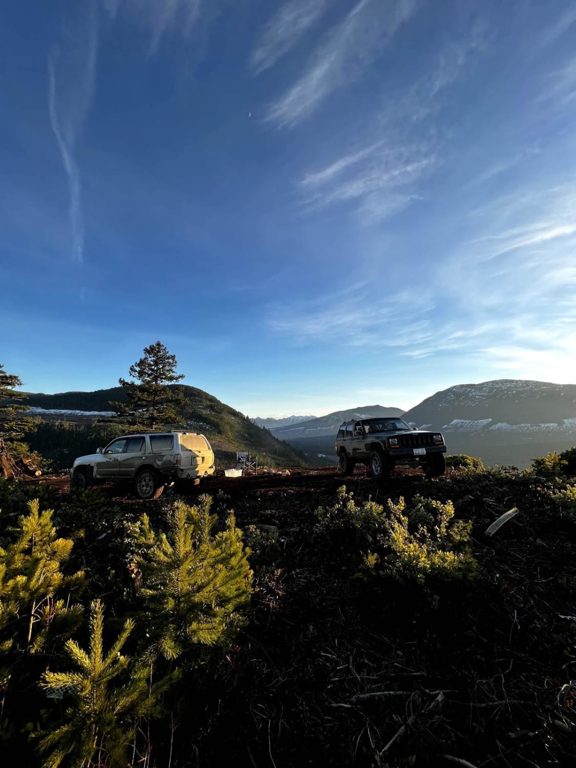
This trail presents contrasting characteristics. The southern part of the loop is narrow and gives the trail its rating, with deeper ruts and some flex sections. However, the northern section of the loop is very easy. It's easy enough to pull campers and a sprinter van. In the middle of the loop is another undeveloped camping area with a few spots. Be sure to pack it in and pack it out, as there are no restroom amenities. The lake views are fantastic once you get by the water. There is a nice floating dock at the campsite, and lots of spots in the shade make it a good place for those warmer days. Do not attempt the southern route with your Sprinter van or trailer; there are tight twists and turns through the trees. Possible downed trees will greatly slow your progress or make it impassable. Be ready to clear trees after a storm or in the springtime. There is no cell service. To ensure you have consistent map coverage, please download your offline maps before exploring the area. Crown Land Camping: Canadian Crown Land is open to Canadian residents for free camping. Out-of-country visitors, particularly from the US, will need to obtain a camping permit from the nearest FrontCounter BC office in Cranbrook before camping on Crown land if camping outside of the paid campsite.
Photos of Sharptail North
Difficulty
The southern section has narrow corners, downed trees, and deeper ruts. The northern section is significantly easier. Sprinter vans and trailers are not advised on the southern section of the loop beyond the camping area.
History
Situated within the Koocanusa Recreation Management Area, the Sharptail area is part of the traditional territory of the Ktunaxa people. The area has a modern view of the Lake, thanks to its creation in the late 1960s with the construction of the Libby Dam. People now enjoy the wildlife, peace, and access to the water.
Status Reports
Sharptail North can be accessed by the following ride types:
- High-Clearance 4x4
- SUV
- SxS (60")
- ATV (50")
- Dirt Bike
Sharptail North Map
Popular Trails

Hale Creek (Easy Way)
Farmers Lookout From 142 Main
The onX Offroad Difference
onX Offroad combines trail photos, descriptions, difficulty ratings, width restrictions, seasonality, and more in a user-friendly interface. Available on all devices, with offline access and full compatibility with CarPlay and Android Auto. Discover what you’re missing today!