Matheson Road Lookout
Total Kilometers
14.6
Technical Rating
Best Time
Summer, Fall
Trail Type
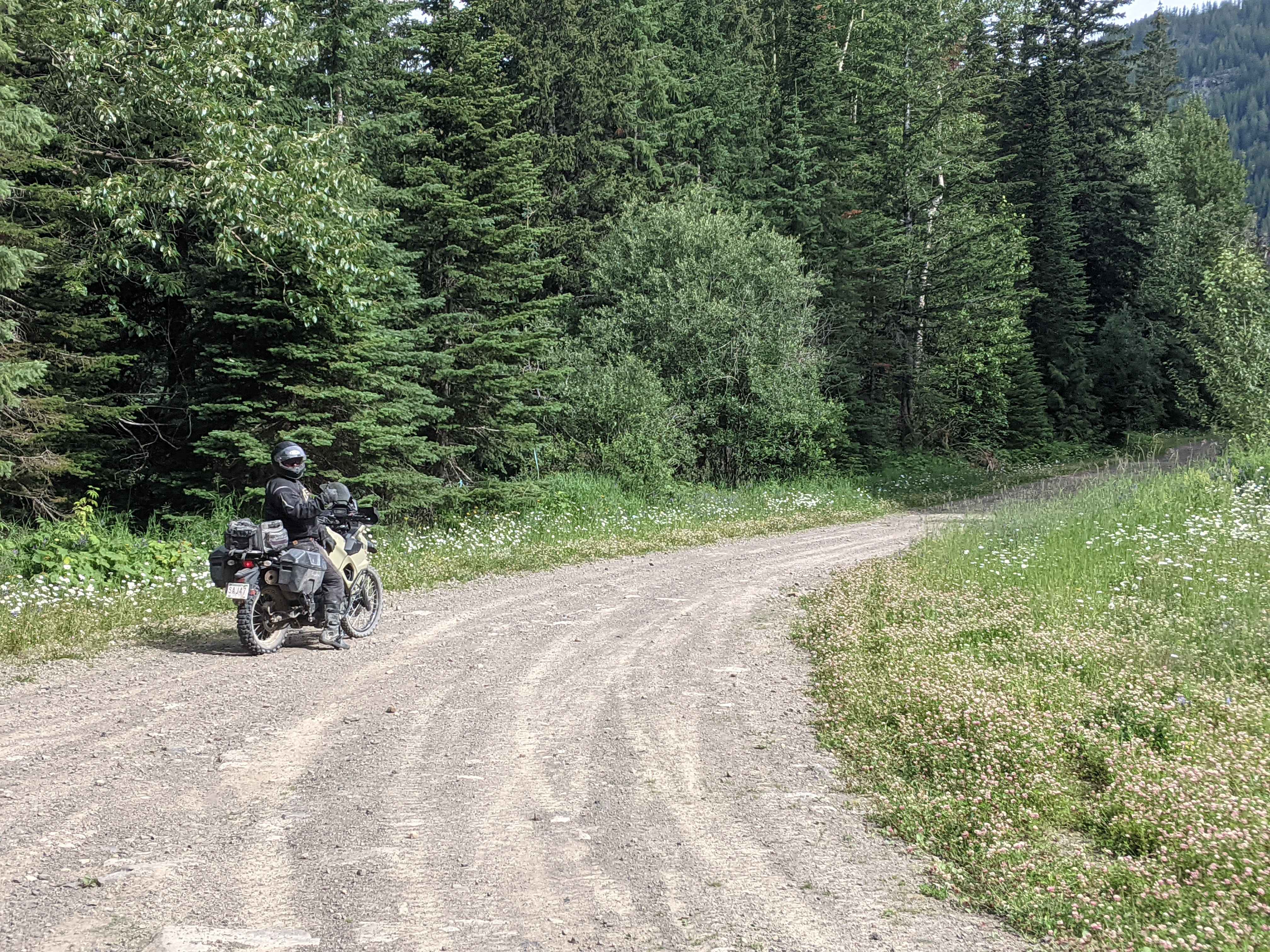
Full-Width Road
Accessible By
Trail Overview
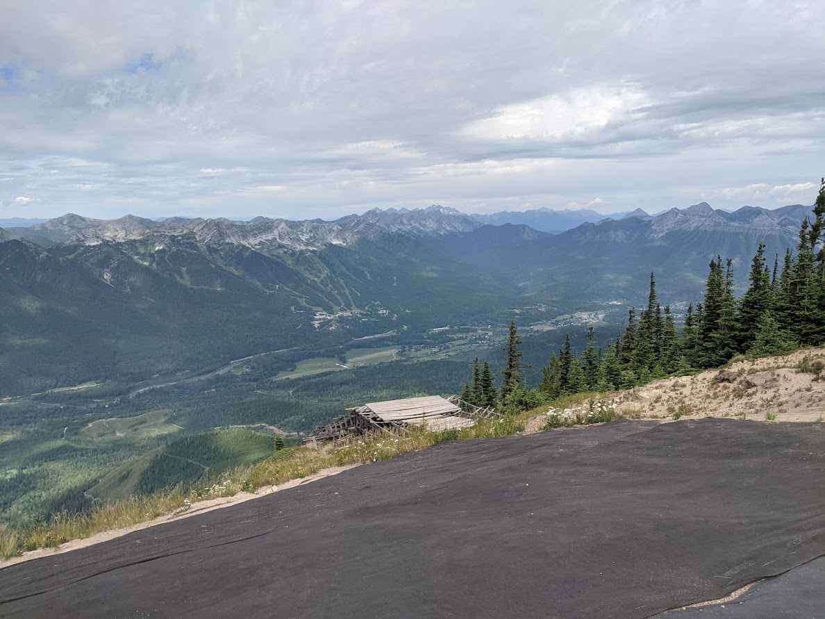
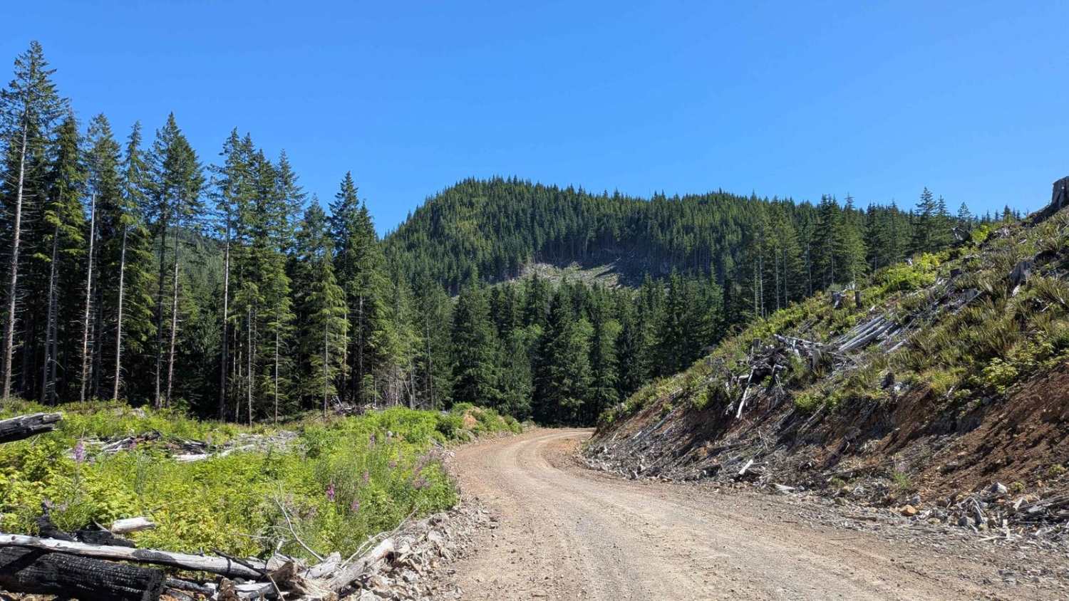
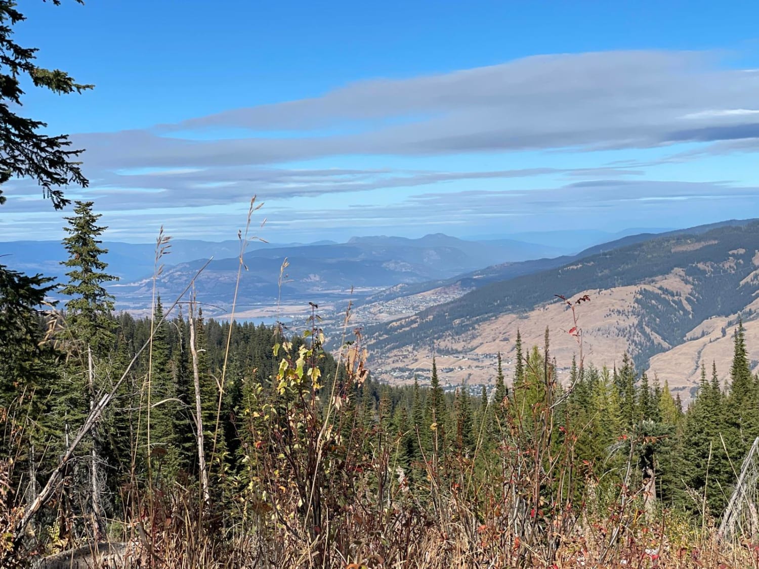
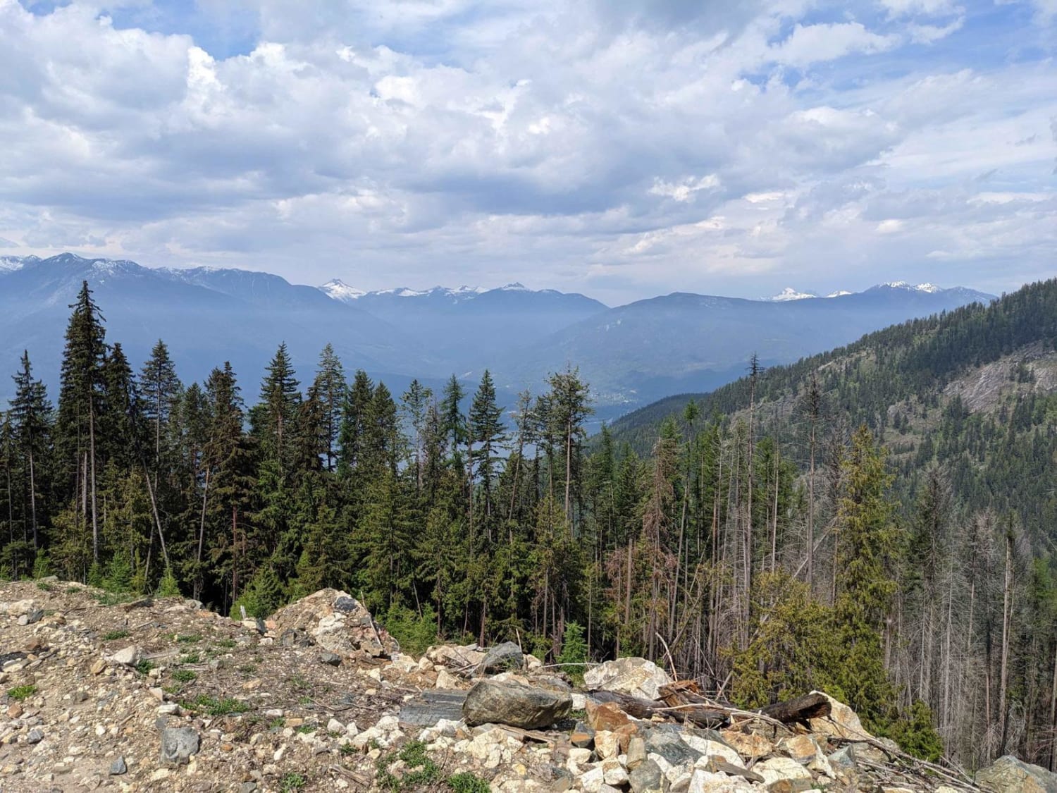
This trail is a steady climb of 2750 feet / 838 meters on approximately 5.5 miles / 9 km with scenic views all the way up. It goes from hard pack gravel to red gravel mixed with clay, at times, expect some narrowing due to small washouts. You will also find many erosion control bars across the road. You will navigate switchbacks & be in & out, mostly out, of cell coverage. At the top, you will be treated to a great view of the Fernie valley, including the town & Ski Hill. Maintenance is minimal but present.
Photos of Matheson Road Lookout
Difficulty
Uneven, rutted dirt/gravel trail with potential for loose rocks. Water crossings from heavy rain are more than a foot deep. Potential for mud holes, including ledges and steep grades. Roads are typically one vehicle wide with places to pass.
Status Reports
Matheson Road Lookout can be accessed by the following ride types:
- High-Clearance 4x4
- SUV
- SxS (60")
- ATV (50")
- Dirt Bike
Matheson Road Lookout Map
Popular Trails
Atluck Main
Pye Beach Recreation Site
King Edward Parallel
Loki Mountain Trail Head
The onX Offroad Difference
onX Offroad combines trail photos, descriptions, difficulty ratings, width restrictions, seasonality, and more in a user-friendly interface. Available on all devices, with offline access and full compatibility with CarPlay and Android Auto. Discover what you’re missing today!