Jordan Creek Road - FS 2S17
Total Miles
4.5
Technical Rating
Best Time
Fall, Summer, Spring
Trail Type
Full-Width Road
Accessible By
Trail Overview
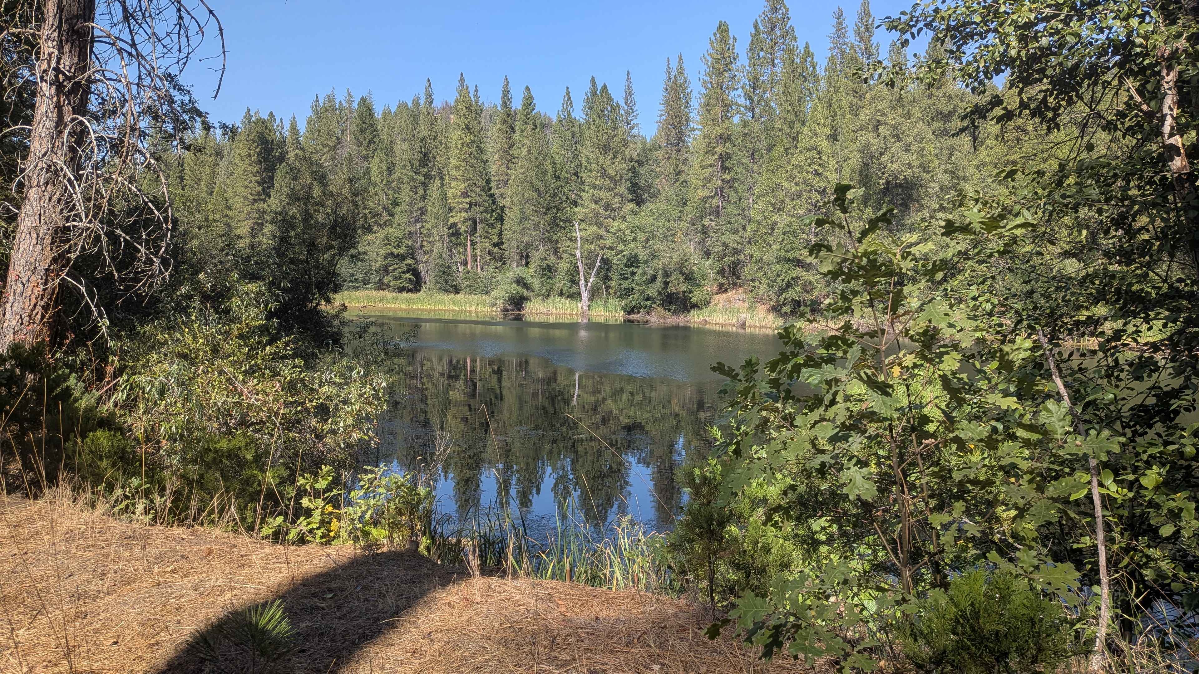
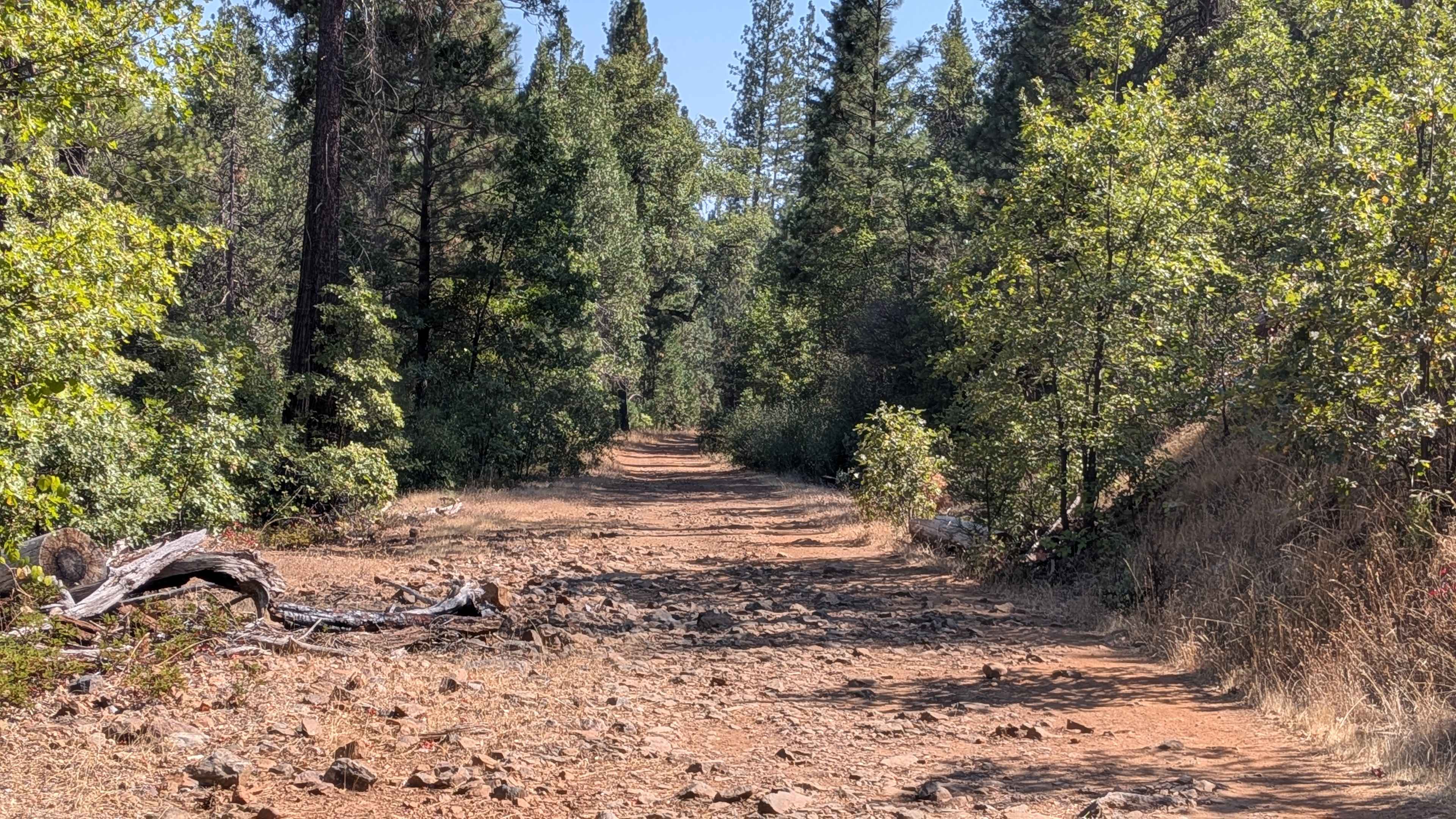
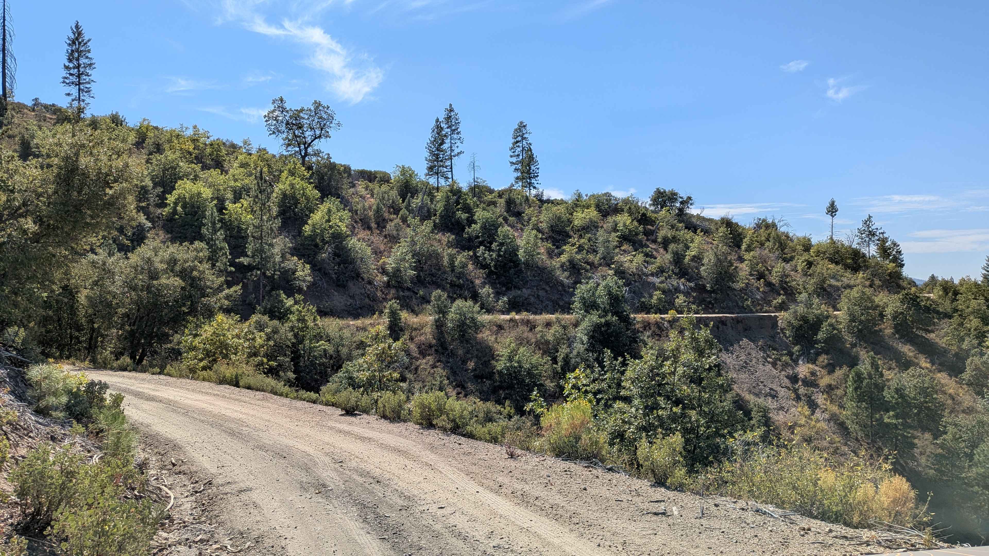
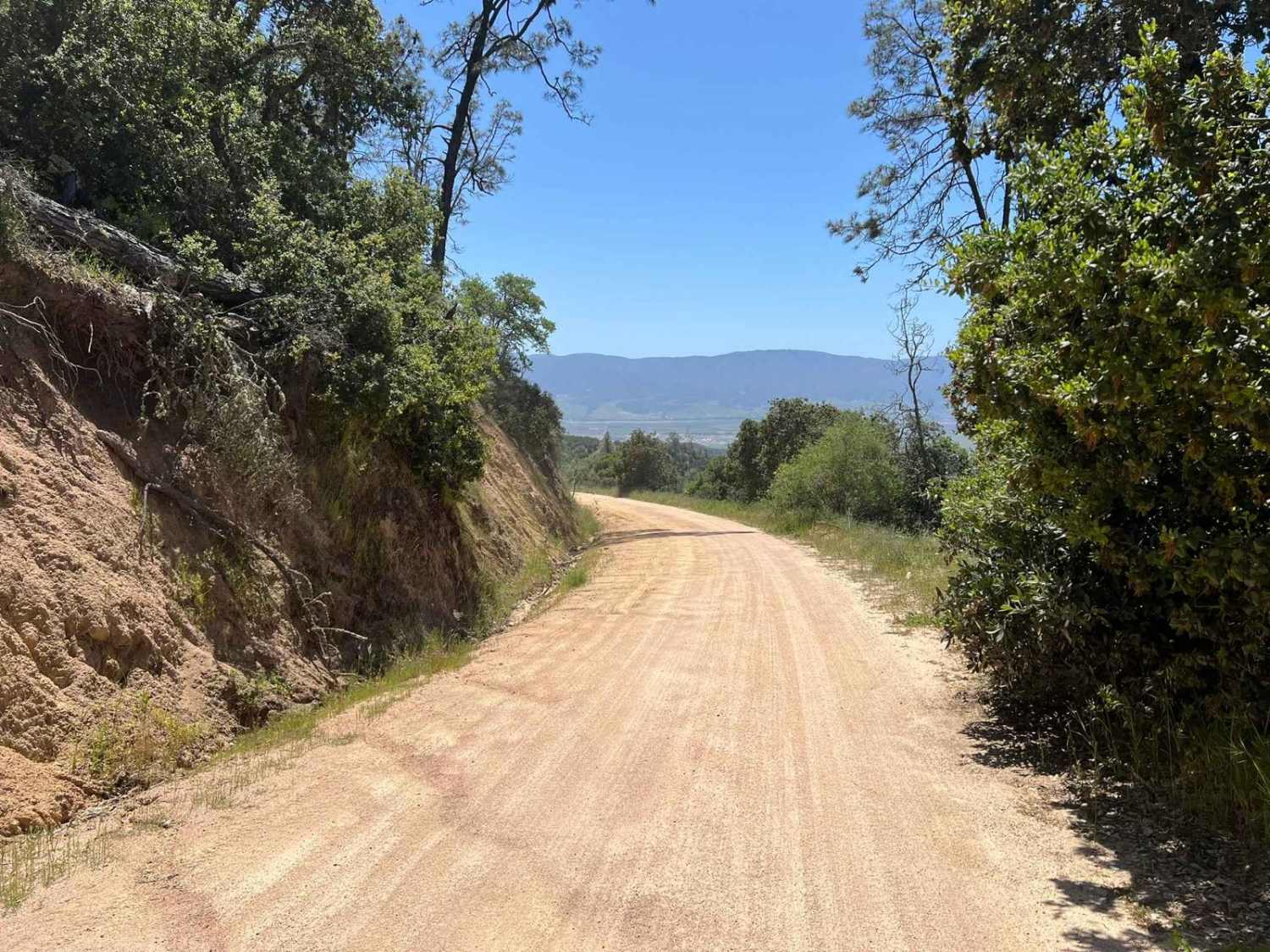
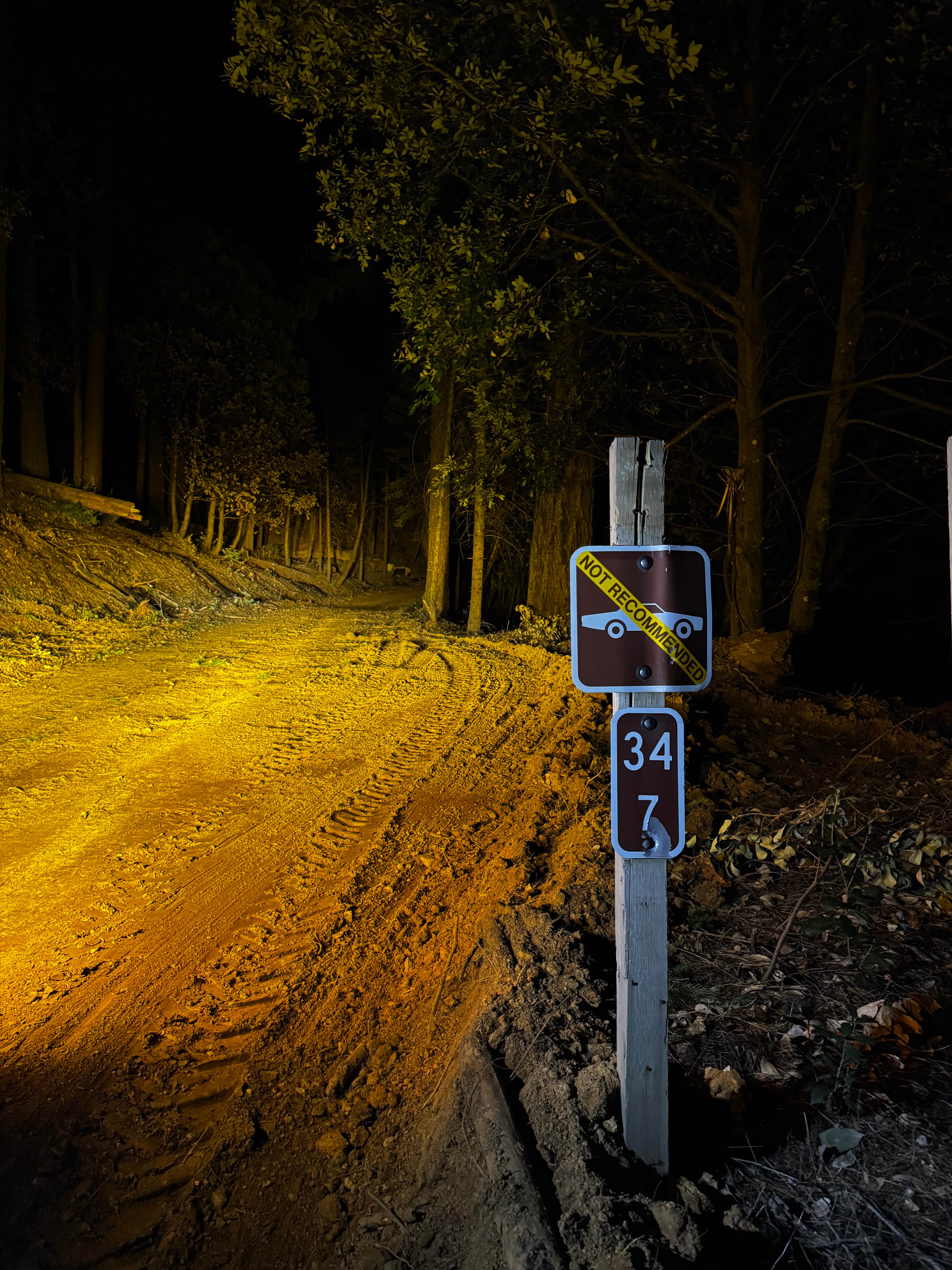
This trail drops over 800 feet in just over 4.5 miles, starting on Smith Station Road (FS J132). The route begins in a neighborhood area requiring respectful behavior, initially following a crushed granite gravel road surface. After the first mile, private land ends and the trail continues through the Stanislaus National Forest, transitioning to public land access. The trail remains very smooth except for a couple of dips encountered after mile 1.5 when approaching from the north. At this point, the trail also narrows as it enters a shelf road configuration that drops down into the valley below. Along the shelf road section, ruts caused by water runoff appear intermittently, measuring less than 12 inches deep and continuing on and off for approximately one mile. At the junction with Forest Service Road 1S15, the surface character changes dramatically as the gravel ends and sand with embedded rocks begins, making the trail rougher for the remainder of the journey, where airing down becomes helpful. At mile 3.5, a small hill with rocks presents challenges for low clearance vehicles that may struggle with the obstacle. The trail runs parallel to Jordan Creek throughout much of its length, and near the south entrance, large manzanita trees grow very tall and provide a huge natural canopy over the trail. The route terminates at Bull Creek Road, completing the descent through varied terrain.
Photos of Jordan Creek Road - FS 2S17
Difficulty
This trail receives a difficulty rating of 2, indicating easy conditions overall. The smooth crushed granite beginning transitions to more challenging elements, including shelf road sections with exposure, ruts up to 12 inches deep from water runoff, the surface change to sand with embedded rocks requiring potential tire pressure adjustments, and the rocky hill at mile 3.5 that may challenge low clearance vehicles despite the easy rating classification.
Status Reports
Jordan Creek Road - FS 2S17 can be accessed by the following ride types:
- High-Clearance 4x4
- SUV
- SxS (60")
- ATV (50")
- Dirt Bike
Jordan Creek Road - FS 2S17 Map
Popular Trails
Moore Pilot Ridge - FS 2S14
Blythe Intaglios Trail
La Gloria Road
The onX Offroad Difference
onX Offroad combines trail photos, descriptions, difficulty ratings, width restrictions, seasonality, and more in a user-friendly interface. Available on all devices, with offline access and full compatibility with CarPlay and Android Auto. Discover what you’re missing today!