Crow Hill Climb
Total Kilometers
1.5
Technical Rating
Best Time
Summer
Trail Type
Full-Width Road
Accessible By
Trail Overview
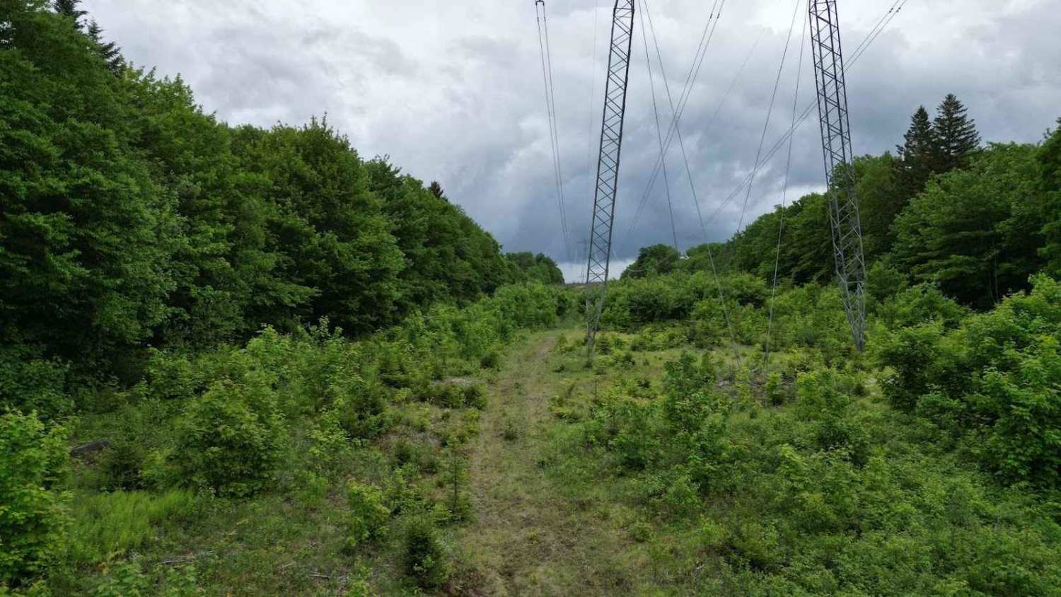
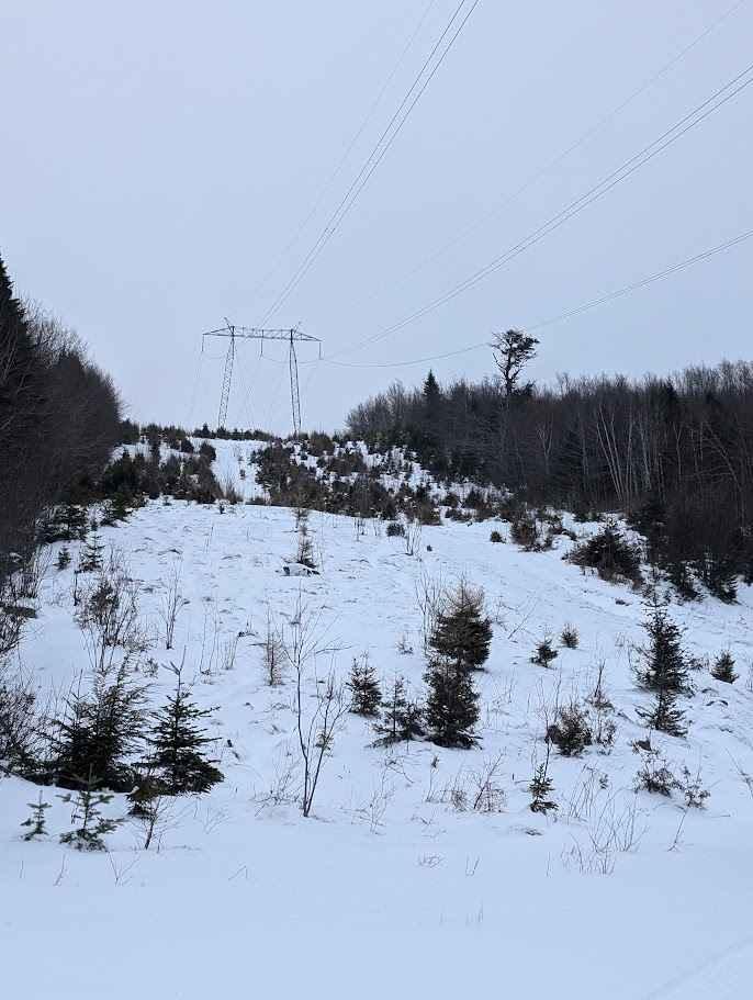
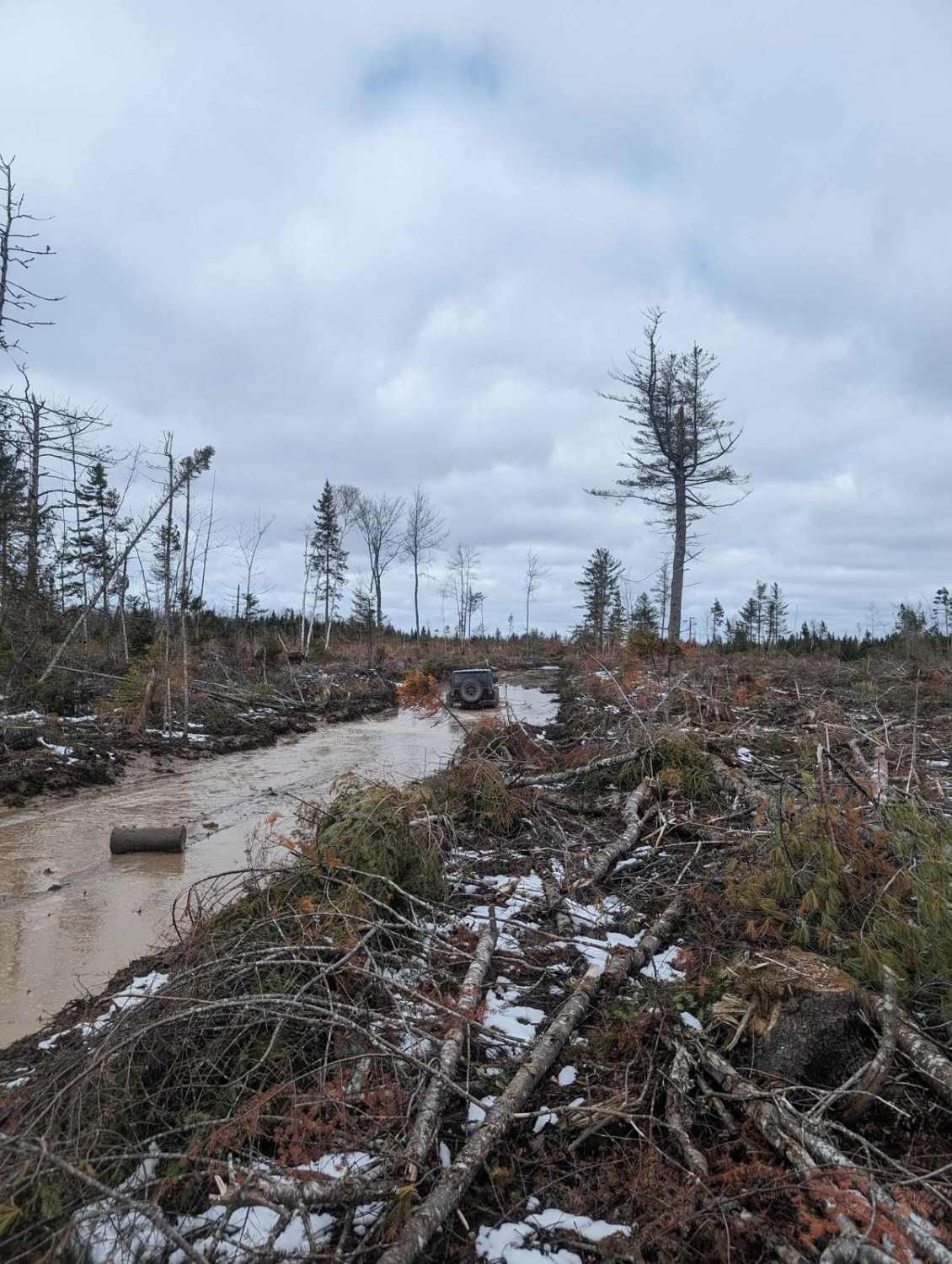
If you follow the Military road off of the Kingsley road in the Birdton area, this utility line trail is 6.5 km after the road turns to gravel. Following the Military road, this is at your first utility line just after the Crow Hill loop. It begins with a steep climb rising 30 meters over 100 meters. The trail follows the transmission lines through gullies and small streams, and has a mudhole just before the last alder-encrusted section. The end of this recorded track has a 45-degree climb that is large loose rocks and boulders covered by vegetation.
Photos of Crow Hill Climb
Difficulty
This trail has 30-degree climbs, some washouts that you may need to bump up, overgrown foliage hiding loose boulders on the trail, and a deep flooded beaver pond mud hole at one point.
Status Reports
Crow Hill Climb can be accessed by the following ride types:
- High-Clearance 4x4
- SUV
- SxS (60")
- ATV (50")
- Dirt Bike
Crow Hill Climb Map
Popular Trails
Ryder Lake Passage

Pioneer Steet
Douglas Clearcut

Firewood Lane Gully
The onX Offroad Difference
onX Offroad combines trail photos, descriptions, difficulty ratings, width restrictions, seasonality, and more in a user-friendly interface. Available on all devices, with offline access and full compatibility with CarPlay and Android Auto. Discover what you’re missing today!