Divide Ridge East
Total Miles
7.9
Technical Rating
Best Time
Trail Type
High-Clearance 4x4 Trail
Accessible By

Trail Overview
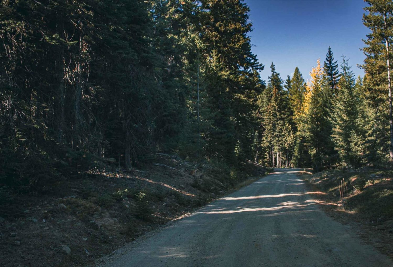
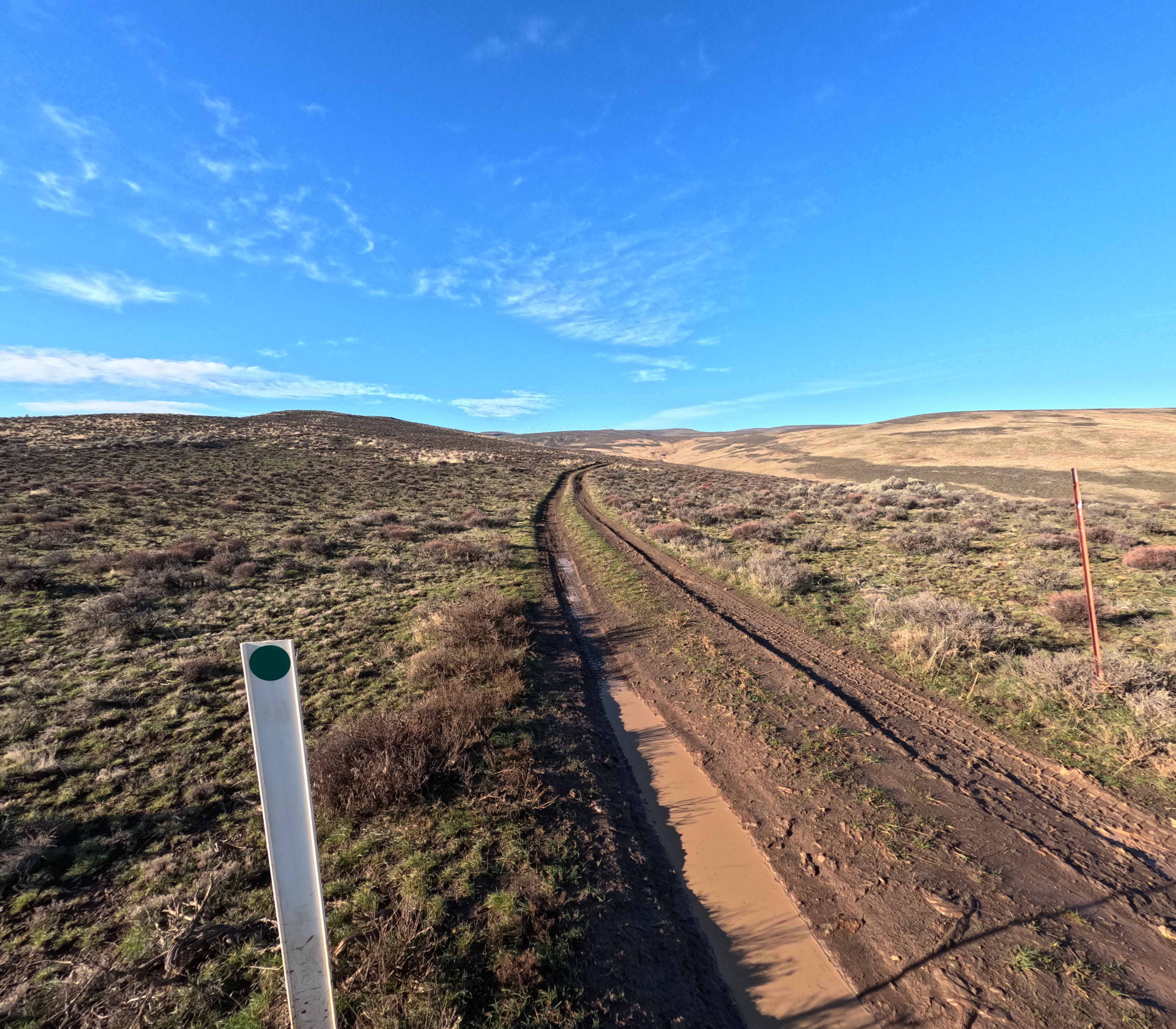
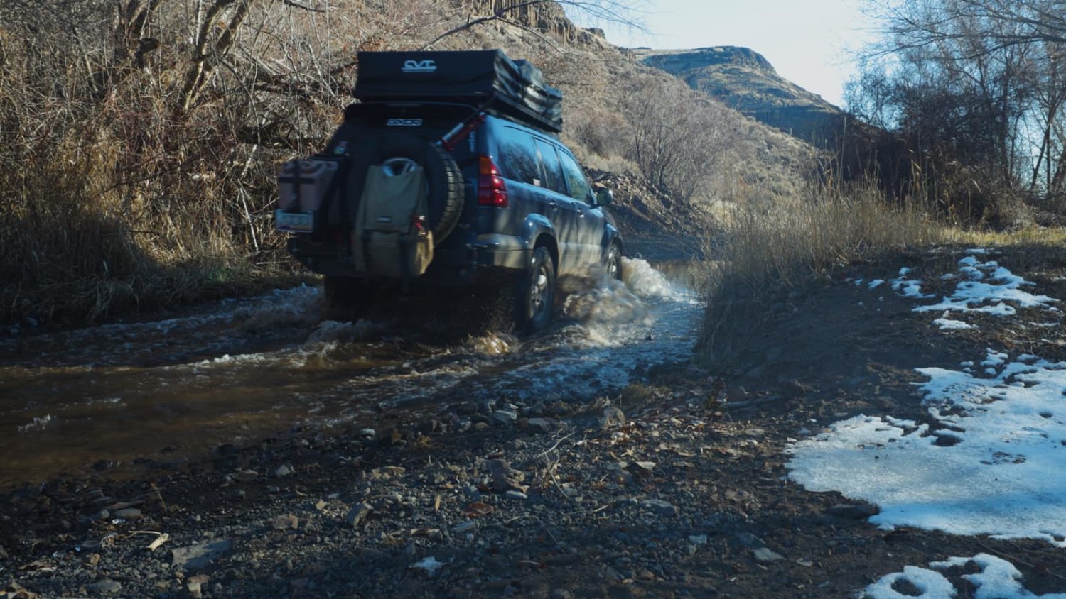
Divide Ridge East Trail is a moderate, high-elevation ridge route best suited for intermediate offroaders looking for sustained exposure and variable terrain in Ahtanum State Forest. Starting at Forest Road 1020, this roughly 8-mile trail holds above 6,000 feet for much of the route before descending to Louie Way Gap at around 4,800 feet. The surface is primarily native dirt with embedded rock, and erosion has created ruts and uneven sections, especially on climbs and along the descent. Conditions can quickly become slick when wet, making high-clearance 4x4 vehicles with low range and solid tires the most capable choice, though ATVs and dirt bikes are permitted under Washington DNR ORV rules. About three miles in, a spur leads to Dome Peak, where the ridgeline provides clear views of Rimrock Lake and the surrounding foothills. The trail also ties into multiple Green Dot Roads, allowing for longer route options within the Ahtanum ORV system and making it a solid option among 4x4 trails in Washington. Expect narrow ridge sections with limited visibility, loose rock on steeper grades, and deeper ruts in shaded or heavily used areas. Access is typically best from late spring through fall, while snow and wet conditions can limit travel, and minimal signage means GPS or MVUM navigation is recommended.
Status Reports
Divide Ridge East can be accessed by the following ride types:
- High-Clearance 4x4
- SxS (60")
- ATV (50")
- Dirt Bike
Divide Ridge East Map
Popular Trails

Eagle Creek Road
Bear Creek Mountain
Bohinkleman Road
Douglas Creek Creekside Campsite
The onX Offroad Difference
onX Offroad combines trail photos, descriptions, difficulty ratings, width restrictions, seasonality, and more in a user-friendly interface. Available on all devices, with offline access and full compatibility with CarPlay and Android Auto. Discover what you’re missing today!