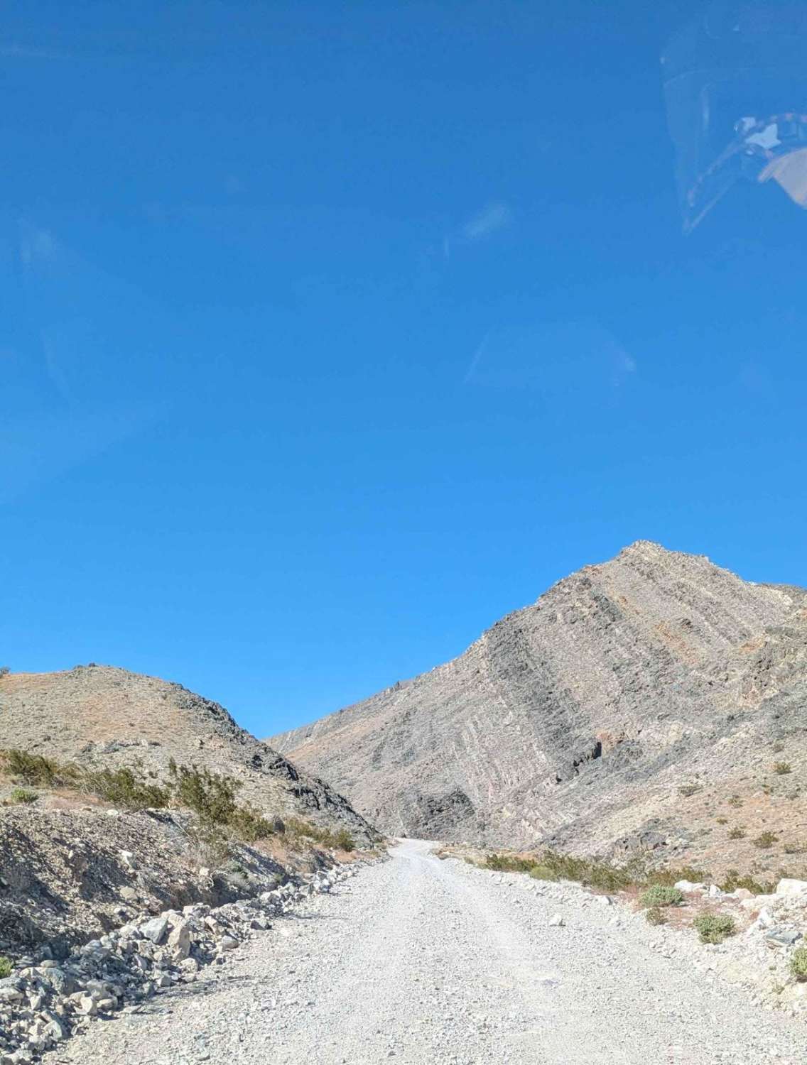
Sulfur Mine Summit Crossing
Total Miles
12.2
Technical Rating
Best Time
Fall, Summer, Spring
Trail Type
Full-Width Road
Accessible By
Trail Overview
This trail is part of the Death Valley/Big Pine Road. It is the summit crossing between the west side where Eureka Dunes is located and the east side at Crankshaft Crossing. The west side starts at 3,300 feet and summits at the Sulfur Mine at 5,226 feet. Then the trail comes down to the east side at 3,895 feet. Watch the weather and snow forecast.
Photos of Sulfur Mine Summit Crossing

Difficulty
The gravel/dirt/rocky road is typically graded by the Death Valley National Park. But weather can close the pass.
Status Reports
Sulfur Mine Summit Crossing can be accessed by the following ride types:
- High-Clearance 4x4
- SUV
Sulfur Mine Summit Crossing Map
Popular Trails
11S03 Lusardi Truck Trail

The onX Offroad Difference
onX Offroad combines trail photos, descriptions, difficulty ratings, width restrictions, seasonality, and more in a user-friendly interface. Available on all devices, with offline access and full compatibility with CarPlay and Android Auto. Discover what you’re missing today!