
Dirt Bike Trails
Near Altamont, Oregon
Explore All Dirt Bike Trails Near Altamont, Oregon
Dirt Bike Trails Near Altamont, Oregon
Discover the best dirt bike trails near you. Browse trail maps, check difficulty ratings, and find your next adventure — whether you're looking for a quick ride or an all-day expedition.
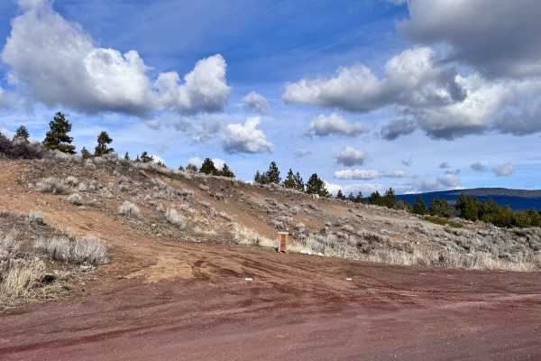
Hagelquin Loop
This is an easy trail/logging road with many offshoots and new things to explore. There is active logging, so it is best to drive this trail in the evenings or on the weekend and carry a CB radio if possible. The first ascent is steep but paved if you are entering near Hagelstein Park, so make sure ...
Learn more about Hagelquin Loop
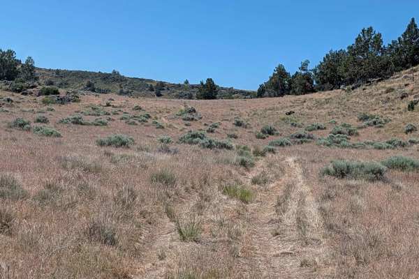
Sheep Camp Spur A - FS 47N18A
This 3.5-mile point-to-point trail connects Sheep Camp Butte to Lower Klamath Road, traveling through a meadow environment flanked by volcanic lava bed ridges. The trail surface consists of loose dirt with occasional small to medium volcanic rocks, some of which can appear unexpectedly since overgro...
Learn more about Sheep Camp Spur A - FS 47N18A
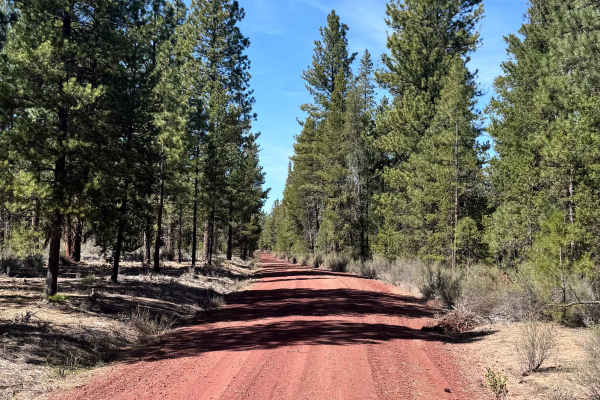
Soloman - FS 4502
Soloman (FS 4502) is an easy trail designed as an alternative route to Burnt Butte Pit. It is a very easy trail with minimal terrain obstacles, perfect for a low-stress drive. This alternative route to Burnt Butte has little traffic and is a good place to go to be on your own in the woods. Keep your...
Learn more about Soloman - FS 4502
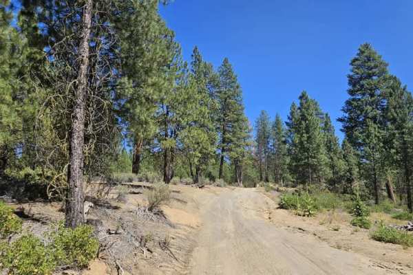
Cave Mountain - FS 5812000
This user-maintained trail offers an enjoyable drive through mixed forest with a surface that changes from sandy beige silt in the south to darker gravel farther north. Near the southern entrance is a parking area that resembles a small camping or staging area, although visitors should note the unfo...
Learn more about Cave Mountain - FS 5812000
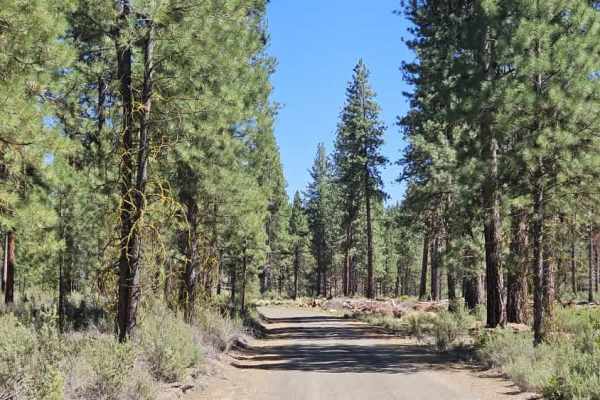
FS 4502080
This scenic forest trail begins on a sandy surface before climbing steadily onto a rocky section where exposed stones and rain erosion require careful wheel placement. After reaching the plateau, the trail levels out before descending into a beautiful pine forest with a soft carpet of pine needles t...
Learn more about FS 4502080
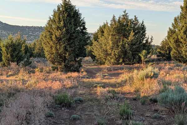
Panhandle Lake - FS 47N21
This short point-to-point route serves as an efficient and scenic shortcut connecting the Bonito Butte area with Gold Digger Pass. The trail traverses a healthy, vibrant section of the Modoc National Forest, characterized by thick stands of pine trees interspersed with patches of sagebrush. As you p...
Learn more about Panhandle Lake - FS 47N21
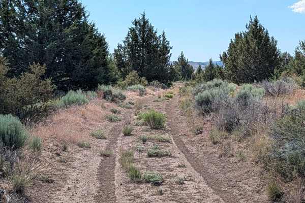
FS 46N21M
This 5-mile point-to-point route provides a scenic ascent from Gold Digger Pass toward FS 46A21K, offering an immersive journey through a diverse high-desert landscape. The trail is framed by thick sagebrush, swaying grasses, and scattered pine trees, with seasonal wildflowers often coloring the pat...
Learn more about FS 46N21M
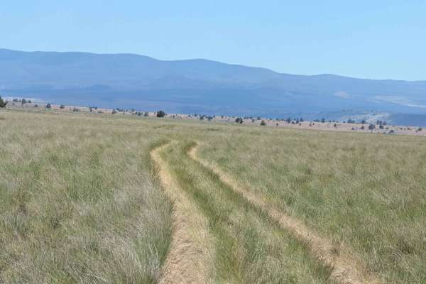
Sheep Camp Butte - FS 47N18
This trail serves as the main north-south route for this canyon, offering dramatic scenery as it travels through the region. The trail surface consists of dirt with small volcanic rocks, surrounded by short bushes and grasses, some of which grow tall along the trail median. Seasonally blooming wildf...
Learn more about Sheep Camp Butte - FS 47N18
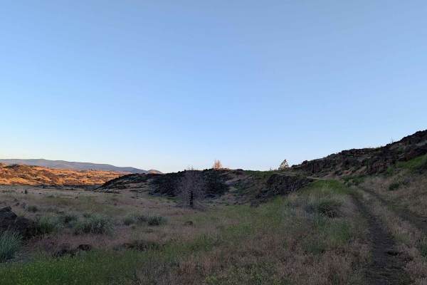
Gold Digger Pass - FS 46N21
This route begins on the east side, diverging from Hill Road within the bounds of the Lava Beds National Monument. The landscape is profoundly defined by ancient volcanic activity, with the trail winding through an environment dominated by sprawling lava rock formations interspersed with patches of ...
Learn more about Gold Digger Pass - FS 46N21
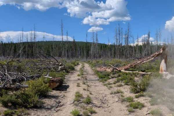
FS 4506
This trail is an unmaintained forest route that links with a maintained road at either end. Around the halfway point, the trail crests a hill before entering an area containing numerous fallen trees scattered across the route. These appear to be naturally fallen trees rather than intentional barrier...
Learn more about FS 4506
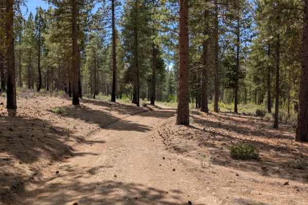
FS 4502190
This trail is an enjoyable connector route that branches from the main road and links with a previously mapped trail. Although it is not heavily traveled, the road remains easy to follow and provides a pleasant drive through shaded forest. The trail is primarily sandy and generally straightforward, ...
Learn more about FS 4502190
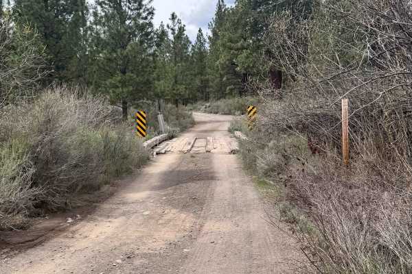
FS 9731000
This trail is a great route to get connected to dozens of amazing trails. Located near the Collier Logging Museum, this trail travels between open logged meadows and thick woods. The road surface is mainly gravel with some sections of sand. This trail offers an alternative route to Burnt Butte Pit, ...
Learn more about FS 9731000
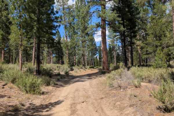
FS 4503270
This is a relatively easy alpine trail with a mostly sandy surface and a few minor ruts along the way. The route has gentle inclines and declines, but there are no major obstacles or particularly technical sections to navigate. The trail is fairly straightforward to follow and should be manageable f...
Learn more about FS 4503270
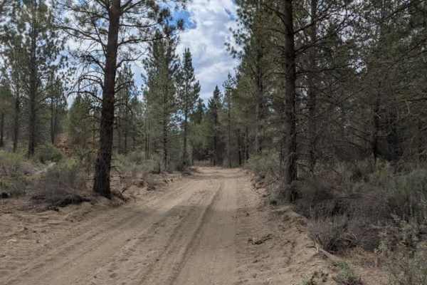
FS 9730230
This trail is a logging road that branches from a main arterial route and travels through an active timber harvesting area. The surface is primarily sandy, with several sections showing damage from heavy logging equipment, creating uneven areas that require moderate care when driving. Large piles of...
Learn more about FS 9730230
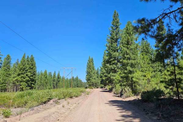
FS 9738
This well-maintained logging road provides an easy and enjoyable drive through beautiful forest before ending at the boundary of Sun Pass State Forest. Although the surface can be quite dusty during dry conditions, the road remains in excellent shape and is suitable for all permitted vehicles. Numer...
Learn more about FS 9738
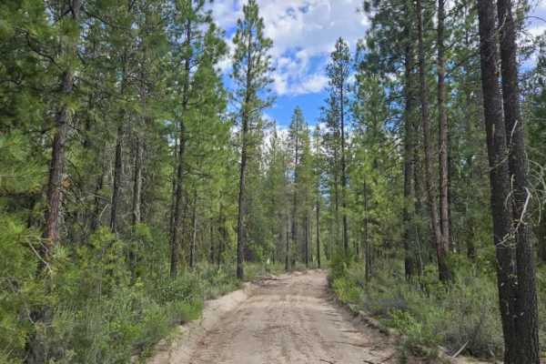
Forge - FS 9734000
This trail begins as a well-maintained forest road with what appear to be the remains of an old gate at the entrance. Shortly after entering, it reaches a spectacular viewpoint overlooking the valley, with several pull-offs suitable for dispersed camping (only for a small section on the northern sid...
Learn more about Forge - FS 9734000
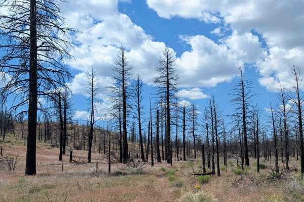
Lairds Well - FS 45N05
This route winds through a serene landscape within the Modoc National Forest, transitioning between expansive open meadows and sparse pine tree forests. The area bears significant evidence of a past forest fire, creating a unique environment where the regrowth of the forest can be observed against a...
Learn more about Lairds Well - FS 45N05
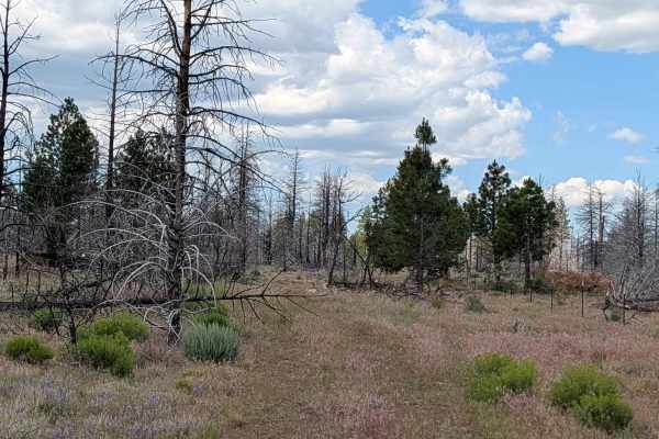
Porterfield Ranch
This route serves as a functional connector beginning at the south side of Porterfield Ranch, providing a passage toward the Absolutely Nothing - FS44N22Y trail, which ultimately links to Highway 10. The landscape is defined by the lasting impact of the 2021 Antelope Forest Fire, with clear evidence...
Learn more about Porterfield Ranch
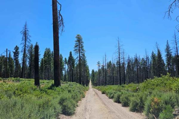
Agency Road - FS 6210000
This user-maintained trail winds through a beautiful old logging forest on a sandy, dusty surface with a mixture of grey gravel in places, particularly toward the southern end. The route meanders through a broad valley with numerous remnants of historic logging activity, including clearings and side...
Learn more about Agency Road - FS 6210000
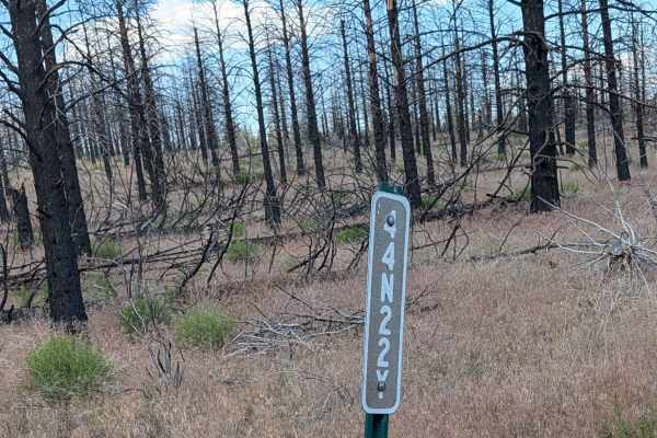
Absolutely Nothing - FS 44N22Y
This route takes you through the stark, sobering landscape of a pine forest significantly altered by the 2021 Antelope Forest Fire. The terrain is characterized by the remnants of fire-affected timber, serving as a powerful display of the fire's reach and the subsequent recovery of the high-desert e...
Learn more about Absolutely Nothing - FS 44N22Y
ATV trails near Altamont, Oregon
Explore ATV-friendly trails near you. These trails are accessible for vehicles up to 50 inches wide, perfect for ATVs and smaller off-road machines.
Hagelquin Loop
This is an easy trail/logging road with many offshoots and new things to explore. There is active logging, so it is best to drive this trail in the evenings or on the weekend and carry a CB radio if possible. The first ascent is steep but paved if you are entering near Hagelstein Park, so make sure ...
Learn more about Hagelquin Loop
Sheep Camp Spur A - FS 47N18A
This 3.5-mile point-to-point trail connects Sheep Camp Butte to Lower Klamath Road, traveling through a meadow environment flanked by volcanic lava bed ridges. The trail surface consists of loose dirt with occasional small to medium volcanic rocks, some of which can appear unexpectedly since overgro...
Learn more about Sheep Camp Spur A - FS 47N18A
Soloman - FS 4502
Soloman (FS 4502) is an easy trail designed as an alternative route to Burnt Butte Pit. It is a very easy trail with minimal terrain obstacles, perfect for a low-stress drive. This alternative route to Burnt Butte has little traffic and is a good place to go to be on your own in the woods. Keep your...
Learn more about Soloman - FS 4502
Cave Mountain - FS 5812000
This user-maintained trail offers an enjoyable drive through mixed forest with a surface that changes from sandy beige silt in the south to darker gravel farther north. Near the southern entrance is a parking area that resembles a small camping or staging area, although visitors should note the unfo...
Learn more about Cave Mountain - FS 5812000
UTV/side-by-side trails near Altamont, Oregon
Find UTV and side-by-side trails near you. These trails accommodate vehicles up to 60 inches wide, ideal for UTVs, side-by-sides, and wider off-road rigs.
Hagelquin Loop
This is an easy trail/logging road with many offshoots and new things to explore. There is active logging, so it is best to drive this trail in the evenings or on the weekend and carry a CB radio if possible. The first ascent is steep but paved if you are entering near Hagelstein Park, so make sure ...
Learn more about Hagelquin Loop
Sheep Camp Spur A - FS 47N18A
This 3.5-mile point-to-point trail connects Sheep Camp Butte to Lower Klamath Road, traveling through a meadow environment flanked by volcanic lava bed ridges. The trail surface consists of loose dirt with occasional small to medium volcanic rocks, some of which can appear unexpectedly since overgro...
Learn more about Sheep Camp Spur A - FS 47N18A
Soloman - FS 4502
Soloman (FS 4502) is an easy trail designed as an alternative route to Burnt Butte Pit. It is a very easy trail with minimal terrain obstacles, perfect for a low-stress drive. This alternative route to Burnt Butte has little traffic and is a good place to go to be on your own in the woods. Keep your...
Learn more about Soloman - FS 4502
Cave Mountain - FS 5812000
This user-maintained trail offers an enjoyable drive through mixed forest with a surface that changes from sandy beige silt in the south to darker gravel farther north. Near the southern entrance is a parking area that resembles a small camping or staging area, although visitors should note the unfo...
Learn more about Cave Mountain - FS 5812000
The onX Offroad Difference
onX Offroad combines trail photos, descriptions, difficulty ratings, width restrictions, seasonality, and more in a user-friendly interface. Available on all devices, with offline access and full compatibility with CarPlay and Android Auto. Discover what you're missing today!
Open Trail Map