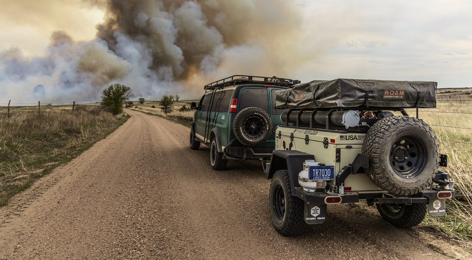

Wildfire Maps for Hunting
View active wildfire perimeters and hotspots, smoke conditions, weather forecasts, historic burns, and access maps to understand how conditions on the ground could affect your scouting and hunts.
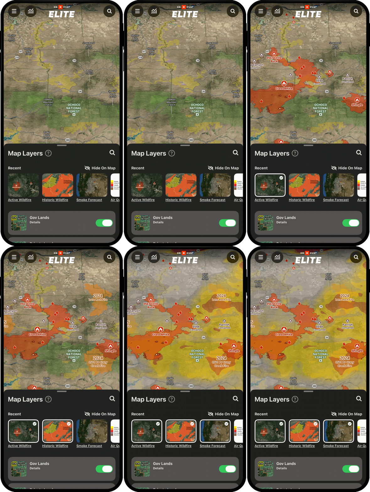
Know How Fire Could Change Your Hunt
An active wildfire can change your plans in a second. Use onX Hunt to understand where a fire is, which way it’s heading, and how you can adapt when conditions change.
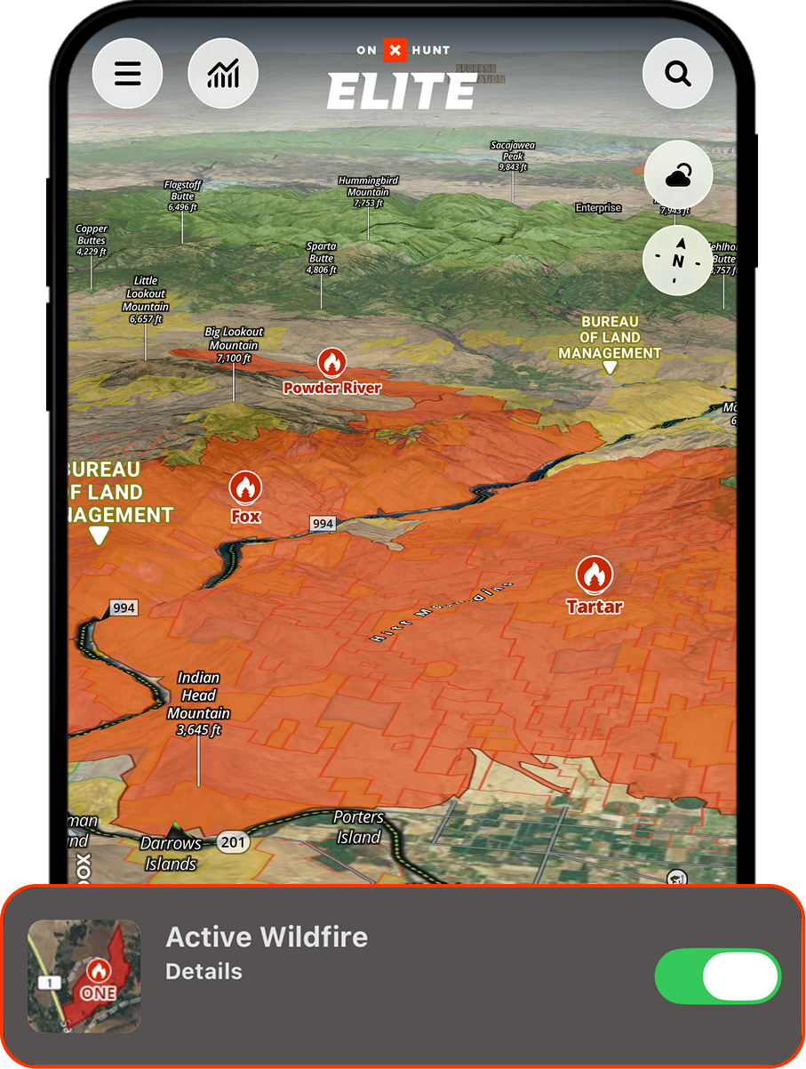
See Active Fires Before They Disrupt Your Plan
View wildfire perimeters and hot spots to understand how a fire is moving and when you might need to avoid an area and move on to your backup plans.
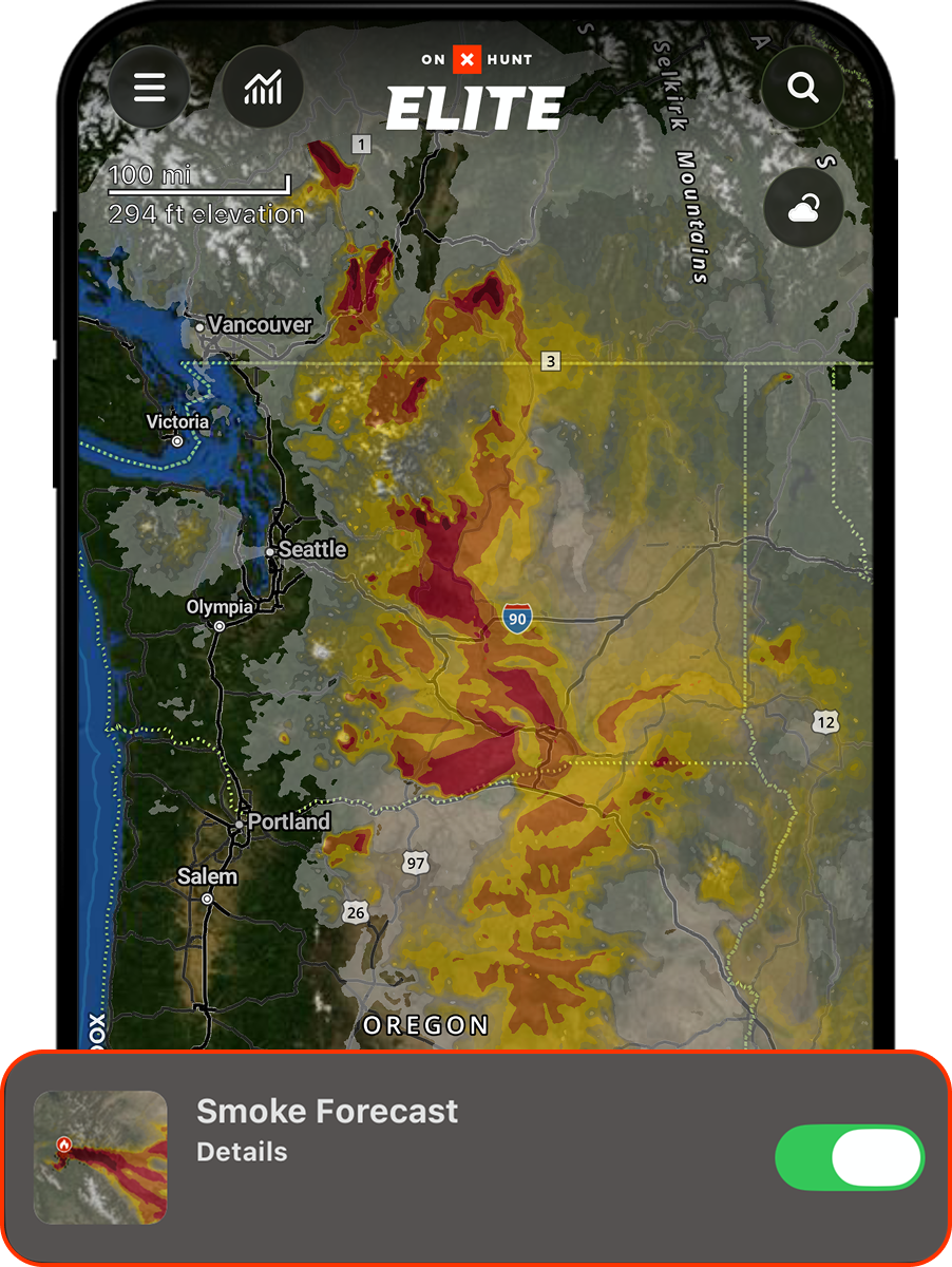
Track Smoke, Wind, and Visibility
Wildfire smoke plumes impact air quality and visibility. The Hunt App shows you where the smoke is and how the prevailing winds could change so you can make better plans.
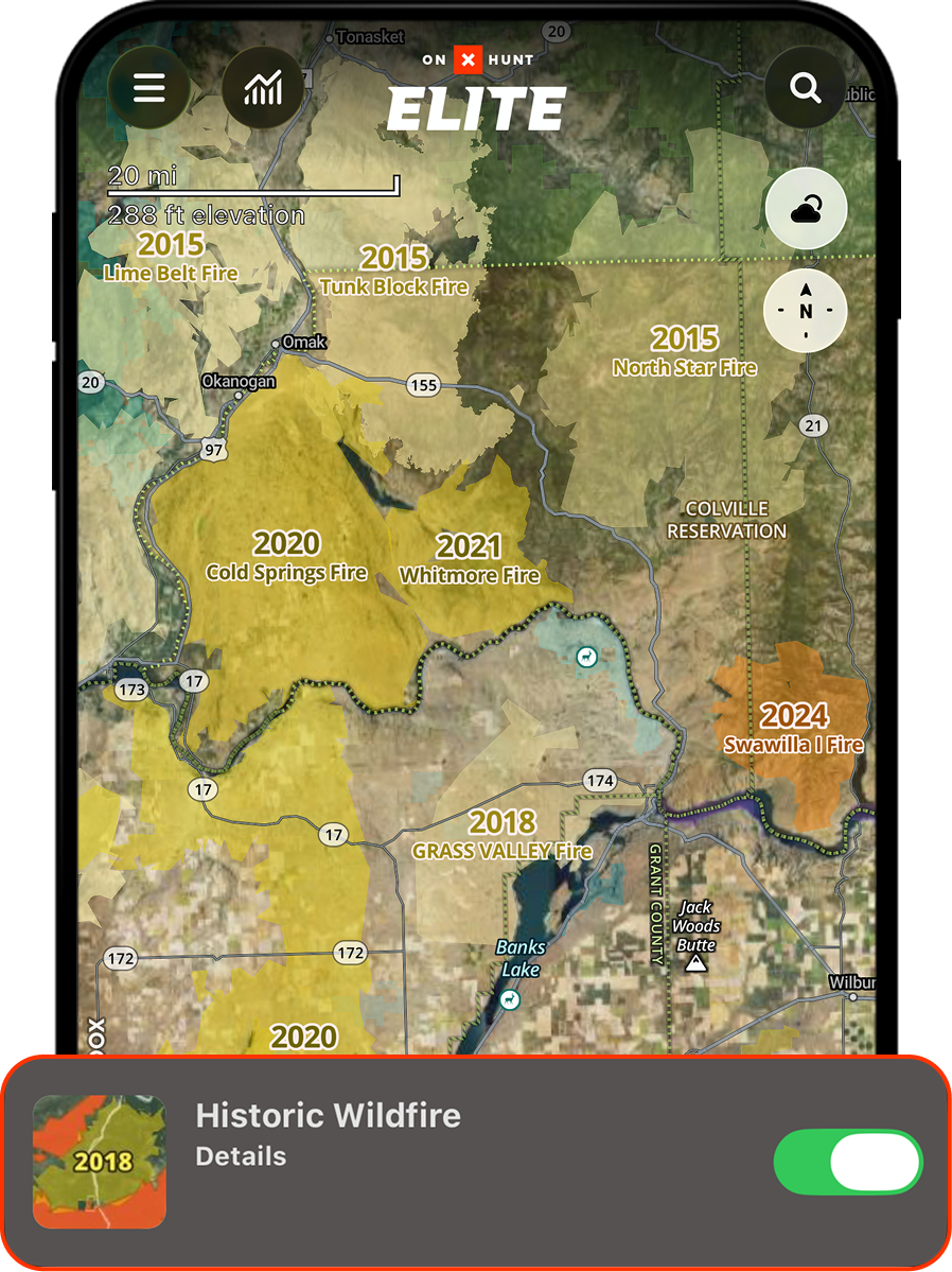
Find Opportunity in Historical Burns
Hunting old burns can make all the difference. Understand where wildfires were, when they happened, and how landscape recovery can provide prime wildlife habitat.
“Wildfire can change a hunt quickly, so I always check the onX Hunt Wildfire layers before heading into the field. Being able to see active fires, smoke, wind, and nearby access in one place helps me make better decisions and build a backup plan before I ever leave home. It’s a simple step that can save a lot of time and help me feel more prepared when conditions change.” – Randy Newberg
Keep Planning, Even When Fires Change the Landscape
Use onX Hunt to check active fires, track smoke movement, study historical burns, identify backup access, and download Offline Maps before you lose service.
Frequently Asked Questions
The Active Wildfire Layer displays mapped wildfire perimeters from the National Interagency Fire Center. It also includes satellite-detected Hot Spots that can help hunters see recent heat activity near hunting areas, access routes, camps, and saved locations.
Mapped wildfire perimeters are updated daily, while satellite-detected Hot Spots are updated hourly. Conditions can change faster than any map, so hunters should also follow official local alerts, closure notices, and emergency guidance.
Hot Spots are points of heat detected by satellites using NASA MODIS and VIIRS sensors. They may indicate recent fire activity, but they are not the same as an official fire perimeter and can occasionally reflect other heat sources.
Yes. Smoke Forecast shows NOAA atmospheric smoke forecast data so hunters can see where smoke is expected to drift and how dense it may be. Weather and Air Quality can provide additional context when comparing hunting locations.
Hunters can download Offline Maps and retain access to saved map content, Waypoints, routes, and GPS navigation without service. Current wildfire, hot spot, smoke, weather, and air-quality data refresh while connected.
onX Hunt can help hunters evaluate fire locations alongside mapped roads, trails, public land, access points, and saved routes. Closure coverage varies by agency, so hunters should confirm current restrictions through the managing agency or local authorities before traveling.
Historical burns can create new forage, edge habitat, open glassing areas, and changes in cover that affect how animals use the landscape. The Historic Wildfire Layer helps hunters identify burned areas and compare them with current satellite imagery, topography, access, and property boundaries.
The Historic Wildfire Layer shows burns from the last 12 years. Product should confirm whether that coverage or membership requirement is changing before publication.
Wildfire-related Map Layers are available to Premium and Elite Members.