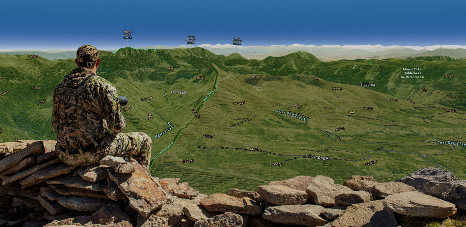

3D Hunting Maps
3D Hunting Maps allow you to explore the terrain from multiple perspectives so you can devise stronger strategies.
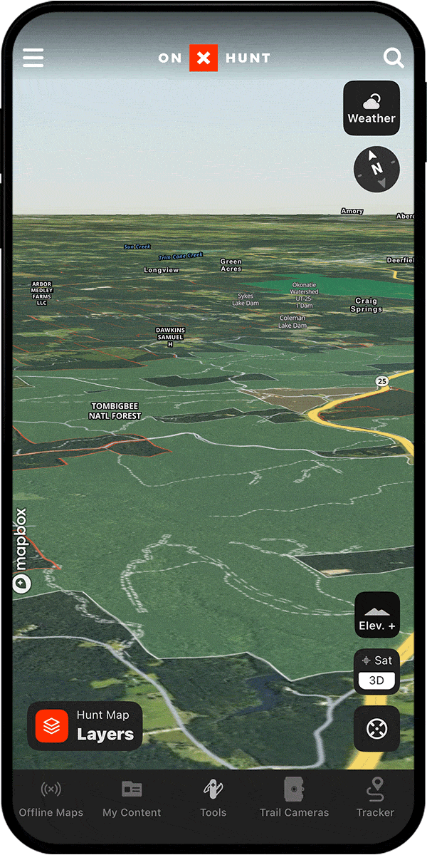
See Every Nook and Cranny With 3D Topographic Maps
From analyzing terrain and assessing your line of sight from a glassing knob to refining your stalk in the field, the Hunt App’s 3D map view brings the terrain to life so you never miss a detail.
3D Maps Breakdown
Assess Vantage Points
There’s nothing like a 3D view to provide a comprehensive understanding of the landscape. By flying over your area of interest, you’ll identify every detail that could impact your hunt.
Plan Your Stalk
Use 3D to plan your routes with confidence and eliminate the surprises that could cost you hours of backtracking to find a way through.
Find Unexpected Habitat
3D topographic maps convey information that just cannot be found in a 2D representation of the land, and more information means more opportunities during your hunts.
Predict Animal Movement
3D maps replicate the natural perspective animals experience, revealing ridgelines, valleys, and funnels that guide their movement. Using 3D, you can see why certain areas attract wildlife, whether it’s good cover, favorable thermals, or travel ease, which lets you predict their patterns and position yourself for success.

3D maps are extremely valuable when hunting out west, but when it comes to whitetail hunting, sometimes the variance in the terrain is subtle. That’s where 3D exaggeration comes in. Being able to exaggerate the topographical makeup of a property allows me to identify saddles, benches, and travel corridors, specifically when hunting big hardwoods where pinch points and paths of least resistance are much less obvious.
– Michael Hunsucker, Heartland Bowhunter
Visualize the Hunt
See elevations and topography from every angle.
Frequently Asked Questions
Yes, the onX Hunt App includes 3D topographic maps available on both mobile and desktop, allowing you to view terrain from every angle to improve scouting and hunt planning.
Tap the “3D” button on the lower right-hand side of your screen, then use two fingers to swipe up to tilt the map into 3D view. Zooming, panning, and rotating all work the same as in 2D mode.
Yes, all of your Markups, including Waypoints, Tracks, Area Shapes, and Lines, are visible and accessible in 3D mode.
Yes, you can view and interact with all Map Layers, including public and private land layers, while in 3D map view.
No, 3D Maps are not currently available when using onX Hunt in Offline Mode.
Even in flat areas, subtle terrain features like small dips, slight ridges, and shallow drainages affect animal movement. The onX Hunt App lets you exaggerate the topography in 3D to make these hidden features easier to identify.
3D maps replicate the natural perspective animals experience, revealing ridgelines, valleys, and funnels that guide their movement so you can identify why certain areas attract wildlife and position yourself accordingly.