How to Navigate Wildfires While Backpacking
Wildfires are increasing in quantity and severity across the West and have impacts felt nationally. We felt strongly that onX Backcountry users need to have the most up-to-date data to make educated decisions in the field.
It’s official—fire season is here. It’s an inevitable challenge we’ll be grappling with for the foreseeable future. For backcountry enthusiasts, it provides many challenges, and a few opportunities, but learning to navigate this force with a reliable wildfire map is imperative to making the most of your summer.
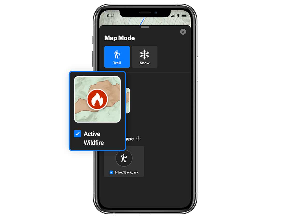
We’re happy to introduce you to our Active Wildfire layer. Pulling data from National Interagency Fire Center, you can see a flame icon within our Basemaps that indicates fires, when enabled.
- Select “Trail” under Map Mode
- Check “Active Wildfire” within the Layers menu.
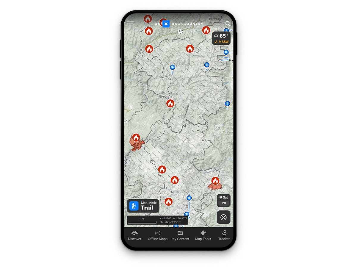
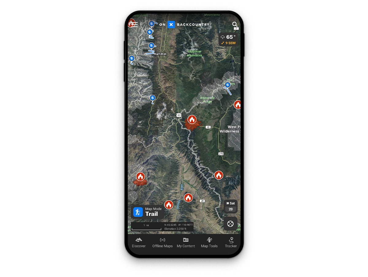
This perspective gives you a broad scope of where fires are currently located. Zoom in further toward a distinct icon to see the name of each individual fire. Clicking on the fire symbol will populate a pop out that illustrates more detail including acreage, when we’ve last updated the data, and the land parcel it’s currently impacting.
While there’s no way to avoid it entirely, there are certain ways you can ensure safe travel through the backcountry this summer. One of those ways is to visit previously burned areas. These zones may see an abundance of new growth and vegetation that’s filling in these charred places. In fact, new vistas may be present given the newfound exposure. Down low make sure to pay attention to new fungi popping up throughout which makes for great foraging.
This layer is available across out Backcountry platforms including onX on Desktop, iOS, and Android. Though wildfire information is particularly timely in states like California, Idaho, Colorado, and Montana this layer applies nationwide from Oregon to Florida.
Use this layer to help plan your backpacking trip in a safe, fire-free zone. Combining this knowledge with active weather patterns including wind speed, direction, and forecasts, you can interpret what you may find in the field.