A Look at onX Backcountry Basemaps
Learn how to use the onX Satellite, Topographic, and Hybrid Basemaps to become a more confident and safer backcountry enthusiast.
Each of onX Backcountry’s three unique Basemap types, provide its own value to off-grid adventurers. By understanding the capabilities of each, backpackers are able to better appreciate the landscape and how to engage with it. It’s imperative to know how to find water sources and understand elevation changes to stay safe in the backcountry. The three Basemaps, along with their strengths and intended uses, are detailed below. We’ve gathered some tips from our ambassadors about how to use each one.
Topo – This invaluable tool has a myriad of uses including finding pinch points in elevation, likely water sources, and cliffs. Using this map, you can easily determine how much elevation you can expect to climb on your hike. Understanding how to navigate a topographic map is imperative, otherwise all those lines are meaningless. Make sure to check out our Guide to Reading a Topo Map for helpful tips on what those elevation lines mean, how to decipher them, and how that’ll impact your trip.
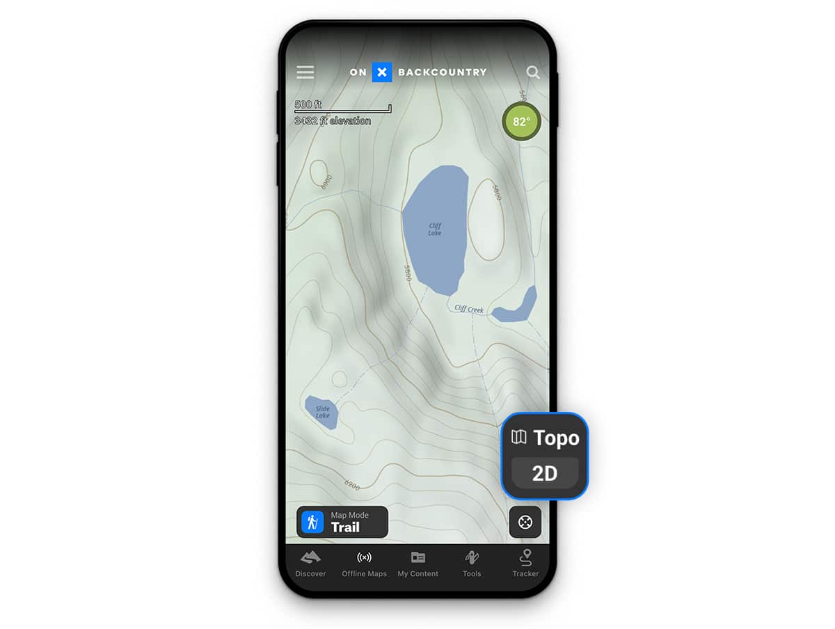
“I use the topo map if I want to get my current elevation compared to where I want to go. It takes a little mental math knowing how many feet each line represents (i.e. 50 feet per line).”
–Mark Smiley, Mountain Guide
Hybrid – The Hybrid Basemap is the perfect blend of Satellite and Topo. By combining the contour lines of topo with the satellite imagery, the landscape begins to really come to life. It’s a universal look at the land and provides a backpacker with a rich visual understanding of the area. This is all in service of making more educated and better decisions out in the field.
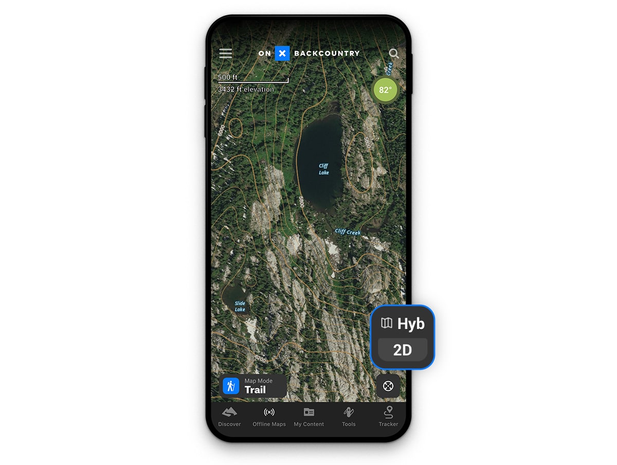
“I like the hybrid feature, especially when trying to decide how reliable different water sources are and what I should expect from an off trail route linkup.”
–Jeff Garmire, Thru-Hiker
Satellite – With the Satellite Basemap users are able to pinpoint natural features like rivers, rocks, trees, etc., while also getting a broad look at the region they’re exploring. It provides a handle on whether you’ll be traversing an exposed ridge or staying low, below treeline. We pride ourselves on the imagery we use in our maps—going to great lengths to make sure they’re current, have variable viewing levels, and are darn-near cloud-free. This Basemap is useful for orienting yourself with physical landmarks and gives enough detail to identify varying types of landscape.
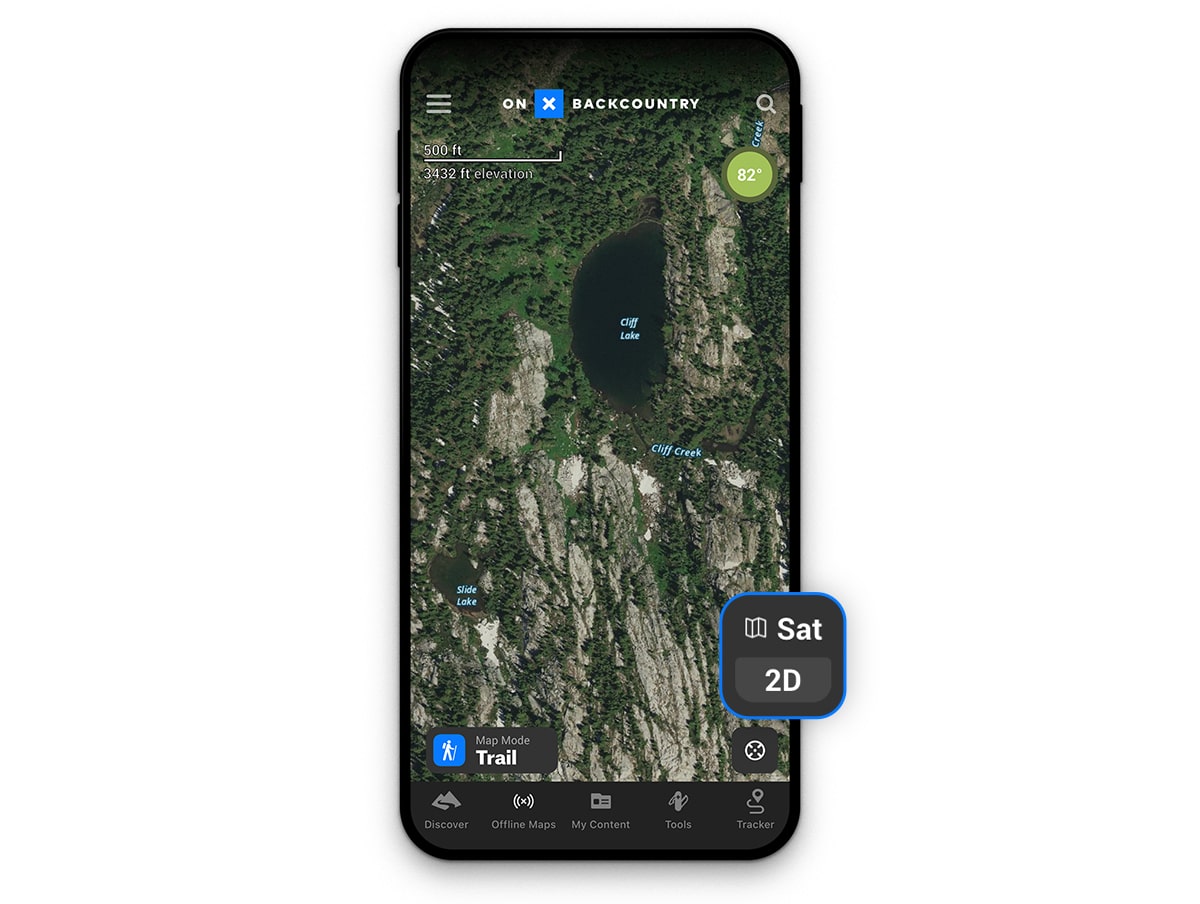
“I use satellite mode most of the time. It’s easy to spot crevasses while on a glacier and open ski lines (where the trees open up) while backcountry skiing.”
–Mark Smiley, Mountain Guide
With the help of onX Backcountry Basemaps, you can make better informed decisions in the wilderness all the while knowing you’ll have access to all your content using offline maps. By combining all these different tools on into your own personal handheld gps on your phone, you can plan your itinerary based on water, elevation, peaks or the countless other natural features that make backpacking amazing.