How to Find Running Trails Near You with onX Backcountry
Exploring new trails with a pair of running shoes on your feet is one of the best parts of long summer days. However, there can be a lot to consider when putting together the perfect trail running route; whether it’s a quick evening jog or a weekend epic. How far do you want to go? How much climbing? Is there water along the way? How rugged is the trail?
Not all hiking trails are great for trail running, so doing a little research ahead of time goes a long way. Asking friends for their favorite routes or looking up local trail running clubs can be a great place to start, but once you start mapping your own routes, the onX Backcountry App has some great features that make trail run planning a breeze. It’s a one-stop shop for preparing for your next trail run as you calculate mileage, elevation, and estimated time.
Whether you’re on vacation or trying to explore a new corner of your own backyard, here’s a step-by-step guide to finding the best running trails in the area with the onX Backcountry App.

How to Find Trail Running Trails in the onX Backcountry App
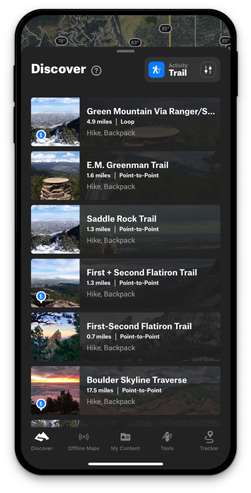
Use the Discover Tab
Sometimes it takes a little inspiration to kick-start the planning process. Choose the area you want to run and click on the Discover tab to find a list of running trails near you. You’ll get a list of potential runs, with difficulty, distance, elevation gain, and estimated time, visible on the main map. Once you select a trail, you can look at the slope feature to see where the steepest sections of the trail are. Unless you’re looking to really crush yourself, look for trails with rolling slopes as they are better than steep trails that go straight up and straight down. If you’re trying to link multiple trails together, using the Discover page will help you get an idea of what trails intersect so you can plan your route accordingly.
Check out the descriptions to see if there’s a suggested direction, or any tips for the area (found in the “need to know” section). If you’re planning a long run, check to see what kinds of water you’ll pass by if you plan to use a filter to top off your reserves.
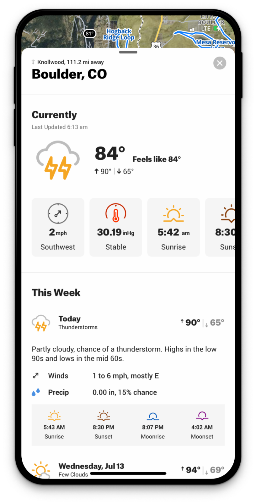
Check The Weather Forecast
Once you’ve selected a trail, click on the weather widget to stay up to date on changes. You can evaluate sunrise and sunset times to choose the optimal time to hit the trail; whether you’re concerned about running out of daylight or worried about getting caught in the hottest part of the day. If you’re in the mountains, storms often roll in in the afternoon, so work backwards and start earlier than you may think. You can use the satellite overlay to get a feel for how exposed to the sun you’ll be by checking where the trail passes through a forest and if it goes into the alpine.
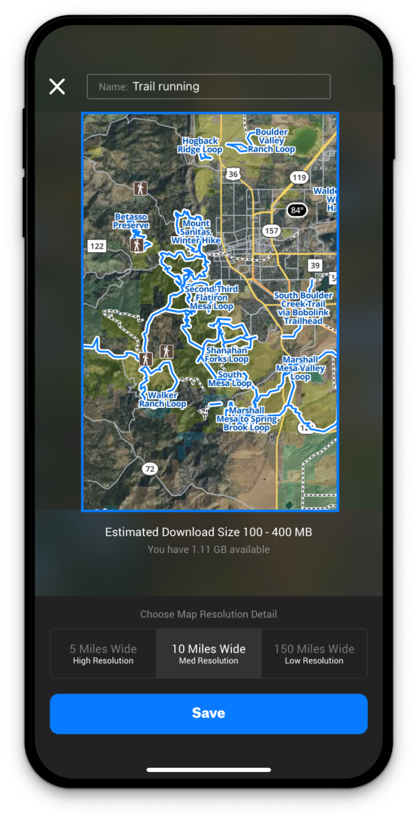
Download Offline Maps
Once you know where you’re going, download the map for availability offline so you can check your progress in the field (where you might not have service). This will help in case you get off route or want to change your plan mid-run.
Track Your Progress
When you leave the trailhead, don’t forget to start Tracking your run. Tracking in the field will show you your speed, distance, and elapsed time while you run, and makes it easy to check that you’re on route. Once you finish, you’ll be able to look back at your track for future reference. And if you forget to turn it off before departing home, the Trim Track feature has you covered.
Share Your Route With Friends
Everything is more fun with company. Love your route and want to suggest it to a friend? Use the sharing feature to share your track with your friends so they can get out and repeat the adventure. Ensure to share it ahead of time too, so someone knows where you’ll be when you’re out in the wild.

There’s no greater feeling than knocking out a killer trail run, and taking a few minutes to do some research always pays off. With these simple steps in the onX Backcountry hiking GPS app, planning the perfect route for your timeframe and skill level has never been easier. Plus, choosing a mapped route and sticking to it will help you stay safe, and let your friends and family know where you are in case of emergency. All that’s left to do is grab your shoes and hit the trails!