Florence County F15 North
Total Miles
5.4
Technical Rating
Best Time
Spring, Summer, Fall
Trail Type
60" Trail
Accessible By
Trail Overview
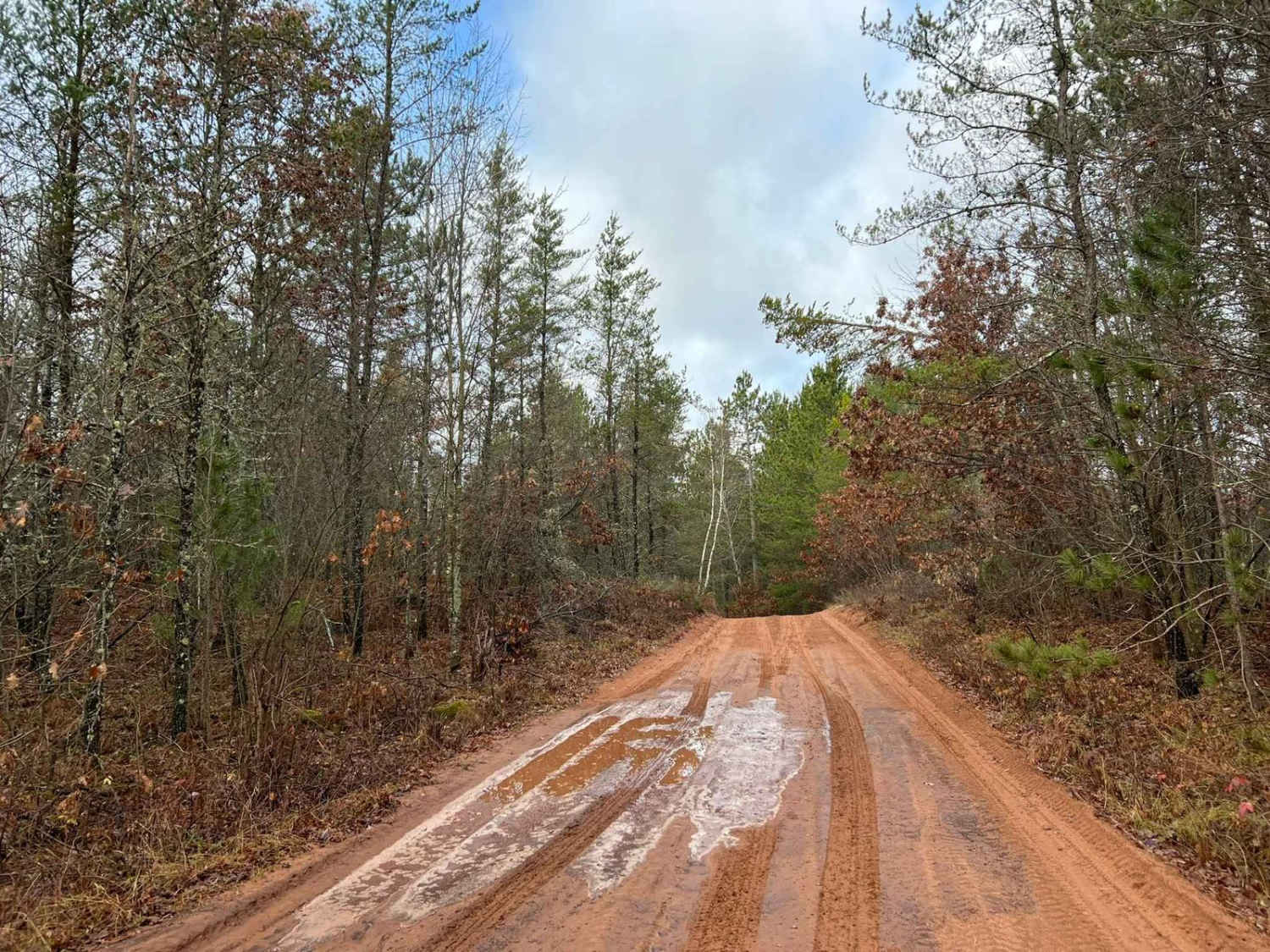
This is the northernmost portion of the F15 Trail. It runs from intersection 10 to 10A. This trail was mapped on 11/24. The trail surface is primarily hard-packed red clay and gravel. If traveling from south to north, this trail will begin by running through several pine forests before entering a section of rolling hardwoods. This area provides spectacular views of the overlooking landscape. Creating some truly breathtaking fall color views. There is also exceptional riding, such as the trail switchbacks through the oncoming landscape. Some areas of this trail, like all in the area, are open to road-going vehicle traffic. The access trail for the La Salle Falls is located just to the west of this trail. This is a large waterfall that is accessed by an adjacent hiking trail. Visiting it should be on everyone's agenda if possible.
Photos of Florence County F15 North

Difficulty
Riders of all skill levels can ride this trail. It has okay to good sight lines, with little in the way of trail obstacles. The trail surface initially starts out as sand if traveled south to north but then quickly transitions into a hard-packed red clay, before it transitions back into sand at the trail's north end. There are occasional water spots that must be crossed after a large rain, with a depth under 12". As well as the potential for washout, exposing medium to large rocks.
Status Reports
Florence County F15 North can be accessed by the following ride types:
- SxS (60")
- ATV (50")
Florence County F15 North Map
Popular Trails
Cattail State Trail: Turtle Lake to Almena

Double Bend FR 2166
CCRT - Gratiot to Darlington
Pelcho Cut Across
The onX Offroad Difference
onX Offroad combines trail photos, descriptions, difficulty ratings, width restrictions, seasonality, and more in a user-friendly interface. Available on all devices, with offline access and full compatibility with CarPlay and Android Auto. Discover what you’re missing today!