Iron Mountain Spur A
Total Miles
5.8
Technical Rating
Best Time
Spring
Trail Type
Single Track
Accessible By
Trail Overview
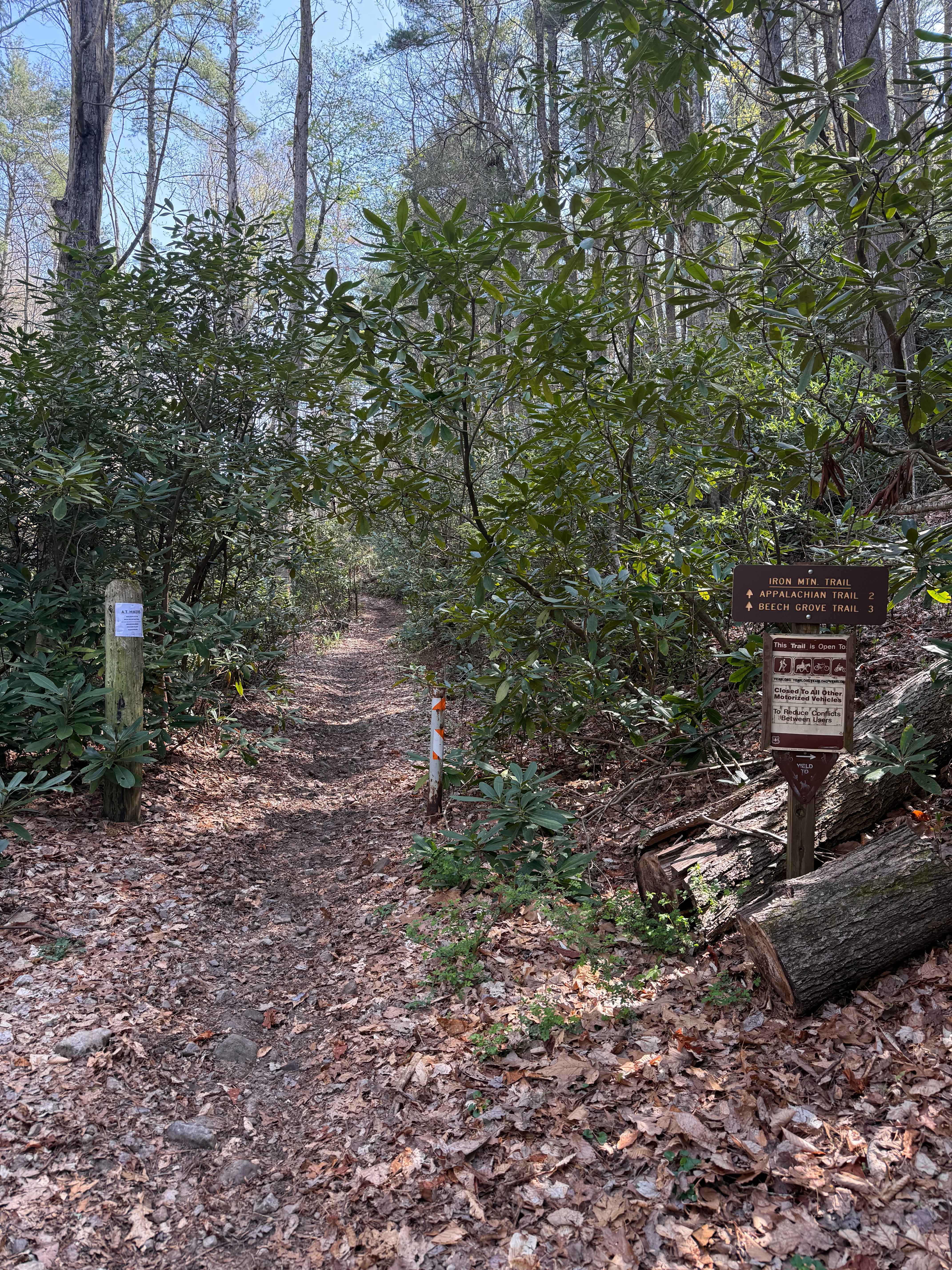
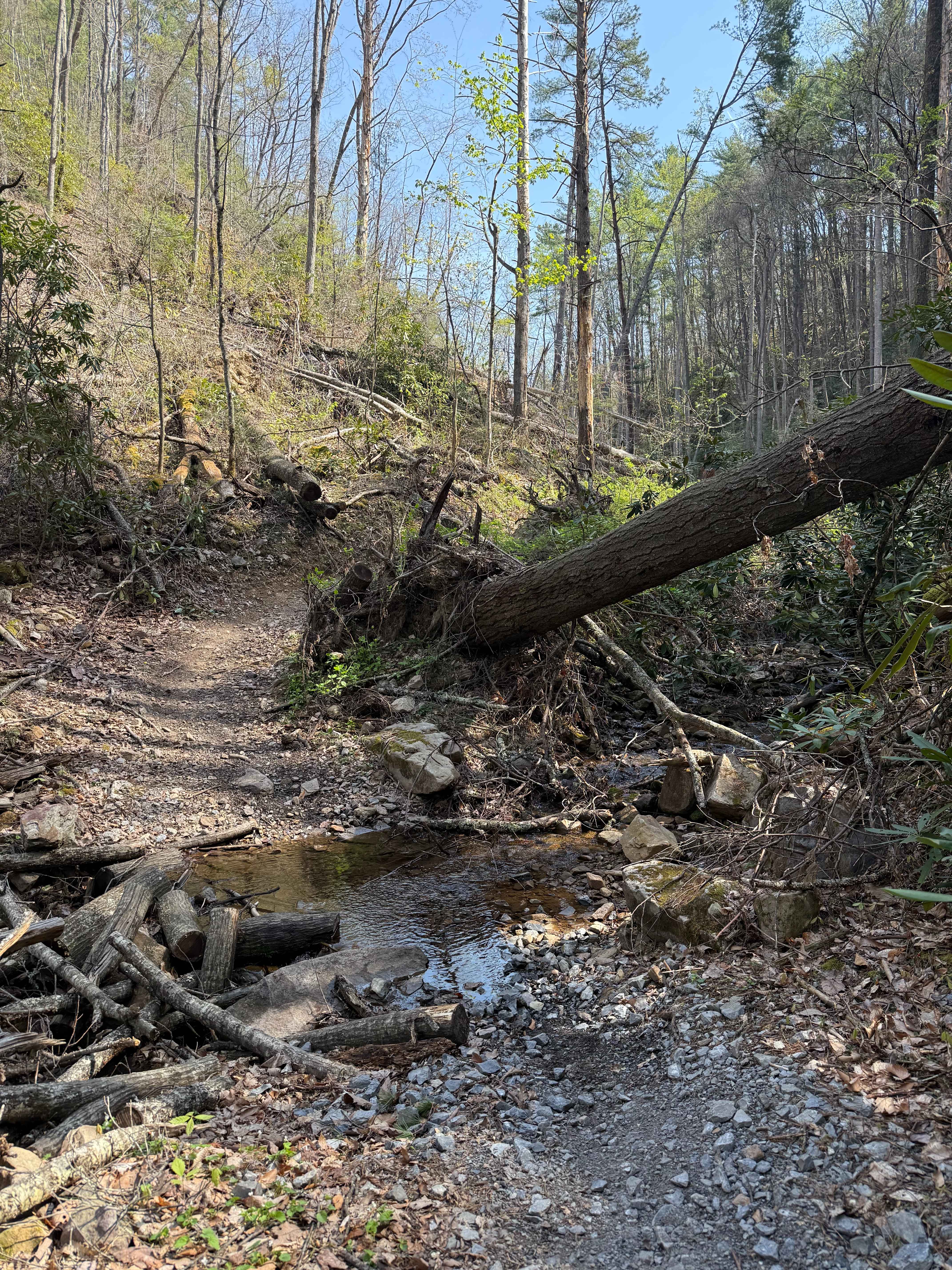
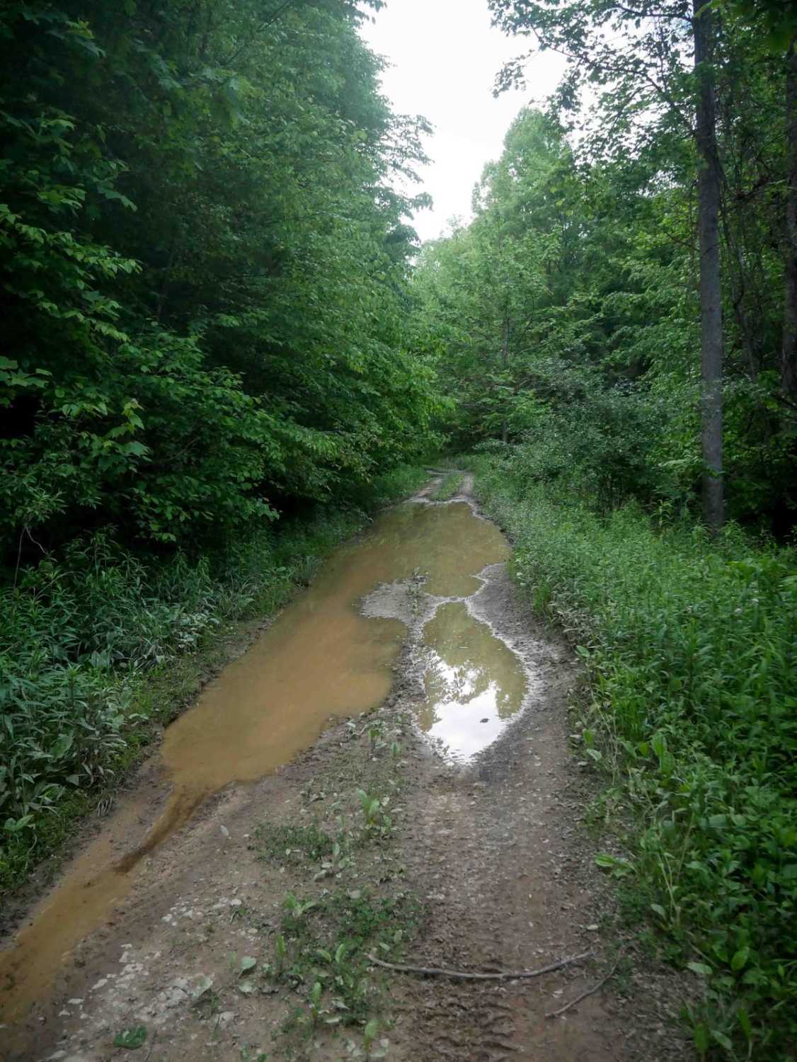
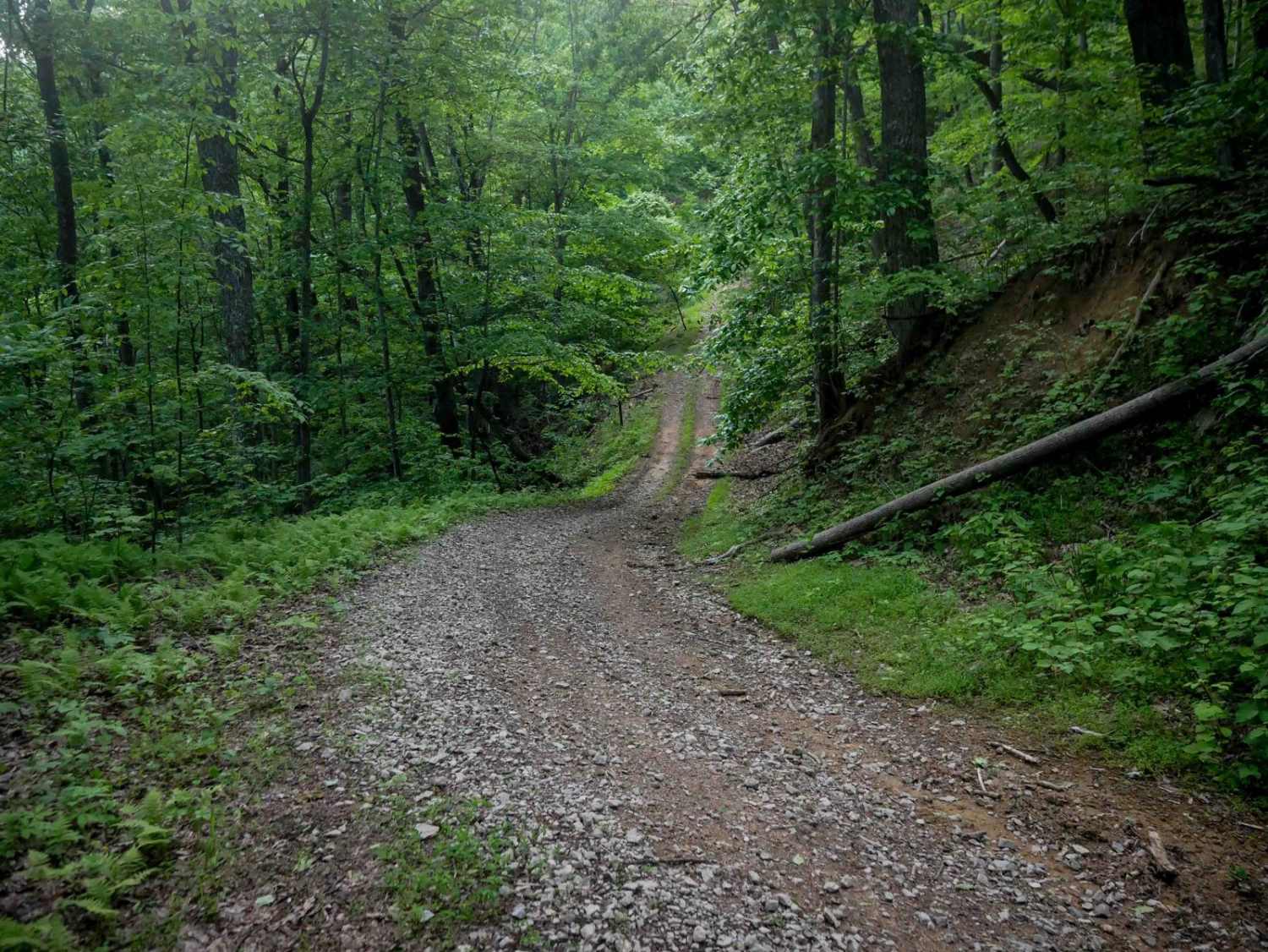
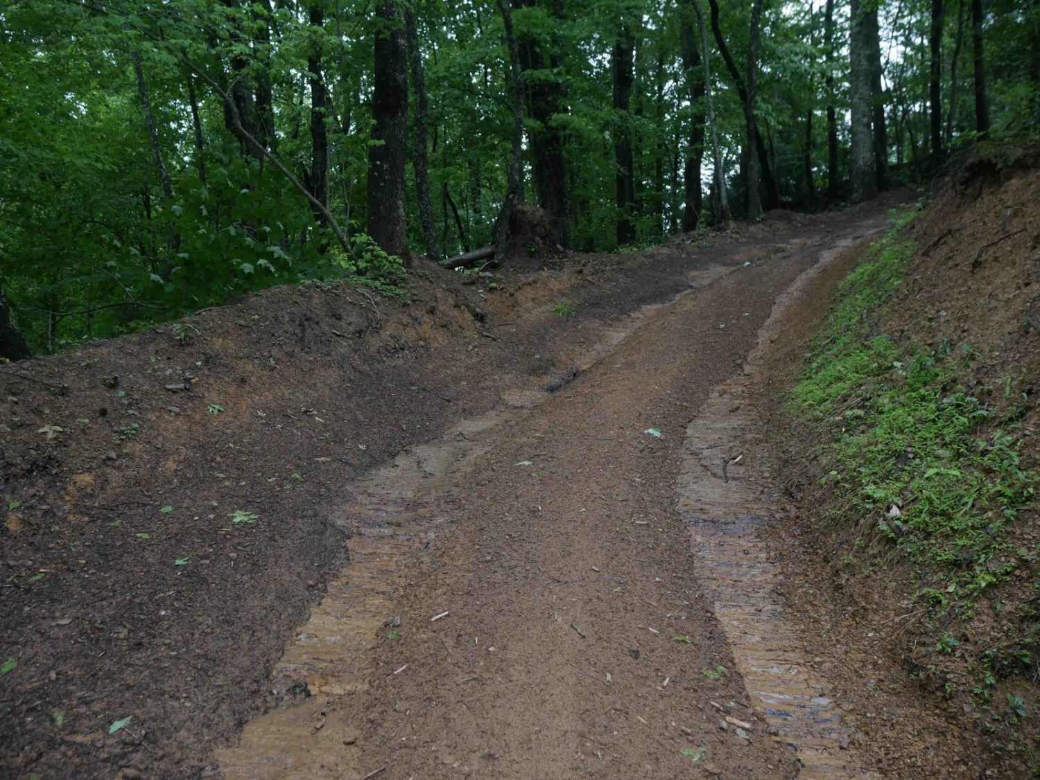
Iron Mountain Spur A is a 6-mile single-track trail starting at the edge of Damascus, Virginia, and running through Jefferson National Forest. The trail is open to motorcycles, mountain bikes, hikers, and horseback riders -- expect to encounter all of them. Damascus is a well-known stop on the Appalachian Trail, and the town sees a steady flow of AT thru-hikers making their way through, especially in spring. You can park in downtown Damascus and ride directly to the trailhead, making this one of the most accessible trails in the area. The trail is a true point-to-point, so plan accordingly with a shuttle or a return route. The surface is a mix of dirt, mud, and rock with wet ruts throughout that hold water well after rain. The trail climbs and drops through steep terrain in mixed hardwood forest, with dense rhododendron pressing in through the lower sections. Multiple water crossings run anywhere from six inches to over a foot deep after significant rainfall -- approach each one with caution as debris and logs collect at the crossing points. Downed trees are present along the route, with evidence of recent clearing from storm damage throughout, and tight turns keep your speed in check on the descents. The upper sections open up with views through the trees before dropping back into thick forest toward the northeast. At the trailhead junction, the Iron Mountain Trail Spur A continues to Sturgill and Feathercamp, which are easy gravel roads that can be used to return home. Beech Grove connects in the middle of the trail at roughly the halfway point and is a technical spur, but can be used to return to pavement in about a mile.
Photos of Iron Mountain Spur A
Difficulty
Iron Mountain Spur A is a legitimate intermediate trail that will test riders who underestimate it. The wet ruts are persistent and deep enough to pull your front wheel off line, and the multiple water crossings come with rocky approaches and debris that changes after every rain. The steep climbs and descents leave little margin, and the storm damage throughout the trail means downed trees and obstacles can appear without warning. This trail rewards riders who are comfortable reading terrain on the fly.
History
Iron Mountain Spur A runs through the Iron Mountain range in Jefferson National Forest, a landscape with a long history of use by hunters, timber operations, and early settlers moving through the highlands of southwest Virginia. The area around Damascus has become one of the most celebrated trail towns in the eastern United States, sitting at the intersection of the Appalachian Trail, Virginia Creeper Trail, and a growing network of off-road routes through the surrounding national forest.
Status Reports
Iron Mountain Spur A can be accessed by the following ride types:
- Dirt Bike
Iron Mountain Spur A Map
Popular Trails

The onX Offroad Difference
onX Offroad combines trail photos, descriptions, difficulty ratings, width restrictions, seasonality, and more in a user-friendly interface. Available on all devices, with offline access and full compatibility with CarPlay and Android Auto. Discover what you’re missing today!