Upper 2 Mile ATV Trail
Total Miles
1.7
Technical Rating
Best Time
Summer, Fall, Spring
Trail Type
50" Trail
Accessible By
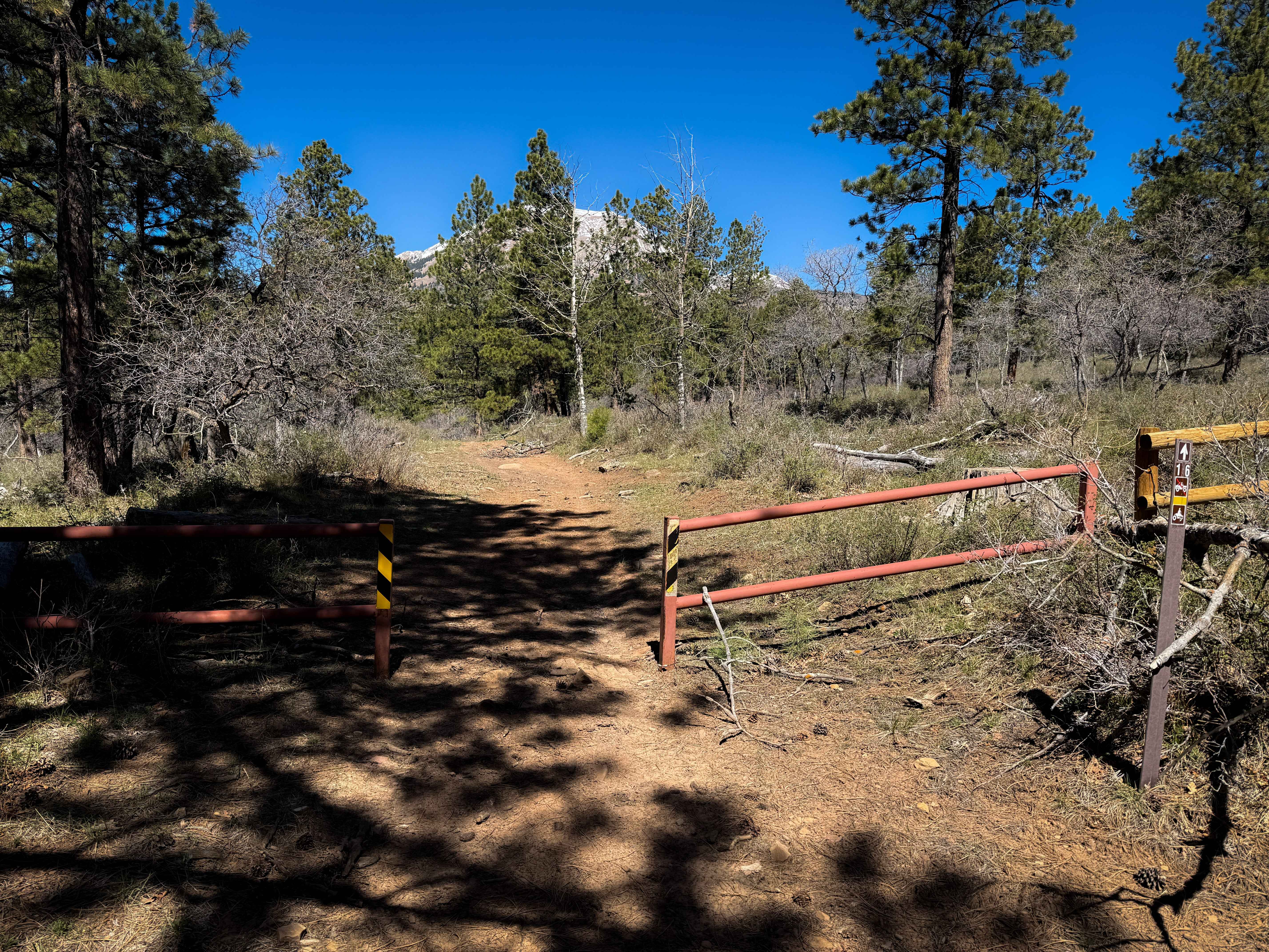
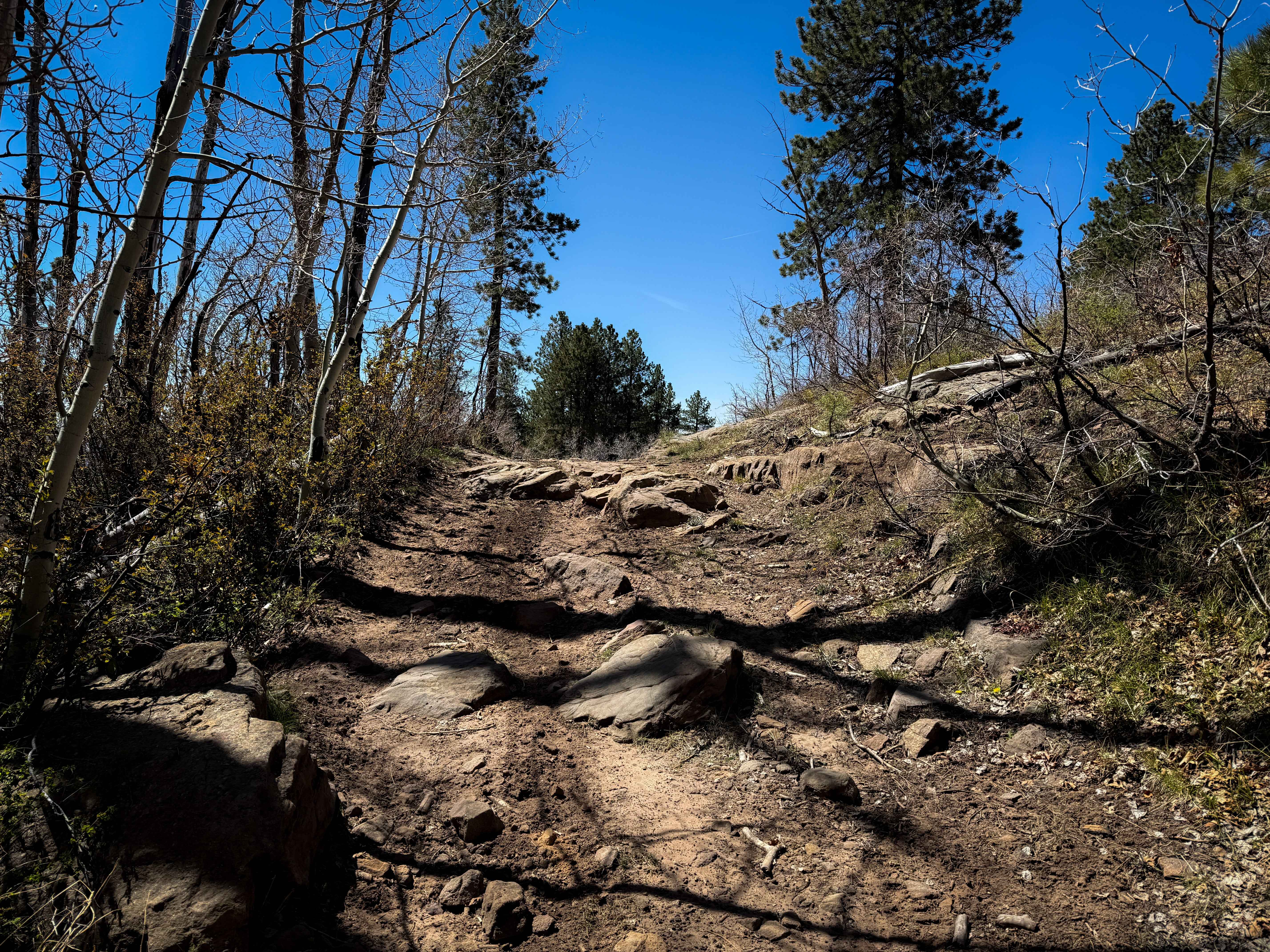
Trail Overview
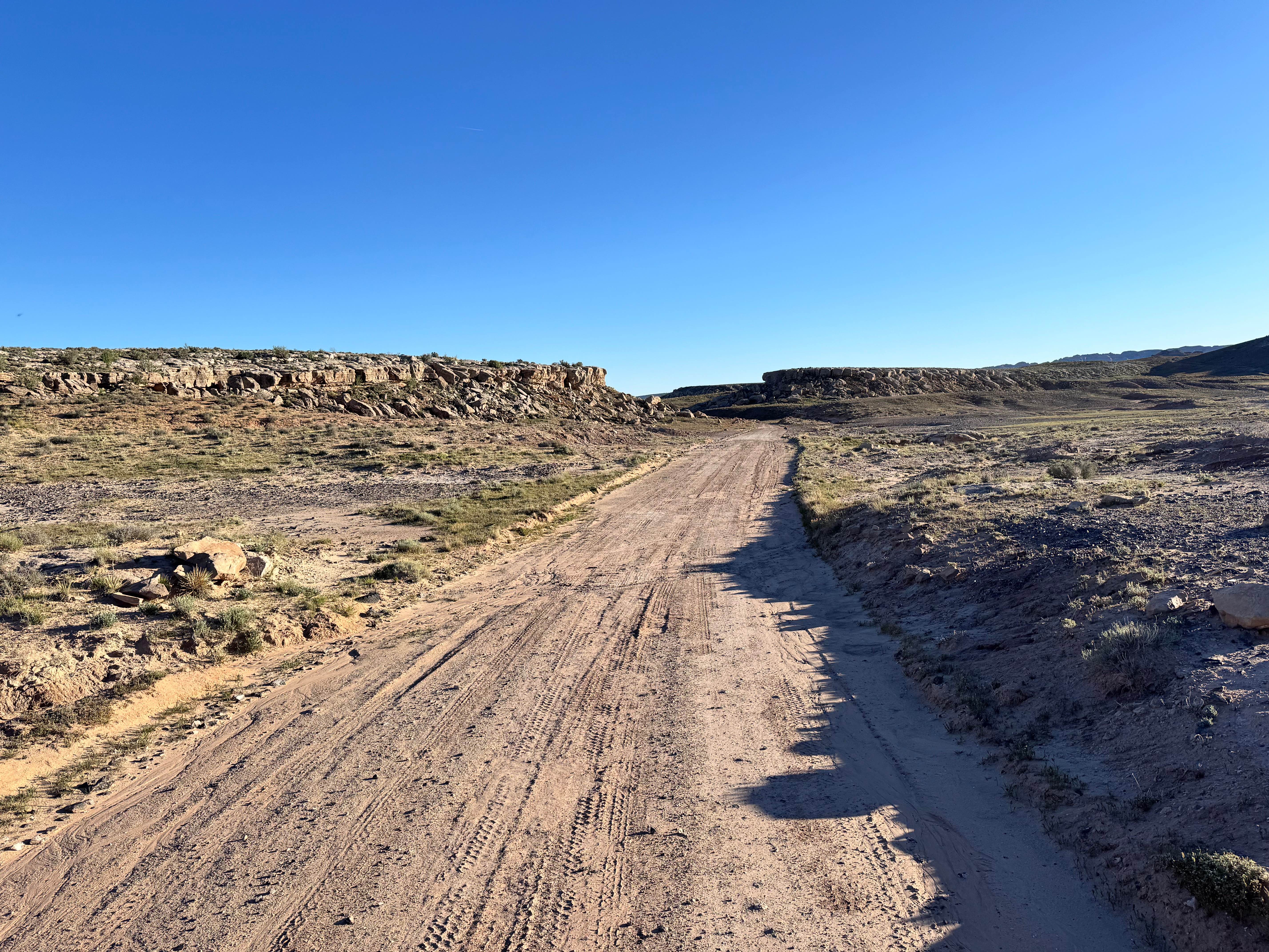
This is a 2-mile-long segment of ATV trail on Utah State Trust Land that starts on the east end of an unimproved road off of Geyser Pass. The trail is decently wide for 50" vehicles, traversing along a hillside between aspens and pines and scrub oak on a shelf trail. It is mostly dirt, with frequent small loose rocks in the trail or chunkier, bigger embedded rocks, and several sections of flat slab rock that make it more scenic and interesting. There are a few embedded rock ledges about a foot tall; however, the ledges can be approached straight on and are not off-camber or exposed, making them still relatively easy. This is a typical alpine environment at 9,000 feet in elevation, so you can expect seasonal hazards such as muddy spots, sudden weather changes, or downed logs. It looks like it's a well-maintained trail system where logs will get cut for the season, but you can expect some big downed logs early in the springtime that will need to be cut to pass through. The trail is best in summer or fall, but could still be rideable in mid-spring depending on the year's snowpack. The west end had more downfall as it continued to gain elevation into a denser forest of aspen trees, before it connects to a segment of singletrack that takes you back to Geyser Pass.
Photos of Upper 2 Mile ATV Trail
Difficulty
This is a moderately easy ATV trail as it is mostly gradual, decently wide, and not off-camber. However, there are a few small rock ledges that will add some technical challenge. The rock ledges are about a foot tall and easily approachable. The trail is rated easier for dirt bikes, as there are easier lines through the rock ledges for the dirt bikes. There is no exposure, nor overly challenging obstacles that would make this too difficult. It is ideal for riders with a basic experience level.
Status Reports
Upper 2 Mile ATV Trail can be accessed by the following ride types:
- ATV (50")
- Dirt Bike
Upper 2 Mile ATV Trail Map
Popular Trails
Looking Glass to Anticline Overlook
Maze Overlook
John's Incline
The onX Offroad Difference
onX Offroad combines trail photos, descriptions, difficulty ratings, width restrictions, seasonality, and more in a user-friendly interface. Available on all devices, with offline access and full compatibility with CarPlay and Android Auto. Discover what you’re missing today!