Lewis Peak (6041)
Total Miles
3.3
Technical Rating
Best Time
Fall, Summer
Trail Type
Single Track
Accessible By
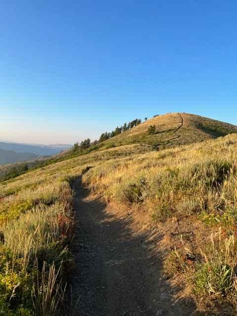
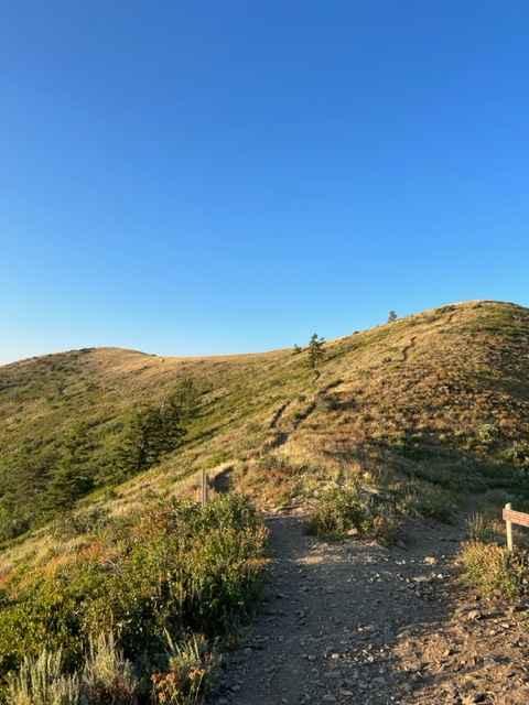
Trail Overview
This single-track trail branches off from Skyline South and Coldwater Peak trails and dead-ends at Lewis Peak. The track is narrow with some plant overgrowth and little room for line selection. There aren't any cliffs alongside the trail, but most of the route crosses steep hillsides. As you ride towards Lewis Peak, the trail enters an aspen forest before turning into a small hill to the peak. There is some trail deterioration in the forest section where riders went off-trail in tight turns.
Photos of Lewis Peak (6041)
Difficulty
There a no major obstacles on this single-track trail, but the narrowness combined with steep hillsides raises the difficulty rating.
Status Reports
Lewis Peak (6041) can be accessed by the following ride types:
- Dirt Bike
Lewis Peak (6041) Map
Popular Trails
BLM721-Kane County 4150

Blue Castle

Emery County Road 1010
Diamond Divide
The onX Offroad Difference
onX Offroad combines trail photos, descriptions, difficulty ratings, width restrictions, seasonality, and more in a user-friendly interface. Available on all devices, with offline access and full compatibility with CarPlay and Android Auto. Discover what you’re missing today!