Big Springs - FS 70109
Total Miles
4.1
Technical Rating
Best Time
Summer, Fall
Trail Type
Full-Width Road
Accessible By
Trail Overview
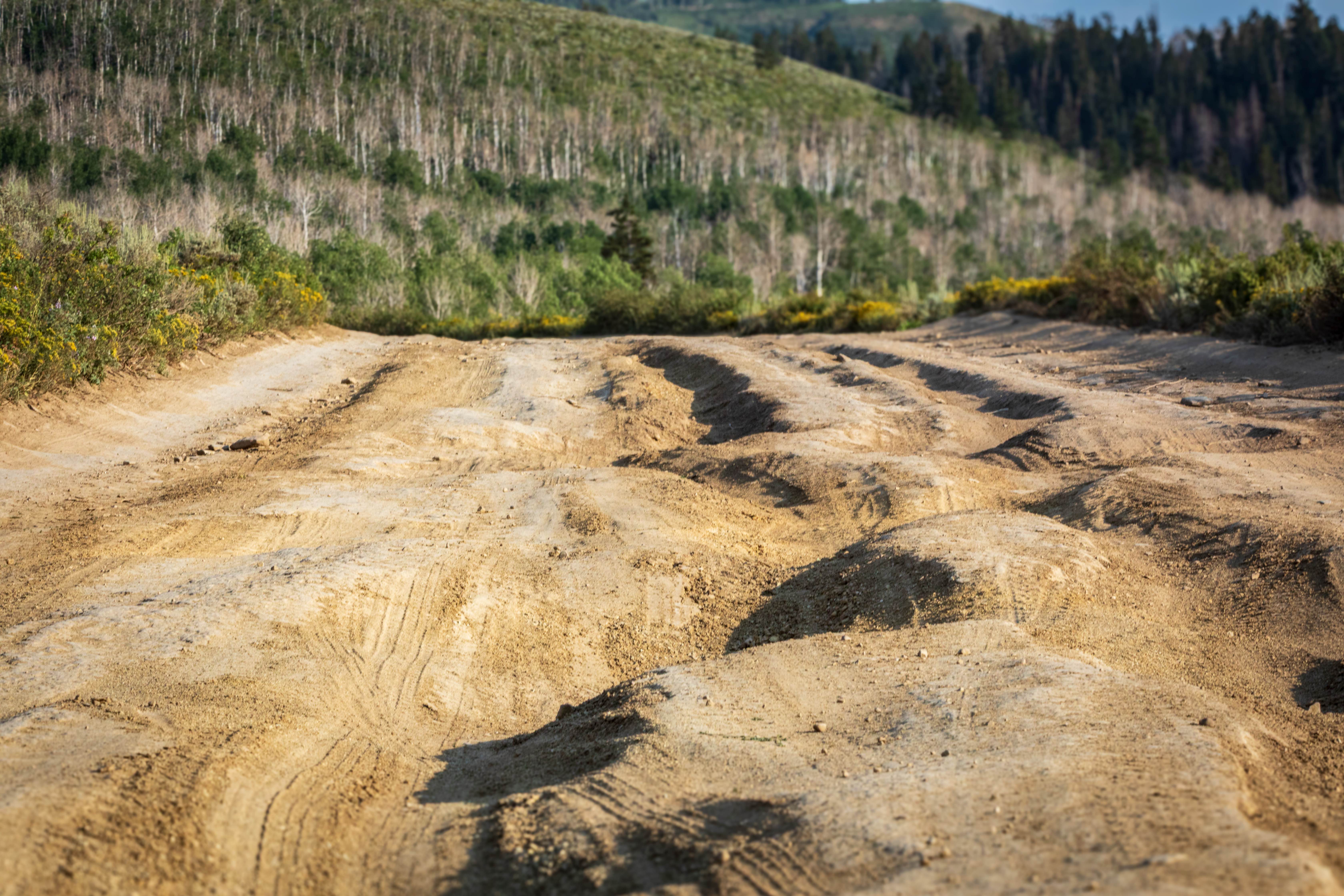
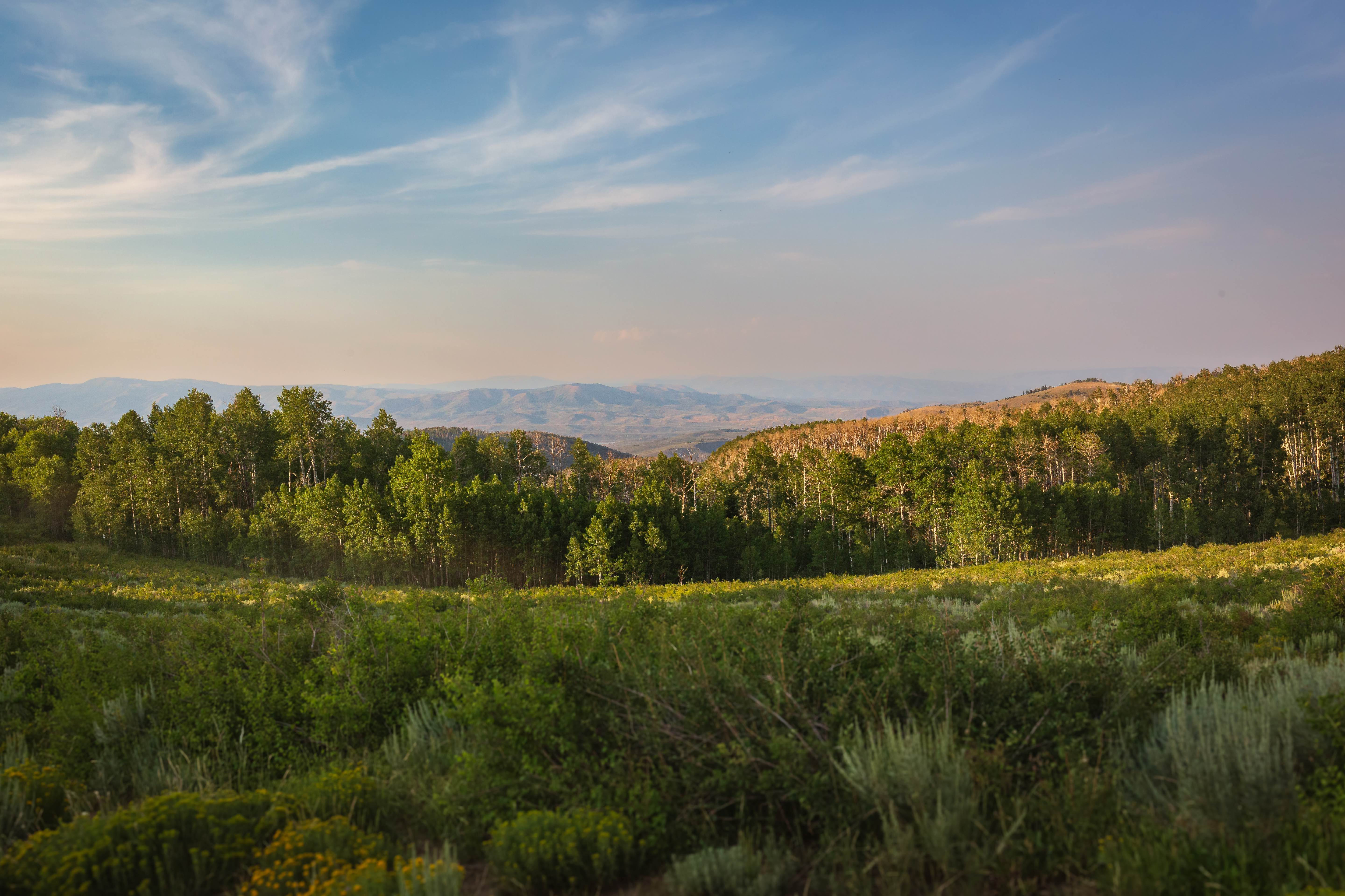
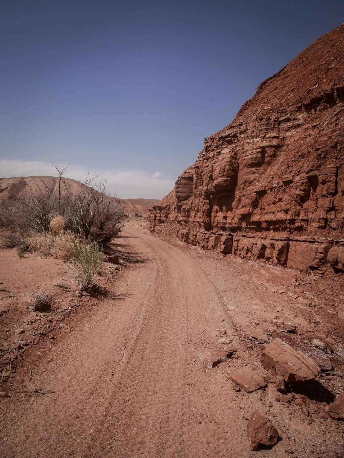
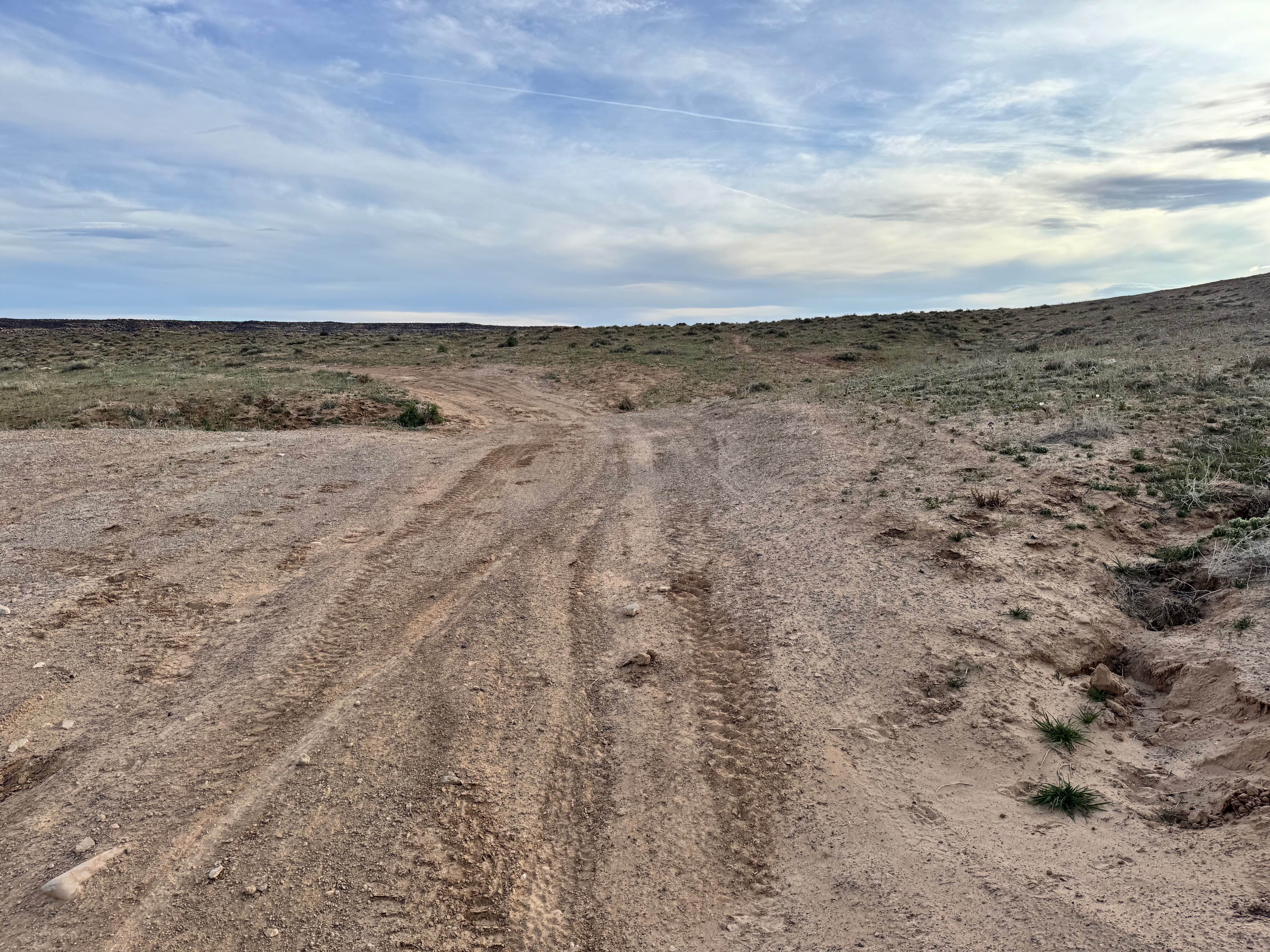
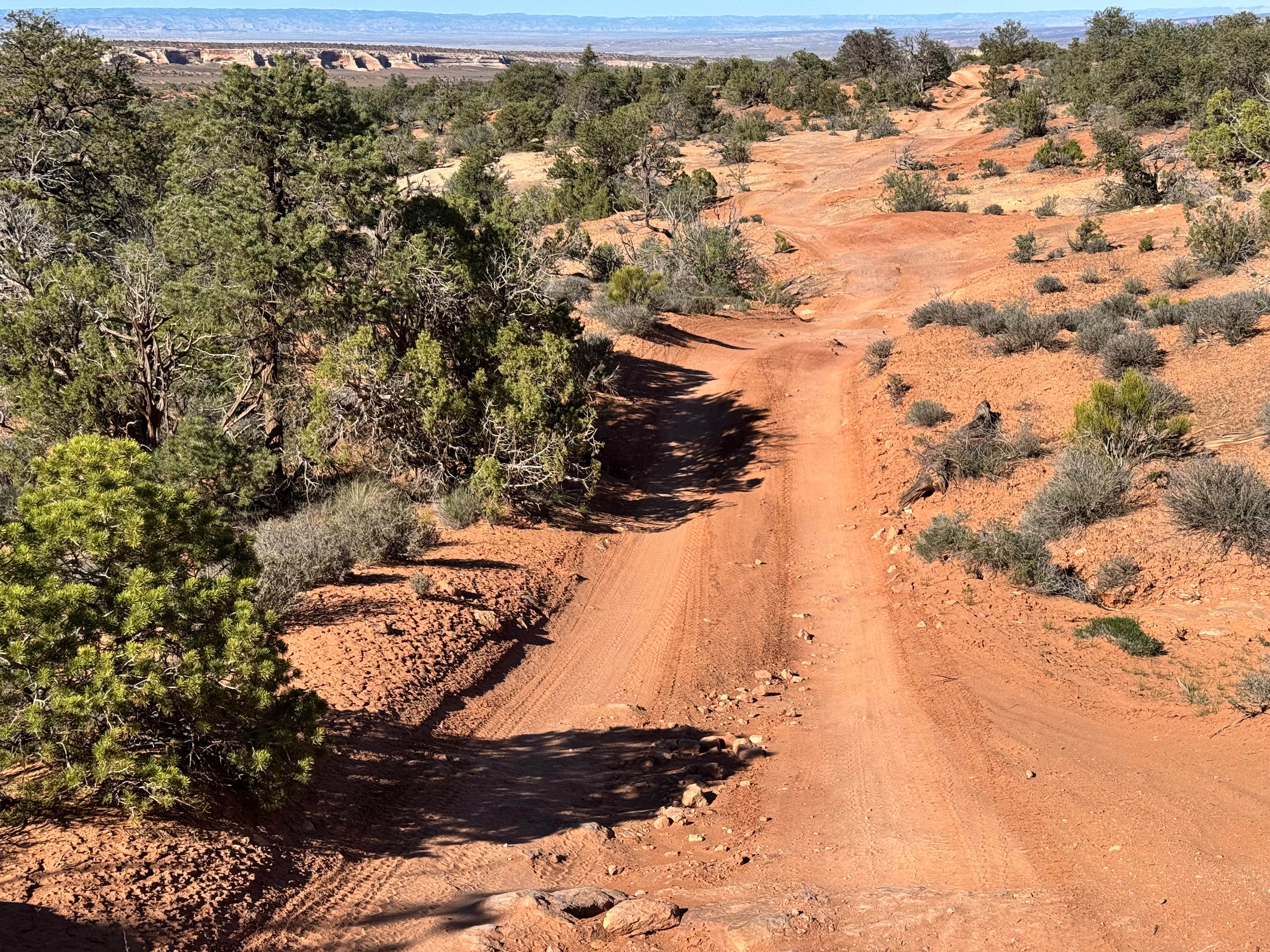
Big Springs (FS 70109) runs northwest to southeast, connecting the Big Springs area to other routes near Strawberry Reservoir. The road is not a graded or well-maintained surface, but it climbs toward higher elevation at its southern end, where it meets Devil's Notch (FS 70090), and offers excellent views of Strawberry Reservoir. Along the way, it winds through pine and aspen groves, open forest meadows, and a few switchbacks. On its northern end, the trail intersects with West Side Strawberry (FS 70131), providing additional route options in the area. The trail surface is mostly compacted clay or dirt with scattered small rocks. Ruts range from shallow to 8-12 inches deep, with some on the roadside reaching up to 18 inches. Many of these ruts contain loose rock, and some sections show additional erosion that can make for a rough ride. While not highly technical, the uneven terrain and occasional deep washouts require attention to line choice. Drivers should also watch carefully at intersections, as multiple junctions along the route can make it easy to drift off the intended trail. According to the U.S. Forest Service Motor Vehicle Use Map (USFS MVUM), this road is open to all highway-legal vehicles. Dispersed camping is permitted up to 150 feet from the center line of the road, with several campsites near the northwest end and fewer toward the southeast. The route is generally wide enough for two vehicles, but in narrower stretches, only one vehicle can pass at a time, and drivers may need to reverse to a wider section of the trail if vehicles need to pass.
Photos of Big Springs - FS 70109
Difficulty
The trail includes some ruts 8 to 12 inches deep, with a few reaching up to 18 inches. Many contain loose rock, and certain sections narrow to a single vehicle's width, requiring drivers to reverse to a wider spot to pass.
Status Reports
Big Springs - FS 70109 can be accessed by the following ride types:
- High-Clearance 4x4
- SUV
- SxS (60")
- ATV (50")
- Dirt Bike
Big Springs - FS 70109 Map
Popular Trails
Oil Well Wash
Upper Levi Well
Roundup Cuddy Back-NFS30566
Dome Plateau Cutoff
The onX Offroad Difference
onX Offroad combines trail photos, descriptions, difficulty ratings, width restrictions, seasonality, and more in a user-friendly interface. Available on all devices, with offline access and full compatibility with CarPlay and Android Auto. Discover what you’re missing today!