S8 Trail
Total Miles
5.8
Technical Rating
Best Time
Spring, Summer, Fall, Winter
Trail Type
Full-Width Road
Accessible By
Trail Overview
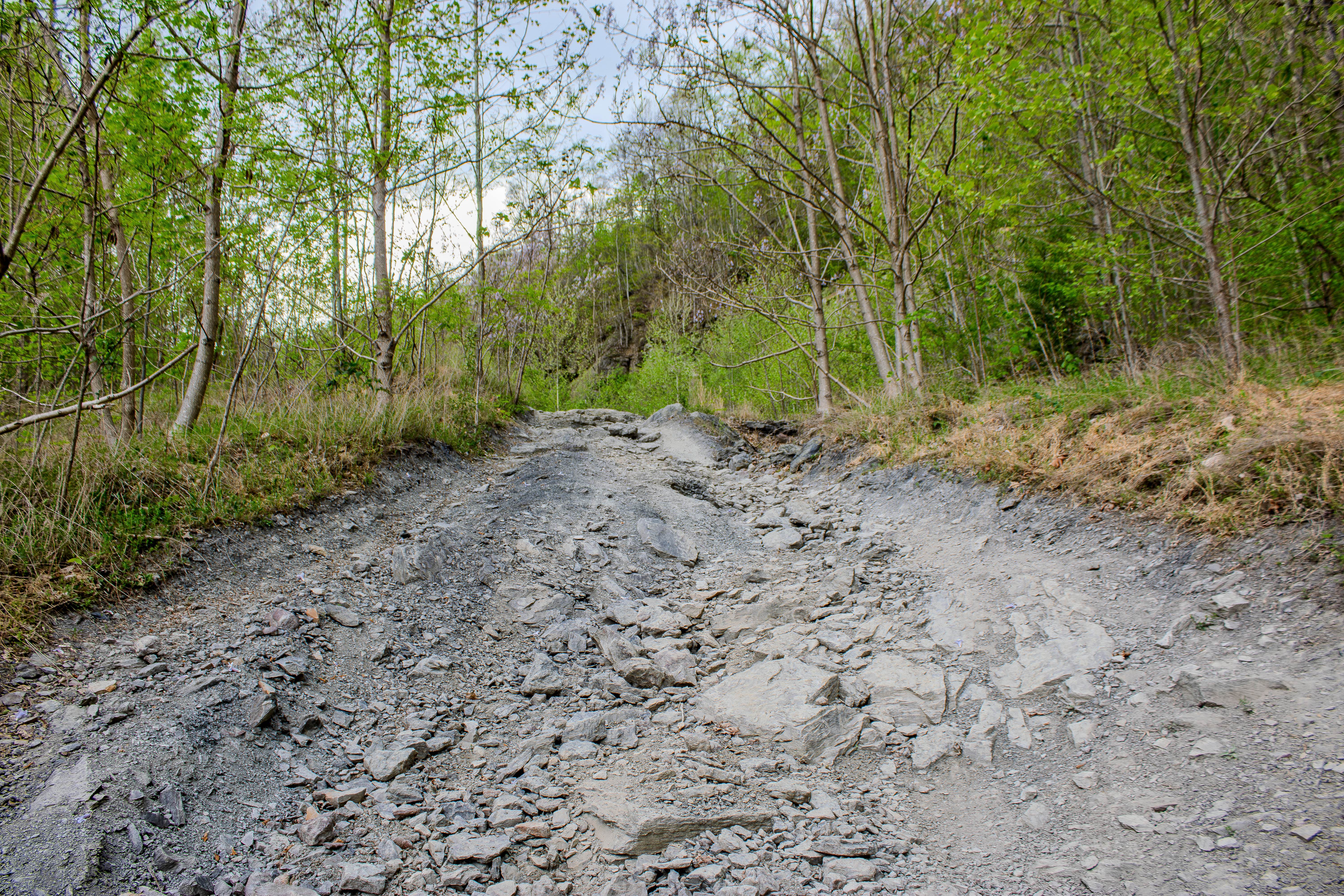
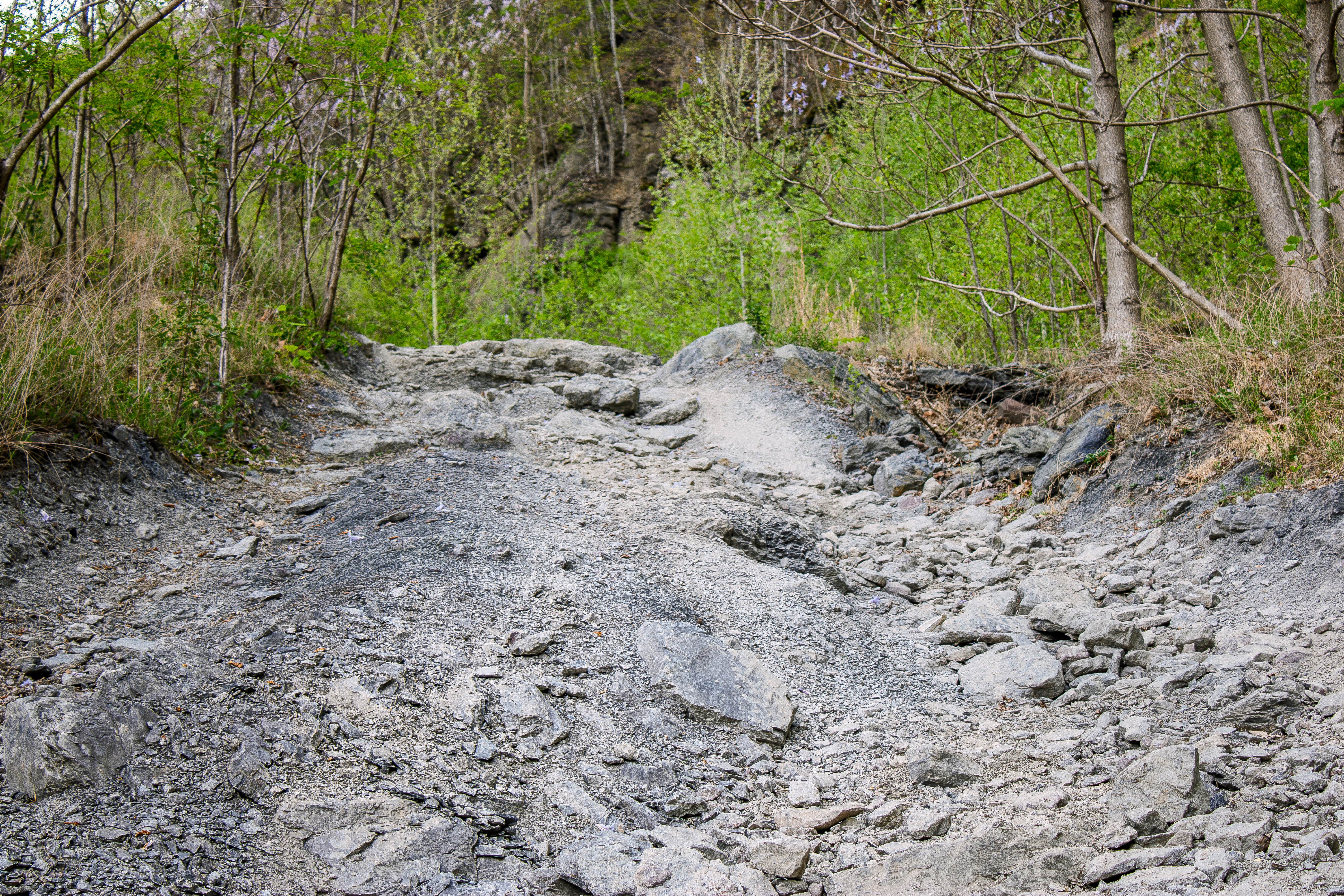
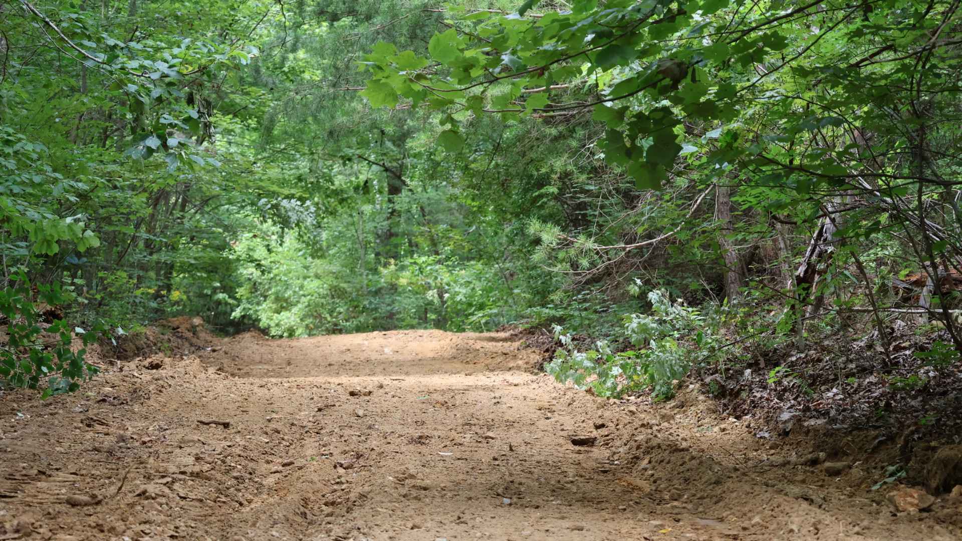
S8 Trail is a two-way, mostly dirt trail that begins near the far end of the open mine area off S8 Road and continues toward Emily Cemetery Road and Phillips Road. This trail is much tighter and more technical than S8 Road. The route is narrow through many sections, with only a few places to pass without getting into heavy brush along the sides of the trail. Wider vehicles should expect tight tree sections, and taller or full-size rigs may need to watch for limbs and brush rubbing along the vehicle. The trail has several areas where water washes across the route, creating ruts, erosion, and washouts. These sections can be challenging for longer wheelbase vehicles because the ruts and uneven washouts may require careful tire placement. Some of the rutted areas are off-camber, which can create a tipping feeling for narrower vehicles or vehicles with a higher center of gravity. Drivers should slow down, look ahead, and choose the smoothest line before entering these sections. Loose rock is also common throughout the trail, especially on the inclines and washed-out sections. These rocks can shift under the tires and make traction harder to maintain, particularly when the trail is wet. The combination of tight trees, brush, loose rock, off-camber ruts, and water-damaged sections makes S8 Trail a more technical connector through this part of the North Cumberland WMA trail system.
Photos of S8 Trail
Difficulty
The trail is not extreme, but it has enough obstacles to require attention and good driving decisions. The biggest challenges are the narrow trail width, limited passing areas, brush, tight trees, loose rock, water washouts, and rutted off-camber sections. Longer wheelbase vehicles may have a harder time crossing some of the washouts cleanly, while wider vehicles may struggle in the tighter tree sections. Wet weather can raise the difficulty because the loose rock, ruts, and washouts can become slick and harder to control.
Status Reports
S8 Trail can be accessed by the following ride types:
- High-Clearance 4x4
- SUV
- SxS (60")
- ATV (50")
- Dirt Bike
S8 Trail Map
Popular Trails
Gatlin Point South FSR 227

Bandy Creek Trek
Inman Point Road
The onX Offroad Difference
onX Offroad combines trail photos, descriptions, difficulty ratings, width restrictions, seasonality, and more in a user-friendly interface. Available on all devices, with offline access and full compatibility with CarPlay and Android Auto. Discover what you’re missing today!