Myatt Creek Road
Total Miles
7.6
Technical Rating
Best Time
Spring, Fall, Winter
Trail Type
Full-Width Road
Accessible By
Trail Overview
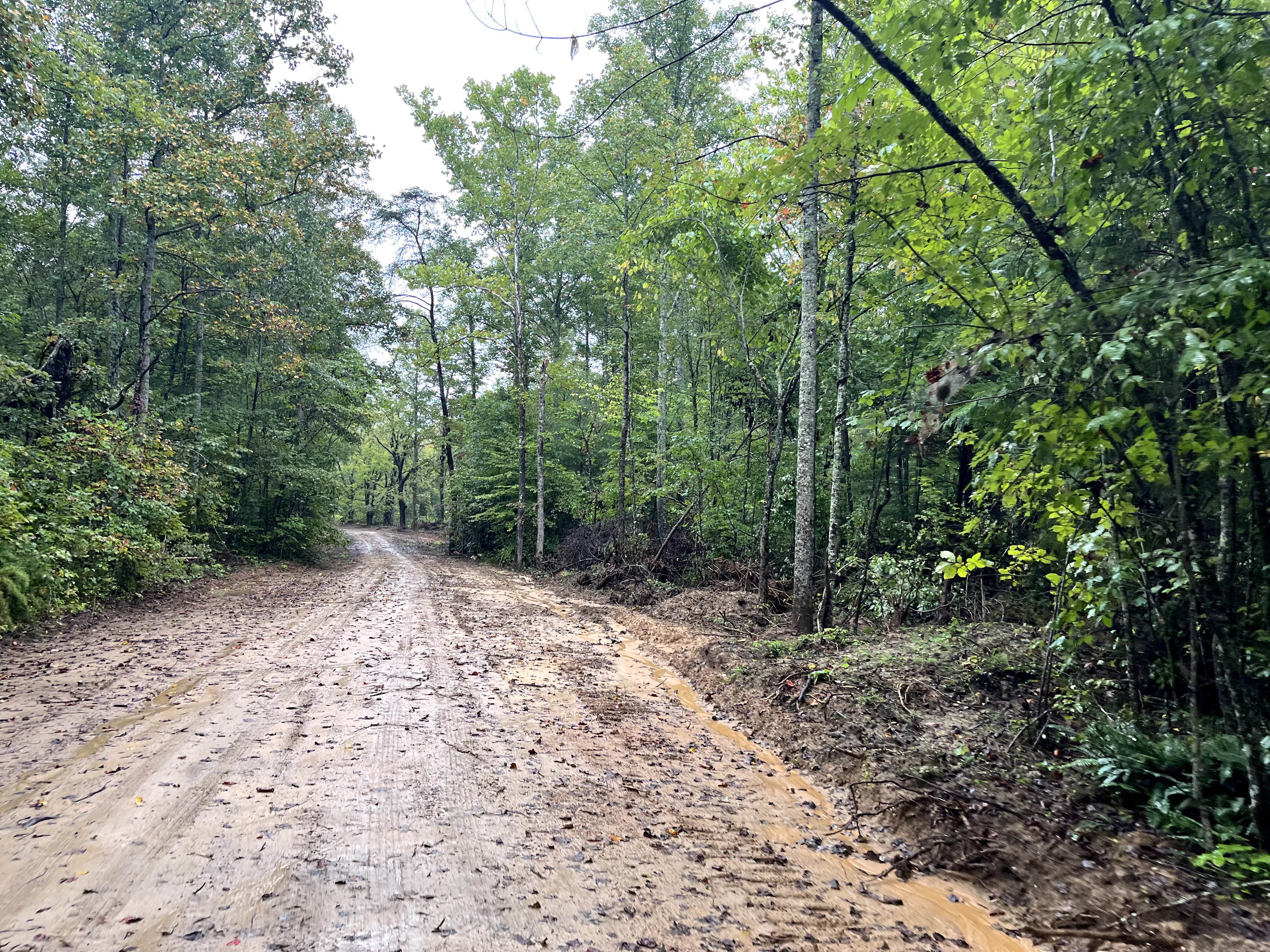
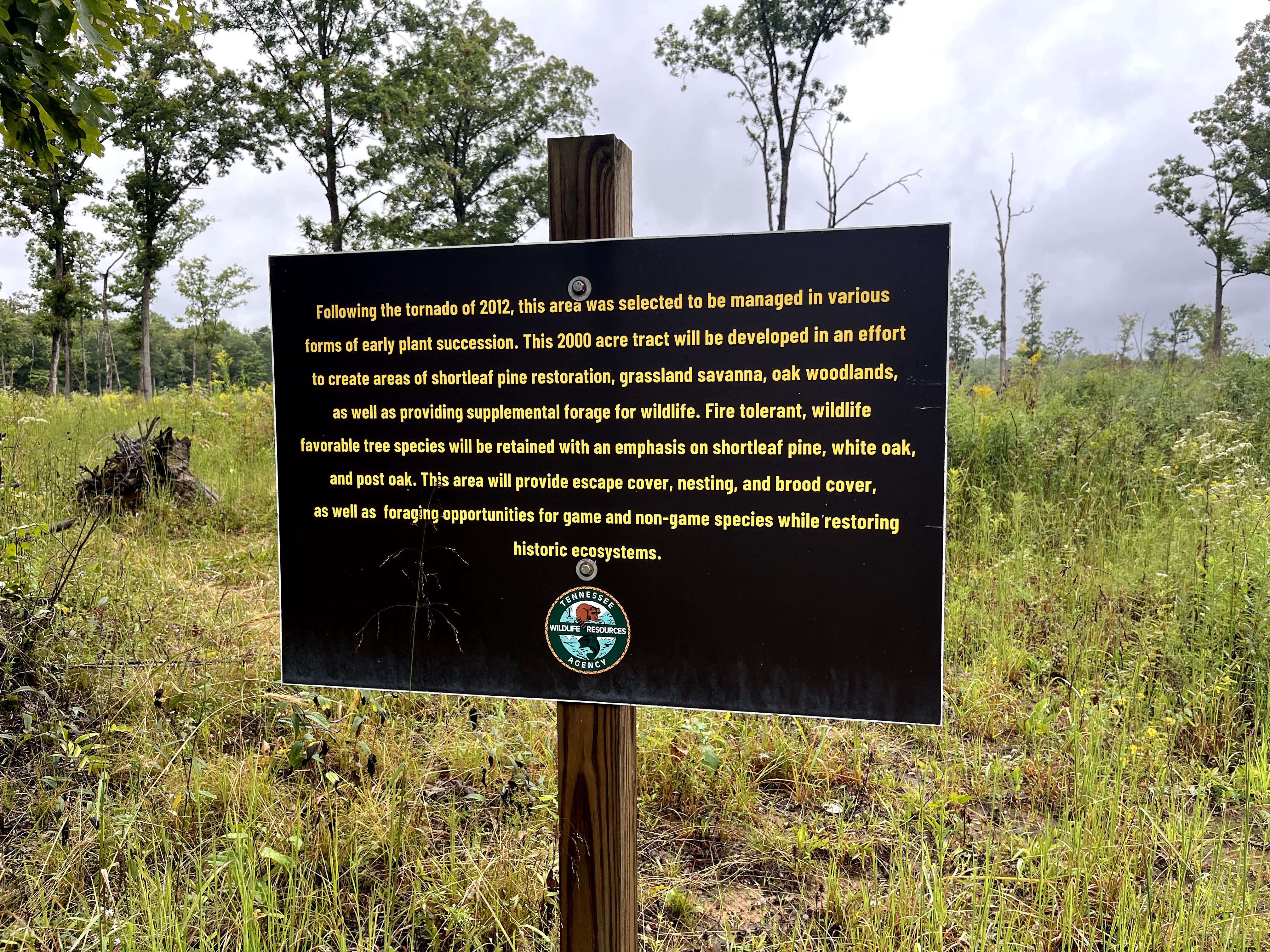
This well-maintained gravel road, mixed with sand, winds through the outskirts of the Catoosa Wildlife Management Area (WMA). Along this route, you'll pass through a site where a tornado struck in 2012. In the aftermath, the area was designated for a range of early plant succession management efforts. Spanning 2,000 acres, this tract is being developed to support the restoration of shortleaf pine forests, grassland savannas, and oak woodlands, while also providing supplemental forage for wildlife. In this restoration project, fire-tolerant and wildlife-friendly tree species will be prioritized, particularly shortleaf pine, white oak, and post oak. The goal is to create diverse habitats that offer escape cover, nesting sites, brood cover, and foraging opportunities for both game and non-game species. In doing so, the project aims to restore and enhance historic ecosystems. This road provides access directly through the project area, offering a unique opportunity to observe the wildlife that inhabits these newly restored habitats. The road eventually transitions to dirt and dead-ends in the woods, providing a peaceful retreat into nature.
Photos of Myatt Creek Road
Difficulty
This is an easy gravel road, which is well-maintained by the Tennessee Wildlife Resources Agency.
History
According to the Tennessee Wildlife Resources Agency, Catoosa WMA's history reflects the Cumberland Plateau's shift from natural habitats to industrial exploitation and back to conservation, with its origins as ancestral hunting grounds, later becoming a center for logging and coal mining. Following devastation by a 1929 flood and subsequent economic decline, the state began acquiring the land in the 1940s to establish the area as a wildlife and state forest. Today, the approximately 82,000-acre area is managed by the Tennessee Wildlife Resources Agency (TWRA) to restore ecosystems like oak savannas and protect native wildlife, which is a return to its ecological roots before human intervention
Status Reports
Myatt Creek Road can be accessed by the following ride types:
- High-Clearance 4x4
- SUV
- SxS (60")
Myatt Creek Road Map
Popular Trails
Coppinger Cove to Cave

G24 - Wildflowers

The onX Offroad Difference
onX Offroad combines trail photos, descriptions, difficulty ratings, width restrictions, seasonality, and more in a user-friendly interface. Available on all devices, with offline access and full compatibility with CarPlay and Android Auto. Discover what you’re missing today!